See the Latest Briefing Slides
Go back to the NWS Cleveland, OH Main Page
General Overview Graphics
|
|
|
|
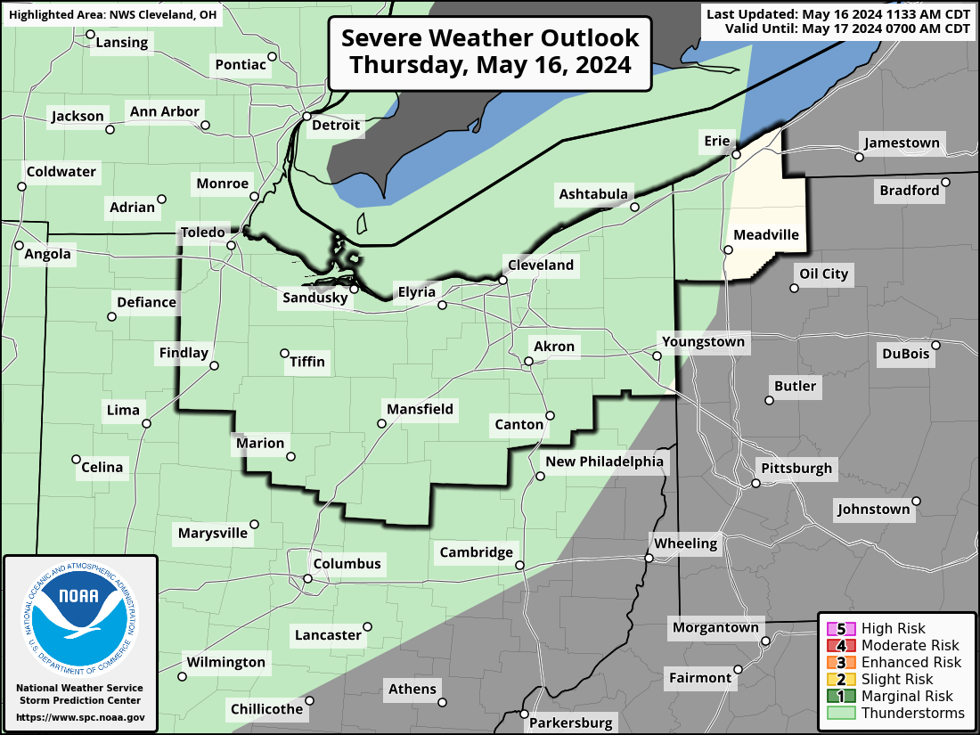
Scattered Severe Storms Possible Today

Multiple rounds of strong to severe thunderstorms are possible today. The first round will be this morning into this afternoon with a second round in the eastern half of the area possible this evening. Damaging wind gusts will be the main hazard, but tornadoes and large hail remain possible.
|
|
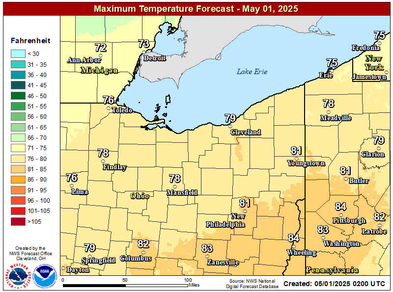
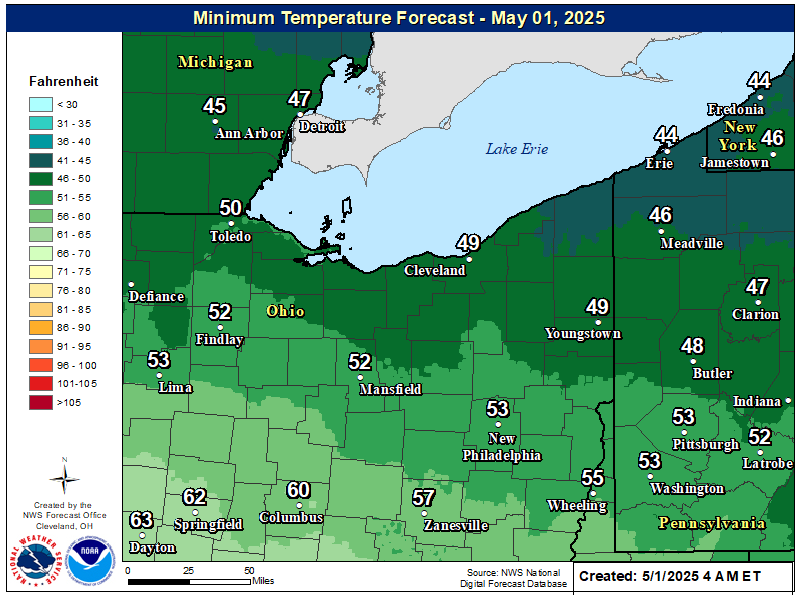
| Today's High Temp | Today's Low Temp |
|
|
|
| WPC Fronts 12-hr | WPC Fronts 24-hr |
|
|
|
| WPC Fronts 36-hr | WPC Fronts 48-hr |
|
|
|
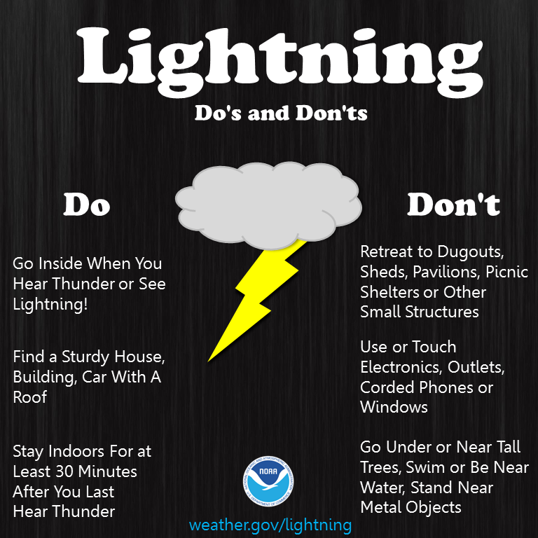
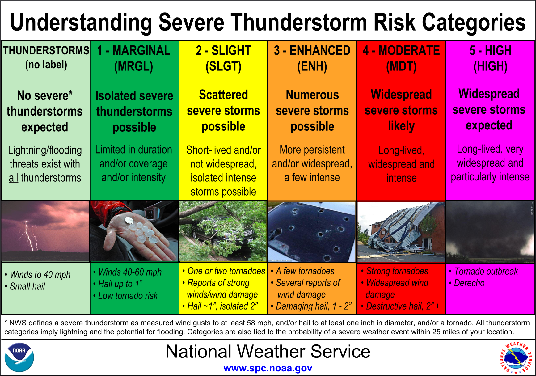
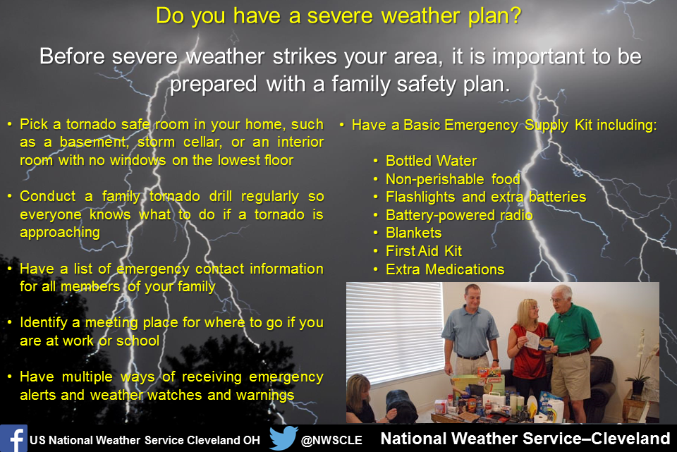
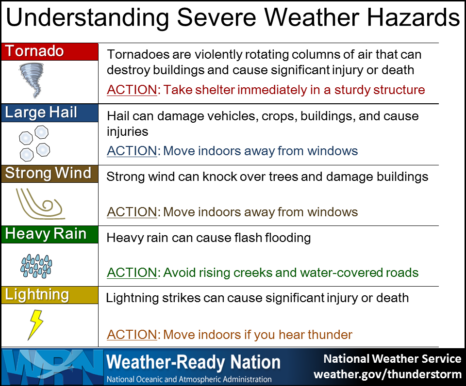
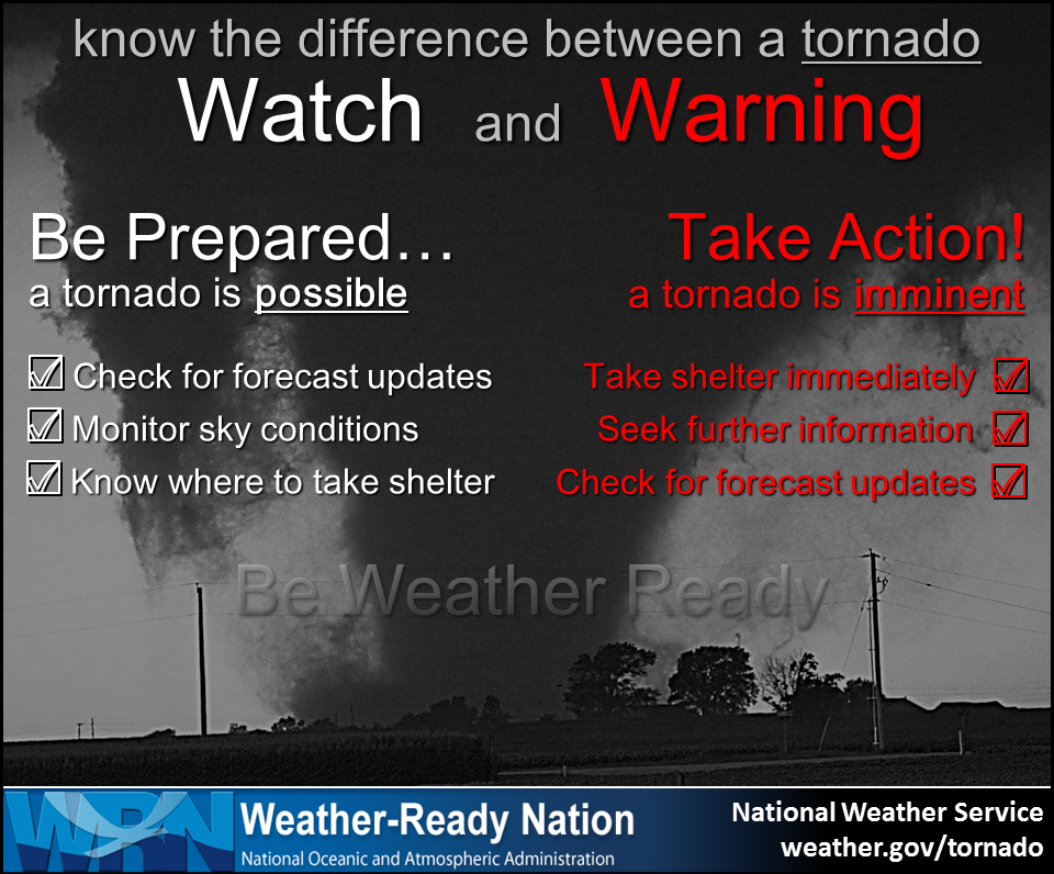
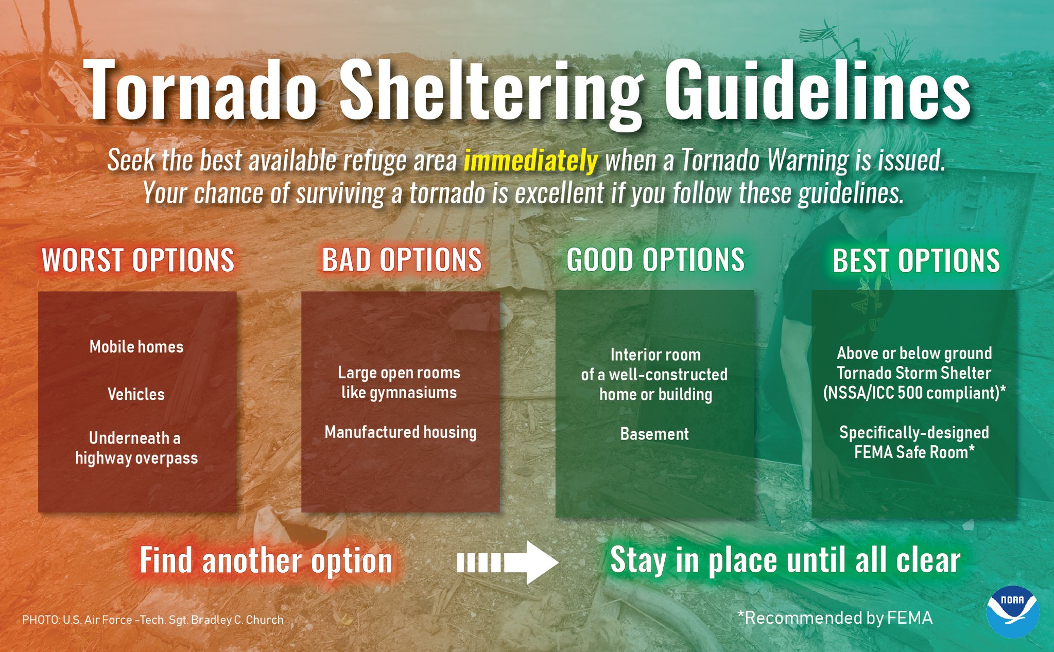
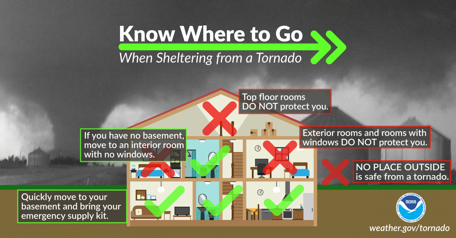
Severe Weather Resources
242
WWUS61 KCLE 190025
WCNCLE

WATCH COUNTY NOTIFICATION FOR WATCH 492
NATIONAL WEATHER SERVICE CLEVELAND OH
825 PM EDT SAT JUL 18 2026

OHC005-007-033-035-043-055-075-077-083-085-093-099-101-103-117-
123-133-139-143-147-151-153-155-169-175-PAC039-049-190130-
/O.CAN.KCLE.SV.A.0492.000000T0000Z-260719T0100Z/

THE NATIONAL WEATHER SERVICE HAS CANCELLED SEVERE THUNDERSTORM
WATCH 492 FOR THE FOLLOWING AREAS

IN OHIO THIS CANCELS 25 COUNTIES

IN NORTH CENTRAL OHIO

ASHLAND               CRAWFORD              ERIE
HURON                 KNOX                  LORAIN
MARION                MORROW                RICHLAND

IN NORTHEAST OHIO

ASHTABULA             CUYAHOGA              GEAUGA
HOLMES                LAKE                  MAHONING
MEDINA                PORTAGE               STARK
SUMMIT                TRUMBULL              WAYNE

IN NORTHWEST OHIO

OTTAWA                SANDUSKY              SENECA
WYANDOT

IN PENNSYLVANIA THIS CANCELS 2 COUNTIES

IN NORTHWEST PENNSYLVANIA

CRAWFORD              ERIE

THIS INCLUDES THE CITIES OF AKRON, ALLIANCE, ASHLAND, ASHTABULA,
AURORA, AUSTINTOWN, AVON LAKE, BAINBRIDGE, BELLEVUE, BOARDMAN,
BRUNSWICK, BUCYRUS, BURTON, CANTON, CARDINGTON, CAREY, CHARDON,
CHESTERLAND, CLEVELAND, CLYDE, CONNEAUT, CRESTLINE, EASTLAKE,
ELYRIA, ERIE, FOSTORIA, FREMONT, GALION, GENEVA, GENOA, HURON,
KENT, KILLBUCK, LORAIN, MANSFIELD, MARION, MASSILLON, MEADVILLE,
MEDINA, MENTOR, MIDDLEFIELD, MILLERSBURG, MOUNT GILEAD,
MOUNT VERNON, NILES, NORTH RIDGEVILLE, NORWALK, OAK HARBOR,
ORRVILLE, PAINESVILLE, PORT CLINTON, RAVENNA, RITTMAN, SANDUSKY,
SOUTH RUSSELL, STREETSBORO, TIFFIN, TITUSVILLE, UPPER SANDUSKY,
WADSWORTH, WARREN, WICKLIFFE, WILLARD, WILLOUGHBY, WILLOWICK,
WOOSTER, AND YOUNGSTOWN.

$$

LEZ143>149-163>169-190130-
/O.CAN.KCLE.SV.A.0492.000000T0000Z-260719T0100Z/

THE NATIONAL WEATHER SERVICE HAS CANCELLED SEVERE THUNDERSTORM
WATCH 492 FOR THE FOLLOWING AREAS

THIS CANCELS THE FOLLOWING ADJACENT COASTAL WATERS

RENO BEACH TO THE ISLANDS OH
THE ISLANDS TO VERMILION OH
VERMILION TO AVON POINT OH
AVON POINT TO WILLOWICK OH
WILLOWICK TO GENEVA-ON-THE LAKE OH
GENEVA-ON-THE-LAKE TO CONNEAUT OH
CONNEAUT OH TO RIPLEY NY
RENO BEACH TO THE ISLANDS OH BEYOND 5NM OFF SHORELINE TO US-
CANADIAN BORDER
THE ISLANDS TO VERMILION OH BEYOND 5 NM OFF SHORELINE TO US-
CANADIAN BORDER
VERMILION TO AVON POINT OH BEYOND 5 NM OFF SHORELINE TO US-
CANADIAN BORDER
AVON POINT TO WILLOWICK OH BEYOND 5 NM OFF SHORELINE TO US-
CANADIAN BORDER
WILLOWICK TO GENEVA-ON-THE-LAKE OH BEYOND 5NM OFF SHORELINE TO US-
CANADIAN BORDER
GENEVA-ON-THE-LAKE TO CONNEAUT OH BEYOND 5 NM OFF SHORELINE TO US-
CANADIAN BORDER
CONNEAUT OH TO RIPLEY NY BEYOND 5 NM OFF SHORELINE TO US-CANADIAN
BORDER

$$
| Current Watches | SPC Mesoscale Discussions |
|
|
|
| SPC Day 1 Discussion | SPC Day 2 Discussion |
|
|
|
| SPC Day 3 Discussion | SPC Days 4-8 Discussion |
|
|
|
|
|
| SPC Day 1 Wind | SPC Day 1 Hail | SPC Day 1 Tornado |
|
|
|
|
Severe Reports Today (click below for an interactive map)

|
|
|
|
|
|
|
|
|
|
|
|
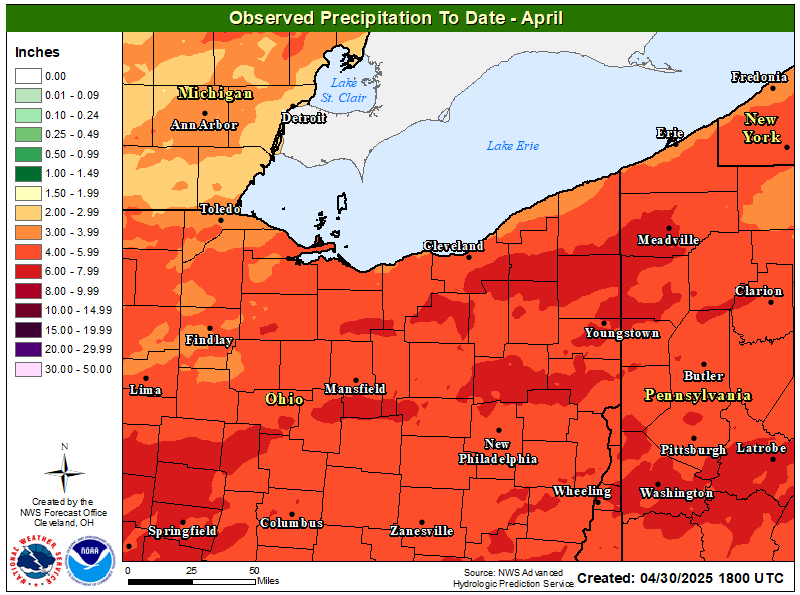
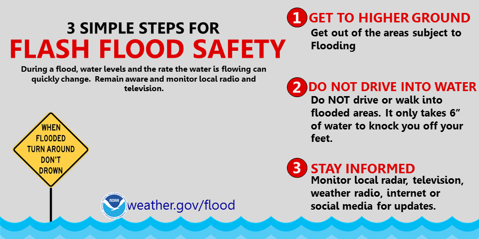
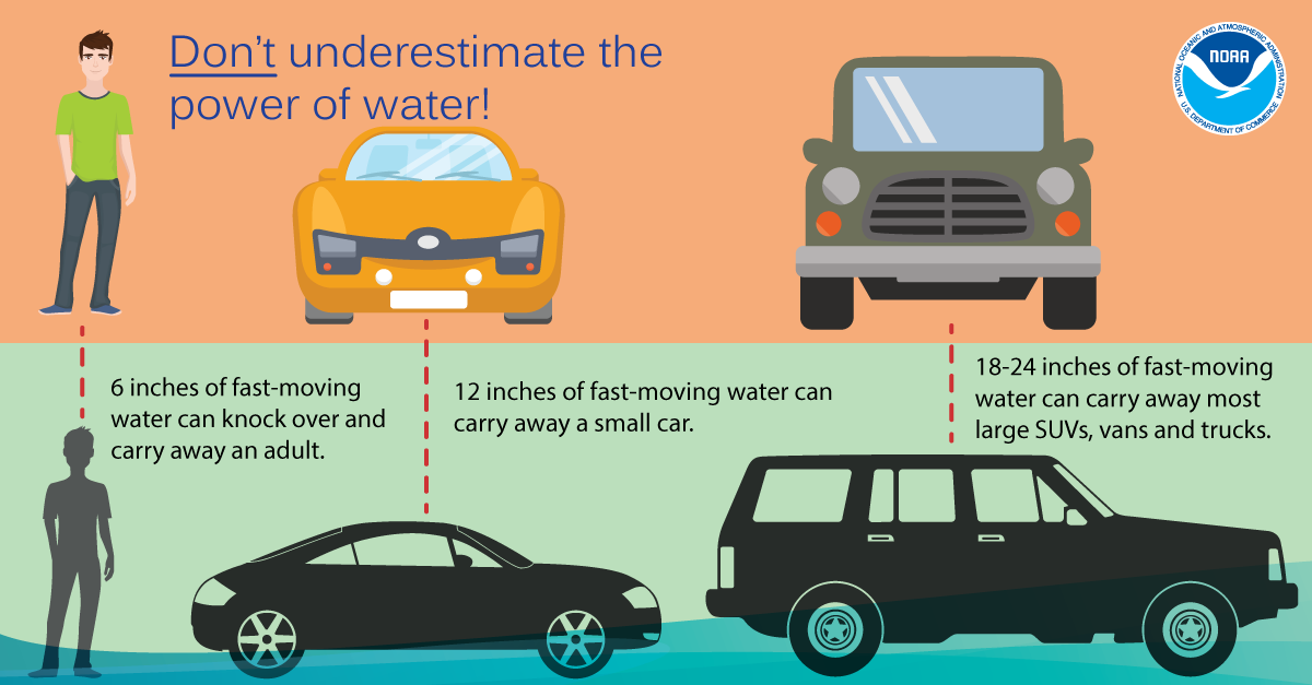
Hydrological Resources
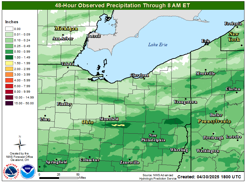
| 48-hr Observed Precip | Month To Date Precip |
|
|
|
Flood Products (Text Products & Previous Versions)
Flash Flood Warnings and Flash Flood Statements
Flood Statements (including Flood Advisories and River Flood Statements)
Flood Warnings (including River Flood Warnings)
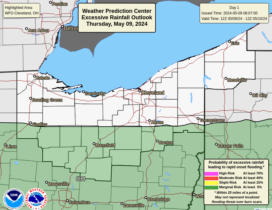
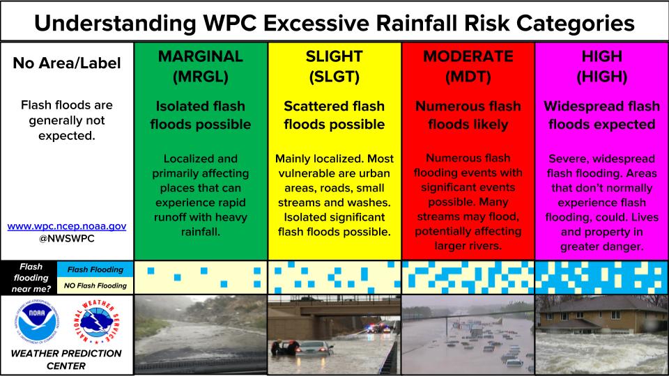
WPC Excessive Rainfall Discussion (Days 1-3)
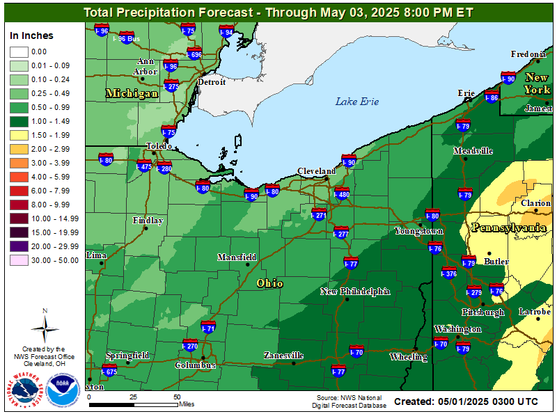
| Storm Total Precipitation Forecast |
|
|
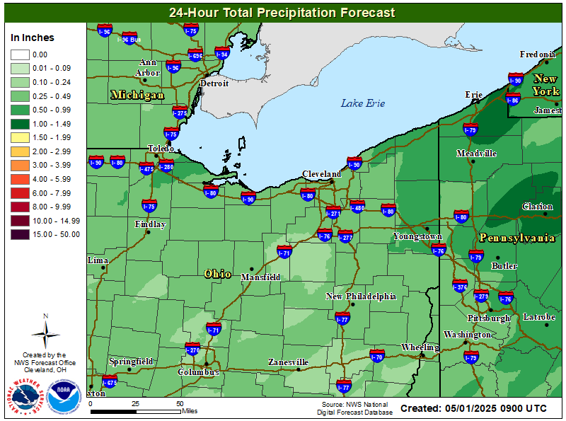
| 24-hr Rainfall Forecast | WPC Day 1 Excessive Rain Outlook |
|
|
|
| WPC Day 2 Precip Forecast | WPC Day 2 Excessive Rain Outlook |
|
|
|
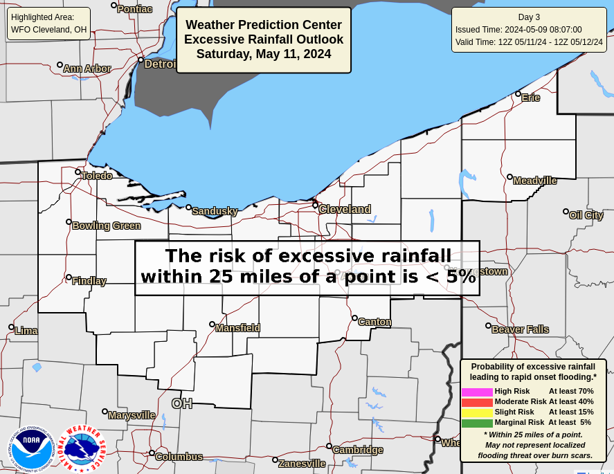
| WPC Day 3 Precip Forecast | WPC Day 3 Excessive Rain Outlook |
|
|
|
| WPC Days 1-7 Precip Forecast |
|
|
|
|
|
|
-
|
|
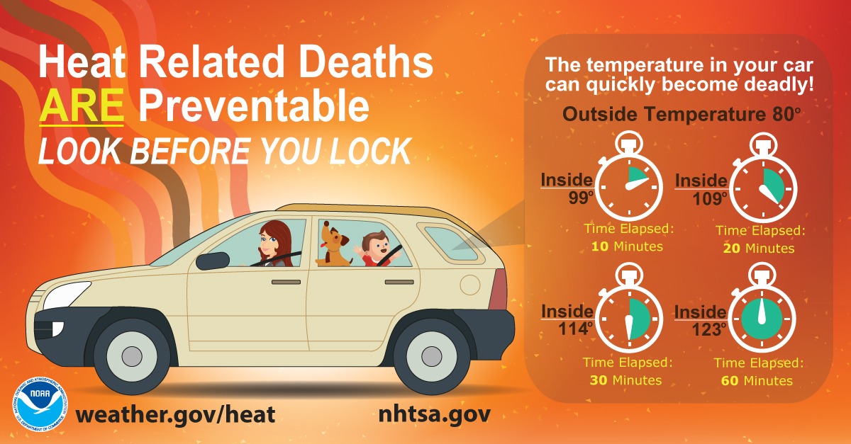
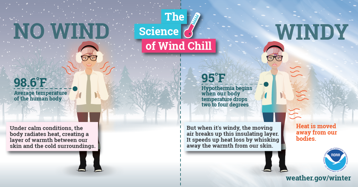
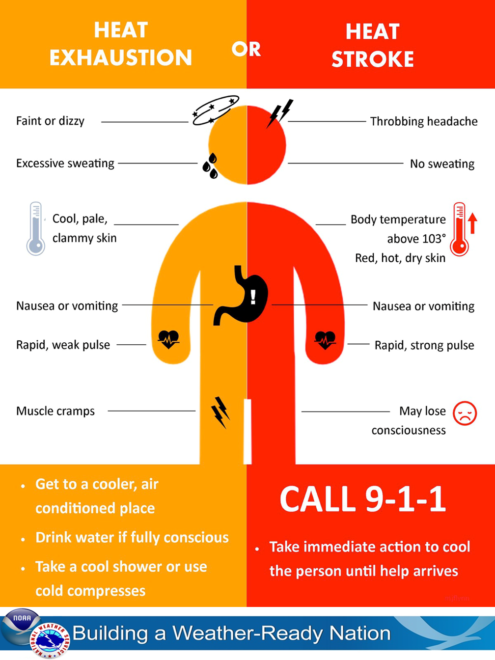
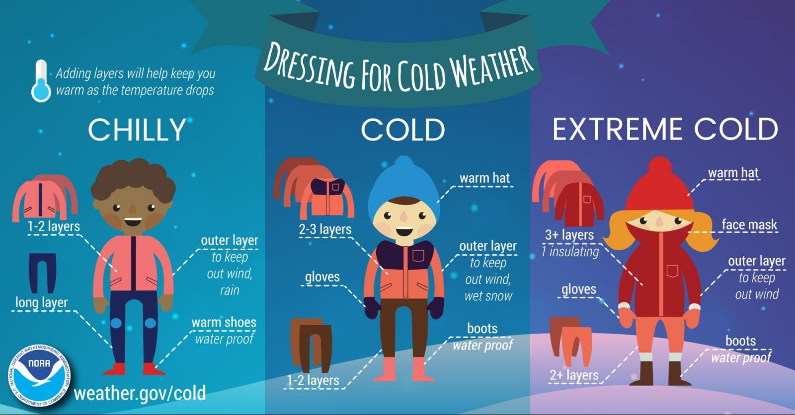
Extreme Heat/Cold Resources
922

WWUS71 KCLE 160020

NPWCLE


URGENT - WEATHER MESSAGE

National Weather Service Cleveland OH

820 PM EDT Wed Jul 15 2026


OHZ003-006>011-017>023-027>033-036>038-047-160130-

/O.EXP.KCLE.HT.Y.0006.000000T0000Z-260716T0000Z/

Lucas-Wood-Ottawa-Sandusky-Erie-Lorain-Cuyahoga-Hancock-Seneca-

Huron-Medina-Summit-Portage-Trumbull-Wyandot-Crawford-Richland-

Ashland-Wayne-Stark-Mahoning-Marion-Morrow-Holmes-Knox-

Including the cities of Willard, Upper Sandusky, Oak Harbor,

North Ridgeville, Millersburg, Elyria, Mount Vernon, Orrville,

Huron, Galion, Fremont, Crestline, Mount Gilead, Ashland,

Massillon, Cleveland, Austintown, Bellevue, Bucyrus, Fostoria,

Canton, Boardman, Genoa, Perrysburg, Toledo, Avon Lake, Sandusky,

Tiffin, Norwalk, Kent, Marion, Clyde, Findlay, Port Clinton,

Medina, Alliance, Aurora, Niles, Rittman, Killbuck, Warren,

Youngstown, Lorain, Akron, Brunswick, Mansfield, Cardington,

Wadsworth, Wooster, Carey, Ravenna, Streetsboro, and Bowling

Green

820 PM EDT Wed Jul 15 2026


...HEAT ADVISORY HAS EXPIRED...


The threat has ended.


$$


77
| Current Heat Index Observations (Map) | Current Wind Chill Observations (Map) |
|
|
|
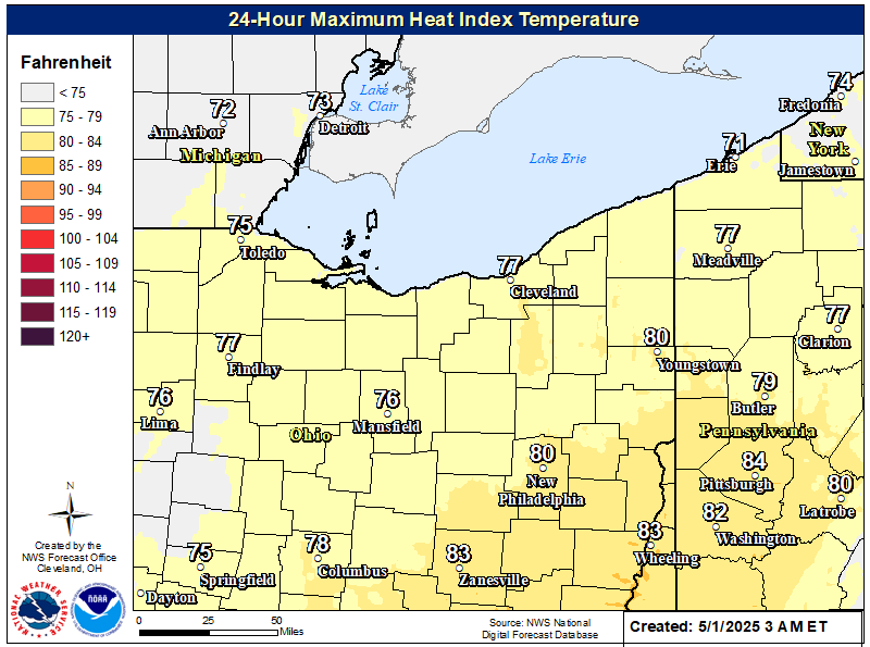
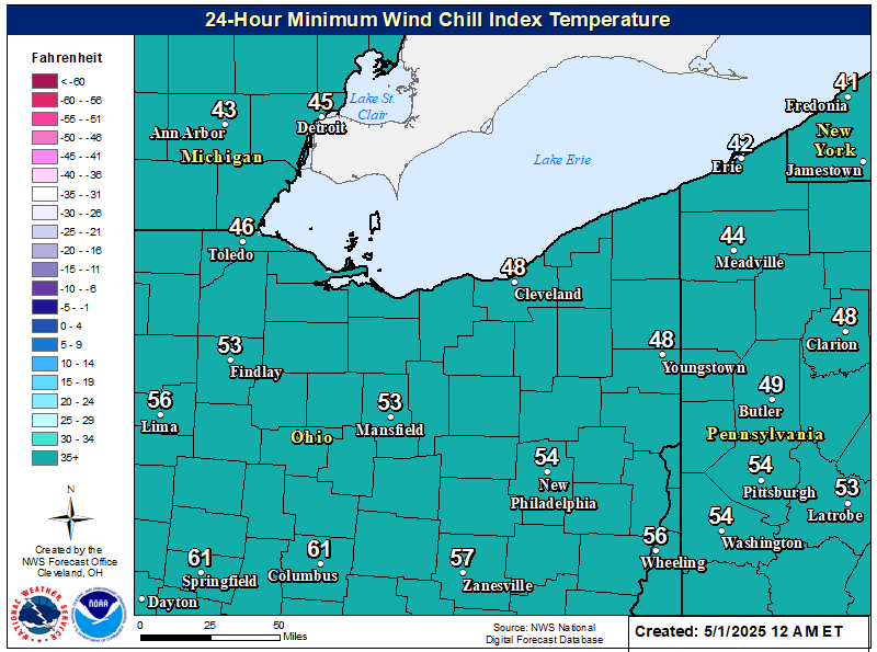
| Max Aparrent Temperature (24-hr) | Minimum Apparent Temperature (24-hr) |
|
|
|
| CPC Temperature Outlook (6-10 days) | CPC Temperature Outlook (8-14 days) |
|
|
|
| CPC Temperature Outlook (1 month) | CPC Temperature Outlook (3 months) |
|
|
|
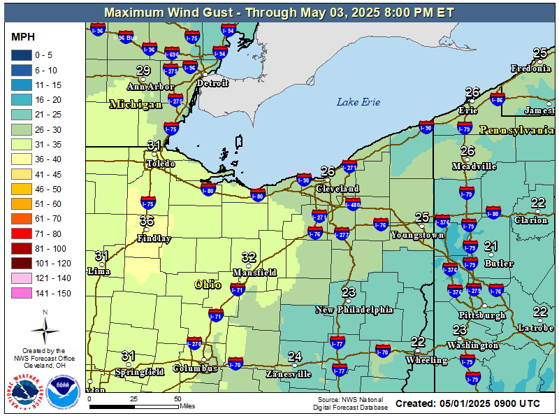
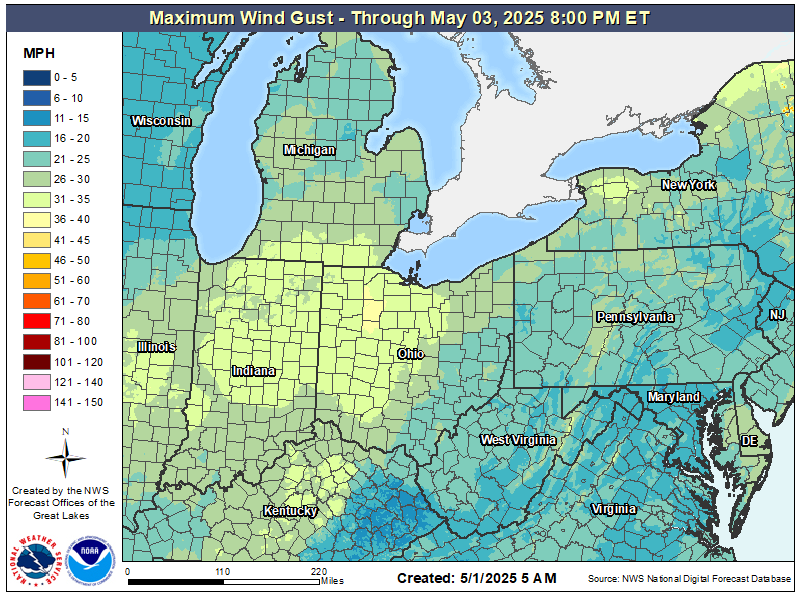
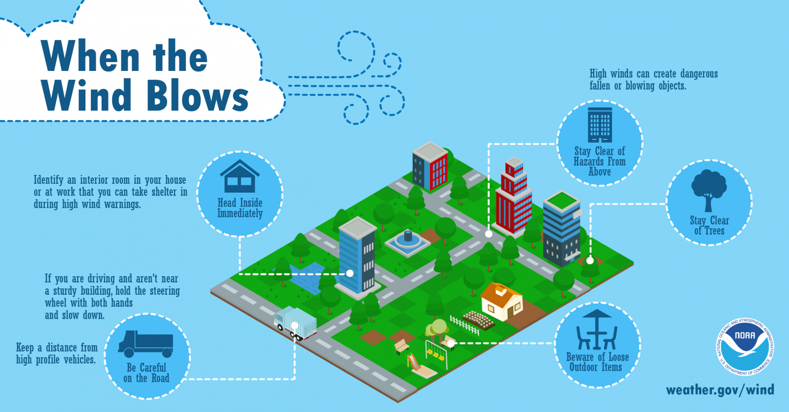
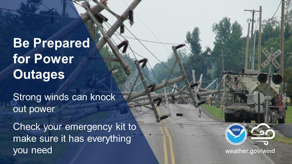
High Wind Resources
922

WWUS71 KCLE 160020

NPWCLE


URGENT - WEATHER MESSAGE

National Weather Service Cleveland OH

820 PM EDT Wed Jul 15 2026


OHZ003-006>011-017>023-027>033-036>038-047-160130-

/O.EXP.KCLE.HT.Y.0006.000000T0000Z-260716T0000Z/

Lucas-Wood-Ottawa-Sandusky-Erie-Lorain-Cuyahoga-Hancock-Seneca-

Huron-Medina-Summit-Portage-Trumbull-Wyandot-Crawford-Richland-

Ashland-Wayne-Stark-Mahoning-Marion-Morrow-Holmes-Knox-

Including the cities of Willard, Upper Sandusky, Oak Harbor,

North Ridgeville, Millersburg, Elyria, Mount Vernon, Orrville,

Huron, Galion, Fremont, Crestline, Mount Gilead, Ashland,

Massillon, Cleveland, Austintown, Bellevue, Bucyrus, Fostoria,

Canton, Boardman, Genoa, Perrysburg, Toledo, Avon Lake, Sandusky,

Tiffin, Norwalk, Kent, Marion, Clyde, Findlay, Port Clinton,

Medina, Alliance, Aurora, Niles, Rittman, Killbuck, Warren,

Youngstown, Lorain, Akron, Brunswick, Mansfield, Cardington,

Wadsworth, Wooster, Carey, Ravenna, Streetsboro, and Bowling

Green

820 PM EDT Wed Jul 15 2026


...HEAT ADVISORY HAS EXPIRED...


The threat has ended.


$$


77
| Current Wind Gust Observations (Map) | Current Station Plot Observations (Map) |
|
|
|
| Wind Gust Forecast Day 1 | Regional Wind Gust Forecast |
|
|
|
|
|
|


.jpg)