A Strengthening El Niño Could Mean A Milder Winter For the Northland
Scientists at the National Oceanic and Atmospheric Administration's (NOAA) Climate Prediction Center (CPC) have stated that there is an approximately 95% chance that El Niño will continue through Northern Hemisphere winter 2015-16, gradually weakening through spring 2016. A strong El Niño typ;ically gives the northland a warmer than normal winter.
An El Niño develops when sea surface temperatures are warmer than average in the equatorial Pacific for an extended period of time. This is important to North America because El Niño has an impact on our weather patterns, most predominantly in the winter.
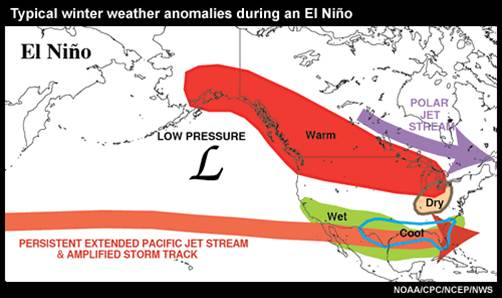
Although each El Niño is different, there are some general patterns that are predictable. For instance, the polar jet stream is typically farther north than usual, while the Pacific jet stream remains across the southern United States. This pattern brings above-normal temperatures to much of the Midwest. During the last six strong El Niño winters (since 1957), winter temperatures have averaged 4 to 5 degrees above normal. Keep in mind that this does not mean that cold weather will not happen this winter. Extreme cold weather may be milder and less frequent,however.
Snowpack can also be impacted by the typical El Niño winter pattern as well. Snowpack in the northern Rockies and Plains can be reduced and heavy snow events may be less frequent. However, El Niño's impact on the Northland's snowfall is much harder to predict as there hasn't been a noticable trend in in the snowfall statistics during El Niño years.
While past El Niño events can help inform forecasters about certain conditions, there are some limitations to using past climate trends. For instance, in the upper Midwest, El Niño is not known to impact:
|
Typical El Niño Weather Pattern Click image for larger view |
|
 |
|
|
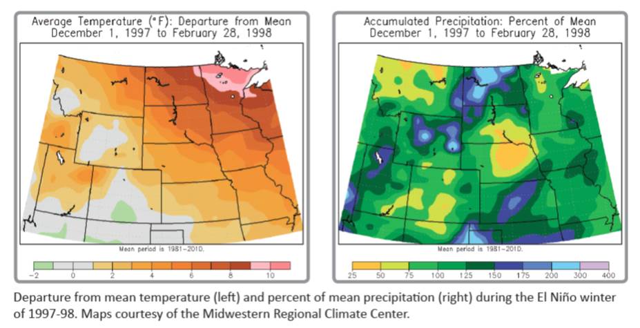
Temperature and Precipitation Anomalies for Last Strong El Niño 1997-98 Click image for larger view |
|
 |
|
 |
|
|
2015-16 Winter Climate Outlook Click on images for larger view |
|
| Temperature Outlook | Precipitation Outlook |
|
|
 |
Learn more!


 Follow us on YouTube