|
On November 11, 1911, the day started out unseasonably mild across much of the Midwest with readings in the 60s. Unknown to essentially everyone, a major storm system with a very strong arctic cold front would sweep through during the afternoon hours bringing damaging winds, severe thunderstorms, tornadoes, and unprecedented temperature falls. The sudden temperature change caught people by surprise, especially hunters who had left that morning wearing only light clothing. The temperature drop from the afternoon of November 11th, to sunrise on November 12th was 60 to nearly 70 degrees. A temperature drop of 30 to 40 degrees occurred in one hour with the passage of the arctic front. However, across southern Missouri the temperature drop occurred in as little as 15 to 30 minutes. |
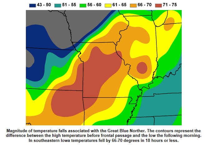 Image courtesy of Jim Lee, NWS Des Moines |
Overview
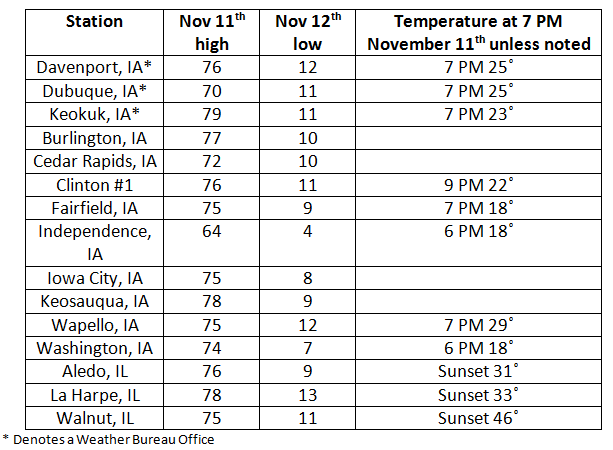
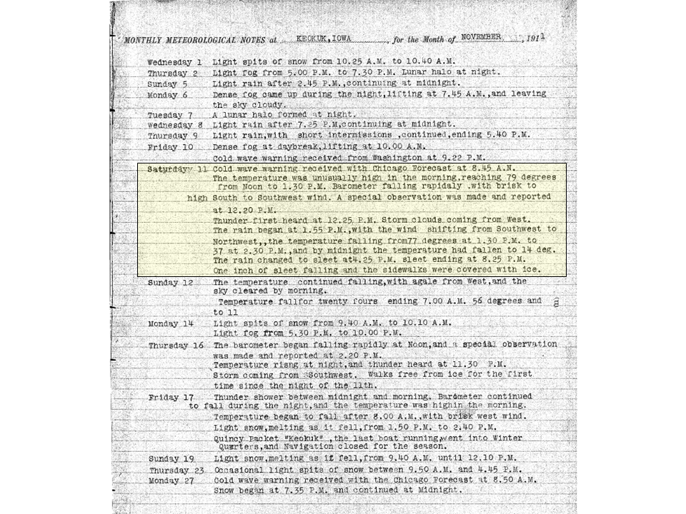
Based on data from the local Weather Bureau offices in eastern Iowa, the arctic front passed through Dubuque shortly after 1 PM (the low passed nearly over Dubuque), Davenport shortly before 1 PM, and Keokuk shortly after 1:30 PM.
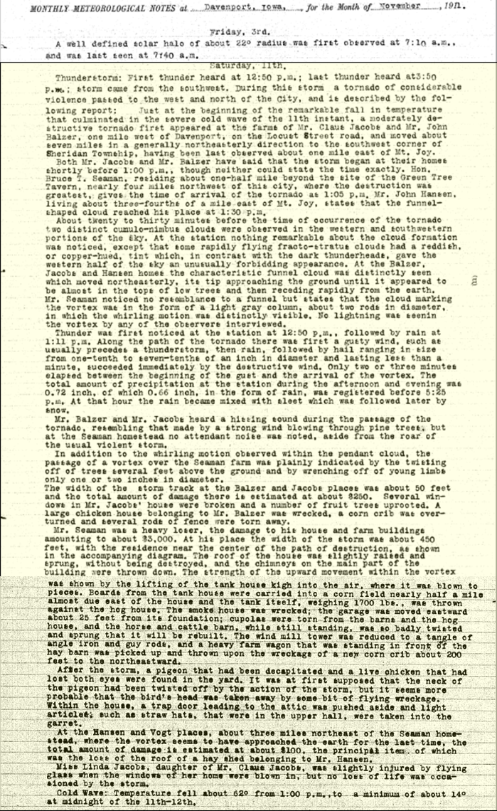
The storm system produced one known tornado in eastern Iowa. A tornado developed west of Davenport, IA on Locust Street Road and passed to the east of Mt. Joy, IA injuring one. Additional tornadoes and severe thunderstorms occurred across parts of Illinois, Indiana, Michigan, and Wisconsin.
Behind the arctic front strong winds resulted in injuries and damage to farm buildings, trees, and utility lines. The rain mixed with sleet and changed over to snow before ending. Keokuk, IA reported an inch of sleet between 4:25 and 8:25 PM on November 11th. High temperatures on November 12th were in the teens and 20s across the area.
Over 100 years later, nearly all the temperature falls set during this event, have not been equaled.
 |
Daily Maps
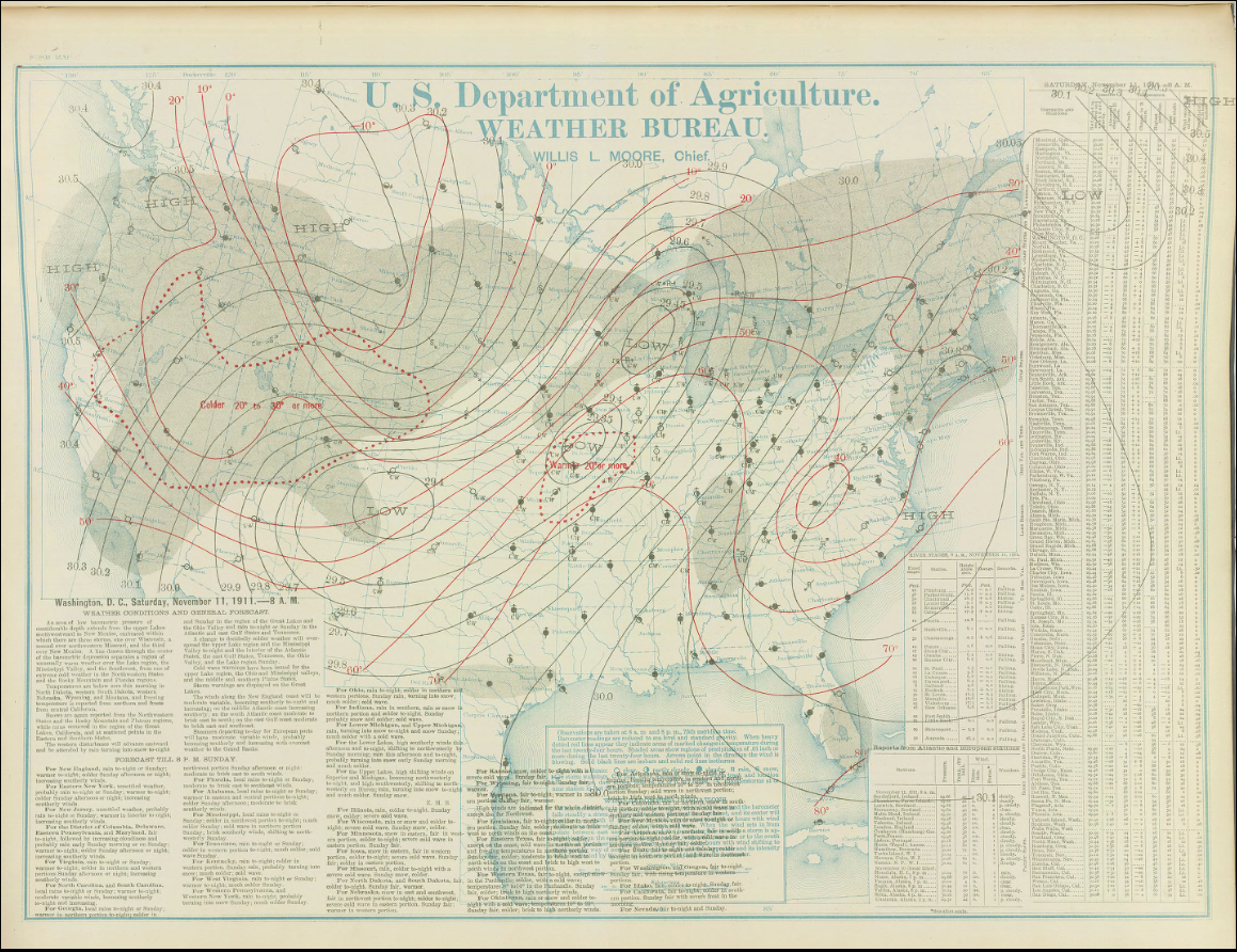
Here are the daily weather maps for November 11th and 12th at 8 AM EST. The observing stations shown in the map are the locations of Weather Bureau offices. No fronts are shown on these maps. The concept of fronts came about during and after World War I with the Norwegian Cyclone Model.
 |
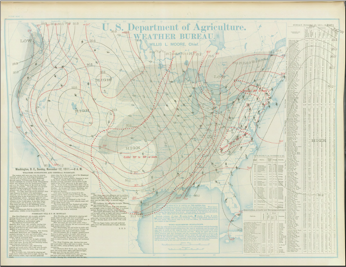 |
| November 11, 1911 | November 12, 1911 |
Temperature Change
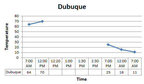
Here are the temperature changes at each Weather Bureau office in eastern Iowa. Observations were only required to be transmitted twice daily at 8 AM and PM EST in 1911. Special observations were done only at the request of the district office or by Weather Bureau headquarters in Washington, D.C. The magnitude of the temperature change on this day resulted in all three offices noting what the temperature was at certain times on November 11th in their respective monthly summary.
 |
 |
 |
Wind Speed / Direction
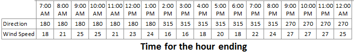
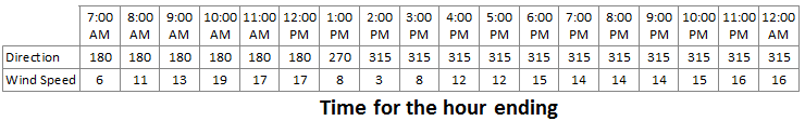
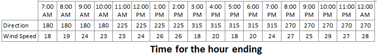
In 1911, wind speed and direction were based on an hourly average. The importance of weather data to the growing aviation industry in the 1920s and 1930s resulted in the eventual requirement that observations would be taken and transmitted each hour and more frequently if specific conditions were met. Today observed wind speed and direction is based on a 2 minute average.
The tables below show the hourly average wind direction and speed at each Weather Bureau office.
Reference; 90=east wind, 180=south wind, 270=west wind, and 360=north wind. Wind speed is in mph.
| Davenport |
 |
| Dubuque |
 |
| Keokuk |
 |
Monthly Summaries
Here are the monthly summaries from each Weather Bureau office. November 11th has been highlighted. Click on image to read each summary.
| Davenport | Dubuque | Keokuk |
 |
 |
 |
 |
Media use of NWS Web News Stories is encouraged! Please acknowledge the NWS as the source of any news information accessed from this site. |
|

