Another round of heavy rainfall will renew concerns for additional flash flooding and landslides in southern California around burn scars and coastal mountain ranges. A low pressure system is bringing enhanced snowfall downwind from the lower Great Lakes into the Northeast mountain ranges. Above average temperatures will challenge or break daily record high temperatures across the southern Plains. Read More >
Overview
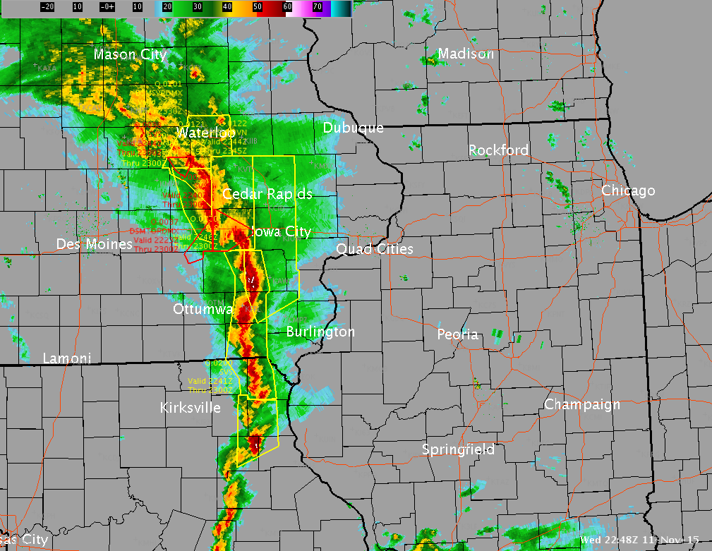
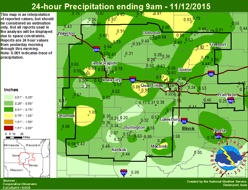
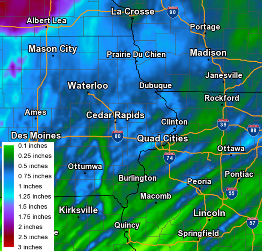
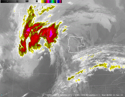
A strong area of low pressure lifted northeast across Iowa during the afternoon and evening of November 11, 2015. A line of strong to severe thunderstorms raced through the area at about 50 to 65 mph producing widespread damaging winds of 60-70 mph with a few 80+ mph reports. Rainfall amounts were mainly between 0.25 inches and 0.50 inches with some higher amounts up to 1.25 inches. Pea to penny sized hail was also reported.
Links to NWS Text Products are courtesy of the Iowa Environmental Mesonet.
Note: The information below is preliminary and subject to change pending final review of the event and publication in NWS Storm Data.
Tornado Statistics
|
Tornado #1: Le Claire, IA / Scott Co.
|
Track Map 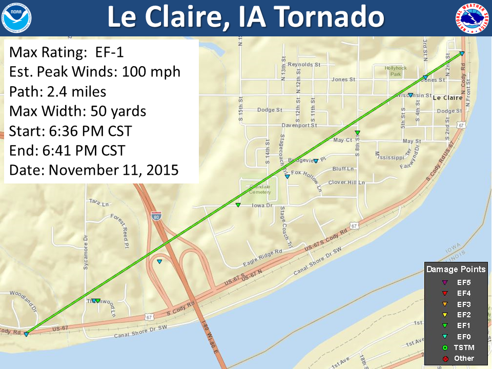
Click Map for Larger Image |
||||||||||||||||
|
Tornado #2: Geneseo, IL / Henry Co.
|
Track Map 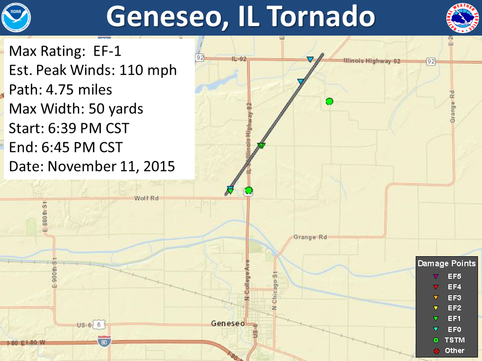
Click Map for Larger Image |
||||||||||||||||
|
Tornado #3: Arbela, MO / Scotland Co.
|
Track Map 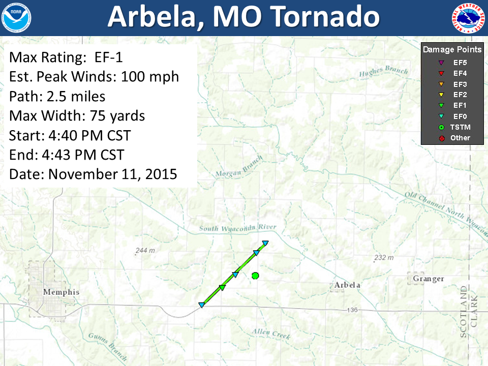 Click Map for Larger Image |
||||||||||||||||
|
Tornado #4: What Cheer, IA to North English, IA / Keokuk Co. & Iowa Co.
|
Track Map 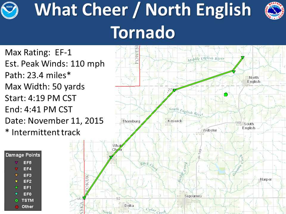
Click Map for Larger Image |
||||||||||||||||
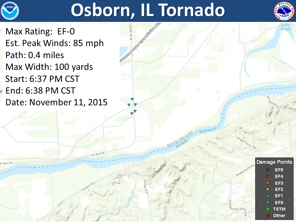
| Tornado #5: Osborn, IL/Rock Island Co. | Track Map | ||||||||||||||||
|
Click Map for Larger Image |
||||||||||||||||
The Enhanced Fujita (EF) Scale classifies tornadoes into the following categories:
| EF0 Weak 65-85 mph |
EF1 Moderate 86-110 mph |
EF2 Significant 111-135 mph |
EF3 Severe 136-165 mph |
EF4 Extreme 166-200 mph |
EF5 Catastrophic 200+ mph |
 |
|||||
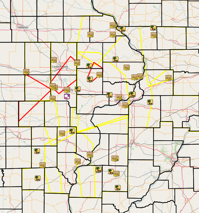
Radar Data
 |
Rain Reports
| Local Rainfall | Regional Rainfall |
| (Created by 11am. Click to enlarge.) | (Click to enlarge.) |
 |
 |
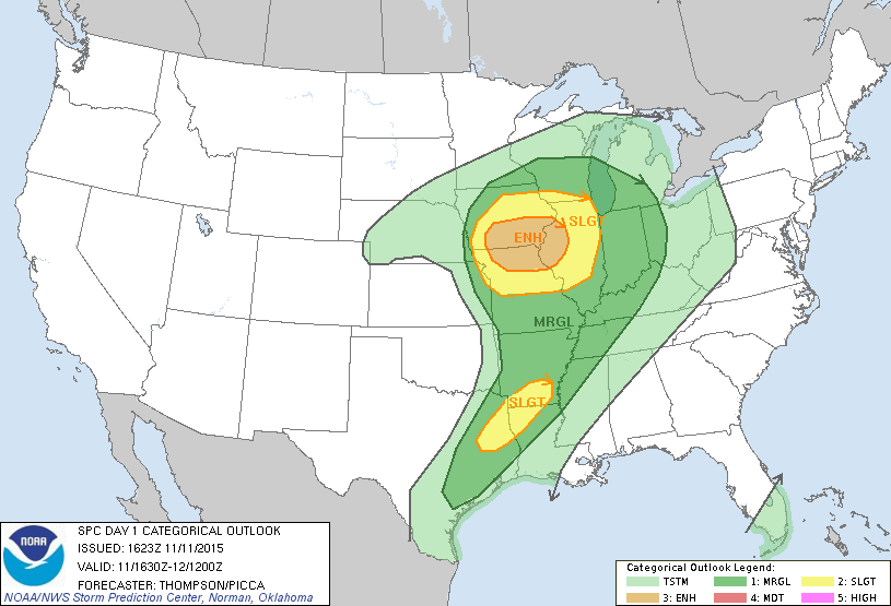
Environment
Miscellaneous
| Satellite Loop | |
| (Click to enlarge.) | |
 |
|
| Summaries from other NWS Offices | |
| Media use of NWS Web News Stories is encouraged. Please acknowledge the NWS as the source of any news information accessed from this site. |