Another round of heavy rainfall will renew concerns for additional flash flooding and landslides in southern California around burn scars and coastal mountain ranges. A low pressure system is bringing enhanced snowfall downwind from the lower Great Lakes into the Northeast mountain ranges. Above average temperatures will challenge or break daily record high temperatures across the southern Plains. Read More >
Quad Cities, IA/IL
Weather Forecast Office
Overview
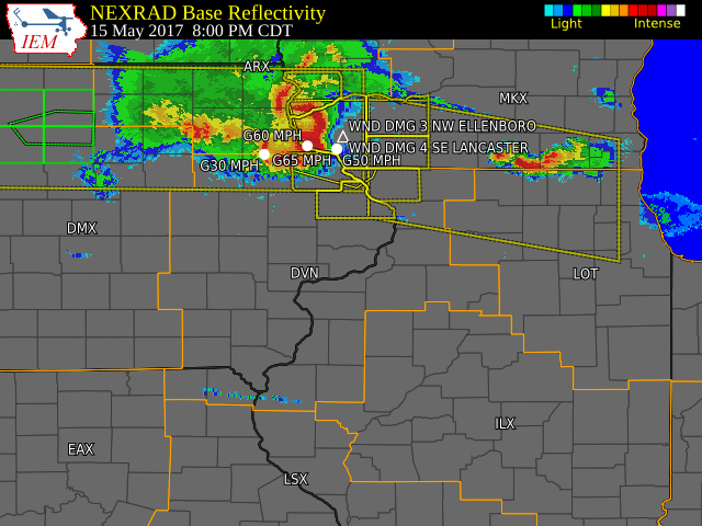
Severe thunderstorms developed along and north of a warm front Monday evening, bringing large hail and damaging winds to areas near a line from Decorah, IA to Rockford IL. Several reports of tree damage was seen with these storms.Storm Reports
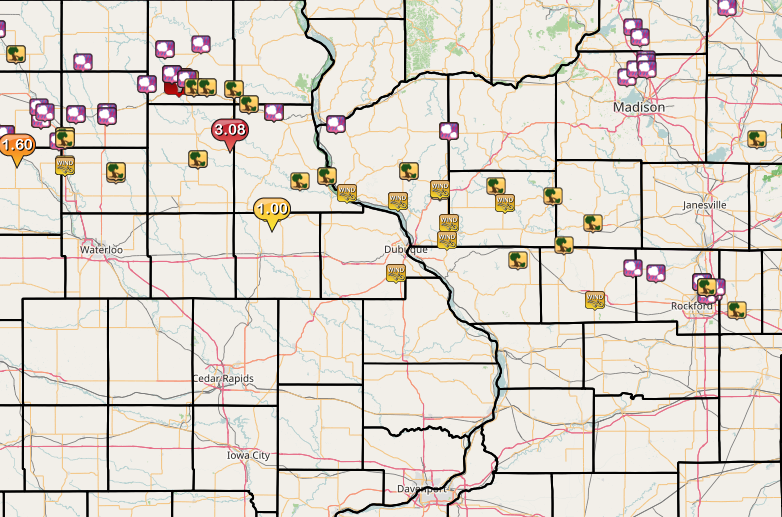
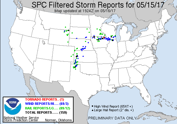
| Interactive Storm Report Map | SPC Storm Reports |
 |
 |
PRELIMINARY LOCAL STORM REPORT...SUMMARY
NATIONAL WEATHER SERVICE QUAD CITIES IA IL
946 PM CDT MON MAY 15 2017

..TIME...   ...EVENT...      ...CITY LOCATION...     ...LAT.LON...
..DATE...   ....MAG....      ..COUNTY LOCATION..ST.. ...SOURCE....
            ..REMARKS..

0824 PM     TSTM WND GST     DUBUQUE REGIONAL AIRPOR 42.40N 90.72W
05/15/2017  E60.00 MPH       DUBUQUE            IA   ASOS

            52 KNOTS MEASURED.

0857 PM     TSTM WND DMG     APPLE RIVER CANYON STAT 42.45N 90.05W
05/15/2017                   JO DAVIESS         IL   LAW ENFORCEMENT

            TREE DOWN ON EAST CANYON RD. DELAYED REPORT, TIME
            ESIMATED.

0923 PM     TSTM WND GST     E FREEPORT              42.29N 89.63W
05/15/2017  M50.00 MPH       STEPHENSON         IL   TRAINED SPOTTER

0940 PM     HAIL             NW DAVIS                42.42N 89.42W
05/15/2017  M0.25 INCH       STEPHENSON         IL   TRAINED SPOTTER
|
|
 |
Media use of NWS Web News Stories is encouraged! Please acknowledge the NWS as the source of any news information accessed from this site. |
|
Hazardous Weather
Watches, Warnings, & Advisories
Briefing
Hazards Page
View Local Storm Reports
Submit Report
Road Reports
Text Products
Forecasts
Fire Weather
Briefing
Hourly Forecast Graphs
Forecast Discussion
User-Defined Area
Activity Planner
Local Forecasts
Space Weather
Text Products
River Graphs
Airport Forecasts
Snow and Ice Probabilities
Winter Storm Severity Index (WSSI)
Current Conditions
Observations
Drought Monitor
Radar
Satellite
Text Products
Rivers and Lakes
River Graphs
Sunrise/Sunset Tables
Seasons (Equinoxes/Solstices)
Road Reports
Past Weather
Recent Observation History
Climate Summaries
Past Events
Climate Normals/Averages
Climate Records
Climate/Almanac Data
Holiday Climatology
Climate Maps
Climate Graphs
Observation Site History
Sunrise/Sunset Tables
US Dept of Commerce
National Oceanic and Atmospheric Administration
National Weather Service
Quad Cities, IA/IL
9040 N Harrison Street
Davenport Municipal Airport
Davenport, IA 52806-7326
563-386-3976
Comments? Questions? Please Contact Us.