Another round of heavy rainfall will renew concerns for additional flash flooding and landslides in southern California around burn scars and coastal mountain ranges. A low pressure system is bringing enhanced snowfall downwind from the lower Great Lakes into the Northeast mountain ranges. Above average temperatures will challenge or break daily record high temperatures across the southern Plains. Read More >
Overview
|
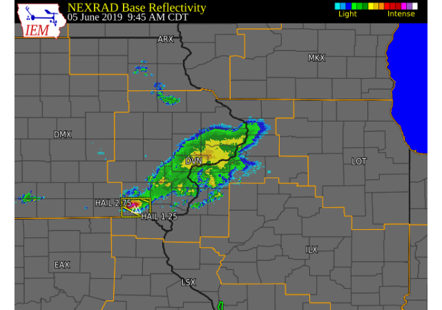
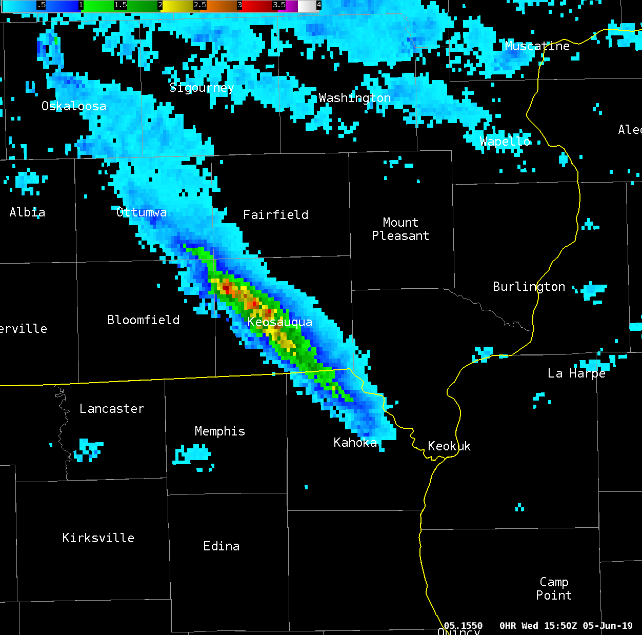
A strong thunderstorm developed over southeast Iowa Wednesday morning and tracked southeast over southeast Iowa and northeast Missouri. This storm quickly intensified over Van Buren county and dropped baseball size hail in Keosauqua, along with heavy rain and lightning. The storm continued into Clark county Missouri where it weakened. |
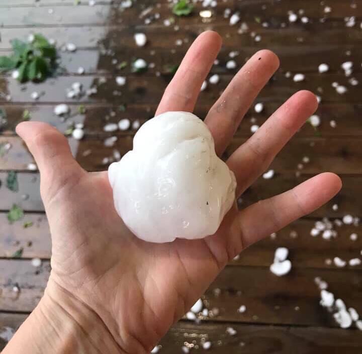 Baseball hail in Keosauqua, IA Photo: Nancy Huff |
 |
 |
 |
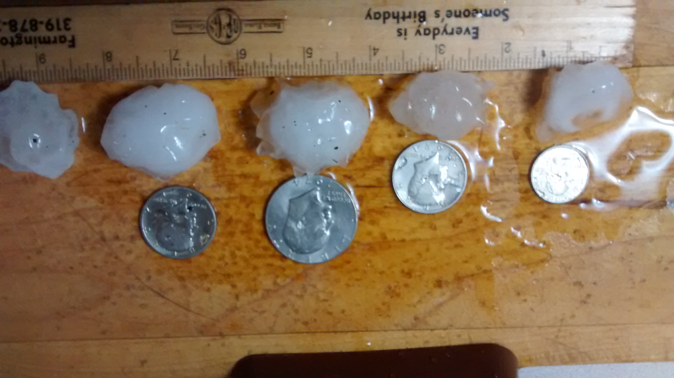
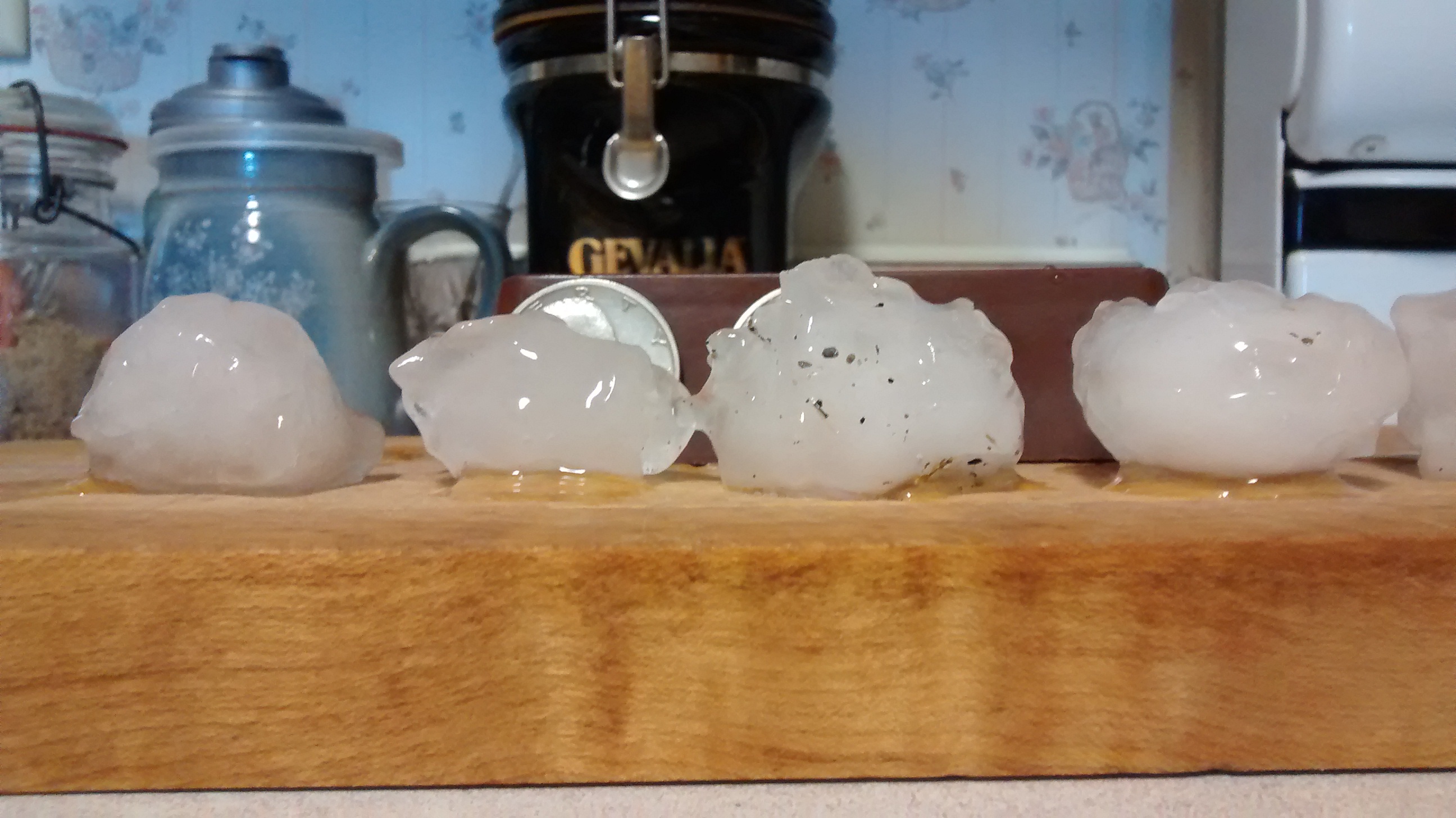
| 5 WSW Farmington, IA Photo: Judy Gaston |
5 WSW Farmington, IA Photo: Judy Gaston |
MRMS Max Estimated Hail Size Swath |
Storm Reports
| Interactive Storm Reports Map | SPC STORM REPORTS |
 |
 |
PRELIMINARY LOCAL STORM REPORT...SUMMARY
NATIONAL WEATHER SERVICE QUAD CITIES IA IL
1143 AM CDT WED JUN 5 2019

..TIME...   ...EVENT...      ...CITY LOCATION...     ...LAT.LON...
..DATE...   ....MAG....      ..COUNTY LOCATION..ST.. ...SOURCE....
            ..REMARKS..

1017 AM     HAIL             5 WSW FARMINGTON        40.61N 91.83W
06/05/2019  M1.00 INCH       VAN BUREN          IA   TRAINED SPOTTER


1015 AM     HAIL             3 ENE CHARLIE HEATH MEM 40.61N 91.84W
06/05/2019  M2.00 INCH       CLARK              MO   TRAINED SPOTTER


1000 AM     HAIL             KEOSAUQUA               40.73N 91.97W
06/05/2019  E2.75 INCH       VAN BUREN          IA   EMERGENCY MNGR

            WINDOWS KNOCKED OUT IN THE HIGH SCHOOL
            BUILDING IN KEOSAUQUA. NO INJURIES.

0957 AM     HAIL             2 ESE KEOSAUQUA         40.72N 91.92W
06/05/2019  M1.25 INCH       VAN BUREN          IA   TRAINED SPOTTER

            QUARTER TO HALF DOLLAR SIZED HAIL. VERY
            HEAVY RAINFALL AND GUSTY WINDS. LEAVES OFF
            SOME TREES. TIME ESTIMATED BASED ON RADAR
            AND OTHER REPORTS.

0955 AM     HAIL             KEOSAUQUA               40.73N 91.97W
06/05/2019  M2.75 INCH       VAN BUREN          IA   TRAINED SPOTTER

            ALSO SMALL BRANCHES DOWN.
 |
Media use of NWS Web News Stories is encouraged! Please acknowledge the NWS as the source of any news information accessed from this site. |
|