Overview
|
The second major winter storm of 2017 arrived late in the weekend, January 8th, and continued through Tuesday, January 10th. Heavy snow fell over the mountains with snow changing over to rain in several of the valleys as warmer temperatures moved into the area. However, some of the valleys saw strong inversions early on in the storm, before most areas mixed out on Monday, January 9th. Even Telluride, Colorado, elevation 9070 feet, received rain late Sunday and again on Monday! The abundance of rain and snow fell as a result of a very warm and moist atmospheric river, also known as the "Pineapple Express", stretching from Hawaii all the way to Colorado. Several waves of energy also passed through the area, enhancing the heavy precipitation. Snowfall amounts varied from 1 to 2 feet for the higher mountains with up to 4 feet of snow near Crested Butte! This resulted in a very rare closure for the ski resort on Monday. One other event, was an anomalous Ice Storm that severely impacted travel, commerce and educational institutes across the cities of Grand Junction and Durango. You can find a detailed overview of the ice storm here. |
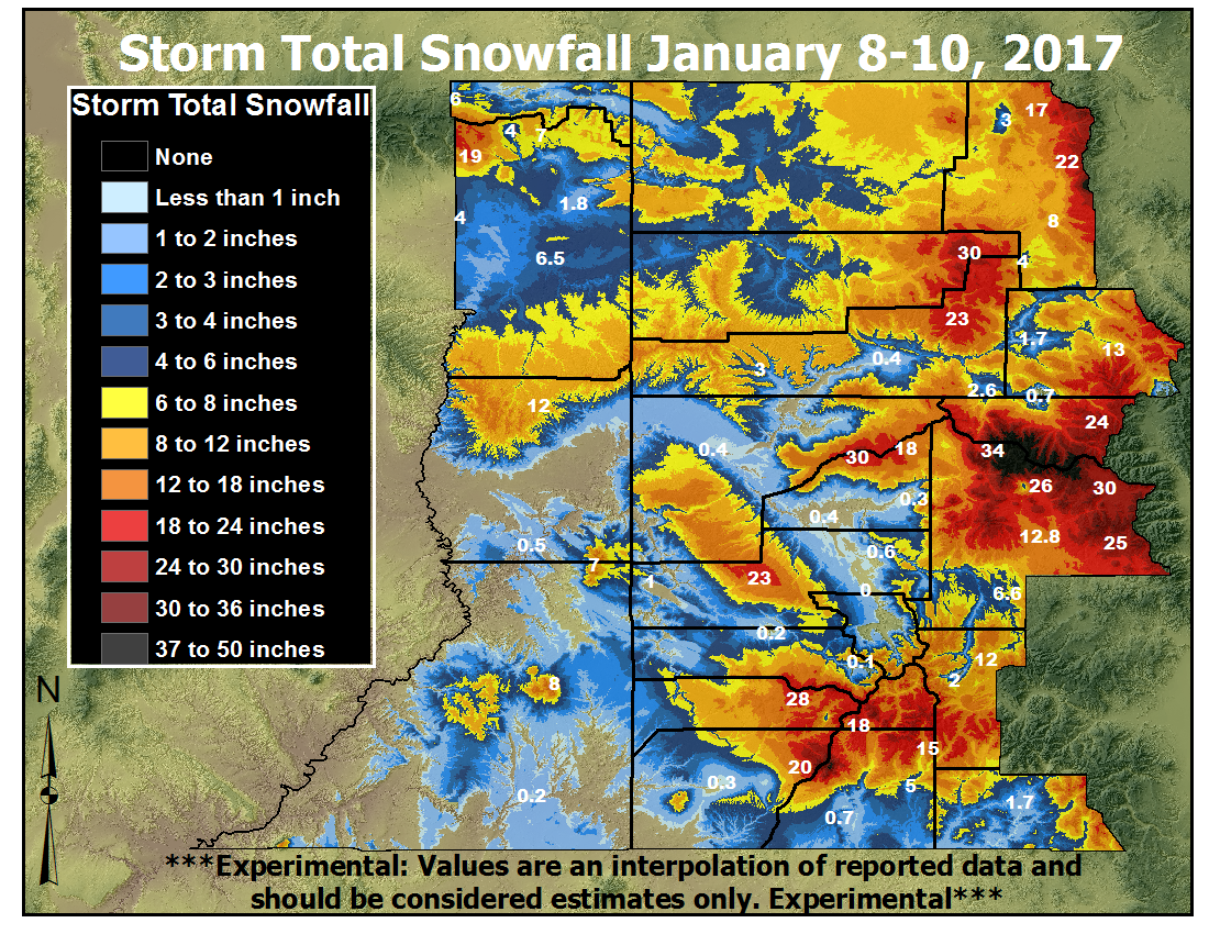 Preliminary Storm Total Snowfall from Sunday, January 8th through Tuesday, January 10th, 2017 |
 |
 |
 |
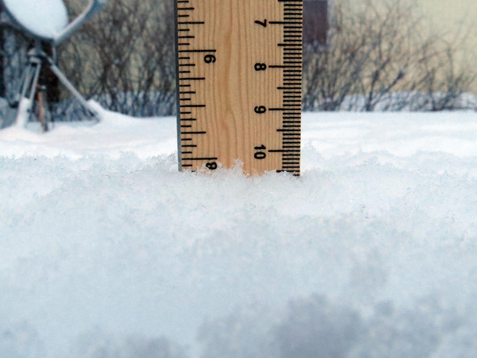
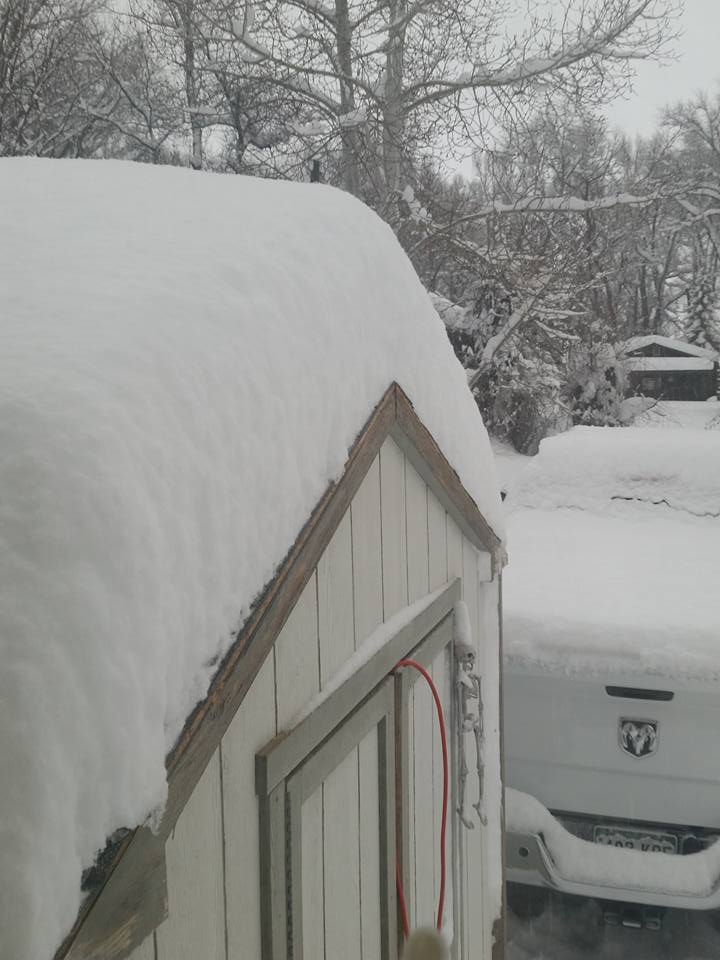
| Snowfall in Gunnison ( Kellie Roberts ) |
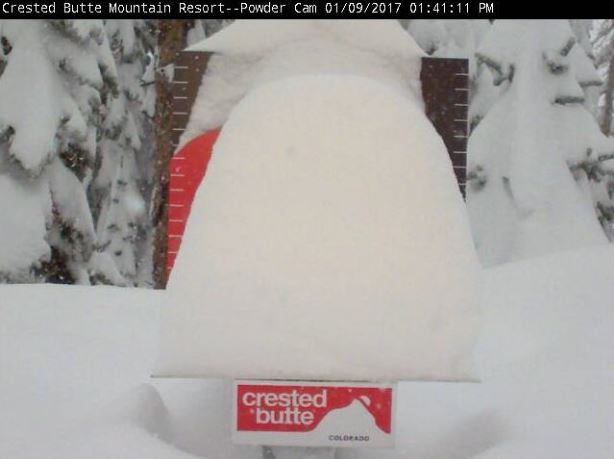
Depth of Snow when the Crested Butte Ski Resort Closed! ( Crested Butte Ski Resort ) |
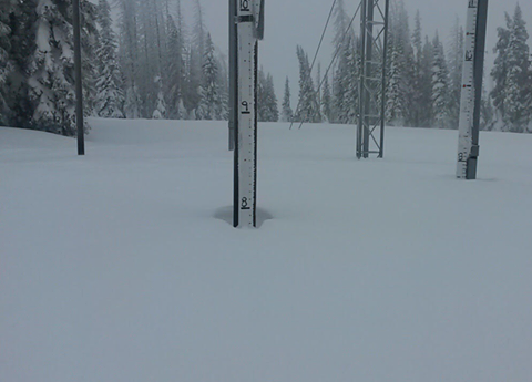
Near 8 FEET of snow at the Tower SNOTEL near Steamboat Springs. ( Art Judson ) |
Photos & Video:
Snowfall pictures during the Storm, Hazardous Travel Conditions, and update on the Snowpack
 |
 |
 |
 |
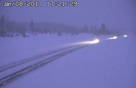
| Travel over Rabbit Ears Pass ( CDOT ) |
Deep Snow in Gunnison ( Desiree Bartelli ) |
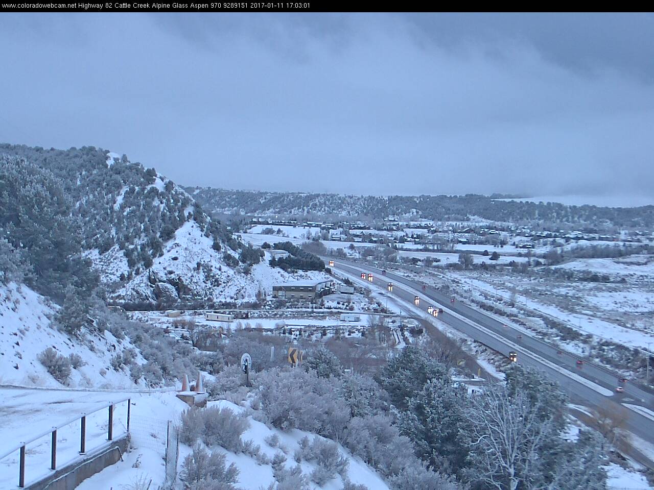
Highway 62 near Basalt ( ColoradoWebCam.net ) |
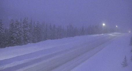
Heavy Snow Falling at Vail Pass ( CDOT ) |
 |
 |
 |
 |
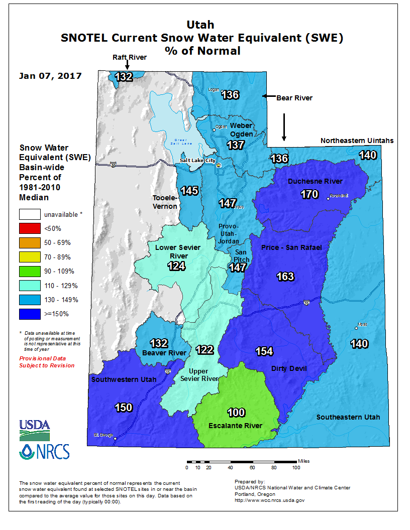
| Utah Snowpack - Jan 7, 2017 ( before the storm ) ( Credit: USDA/NRCS ) |
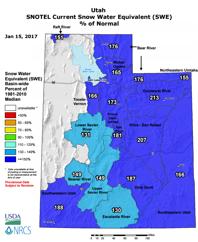
Utah Snowpack - Jan 15, 2017 ( after the storm ) ( Credit: USDA/NRCS ) |
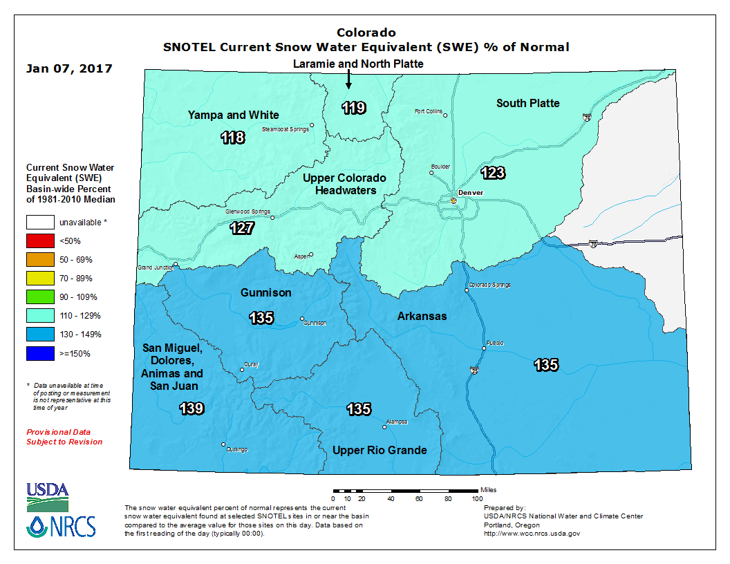
Colorado Snowpack - Jan 7, 2017 ( before the storm ) ( Credit: USDA/NRCS ) |
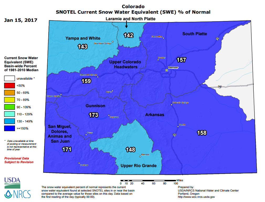
Colorado Snowpack - Jan 15, 2017 ( after the storm ) ( Credit: USDA/NRCS ) |
Storm Reports
Snow continued for the Colorado mountains though it became lighter
and will remain so through Wednesday.  The following amounts are preliminary
and since snow began.

Northwest Colorado Mountains:
Elkhead and Park Ranges........18 to 24 inches. Tower reports 48 inches.
Flat Tops......................12 to 24 inches.

West Central Colorado Mountains:
Grand Mesa.....................18 to 30 inches.
Gore and Elk Ranges............12 to 36 inches.
West Elk and Sawatch Ranges....24 to 48 inches.

Southwest Colorado Mountains:
Uncomphagre Plateau............24 to 36 inches.
Northwest San Juan Mountains...18 to 24 inches.
Southwest San Juan Mountains...12 to 24 inches.

...Snowfall Reports...

Location                     Amount    Time/Date       Elevation (ft.)
Crested Butte 6.2 N          19.5 in   0700 AM 01/10   9606
Gothic                       19.0 in   0700 AM 01/10   9469
Pitkin 1.1 SW                17.0 in   0700 AM 01/10   9139
Cedaredge 10.5 NNW           11.3 in   0800 AM 01/10   10399
Vail 0.9 WNW                 10.0 in   0700 AM 01/10   8172
Vail 2.6 E                   9.0 in    0700 AM 01/10   8389
Yampa 5.1 S                  7.5 in    0730 AM 01/10   8496
Avon 2N                      6.8 in    0600 AM 01/10   8200
Bayfield 7.0 N               5.0 in    0700 AM 01/10   8200
Naples                       5.0 in    0700 AM 01/10   5200
Steamboat Springs 1.9 E      4.6 in    0600 AM 01/10   7200
5 W Vallecito                4.6 in    0700 AM 01/10   8228
Vernal                       4.5 in    0630 AM 01/10   5470
Vernal 0.8 S                 4.5 in    0630 AM 01/10   5351
Steamboat Springs 0.7 ESE    3.3 in    0700 AM 01/10   7049
Gunnison Coop                3.0 in    0800 AM 01/10   7640
Steamboat Springs 1.5 WNW    3.0 in    0700 AM 01/10   6778
Steamboat Springs 2.5 N      3.0 in    0700 AM 01/10   7005
2 SSE Glenwood Springs       2.7 in    0700 AM 01/10   5947
Steamboat Springs 1.2 SE     2.7 in    0545 AM 01/10   7075
Gunnison 6.6 N               2.5 in    0700 AM 01/10   7941
Carbondale 4.6 NNE           2.3 in    0700 AM 01/10   6521
Doyleville 2.1 W             2.0 in    0827 AM 01/10   8134
Glenwood Springs 7.2 S       2.0 in    0700 AM 01/10   6914
Mesa 6S                      2.0 in    0600 AM 01/10   7720
Pagosa Springs 2.5 W         2.0 in    0800 AM 01/10   7566
Glenwood Springs 1.7 NW      1.9 in    0700 AM 01/10   6050
Carbondale 5.7 E             1.8 in    0730 AM 01/10   6427
Pagosa Springs 1.6 SSW       1.7 in    0815 AM 01/10   7401
Glenwood Springs 5.3 SSE     1.6 in    0700 AM 01/10   5942
3 E Plateau City             1.6 in    0700 AM 01/10   7044
Bayfield 7N                  1.5 in    0700 AM 01/10   7460
Carbondale 0.5 W             1.5 in    0500 AM 01/10   6171
Gypsum 1.9 SSW               1.5 in    0700 AM 01/10   6531
Jensen 0.4 WSW               1.3 in    0700 AM 01/10   4768
5 SW Colona                  1.0 in    0900 AM 01/10   0
Gunnison 3wsw                1.0 in    0700 AM 01/10   7602
Gypsum 13.4 NW               1.0 in    0700 AM 01/10   7209
Mack 5 NW                    1.0 in    0700 AM 01/10   4620
Montrose #2                  1.0 in    0800 AM 01/10   5785
Montrose 8.1 WNW             1.0 in    0700 AM 01/10   5770
Rangely                      1.0 in    0800 AM 01/10   5290
Powderhorn 4.4 NNE           0.9 in    0800 AM 01/10   9065
Shoshone                     0.7 in    0730 AM 01/10   5930
Basalt 5.8 E                 0.6 in    0700 AM 01/10   7164
Black Canyon of the Gunnison 0.6 in    0800 AM 01/10   8150
Ouray .23 NNW                0.6 in    0738 AM 01/10   7728
Ouray Spotter                0.6 in    0738 AM 01/10   7727
Cimarron 11.2 S              0.5 in    0700 AM 01/10   8356
Craig Coop                   0.5 in    0700 AM 01/10   6440
17 W Glade Park              0.5 in    0800 AM 01/10   6385
Glenwood Springs .64 S       0.5 in    0700 AM 01/10   5824
Montrose 7.3 ENE             0.5 in    0700 AM 01/10   6914
Durango 4.8 WSW              0.4 in    0700 AM 01/10   7430
Montrose 2.9 ESE             0.4 in    0700 AM 01/10   6043
Collbran 0.2 ESE             0.3 in    0700 AM 01/10   6043
2 ESE Gypsum                 0.3 in    0700 AM 01/10   6660
Gypsum 0.4 WNW               0.3 in    0700 AM 01/10   6345
Pagosa Springs 15.0 SSE      0.3 in    0700 AM 01/10   7408
Grand Junction 4.1 W         0.2 in    0700 AM 01/10   4630
Hesperus 9.8 SW              0.2 in    0640 AM 01/10   7035
Hotchkiss 7.1 WNW            0.2 in    0700 AM 01/10   6600
Ignacio Spotter              0.2 in    0700 AM 01/10   6562
Montrose 4.0 NW              0.2 in    0800 AM 01/10   5729
Paonia 2.1 SSE               0.2 in    0800 AM 01/10   6100
Ridgway 3.3 NNW              0.2 in    0700 AM 01/10   7623
Grand Junction Coop          0.1 in    0800 AM 01/10   4760
Montrose 1.6 E               0.1 in    0700 AM 01/10   5919
Montrose 2e                  0.1 in    0700 AM 01/10   5806
Norwood 1.4 W                0.1 in    0845 AM 01/10   7100
 |
Media use of NWS Web News Stories is encouraged! Please acknowledge the NWS as the source of any news information accessed from this site. |
|


 Follow us on YouTube