
Heavy lake effect snow, gusty winds, and localized blizzard conditions will persist through Thanksgiving near and downwind of the Great Lakes. Rain and mountain snow are forecast for the Pacific Northwest. Confidence is increasing for another winter storm to develop over the northern and central Rockies Friday and track across the central Plains through the Midwest and Great Lakes this weekend. Read More >
After several days (and weeks in some areas) of warm, spring-like temperatures and dry conditions, a return to wetter and cooler conditions can be expected by early next week.
For much of February, the weather across eastern Utah and western Colorado has been dominated by a stubborn ridge of high pressure centered over the Great Basin. This has acted to deflect (or move) most of the active storm track well north of the area. The persistent ridge is expected to breakdown or shift east late this weekend, opening the door for a series of wet Pacific storms to pass through the western states.
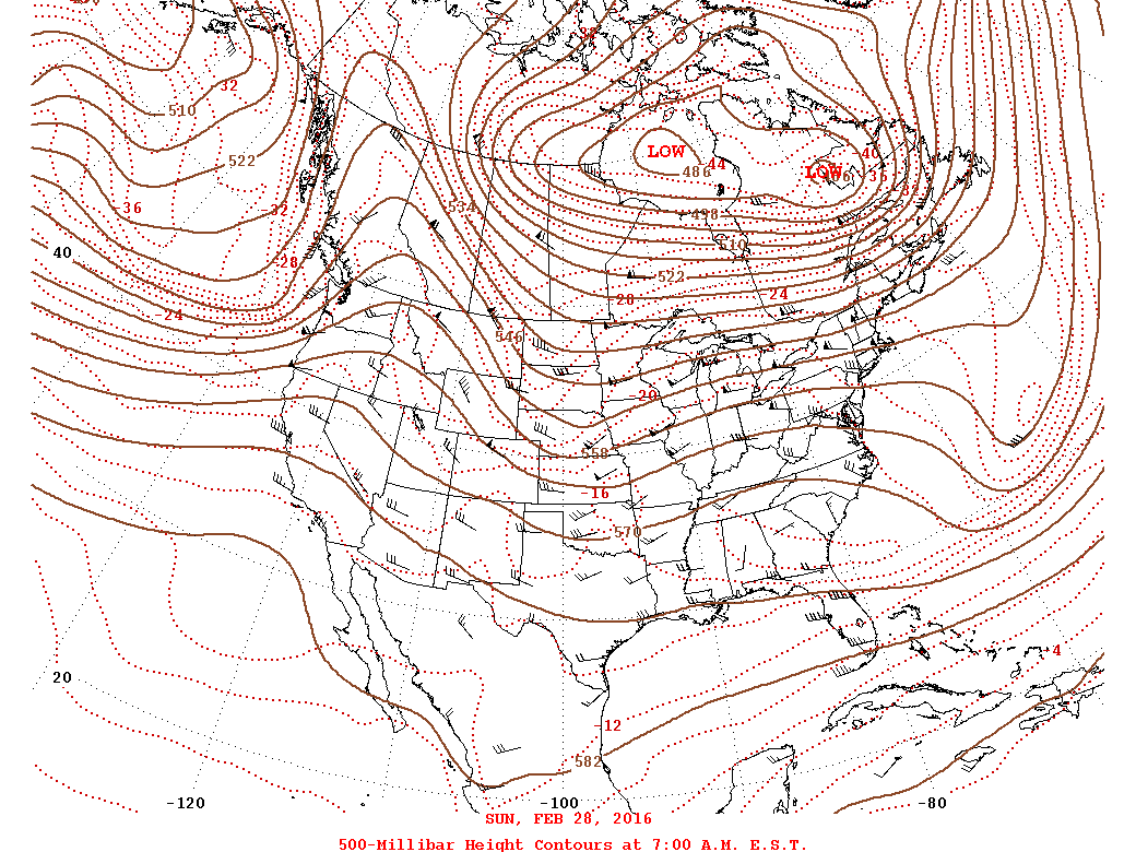
| Map showing a ridge of High Pressure over the western United States. This ridge is expected to breakdown late this weekend, opening the door for more Pacific storms to pass through the region. |
This shift to a wetter and cooler pattern can be seen in the latest 8 to 14 day outlooks from the Climate Prediction Center (below) with several signs pointing to this changing weather pattern. This should allow us to shift back into a more progressive and wetter period as storms pass through the Great Basin and across our region. This would also bring an increased probablity for wet and cooler conditions beginning on or around March 8 for eastern Utah and western Colorado. While we await the arrival of this more active weather pattern, take a look at this blog titled, "Is El Niño AWOL?. There are a lot of factors that play into our day-to-day weather and this blog helps explain a few of the reasons conditions may be drier or wetter than expected during an El Niño pattern. Check it out to learn more!

| Latest 8 to 14 day precipitation outlook for the United States. This graphic shows an increased probability for above normal precipitation centered near Reno, NV. In addtion, much of the western U.S. is painted "green" and points to the shifting pattern and the breaking down of the persistent ridge of High Pressure. |

| Latest 8 to 14 day temperature outlook showing the probability that the temperatues will be above, below or near normal. Here we can see a pocket of cooler conditions possible across the Southwest U.S. This is something we would expect to see in such a pattern shift toward a more progressive and wetter period. Even though western Colorado is mostly in the 'normal' area, the trends are headed toward a cooler period. |
Of course, all of this may change now that we have mentioned it, so be sure to check back throughout the week for additional updates!

