
A storm system will continue to produce widespread showers and thunderstorms as it progresses eastward across the central U.S. into the Northeast through the weekend. There are risks of severe thunderstorms and excessive rainfall on Saturday from the Ozarks into the mid-Mississippi River Valley with potential for damaging winds, large hail, tornadoes, and flash flooding. Read More >
|
Below are a table of some final statistics about the tornadoes that occurred both in the Huntsville forecast area (CWA) and the entire state of Alabama. |
||||||||||||||||||||||||||||||||||||||||||||||||||||||||
|
||||||||||||||||||||||||||||||||||||||||||||||||||||||||
| ** These numbers reflect direct deaths and injuries from only tornadoes. | ||||||||||||||||||||||||||||||||||||||||||||||||||||||||
|
||||||||||||||||||||||||||||||||||||||||||||||||||||||||
|
||||||||||||||||||||||||||||||||||||||||||||||||||||||||
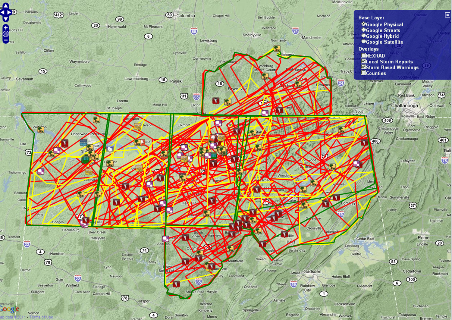
Below is a grahipcal map of all severe thunderstorm, tornado, and flash flood warnings issued on April 27th, 2011 for the Huntsville forecast area. Note: Two of these warnings were issued by the NWS Jackson, MS office while NWS Huntsville briefly took shelter on Wednesday afternoon, April 27th. Ninety two tornado warnings speaks for itself, an extremely busy day!!!Tornado Warnings.............................92
|
||||||||||||||||||||||||||||||||||||||||||||||||||||||||
|
|


 Local Radar
 Weather Map