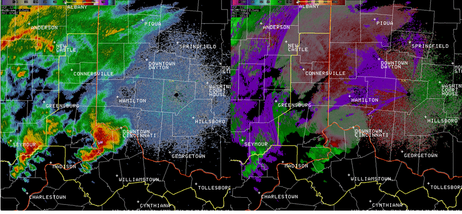
The following radar loop shows the evolution of supercell development across extreme southeastern Indiana and northern Kentucky during the late afternoon of October 19th. The leading storm maintained its supercell structure over a long period of time thanks to persistent rotation and a very strong updraft. While the storm did not produce any tornadoes, it did produce very large hail and scattered reports of wind damage. The strong updraft was able to suspend hail for long periods of time, resulting in optimal growth for the hailstones within the storm's core. Of particular note is the presence of very high reflectivities (greater than 70 dBz) for long periods of time. Tennis ball and even baseball-sized hail was reported in several locations along the leading storm's path. The storm maintained a classic "hook" structure for a remarkably long time as it tracked across southwestern parts of the area. Subsequent storms tracked along a similar path as the leading storm, resulting in several reports of flash flooding due to repeated high rain rates.
KILN 0.5° Reflectivity (Z) and Velocity (V) from 21:04Z to 01:28Z (Click for Animation)
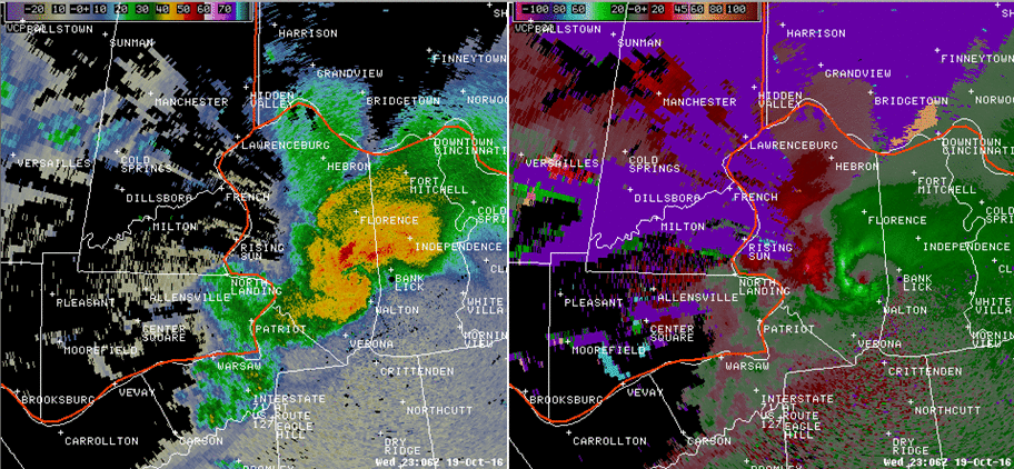
The following Cincinnati terminal doppler weather(TCVG) radar loop shows the progression of the supercell across southeastern Indiana and northern Kentucky. While the presence of hail cannot be deduced from this loop, it can clearly be seen that pockets of strong to severe wind were present with this storm. In fact, TCVG sampled wind between 60-70 MPH just several hundred feet above the ground at times (some of which made it down to the ground causing tree damage). Also of interest in the loop is the persistent rotation within the "hook" of the storm.
TCVG 0.1° Reflectivity (Z) and Velocity (V) from 21:59 to 23:30Z (Click for Animation)
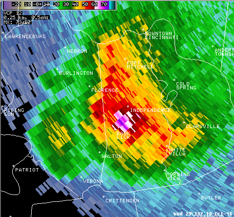
This KILN radar image at 23:13Z (7:13 PM local time) shows very impressive reflectivites at high altitudes. This particular scan sampled 73 dBz at over 33,000 feet above ground level! That indicates the presence of very large hail being suspended by a very strong updraft. This storm produced several reports of tennis ball and baseball-sized hail along its path.
KILN 6.4° Reflectivity (Z) at 23:13Z (about 33,000 ft AGL)
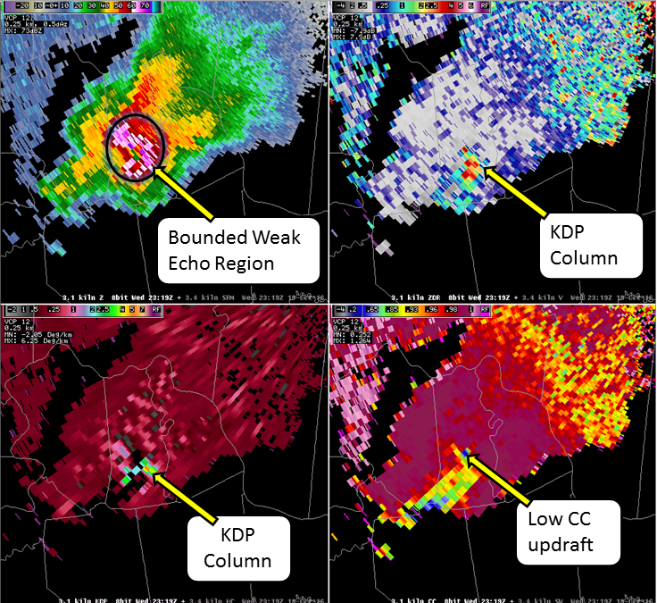
This KILN radar image at 23:19Z (7:19 PM local time) shows the structure of the intense supercell thunderstorm.
KILN 3.1° Reflectivity (Z) at 23:13Z (about 16,000 ft AGL)


 Follow us on YouTube