Tornado #2:
Long-Track Washington Tornado (Tazewell, Woodford, La Salle, Livingston Counties)
 |
 |
 |
|
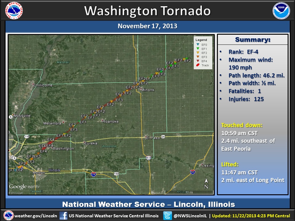
Entire track |
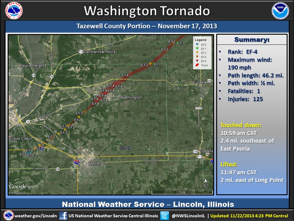
Tazewell County portion |
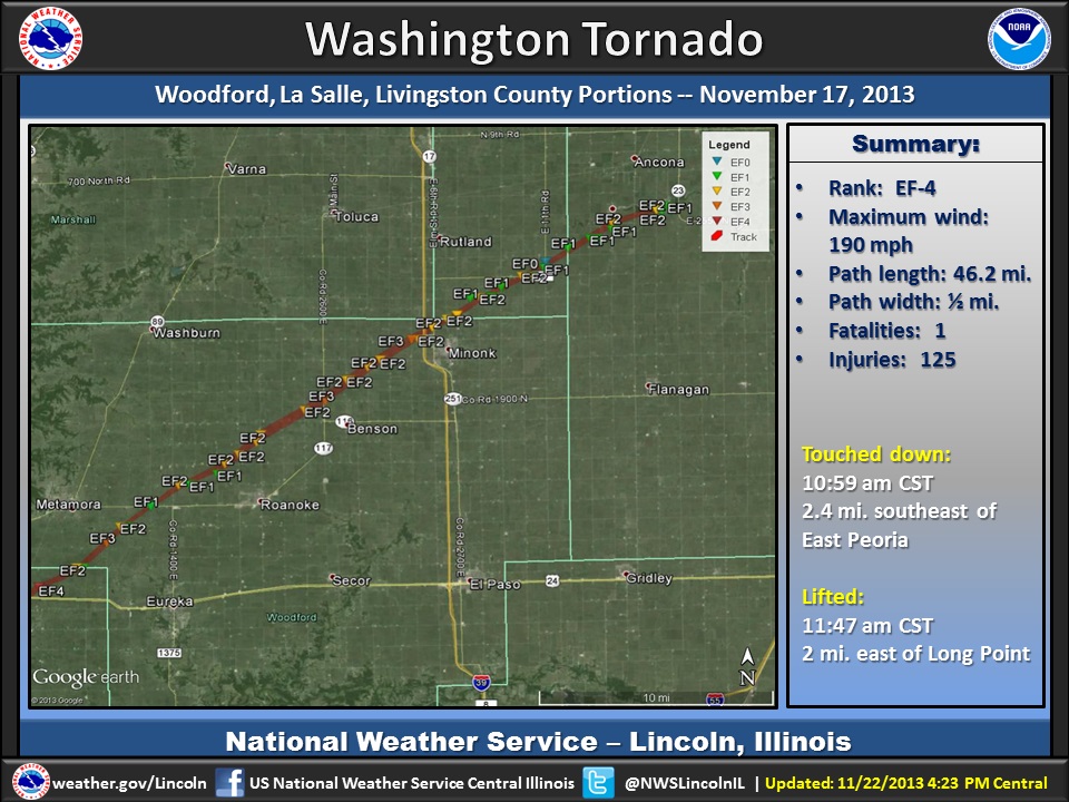
Woodford County portion |
Summary:
| Rating: | EF-4 |
| Peak wind: | 190 mph |
| Touched down: | 10:59 am CST 2.4 miles southeast of East Peoria (Tazewell County) |
| Lifted: | 11:47 am CST 2 miles east of Long Point (Livingston County) |
| Path length: | 46.2 miles (34.5 miles in Tazewell and Woodford Counties) |
| Path width: | 1/2 mile |
| Fatalities: | 3 |
| Injuries: | 125 (121 in or near Washington, 4 in Woodford Co.) |
Survey teams from the NWS offices in Lincoln and Chicago surveyed this tornado.
The tornado initially developed over the southeast portion of East Peoria, and then headed northeast. It reached a maximum intensity of EF-4 as it entered the city of Washington. It then continued northeast, moving through Woodford County, reaching the Woodford/LaSalle County border near Minonk, a total of 34.5 miles.
The tornado then continued northeast into far southern LaSalle County near Dana, then moved into Livingston County, finally diminishing 2 miles east of Long Point. The track length in LaSalle and Livingston Counties was 11.7 miles, with the peak intensity in these two counties as EF-2. The total tornado path on the ground was 46.2 miles.
More information on the LaSalle and Livingston portion of the track can be found on the NWS Chicago webpage.
Warning Timeline:
Google Earth satellite imagery:
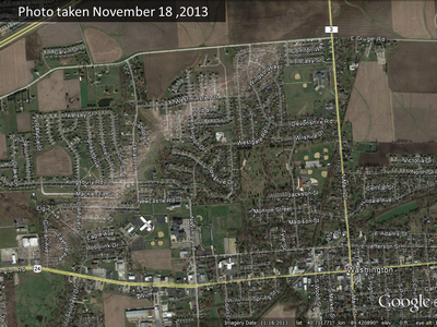 |
Special satellite imagery was taken the day after the tornado. This image clearly shows the track of the tornado across Washington, from lower left to top right. |
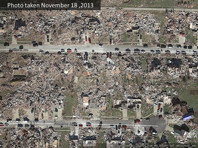 |
A zoomed-in view of some of the damage in Washington. This was along Gillman and Floosmoor Avenues. |
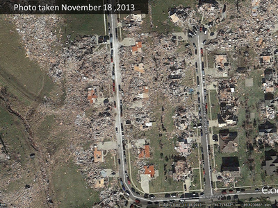 |
A zoomed-in view of some of the damage in Washington. This was along Coventry Drive and Prince George Court. |
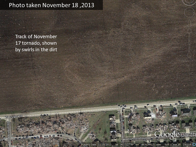 |
As the tornado left Washington, the swirls in the dirt clearly show the track of the storm. |
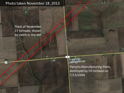 |
The Parsons Manufacturing Plant, shown in the lower right part of the image, was destroyed by an F4 strength tornado on July 13, 2004. The swirls in the dirt from the November 17 tornado show just how close Parsons came to being demolished again (the closest point of the track was about 2/3 mile away). |
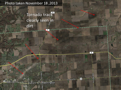 |
This image contains about 8 miles worth of tornado track. The swirls in the dirt clearly show the track of the storm. This was visible all the way through Woodford County and into portions of La Salle and Livingston Counties. Zooming in closely in some spots even showed smoke from debris being burned. |
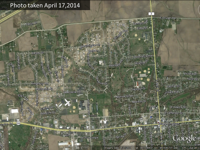 |
This image was taken 6 months after the tornado. The scars through Washington are still clearly visible. |
Radar imagery (click images to enlarge):
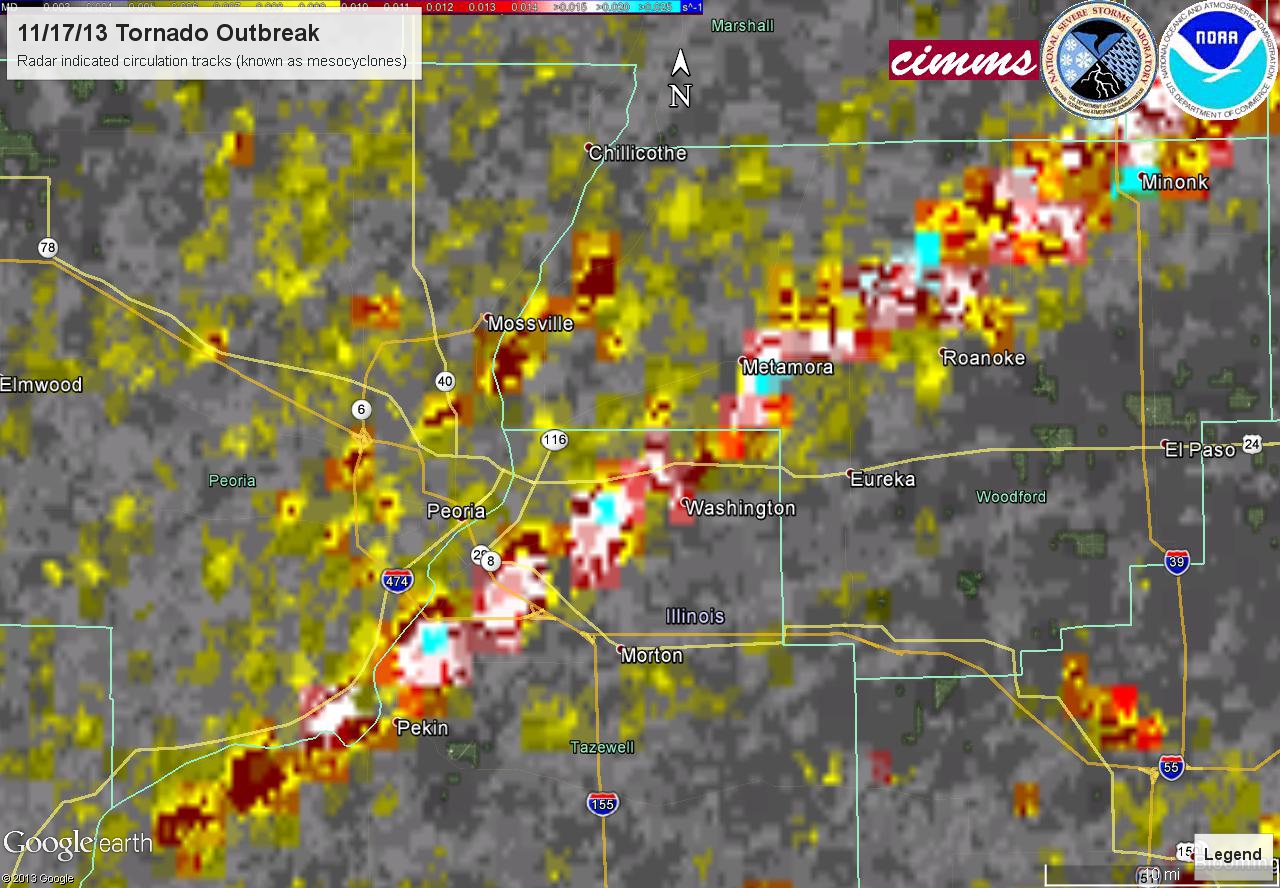 |
This image, from the National Severe Storms Laboratory, is a composite of radar rotations associated with the tornado. The rotations started when the storm was southwest of Pekin, and increased in intensity as it approached East Peoria. A clear track of rotations continues northeast through Woodford County past Minonk. |
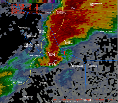 |
This radar image from 10:58 am shows a hook echo, associated with the developing tornado, approaching the east end of I-474. The tornado touched down at 10:59 am. |
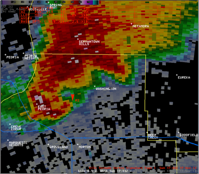 |
The next radar image, from 11:03 am, shows the hook echo persisting near the red triangle (which is the radar's Tornado Vortex Signature, or TVS). |
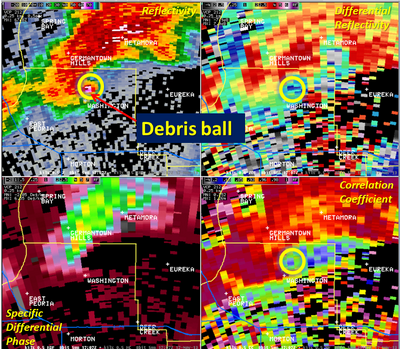 |
These images were taken at 11:07 am, and are reflecting what is referred to as a Tornado Debris Signature. By this time, the tornado had passed through Washington. The pinkish shades located within the hook echo (located northeast of Washington in the top left image) represent a "debris ball". The radar is showing significantly higher intensities, due to the radar beam reflecting off of debris that is present aloft. The other images are part of the dual-polarization upgrade that was performed on the radar in the fall of 2012. The top right image is called "differential reflectivity" (ZDR), and is a ratio of the reflected horizontal and vertical parts of the radar beam. The lower right image is called "correlation coefficient" (CC), and is a measure of how the horizonal and vertical pulses of the radar beam are behaving. Low values of CC are an indication of non-precipitation targets detected by the radar beam. The low values of ZDR and CC (blue shades) within the yellow circles, which line up with the sigificantly high values of the standard reflectivity, help the radar operator be certain that a tornado is occurring. |
 |
At 11:12 am, the tornado had exited the northeast corner of Tazewell County and entered Woodford County southeast of Metamora. |
 |
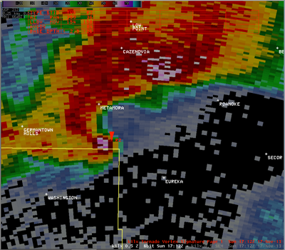
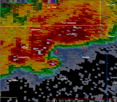
At 11:17 am, the tornado was between Metamora and Roanoke. The debris ball is still clearly visible. |
 |
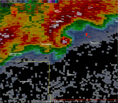
By 11:22 am, the tornado was passing north of Roanoke. |
 |
At 11:31 am, the tornado was approaching I-39 near Minonk. |
 |
The tornado remained on the ground as it moved through extreme southern La Salle County. On this image at 11:41 am, it was located just north of Dana and was crossing into Livingston County. The tornado finally lifted at 11:47 am, just east of Long Point. |
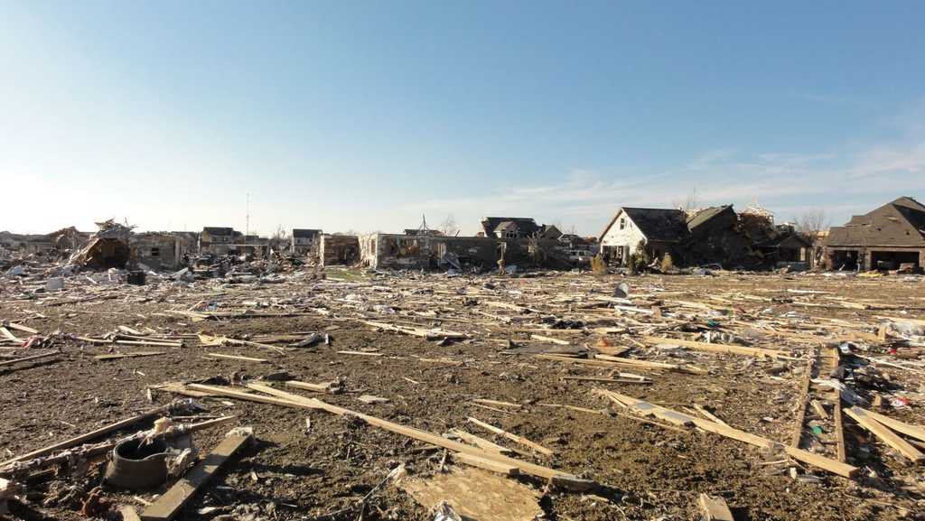
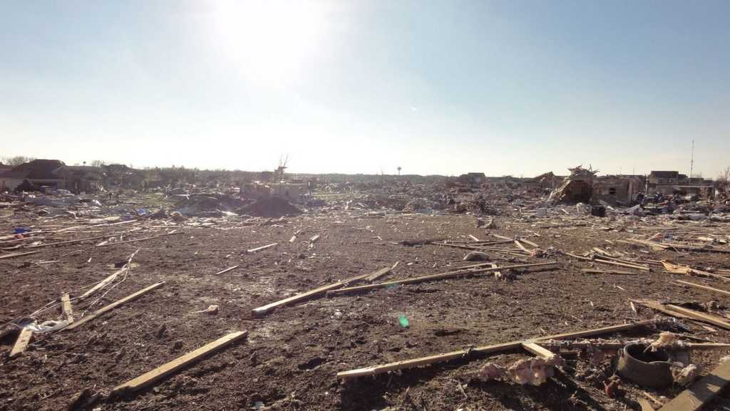
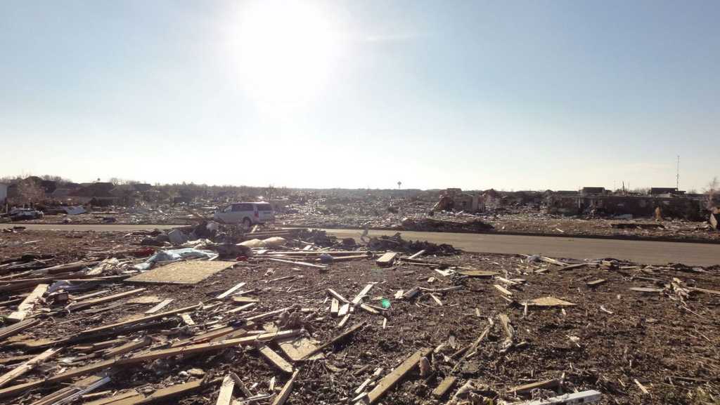
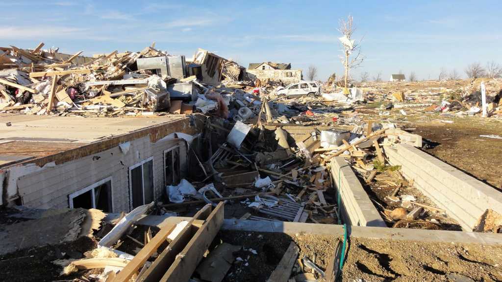
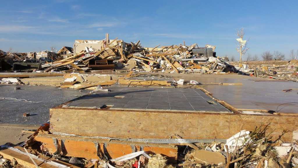
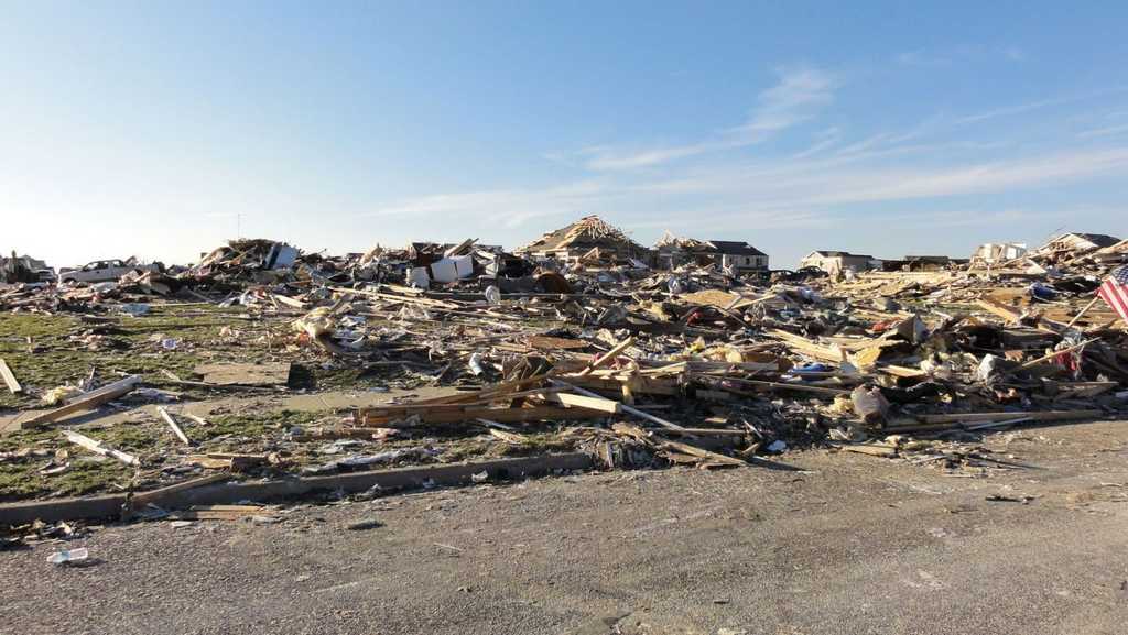
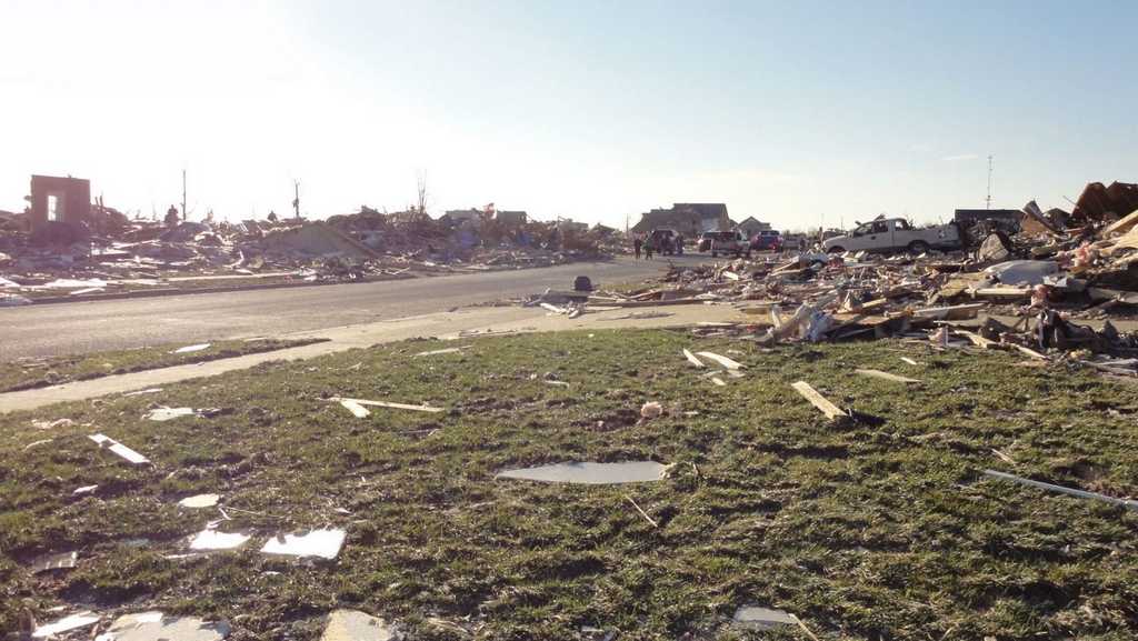
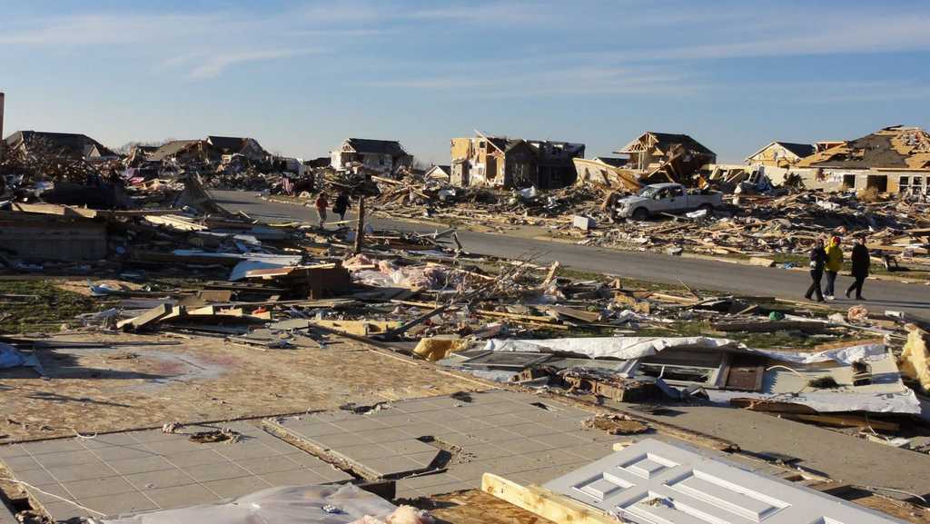
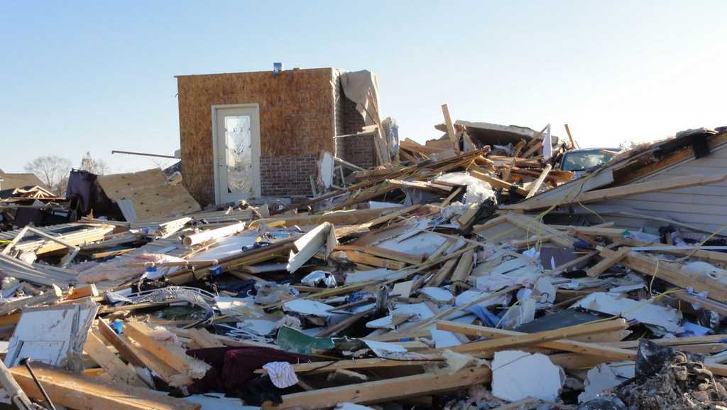
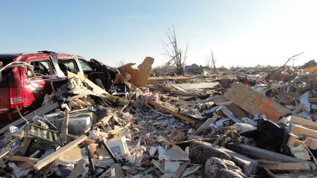
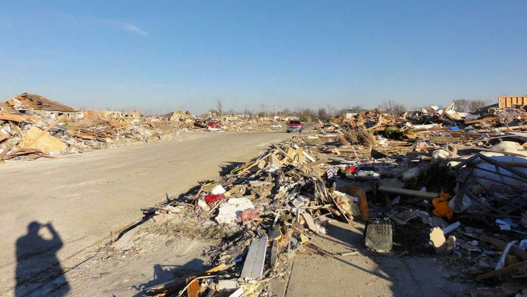
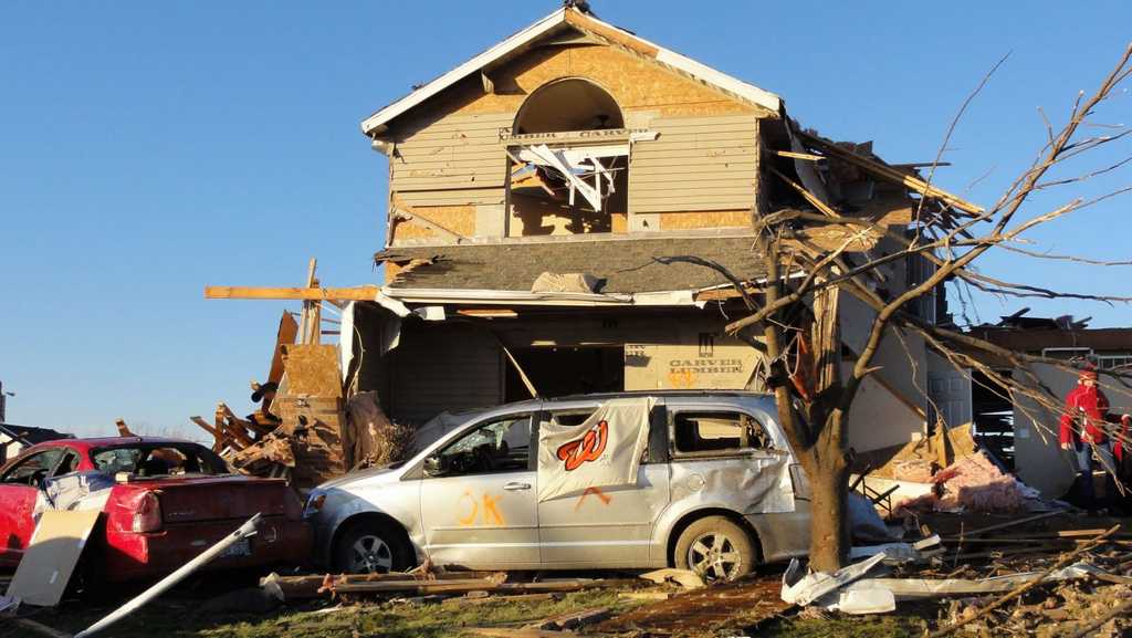
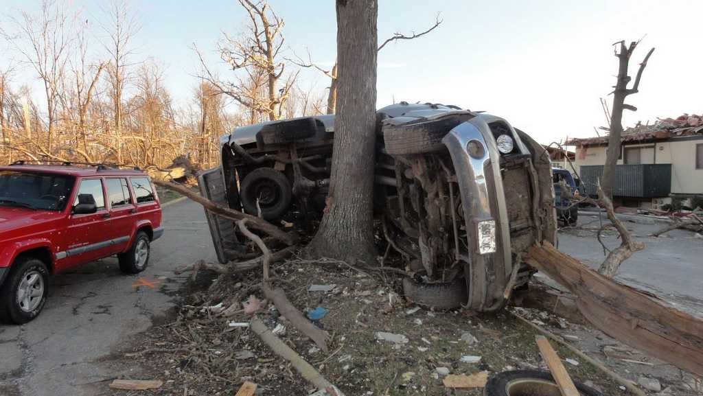
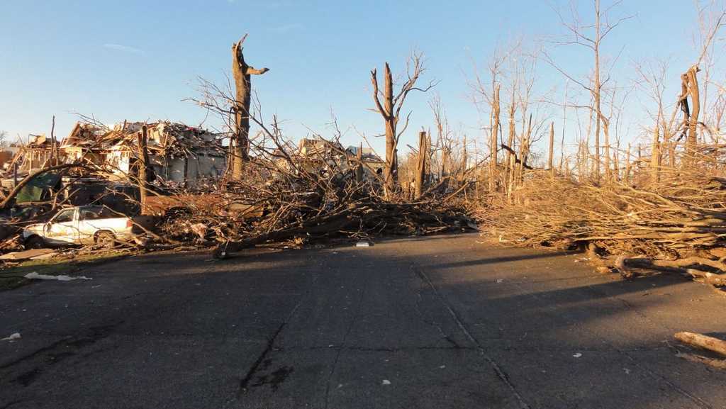
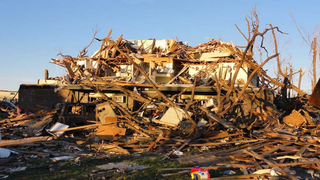
Photos (click images to enlarge):
|
|
|
|
|
|
|
|
|
|
|
|
|
|
|
|
|
|
|
|
|
|
|
|
|
|
|
|
Event Links: Overview | Pekin | Washington | Pana | Altamont | West Liberty
Garrett | Gifford | Villa Grove | Tuscola | Westville | Radar