A prolonged atmospheric river will continue to impact the Pacific Northwest into the Northern Rockies with heavy rainfall, areas of urban and river flooding, landslides, heavy mountain snow, and gusty winds into Thursday. A strong clipper system will bring the threat of heavy snow and high winds across the Upper Midwest/Great Lakes as well as portions of the interior Northeast and Appalachians. Read More >

Updated 3/26/2016 400 am EDT
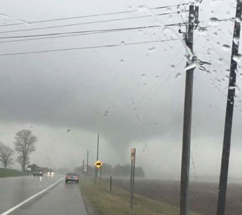
Severe storms moved across northwest Indiana and southwest Michigan during the afternoon of March 24th, 2016. Three EF-0 tornadoes were confirmed. Two were near Hanna, IN and one was in Edwardsburg, MI. There was also straight-line wind damage from North Liberty to South Bend.
In coordination with Cass County Emergency Management, a storm survey was conducted in the areas hardest hit by the storm. The worst damage occurred in Edwardsburg where there was significant damage to a barn, part of a church roof was removed, and several trees were uprooted. There was also video taken near the intersection of US-12 and Sundance Rd that showed debris being lofted with notable rotation.
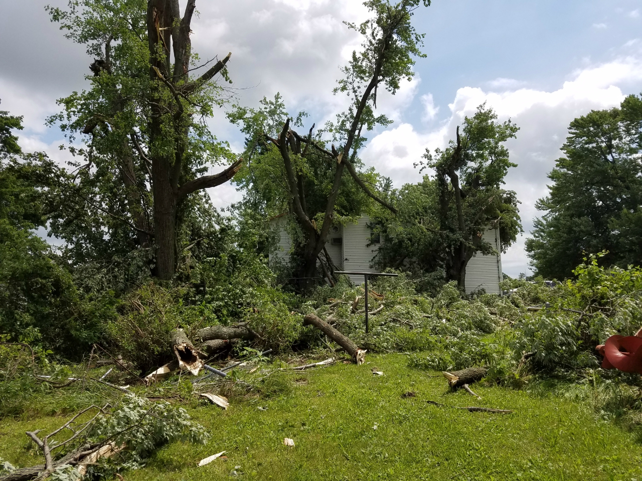
A storm survey was also completed in LaPorte County. One tornado touched down 2.5 miles southeast of South Wanatah, IN where a barn suffered significant damage. Another tornado formed 3 miles northeast of Hanna causing extensive damage to trees and powerlines. There was also some straight-line wind damage to a farm southeast of this tornado.
Additional straight-line wind damage occurred from North Liberty to South Bend. Numerous trees were uprooted with several downed powerlines and some structural damage to roofs. The damage was consistent with straight-line winds of 60-70 mph.
An overview of the damage reports is below:


Two EF-0 tornadoes were confirmed near Hanna, IN. The first occurred at 1:26 PM CDT on March 24, 2016 at the intersection of W County Road 1600 S and S County Road 900 W. Eye witnesses report seeing a brief tornado and there was significant damage to a large pole barn with 80 percent of the roof being removed. The second tornado developed at 1:30 PM near the intersection of SR 39 and W County Road 1150 S causing extensive damage to a small grove of trees and nearby powerlines. There was also significant straight-line wind damage to the southeast of this tornado.
An EF-0 tornado was confirmed in Edwardsburg, MI. It touched down 1 mile west of Edwardsburg at 3:14PM EDT yesterday, March 24, 2016. It travelled 1.4 miles to the northeast and lifted at 3:18PM. The maximum width was 150 yards and the maximum estimated wind speed was 75 mph.
A strong low level jet brought abundant moisture northward to the area in advance of an upper level disturbance. While conditions were not very unstable, the strong wind shear throughout the atmosphere played a large role in the development of showers that produced isolated damaging wind gusts and a few tornadoes. Some of the meteorological variables that were important in this event are shown below. The valid times for the plots below are 2pm Thursday afternoon March 24:
 |
 |
 |
| Surface analysis (18Z) Shows surface low pressure across northwest Indiana at intersection of cold front and warm frontal boundaries | 850 mb analysis Shows a large area of low moisture being advected across much of Indiana/southern lower Michigan. Wind speeds (not shown) at the 850 mb level (about 4500 feet above ground) were about 55-70 mph. | 500 mb analysis Shows a strong upper level trough across the mid MS valley. The combination of this upper trough and a strong upper level jet helped force shower/thunderstorm development across northern Indiana/southern lower Michigan. |
 |
 |
 |
| SB CAPE Plot of surface-based CAPE (Convective Available Potential Energy) indicated only very weak instability across northwest Indiana and southwest lower Michigan. | 0-6km shear vector Shows strong deep layer shear (wind changes with height) on the order of 60-70 knots. This helped support organized clusters of convection despite the weak instability. |
0-1km SRH Shows 0-1 km storm relative helicity, which is a measure of the potential of updrafts to rotate. Strong wind shear in the lowest 1 km of the atmosphere played a role in creating a favorable environment for isolated tornadoes. |
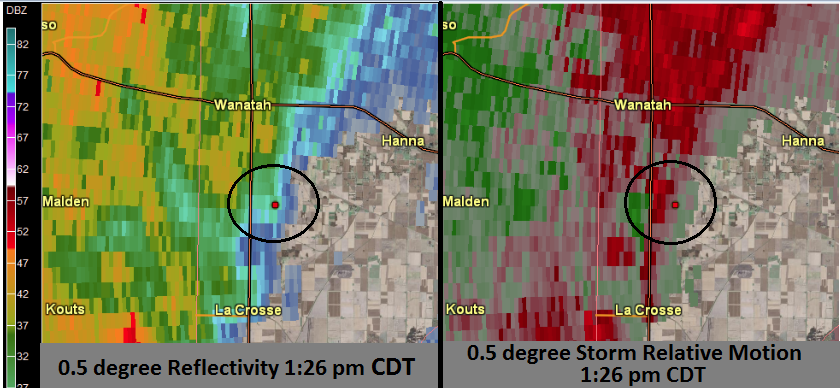
TORNADO 1 (South of Wanatah, IN)
While not impressive from a reflectivity perspective, some very weak rotation is noted in the storm relative motion image in the right diagram. At this distance from the radar, the beam height of the radar is between 4500-5000 feet above ground level. Given the shallow nature of these showers, many important features in regards to storm scale circulations may be missed of "overshot" by the radar.
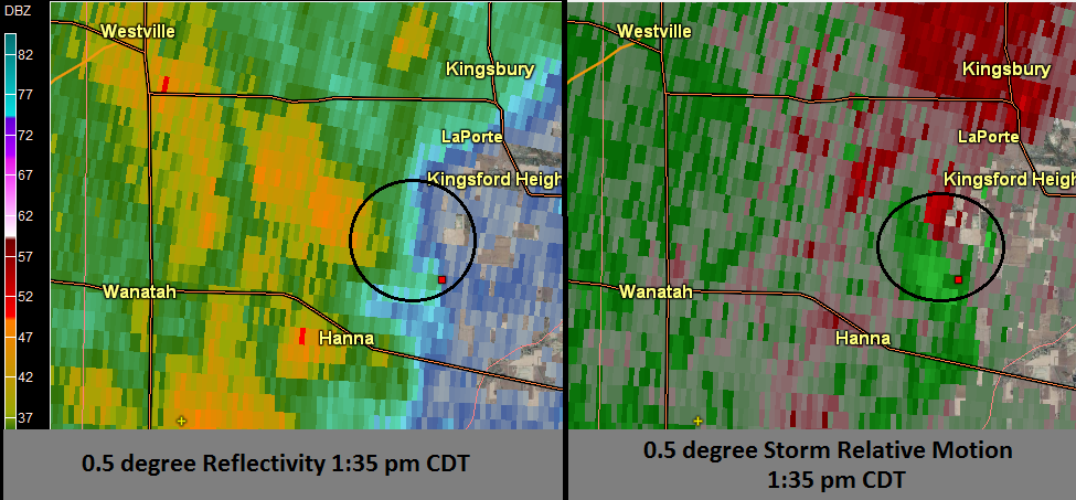
TORNADO 2 (Northeast of Hanna, IN)
Once again, reflectivity stucture is very subtle, but broad storm scale rotation is noted with the storm relative motion product highlighted by the black circle in the right diagram.
TORNADO 3 (WNW of Edwardsburg, MI)
Weak rotation was also noted with the tornado just to the northwest of Edwardsburg. The height of the radar beam at this location is approximately 2600 feet above ground level. The dual-polarization radar product of Correlation Coefficient (CC), also provides some indication of a tornado. Correlation coefficient is a measure of how different the targets are in terms of shape and behavior that the radar is sampling by utilizing both the veritcal and horizonal polarizations offered by dual polarization radar. For precipitation, such has rain, hail, and snow, values of correlation coefficient are typically greater than 0.80. Note that in the location of the tornado near Edwardburg, correlation coefficient values are between 0.5 to 0.6 which is indicative of non-meteorological radar targets such as debris or dirt.

Below are the Storm Prediction Center Outlooks for to this event.
| Storm Prediction Center Day 1 Outlook Issued 1:56 AM 3/24/16 |
|
|
| Storm Prediction Center Day 1 Update Issued 12:30 PM 3/24/16 |
|
|
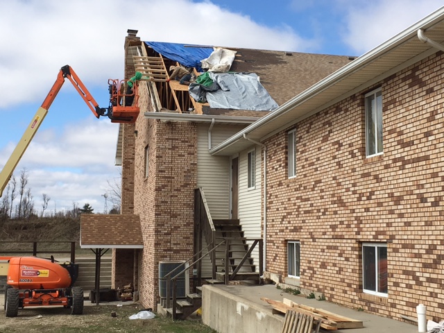
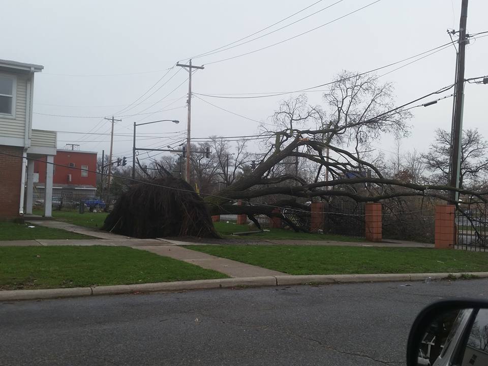
Edwardsburg, MI Edwardsburg, MI South Bend, IN
Updated 3/25/2016 4:00 AM EDT
AGD