Overview
A few pockets of snow, sleet, and freezing rain tracked across the region early Sunday evening. A larger area of a wintry mix of precipitation then overspread the area later Sunday evening into the overnight hours early Monday morning. The wintry mix eventually changed over to snow from northwest to southeast. Snowfall accumulations ranged from less than an inch up to 3 inches, with the greatest totals across far northeast Indiana, far northwest Ohio, and south central Lower Michigan. A light glaze of ice accumulation was also reported that led to hazardous travel conditions from late Sunday night through the Monday morning commute. Thanks to everyone who submitted reports during this event!Photos & Video:
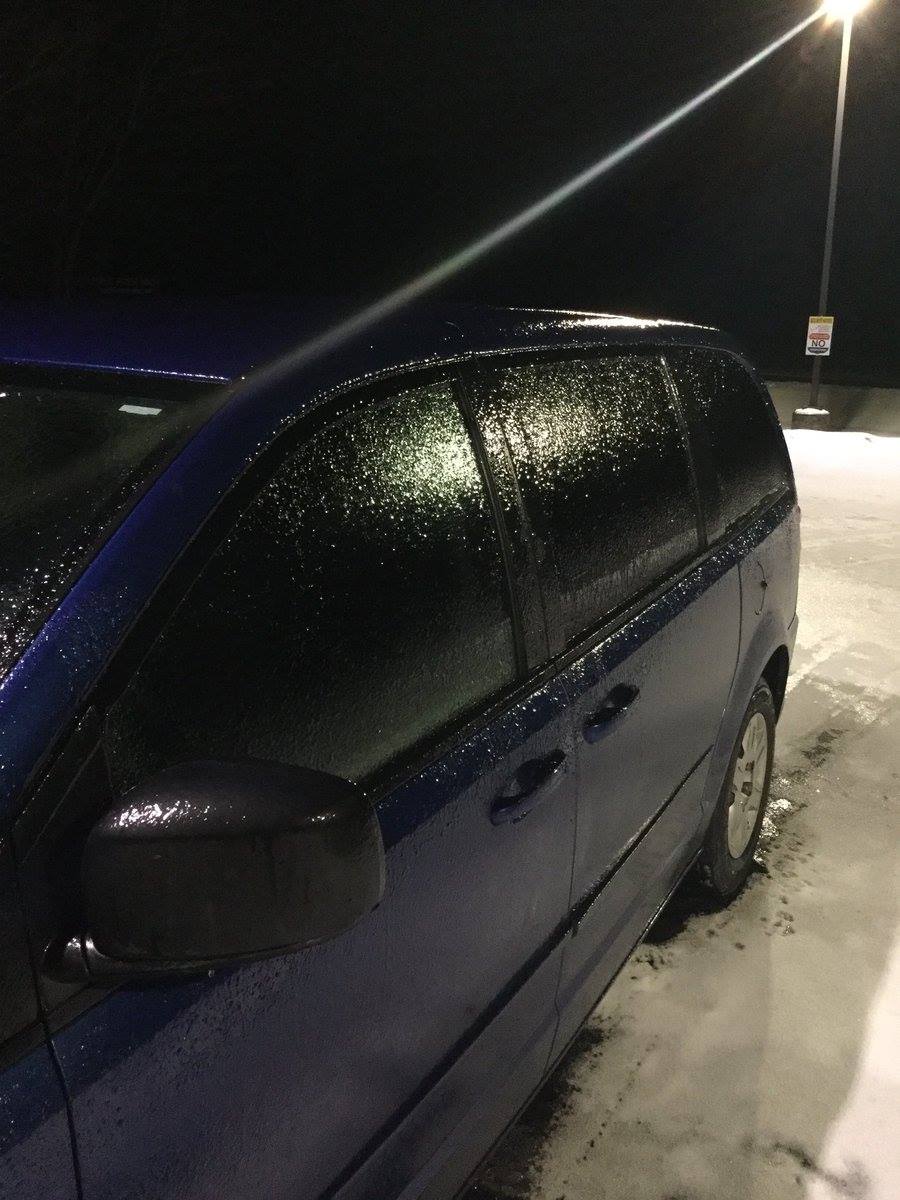
Many locations reported a light glaze of ice resulting in very hazardous travel conditions
 |
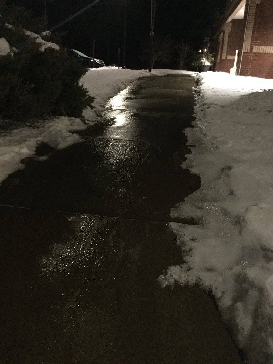 |
| Coating of ice on vehicle at NWS Northern Indiana | Ice covered sidewalk at NWS Northern Indiana |
Radar:
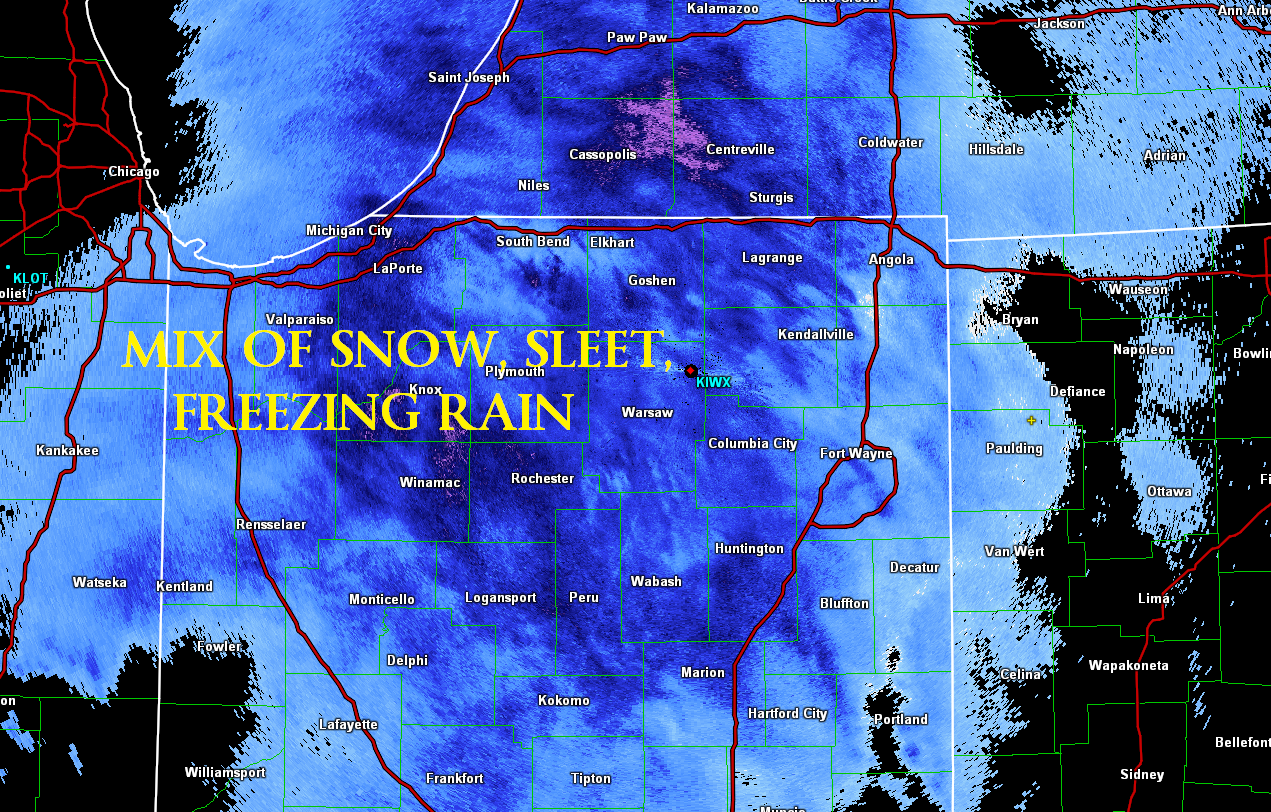
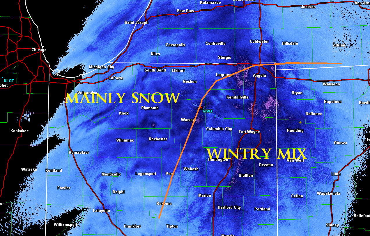
Evolution of wintry mix changing to snow
 |
 |
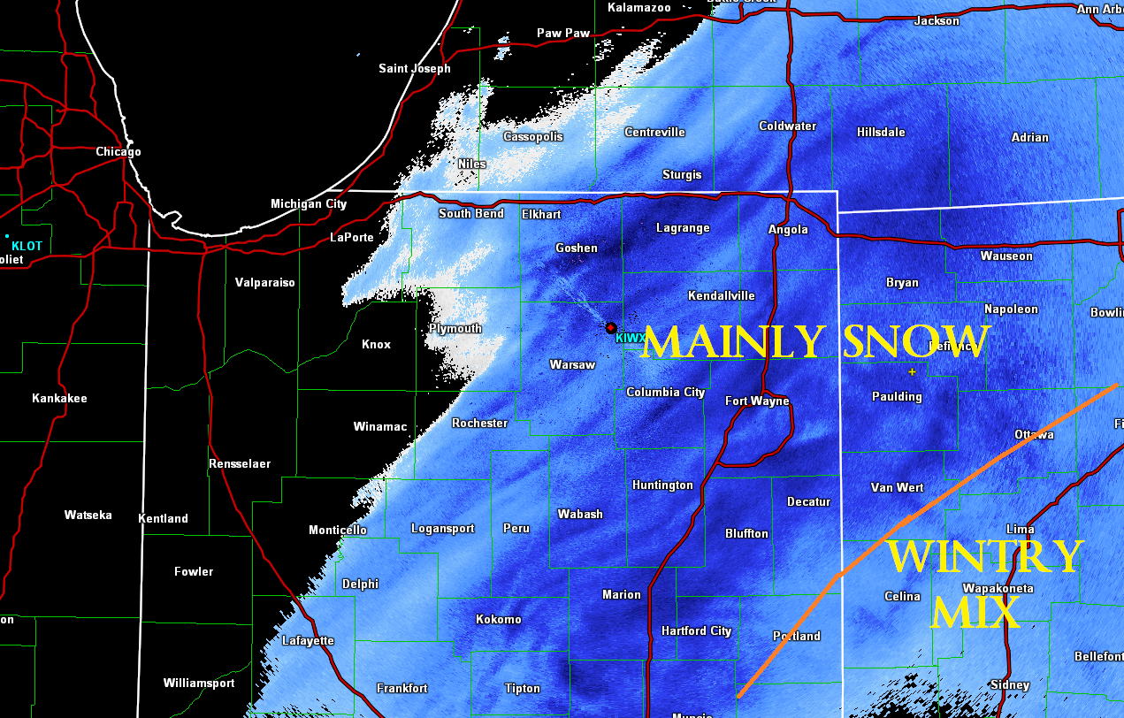 |
| 0.5 degree reflectivity KIWX radar at 11pm EST. At this time precipitation was a mix of snow, sleet, and freezing rain | 0.5 degree reflectivity KIWX radar at 1am EST. At this time precipitation had changed over to mainly snow across northwest portions of the area | 0.5 degree reflectivity KIWX radar at 3am EST. Precipitation had changed over to mainly snow for all but far southeast portions of the area in northwest Ohio. |
Storm Reports
Public Information Statement
National Weather Service Northern Indiana
400 PM EST Mon Jan 8 2018

...24 HR Snowfall Reports...

Location                     Amount    Time/Date       Lat/Lon

...Indiana...

...Steuben County...
1 E Salem Center             2.8 in    0600 AM 01/08   41.59N/85.11W
2 WSW Golden Lake            2.8 in    0600 AM 01/08   41.59N/85.10W
Angola                       2.2 in    0700 AM 01/08   41.64N/84.99W
2 ENE Crooked Lake           2.0 in    0545 AM 01/08   41.70N/84.99W

...Michigan...

...Hillsdale County...
2 W Camden                   2.0 in    0800 AM 01/08   41.75N/84.79W
1 SSE Montgomery             2.0 in    0800 AM 01/08   41.76N/84.79W

...Ohio...

...Fulton County...
3 NW Tedrow                  3.0 in    0530 AM 01/08   41.64N/84.25W

Observations are collected from a variety of sources with varying
equipment and exposures. We thank all volunteer weather observers
for their dedication. Not all data listed are considered official.

$$
Environment
Strong southwest flow in the lower levels of the atmosphere allowed a warm layer aloft to be maintained through the evening hours on Sunday. This warm layer aloft allowed precipitation to melt in this layer and then refreeze at the surface resulting in the very slick and hazardous roadwdays.
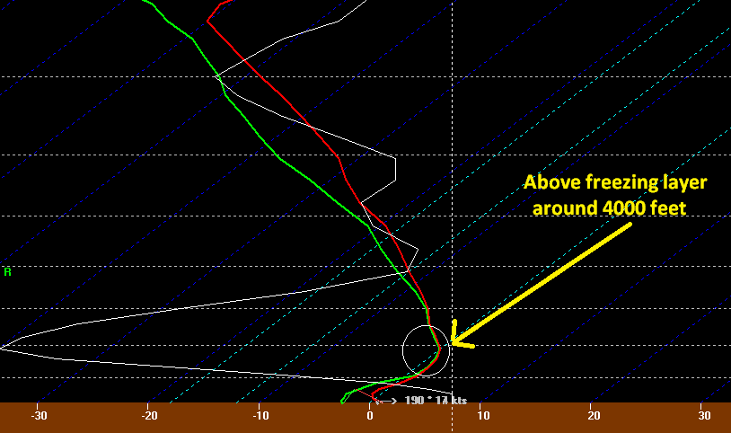 |
| RAP 1-hour forecast sounding valid at midnight EST for Fort Wayne. |
 |
Media use of NWS Web News Stories is encouraged! Please acknowledge the NWS as the source of any news information accessed from this site. |
|

