
Critical fire weather conditions, severe thunderstorms capable of producing severe wind gusts, large hail, strong tornadoes and heavy rainfall remain on tap for the central U.S. this evening. Flash flooding is also possible for portions of the Plains and Mississippi Valley. Very large hail up to 3 inches in diameter will be possible this evening across western Kansas. Read More >
This page contains pictures of sun and clouds.
 |
Sunset under a mackerel sky. Photo courtesy Todd Holsten |
 |
Morning sun shining in the mist. Photo courtesy Bob Hammitt |
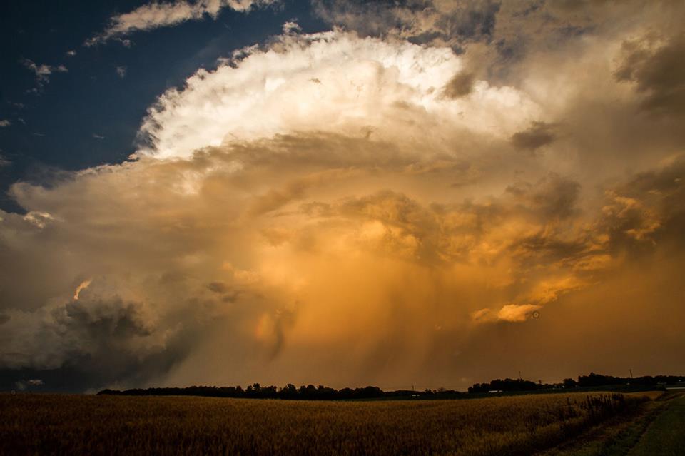 |
Sunlit side of a 2" producing supercell in Whitley county. Photo courtesy Todd Holsten |
 |
A dramatic black and white shot of an arcus cloud associated with a severe squall line April 11 2007. Photo courtesy Bob Hammitt |
 |
Contrail cirrus at sunset. Photo courtesy Bob Hammitt |
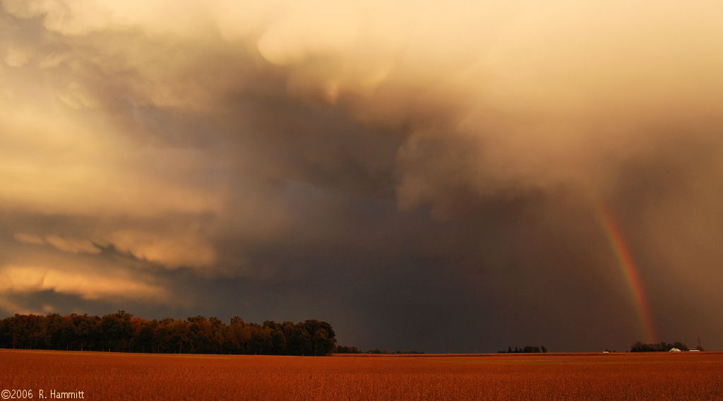 |
A dramatic rainbow underneath mammatus clouds September 2006. Photo courtesy Bob Hammitt |
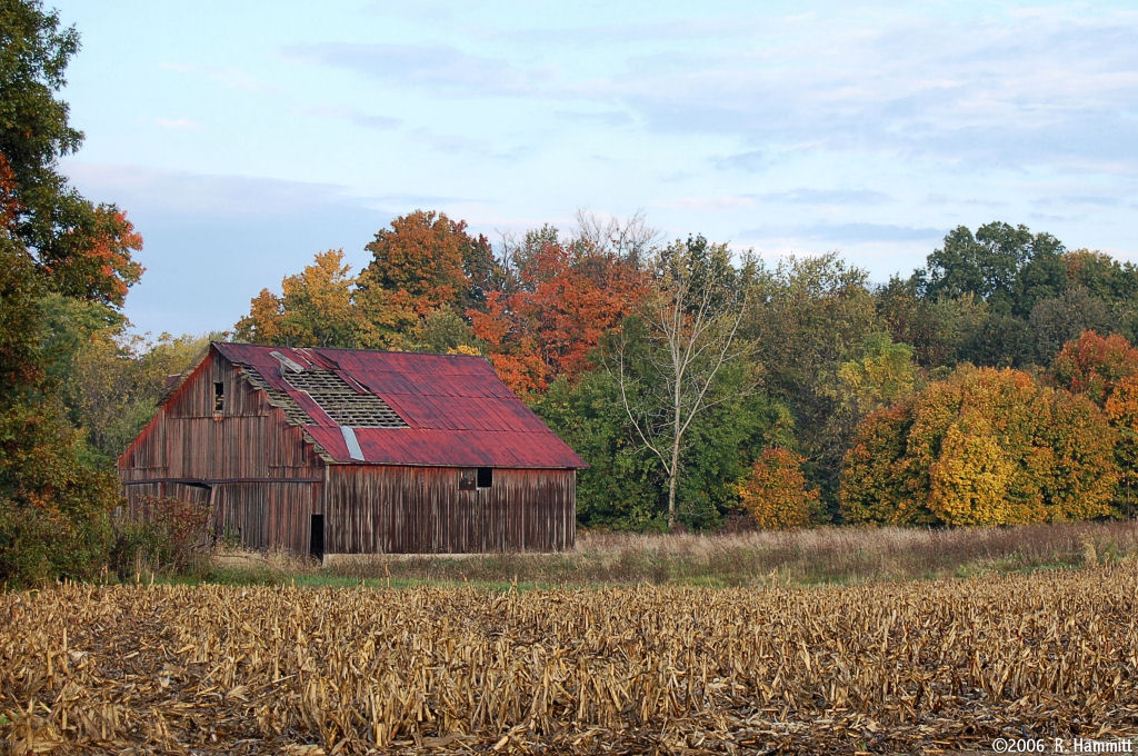 |
Peak fall colors from October 22 2005. Photo courtesy Bob Hammitt |
 |
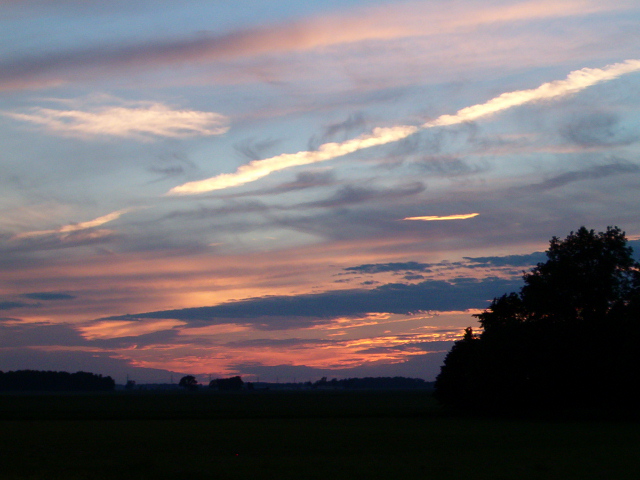
Beautiful crepuscular rays (top) from May 30 2006. Photo courtesy Bob Hammitt |
 |
Geese at sunrise. Photo courtesy Bob Hammitt |
 |
A serene fall setting. Photo courtesy Bob Hammitt |
 |
Sunset near Milford, IN (Kosciusko Co) in June 2004. Photo courtesy John Yoder |
 |
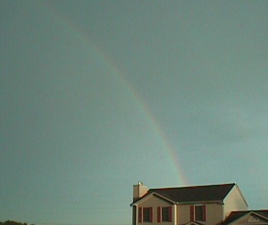
Double rainbow east of Jonesville, MI (Hillsdale Co) in March of 2003. Photo courtesy Tom Palmer |
 |
Storm approaching Grissom Air Reserve Base at 6pm July 3, 2004. No severe weather occurred. Photo courtesy Eric Flory. |
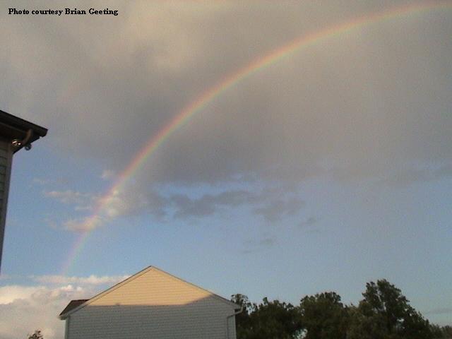 |
Rainbow around 8:15pm June 1, 2004. Photo courtesy Brian Geeting. |
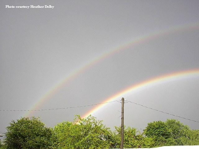 |
Rainbows over Poneto, Indiana on June 1, 2004. Photo courtesy Heather Dolby. |
 |
Rainbows over Poneto, Indiana on June 1, 2004. Photo courtesy Heather Dolby. |
 |
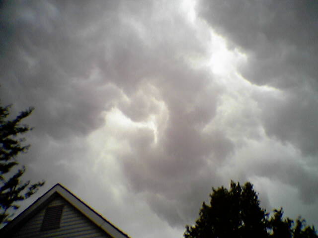
Turbulent clouds over Fort Wayne around 3:30pm May 30, 2004. No severe weather occurred. Photo taken with an LG VX-6000 camera phone by Jonathon Jacob. |
 |
Turbulent clouds over Fort Wayne around 3:30pm May 30, 2004. No severe weather occurred. Photo taken with an LG VX-6000 camera phone by Jonathon Jacob. |
 |
Turbulent clouds over Fort Wayne around 3:30pm May 30, 2004. No severe weather occurred. Photo taken with an LG VX-6000 camera phone by Jonathon Jacob. |
 |
A storm approaches Fort Waynearound 3:30pm May 30, 2004. The smooth grey area in the background is heavy rain. No severe weather occurred. Photo taken with an LG VX-6000 camera phone by Jonathon Jacob. |
 |
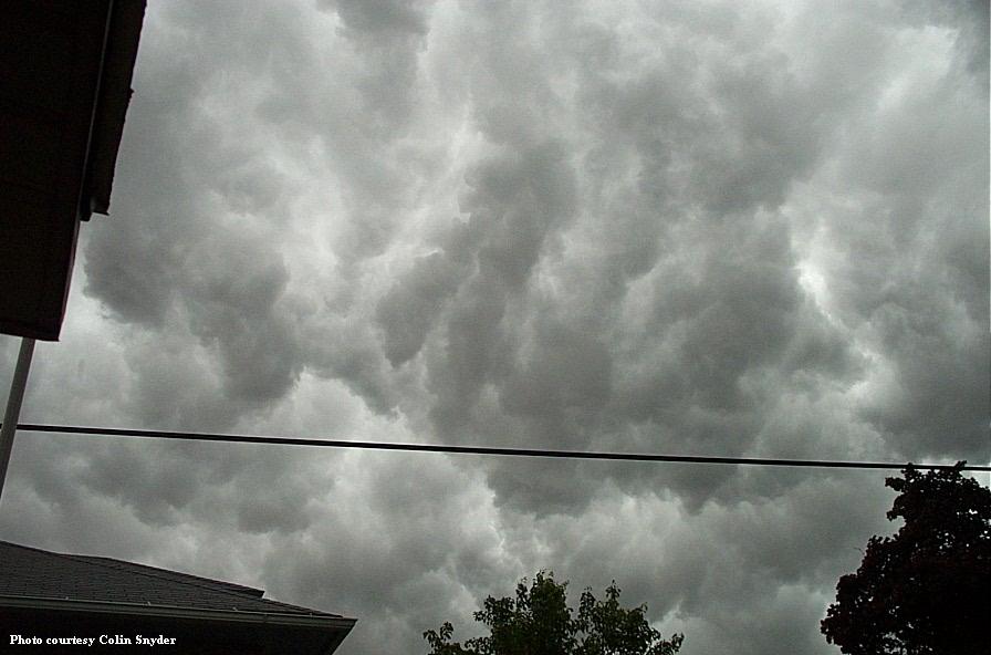
Turbulent skies over Kendallville, Indiana May 30, 2004. Photo courtesy Colin Snyder. |
 |
Turbulent skies over Kendallville, Indiana May 30, 2004. Photo courtesy Colin Snyder. |
 |
Lightning bolt over Lake Michigan near Saint Joseph, Michigan just after noon May 21, 2004. Photo courtesy John E. Boyce. |
 |
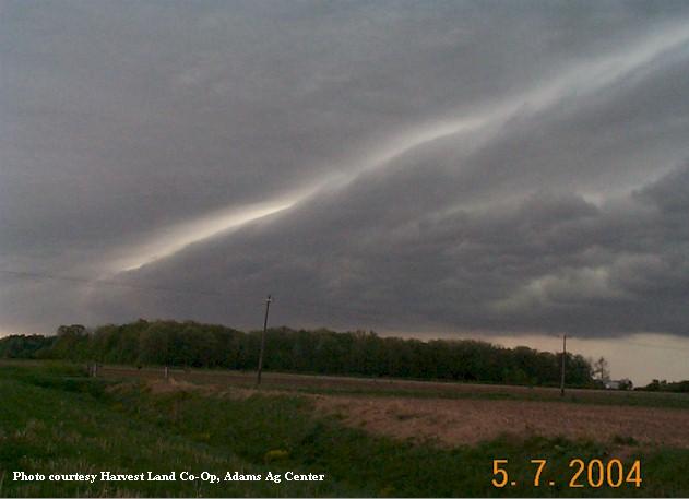
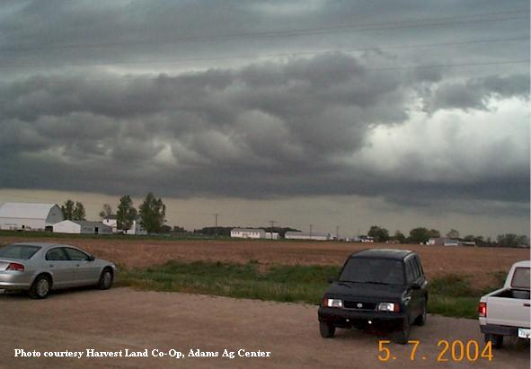
Thunderstorm south of Monroe, Indiana, in Adams County on the morning of May 7, 2004. |
 |
Thunderstorm south of Monroe, Indiana, in Adams County on the morning of May 7, 2004. |
 |
Thunderstorm south of Monroe, Indiana, in Adams County on the morning of May 7, 2004. |
 |
Thunderstorm south of Monroe, Indiana, in Adams County on the morning of May 7, 2004. |
 |
Thunderstorm south of Monroe, Indiana, in Adams County on the morning of May 7, 2004. |
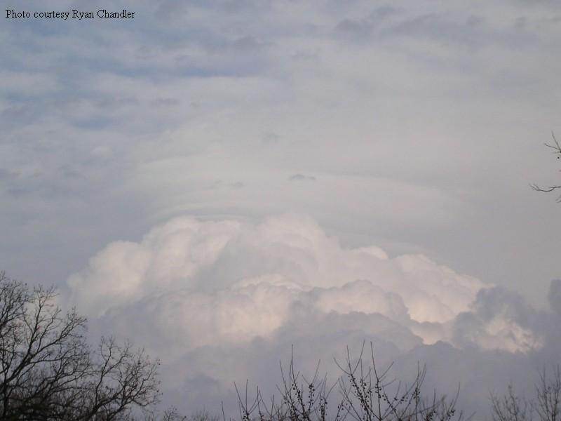 |
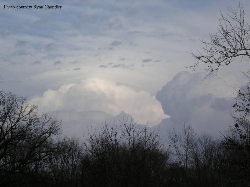
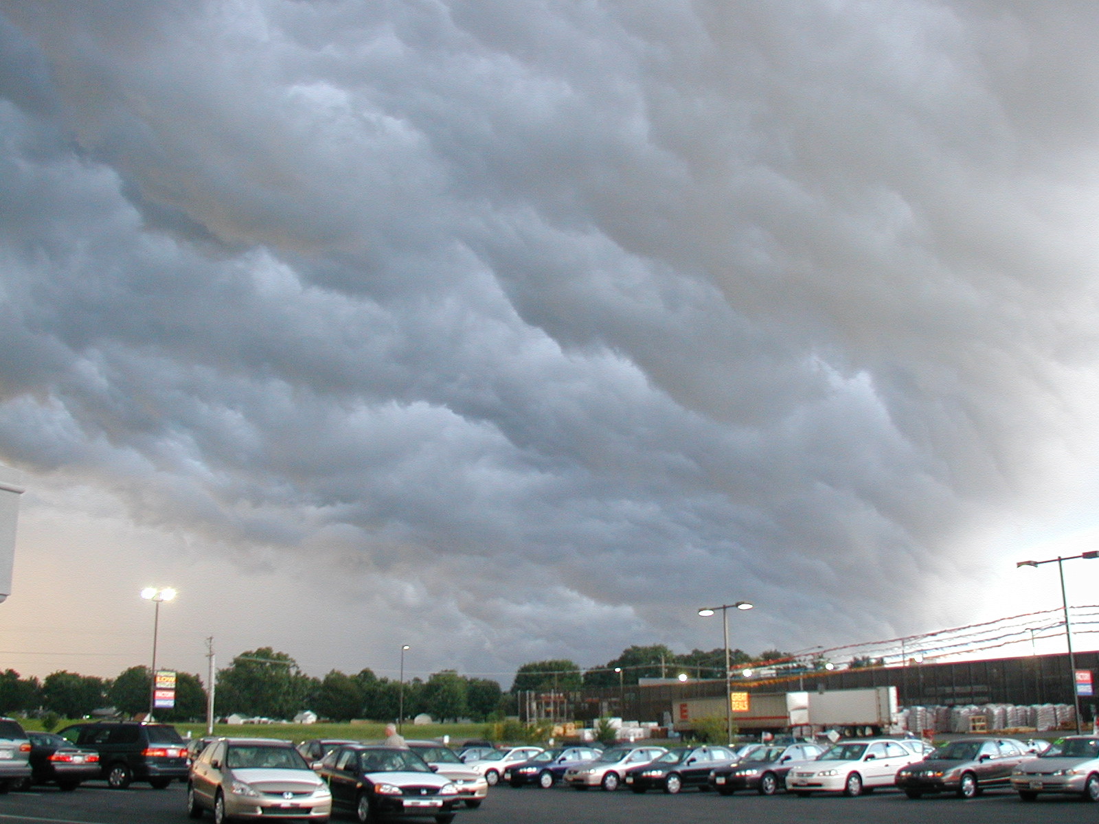
Thunderstorms crossing from Indiana into Ohio east of Fort Wayne November 12, 2003. On this date quarter and nickel sized hail were observed around DuPont (Putnam County), and construction trailers were blown over at Wayne Trace High School two miles north of Haviland (Paulding County). Photo courtesy Ryan Chandler. |
 |
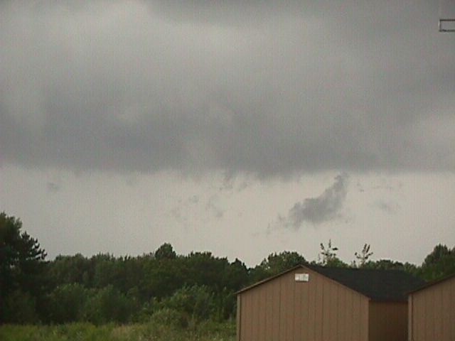
Low cumulus cloud development just east of Ashley, Indiana, August 10, 2003. |
 |
Thunderstorm at 9pm August 8, 2003 over Williams County, Ohio. Photo taken one mile west of Quincy, Michigan, in Branch County. The storm was about 35 miles from the photographer. Photo courtesy Don Cook KC8PRM. |
 |
Storm clouds approaching Osceola, Indiana August 3, 2003. Photo courtesy Richard Varda. |
 |
Setting sun illuminating storm clouds near Osceola, Indiana August 3, 2003. Photo courtesy Richard Varda. |
 |
Storm clouds over Osceola, Indiana August 3, 2003. Photo courtesy Richard Varda. |
 |
Low clouds above Osceola, Indiana, with very heavy rain in the background. Photo taken August 3, 2003 by Richard Varda. |
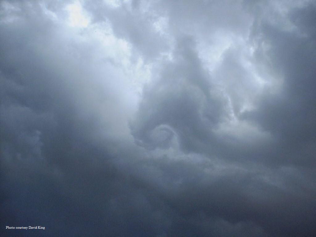 |
Small circulating cloud feature above Litchfield, Michigan at 4:15pm EDT August 2, 2003. Photo courtesy David King. |
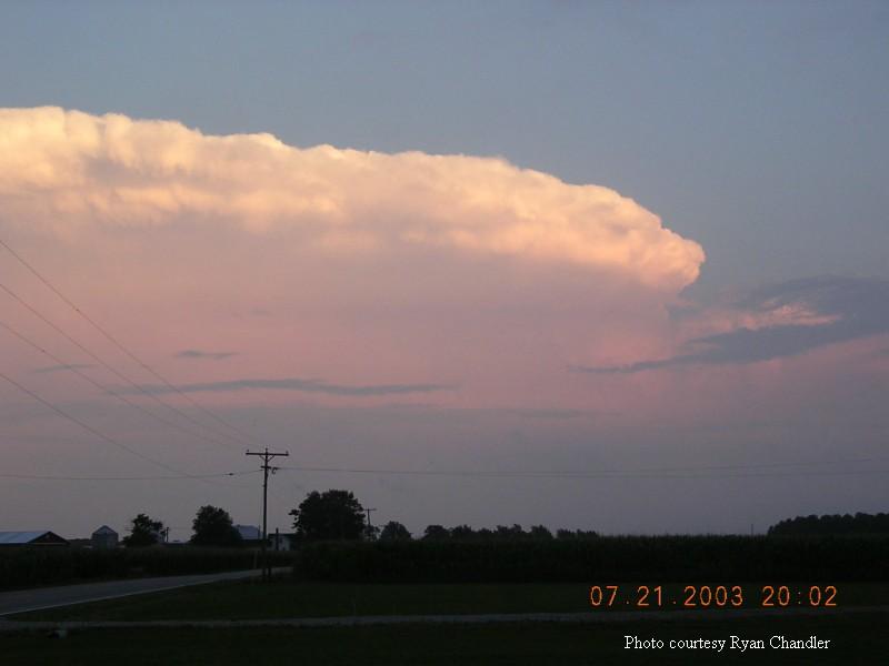 |
Thunderstorm 30 to 40 miles south of Woodburn, Indiana, July 21, 2003. Photo courtesy Ryan Chandler. |
 |
Storm clouds over Lima, Ohio July 21, 2003. No severe weather was reported. |
 |
Storm clouds over Lima, Ohio July 21, 2003. No severe weather was reported. |
 |
Storm clouds over Lima, Ohio July 21, 2003. No severe weather was reported. |
 |
Mammatus clouds near Harrod, Ohio, on May 10, 2003 around 4pm. Photo courtesy Chad Wright. |
 |
Mammatus clouds near Harrod, Ohio, on May 10, 2003 around 4pm. Photo courtesy Chad Wright. |
 |
Thunderstorm near Harrod, Ohio, April 30, 2003. Photo courtesy Chad Wright. |
 |
Rainbow one mile east of Poneto, Indiana, April 20, 2003. Photo courtesy Heather Dolby. |
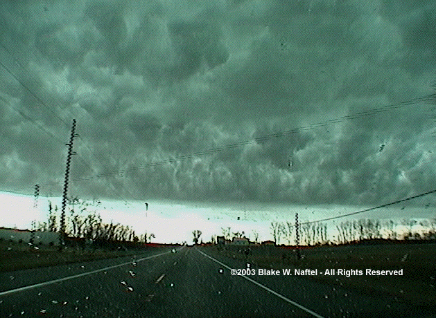 |
Storm clouds in Steuben County, Indiana, March 20, 2003. Photo courtesy Blake W. Naftel, KC8VPG. |
 |
Storm clouds that produced pea sized hail near Kinderhook, Michigan March 20, 2003, 3:40pm. (large file) |
 |
Storm clouds that produced pea sized hail near Kinderhook, Michigan March 20, 2003, 3:40pm. (large file) |
 |
Storm clouds that produced pea sized hail near Kinderhook, Michigan March 20, 2003, 3:40pm. Sometimes this feature is referred to as a "whale's mouth". (large file) |
 |
Sunset at the weather office December 31, 2002. |
 |
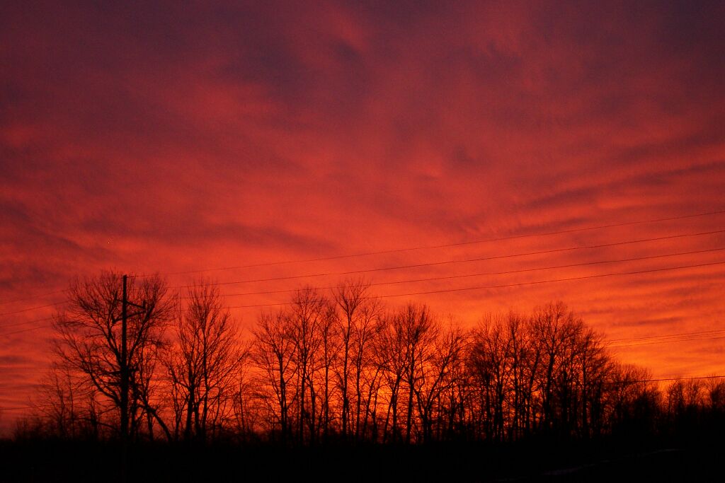
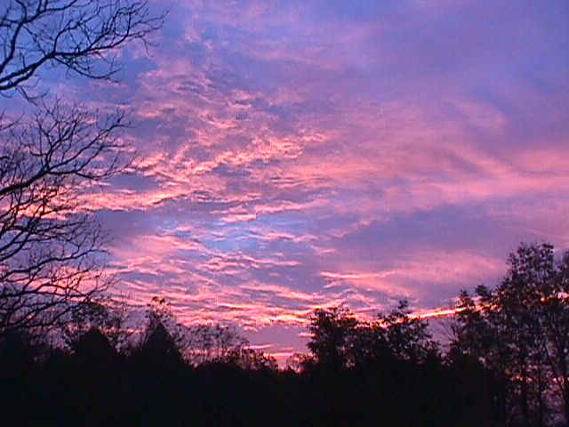
The sky was filled with color during this autumn sunset in October 2002. Photo taken by Rich Varda of Osceola, Indiana. |
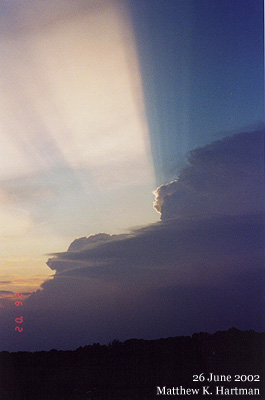 |
Sun setting behind a large thunderstorm over northwest Ohio on June 26, 2002. In Indiana on this evening, Fort Wayne was besieged by the worst flash flood ever seen in the city. |
 |
Sun setting behind a large thunderstorm over northwest Ohio on June 26, 2002. In Indiana on this evening, Fort Wayne was besieged by the worst flash flood ever seen in the city. |
 |
Large thunderstorm over northwest Ohio on June 26, 2002. In Indiana on this evening, Fort Wayne was besieged by the worst flash flood ever seen in the city. |
 |
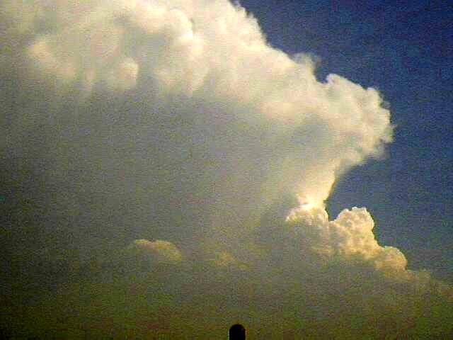
This photo was taken by Eric Flory on June 1, 2002, from Peru, Indiana. It is a picture of the top portion (the "anvil") of a very large thunderstorm near Terre Haute. The storm produced large hail in the Dana (Vermillion County) and Brazil (Clay County) areas, and created 58 m.p.h. winds at Spencer (Owen County). The center of the storm was 100 miles away from the photographer when this picture was taken. |
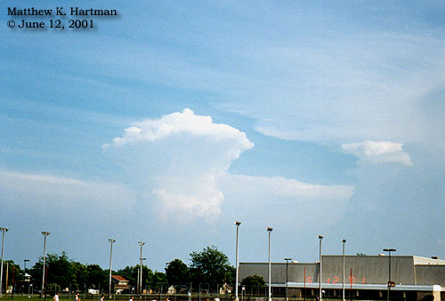 |
Distant thunderstorms on June 12, 2001. Photo was taken facing southeast from near Geneva, Indiana. Of the 37 counties in this office's area of responsibility, only 4 escaped severe weather on this day: Blackford, Adams, Williams, and Fulton OH. |
 |
Distant thunderstorms on June 12, 2001. Photo was taken facing southeast from near Geneva, Indiana. Of the 37 counties in this office's area of responsibility, only 4 escaped severe weather on this day: Blackford, Adams, Williams, and Fulton OH. |
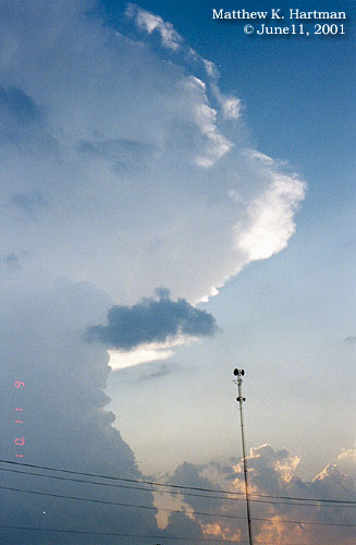 |
Developing thunderstorm south of Bluffton, Indiana on June 11, 2001. Note the presence of a strong updraft as revealed by the central storm tower in the lower left-hand portion of the photo, and the anvil cloud spreading out at the top of the storm. The small, dark, ragged clouds indicate the presence of low level moisture.
Severe weather was reported this day in the counties of LaPorte, St Joseph IN, and Berrien. |
 |
Can you tell where the clouds end and the snow begins? This is a visible satellite image taken after the late March 2002 snowstorm. The snow begins in western Illinois and goes through northern Indiana...northwest Ohio and southern Michigan. Clouds extend from north central Ohio into Kentucky. |
 |
Shelf cloud at Enid, Oklahoma. The storm produced 78 mph winds. Photo courtesy Doug Berry and the Ball State University Storm Chasing Team. |
 |
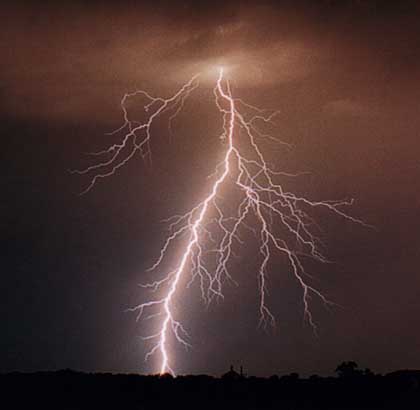
Lightning at Middlebury, Indiana, July 28, 2000. This storm blew down power lines in Middlebury. Photo courtesy Doug Berry. |
 |
Lightning at Middlebury, Indiana, July 28, 2000. This storm blew down power lines in Middlebury Photo courtesy Doug Berry. |
 |
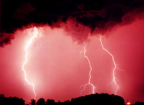
Lightning at Enid, Oklahoma. Photo courtesy Doug Berry and the Ball State University Storm Chasing Team. |
 |
Scud (fractostratus) is sometimes mistaken as a funnel cloud. The first thing to look for when trying to determine if a cloud is scud or a funnel is rotation. Whereas funnel clouds rotate, scud does not (although scud does move and change shape with time). |
 |
At first glance, this cloud could be mistaken for a funnel. However, careful inspection showed that there was no rotation. |
 |
Scud forms below a shower or thunderstorm as cool moist air flows up into the parent cloud. It is ragged in appearance and usually is not attached to the parent cloud. |
 |
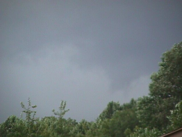
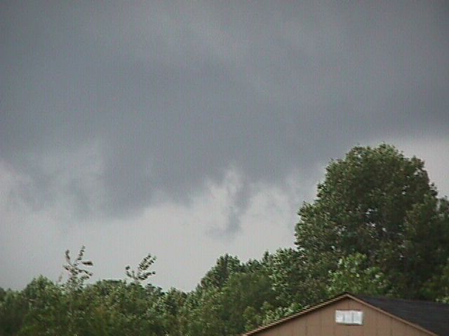
This series of four scud pictures was taken on August 19, 2001, from the parking lot at the Northern Indiana weather office, facing northeast. A shower was passing just off to the east (the light gray color along the tree line is heavy rain). |
 |
Mammatus clouds taken on July 4, 2001 by Meteorologist John Taylor. |
 |
Mammatus clouds taken on July 4, 2001 by Meteorologist John Taylor. |
 |
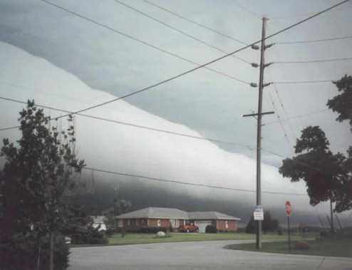
This is a picture of a shelf cloud taken on July 3, 2001 around 510 am EST on the northwest side of Fort Wayne. Photo taken by Loretta Barlow. |
 |
Another picture of the shelf cloud taken on July 3, 2001 around 512 am EST on the northwest side of Fort Wayne. Notice the bright pink area between the two houses. This is a distant lightning strike. Photo taken by Loretta Barlow. |
 |
Another glimpse of the shelf cloud as it nears the northwest side of Fort Wayne. Photo taken by Loretta Barlow. |
 |
An excellent example of cirrocumulus. These clouds are found about five miles above the earth's surface. This picture was taken at the weather office on July 19, 2000. |
 |
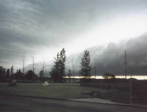
An approaching shelf cloud from the north, in Porter county Indiana on the morning of June 12, 2001. |
 |
Shelf cloud is now overhead!! Winds with this feature were not severe but the atmosphere was ominous! |
 |
...the shelf cloud is now moving away to the south... |
 |
...same shelf cloud...moving farther away. No rain occurred with this cloud feature. |
 |
Towering cumulus and the edge of a cumulonimbus cloud. In the upper right corner you can see the edge of the updraft tower and the anvil as it begins to spread out. Picture taken by Loretta Barlow on May 9, 2000 in northwest Allen County in Indiana...approximately 4 miles southwest of Huntertown. |
 |
Sun partially obscured by towering cumulus clouds gives the appearance of a "silver lining" to the clouds. Picture taken by Loretta Barlow on May 9, 2000 in northwest Allen county, Indiana. |
 |
Rainbow Photograph taken by Loretta Barlow on May 9, 2000 in northwest Allen county, Indiana. Thanks to Loretta for these great pictures!! |
 |
Thunderstorm northwest of Fort Wayne July 28, 1999. Photo taken by weather watcher Joel Esslinger at the intersection of Interstate 69 and Indiana 14. |
 |
Thunderstorm northwest of Fort Wayne July 28, 1999. Photo taken by weather watcher Joel Esslinger at the intersection of Interstate 69 and Indiana 14. |
 |
These are fair weather cumulus congestus clouds. This picture was taken by Sam Lashley at the NWS IWX office. |
 |
Sunset at the weather office, September 1999. |
 |
Towering cumulus over north central Indiana June 12, 1998. |
 |
Towering cumulus over north central Indiana June 12, 1998. |
 |
The sun rising over Tri-County Fish and Wildlife Area, near North Webster, Indiana. Taken from the weather office, when it was housed in temporary trailers before the new permanent building was erected. |
 |
This is a great example of Scud clouds. These clouds hang below the base of clouds and are often erroneously reported as funnel clouds. This picture taken by Sam Lashley in Millersburg, Indiana in Elkhart County |
 |
A supercell thunderstorm just south of Brookston Indiana in White County. You are looking south and this is the rear of the thunderstorm and a cumulonimbus cloud. Picture taken by Meteorologist Sam Lashley. |
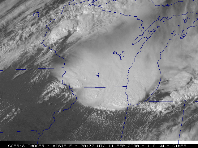 |
A visible satellite picture of a Mesoscale Convective System (MCS) on September 11, 2000. An outflow boundary from this system can be seen across northern Indiana and southern Michigan, approaching northwest Ohio. Large hail, damaging winds and flash flooding were observed. |
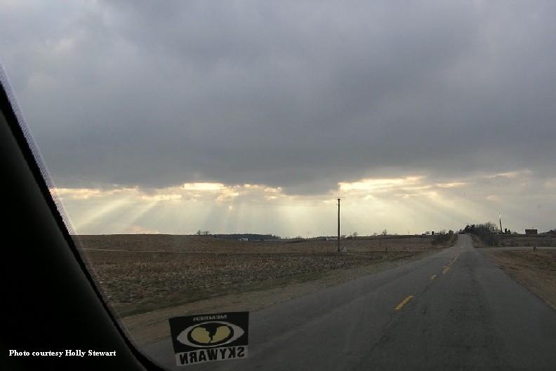 |
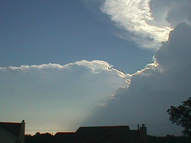
An example of crepuscular rays, as the sunlight filters through the clouds. |
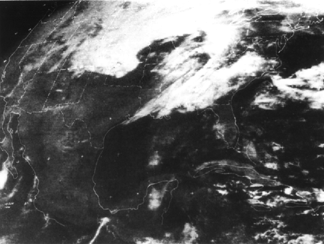 |
Years ago, satellite pictures were of much lesser quality. This picture was taken during the infamous tornado Super Outbreak on April 3, 1974. |
Select Another picture page
|
Tornado / Lightning, Wind, and Hail / Winter/ Flooding / Clouds and Sun / History / Main |


 Follow us on YouTube