Cold temperatures will continue across much of the eastern U.S. into today. Heavy lake effect snow continues into today east of Lakes Erie and Ontario. Two Pacific cold fronts will cross the Pacific Northwest early this week followed by another atmospheric river. Heavy rain and gusty winds are expected through midweek, with the potential for renewed urban and river flooding. Read More >
Jackson, KY
Weather Forecast Office
Overview
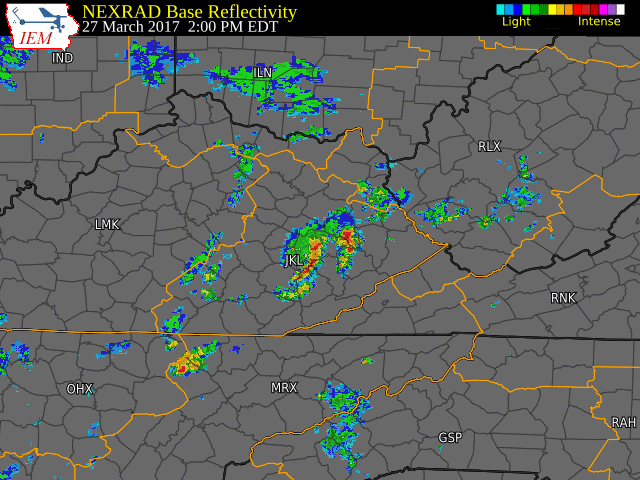
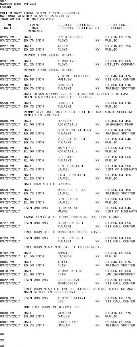
Scattered to numerous thunderstorms developed early this afternoon as temperatures warmed into the 70s ahead of an approaching cool front. These produced isolated reports of large hail across Floyd County. More widespread storms arrived into the late afternoon and evening in the form of a line as the front approached the Bluegrass region and Interstate 75 corridor. These produced up to golf ball size hail, while also causing multiple trees to be blown down.
Radar
 |
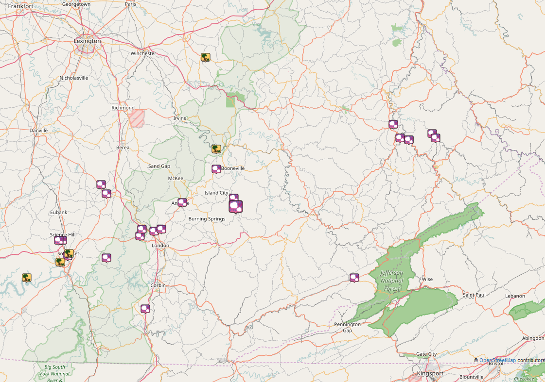
Storm Reports
|
|
 |
 |
Media use of NWS Web News Stories is encouraged! Please acknowledge the NWS as the source of any news information accessed from this site. |
|
Warnings/Hazards
Decision Support - Outlooks
Current Weather Hazards
Hazards Criteria
Weather Story Graphic
Recent Storm Reports
Submit a Report
Forecasts
Decision Support - Forecast
Aviation Forecasts
Fire Weather Forecasts
Hourly Weather Forecast
Activity Planner
River Forecasts
Forecast Discussion
Current Conditions
Regional Radar
Decision Support - Current
Rivers and Lakes
Hourly Airport Weather
Local Radar
Satellite
Kentucky Mesonet
Past Weather
Local Climate Info
Temp/Precip Summary
How Much Rain Fell?
How Much Snow Fell?
Past Weather Events
Drought Information
Local Coop Observers
US Dept of Commerce
National Oceanic and Atmospheric Administration
National Weather Service
Jackson, KY
1329 Airport Road
Jackson, KY 41339
606-666-8000
Comments? Questions? Please Contact Us.