
A storm system will shift across the southwest U.S. through Thursday with widespread showers and isolated thunderstorms. Isolated flooding is possible. High-elevation snow is also expected in parts of Nevada and the southern Sierra Nevada range. East of this storm, above average temperatures will challenge or break daily record high temperatures this week in the southern Plains and southeast U.S. Read More >
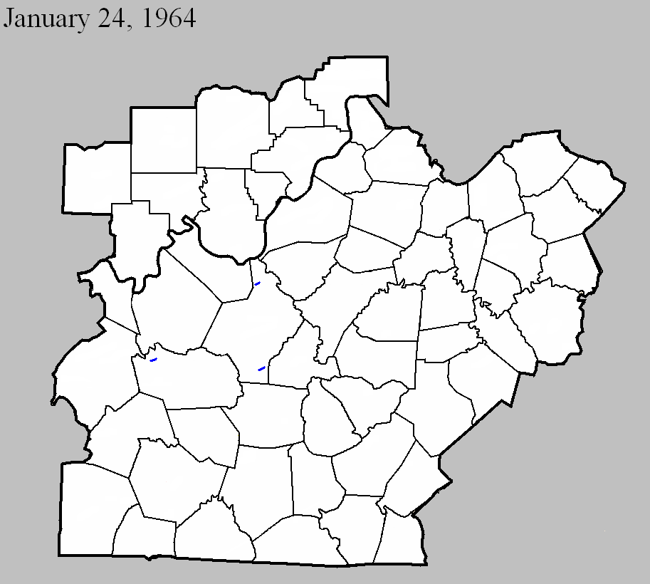
January 24, 1964
Counties: Grayson
F-scale: F1
Deaths:
Injuries:
Path width:
Path length:
Time: 8:16pm
Notes: Narrow swath through thick timber, evidence of rotary motion.
Noted discrepancies: SPC gives a path width of 10 yards and a path length of 1/10 of a mile...NCDC gives nothing for either. The only Kentucky event on this day in Storm Data is in Fulton County because the report for this tornado came in too late for inclusion in the publication.
January 24, 1964
Counties: Hardin
F-scale: F1
Deaths:
Injuries:
Path width:
Path length:
Time: 9:00pm
Notes: One to two miles west of Sonora a large barn with corrugated iron siding was completely torn from its foundation, with corrugated iron sheets extending about 0.25 mile across two fields. A 12" diameter oak tree was twisted off in the center of the damage path. Definite indication of rotary motion in the damage path according to the Louisville Weather Bureau surveyor. Two other barns were damaged though not destroyed.
Noted discrepancies: SPC gives a path width of 10 yards and a path length of 1/10 of a mile...NCDC gives nothing for either. The only Kentucky event on this day in Storm Data is in Fulton County because the report for this tornado came in too late for inclusion in the publication.
January 24, 1964
Counties: Hardin
F-scale: F1
Deaths:
Injuries:
Path width:
Path length:
Time: 9:45pm
Notes: Manager of radio station WIEL relayed a report of considerable damage, with indications of a circular patter in the debris, at the rear of an athletic field at a dependent school.
Noted discrepancies: SPC gives a path width of 10 yards and a path length of 1/10 of a mile...NCDC gives nothing for either. The only Kentucky event on this day in Storm Data is in Fulton County because the report for this tornado came in too late for inclusion in the publication. The SPC/NCDC lat/lon pairs actually put this tornado in Meade County. There was minor tree damage in Meade County, but so far this project has been unable to find any documentation of a tornado there.


 Weather Story
 Weather Map
 Local Radar