Louisville, KY
Weather Forecast Office
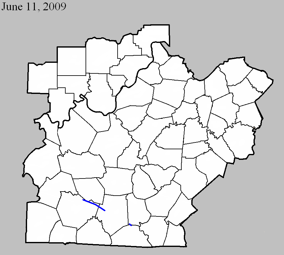
June 11, 2009
Counties: Warren, Edmonson, Barren
EF-scale: EF1
Deaths: 0
Injuries: 0
Path width: 150 yards
Path length: 18 miles (skipping)
Time: 7:00pm CDT
Notes: This tornado touched down along the Edmonson/Warren county line between Brownsville and Bowling Green. It moved to the east-southeast, passing just north of Smiths Grove, west of Hays, and dissipating at Beckton west of Glasgow. Many trees were snapped or uprooted, and farms in the path suffered roof and outbuilding damage. Cornfields were flattened and convergent wind signatures could be seen in the vegetation.
June 11, 2009
Counties: Metcalfe, Monroe
EF-scale: EF1
Deaths: 0
Injuries: 0
Path width: 150 yards
Path length: 1.3 miles
Time: 8:01pm CDT
Notes: A small tornado traveled from northwest of Cyclone to south of Cyclone, damaging a few buildings and felling trees.
Current Hazards
Hazardous Weather Outlook
Storm Prediction Center
Submit a Storm Report
Advisory/Warning Criteria
Radar
Fort Knox
Evansville
Fort Campbell
Nashville
Jackson
Wilmington
Latest Forecasts
El Nino and La Nina
Climate Prediction
Central U.S. Weather Stories
1-Stop Winter Forecast
Aviation
Spot Request
Air Quality
Fire Weather
Recreation Forecasts
1-Stop Drought
Event Ready
1-Stop Severe Forecast
Past Weather
Climate Graphs
1-Stop Climate
CoCoRaHS
Local Climate Pages
Tornado History
Past Derby/Oaks/Thunder Weather
Football Weather
Local Information
About the NWS
Forecast Discussion
Items of Interest
Spotter Training
Regional Weather Map
Decision Support Page
Text Products
Science and Technology
Outreach
LMK Warning Area
About Our Office
Station History
Hazardous Weather Outlook
Local Climate Page
Tornado Machine Plans
Weather Enterprise Resources
US Dept of Commerce
National Oceanic and Atmospheric Administration
National Weather Service
Louisville, KY
6201 Theiler Lane
Louisville, KY 40229-1476
502-969-8842
Comments? Questions? Please Contact Us.


 Weather Story
 Weather Map
 Local Radar