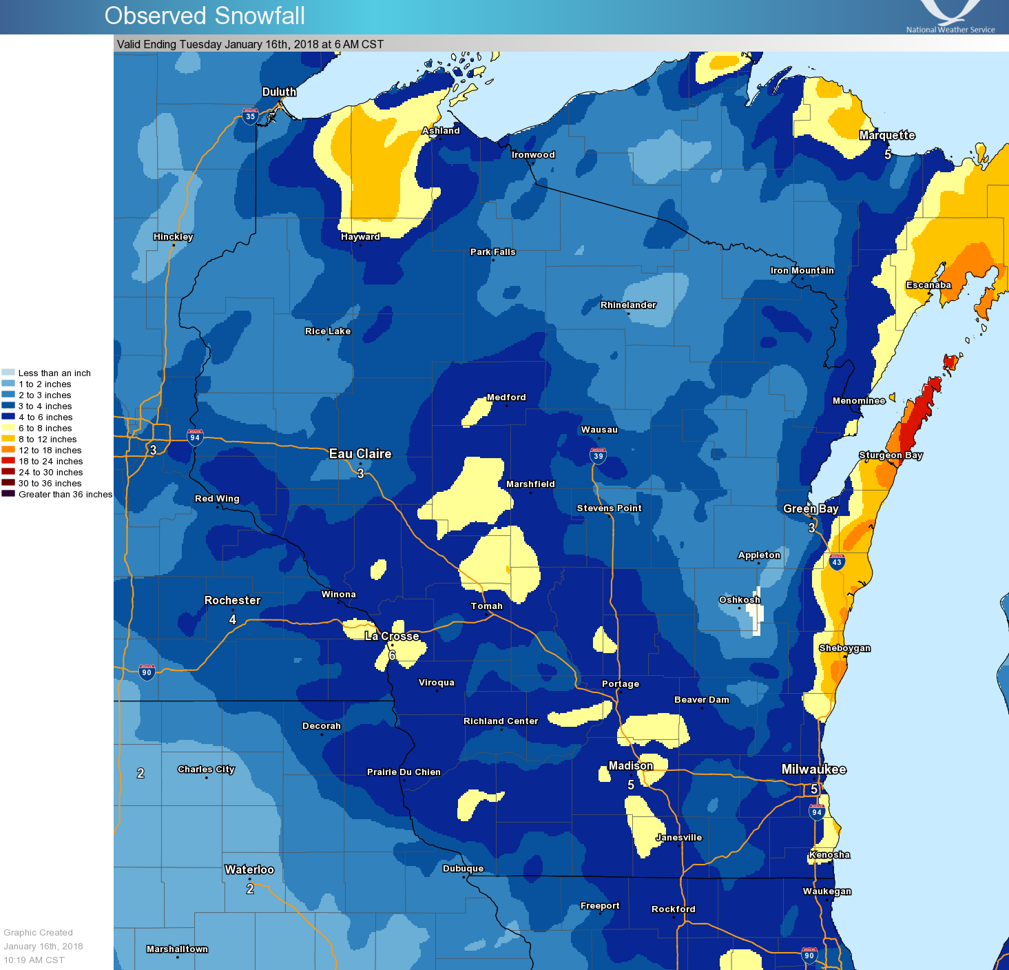
Overview
A long duration snow event occurred across southern Wisconsin with the highest totals closer to Lake Michigan where the lake helped to make the snow more intense. The first round moved in on Sunday night with the heaviest snow band developing out over the lake Monday morning. This band moved into Sheboygan county about 10am and then pivoted southwest across southern Wisconsin through Monday evening. Some lake effect snows lingered into Tuesday morning with snow event totals ranging from 3-6 inches in south central Wisconsin to 6-14" near Lake Michigan.Snow
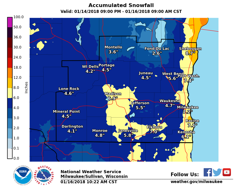
Two-day snowfall amounts generally ranged from 8-14" near the lake to about 3-6" away from the lake.
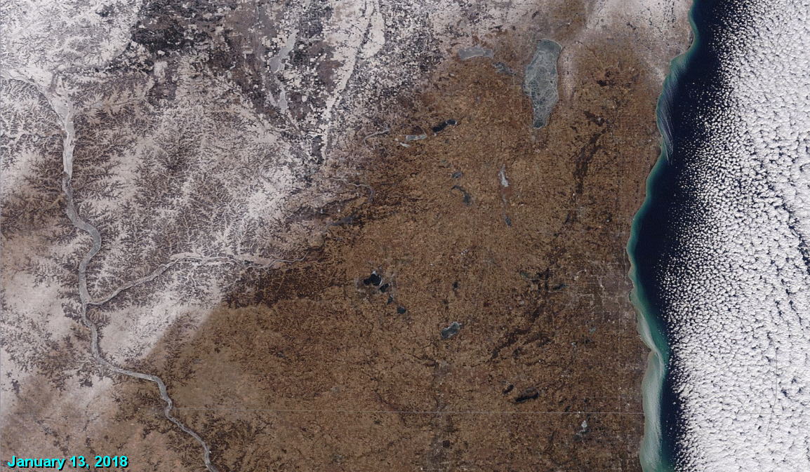
Here is a great "before and after" animation of MODIS satellite imagery. The before shot (no snow over southern Wisconsin) was captured on January 13th. The after image (showing the new snow cover) is January 16th.
Photos:
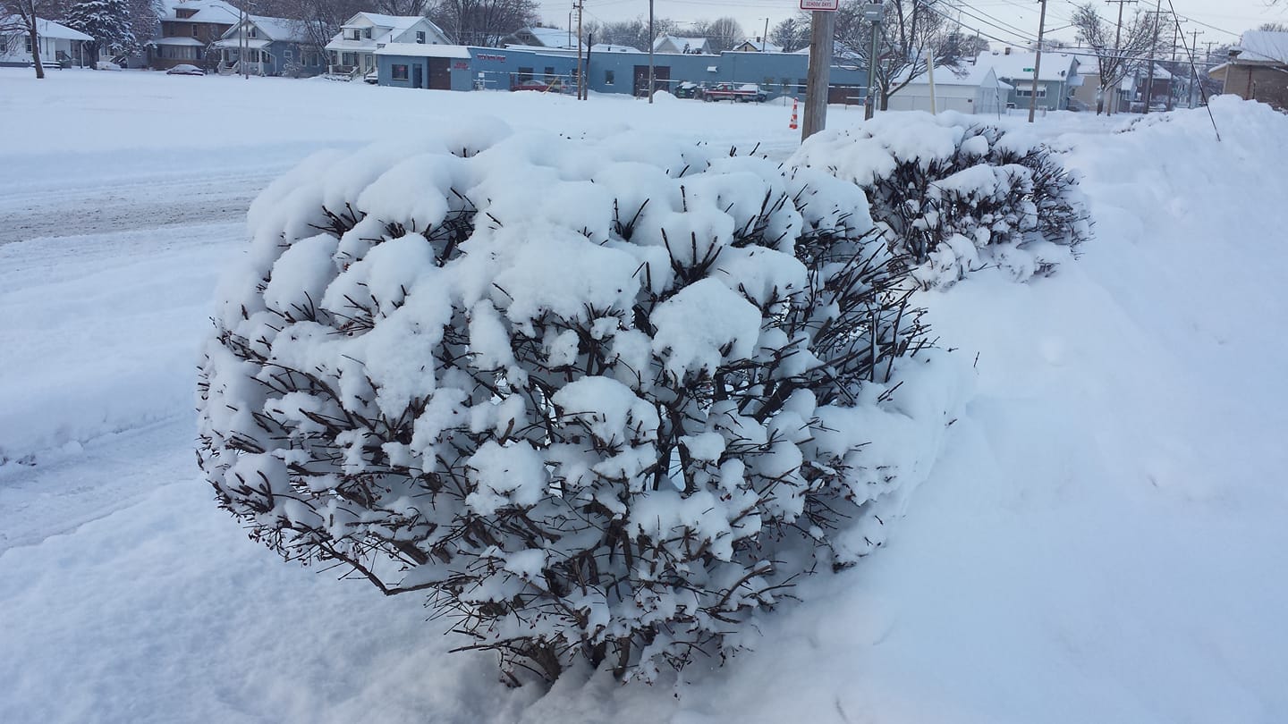
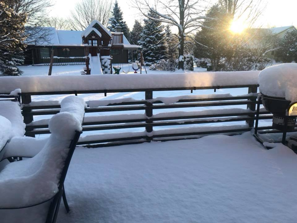
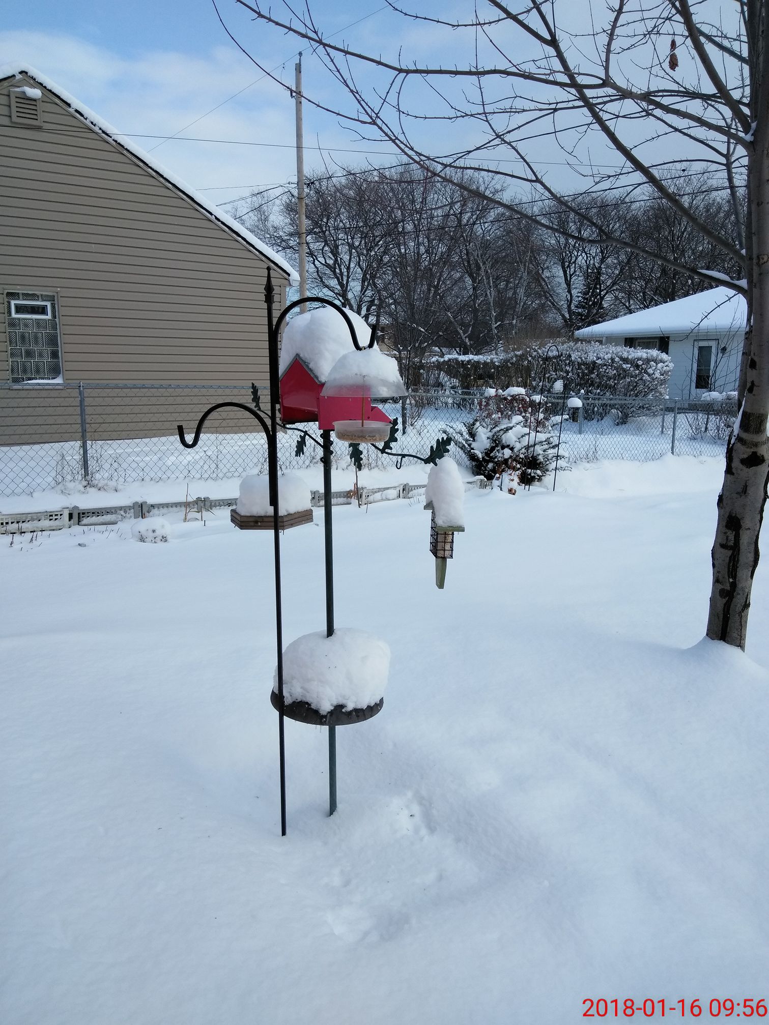
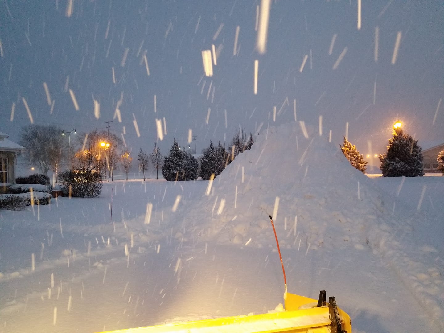
Social Media Pictures
 |
 |
 |
 |
|
Kenosha (Jennifer Johnson) |
Sheboygan Falls (Christian Ellis) |
South Milwaukee (Jennifer Warren) |
Kenosha-Carthage College (Jason Truax) |
Radar:
Two Day Radar Loop
 |
|||
| Radar Loop: Sunday Night into Tuesday Morning |
Storm Reports
This list combines the National Weather Service's volunteer COOP
network, unofficial COOP stations and the CoCoRaHS network

Location               Amounts (inches)

Milwaukee Airport            8.0
Madison Airport              6.9

...Columbia...
Portage                      7.0
Arlington                    5.2
Lodi                         5.0
Columbus                     4.5
Fall River                   4.0
Pardeeville                  4.0

...Dane County...
6 W Madison                  7.4
Oregon                       6.5
Middleton                    5.7
5 SW Fitchburg               5.3
Mt. Horeb                    5.0
Waunakee                     5.0
Cottage Grove                4.8
Stoughton                    3.1

...Dodge...
Westford                     6.2
Beaver Dam                   4.0
Horicon                      3.6
Wapun                        3.2
Hustisford                   3.0

...Fond du Lac...
Fond du lac                  2.3
Taycheedah                   2.0

...Green...
Broadhead                    6.5
Monticello                   6.5

...Green Lake...
Markesan                     4.5
Berlin                       3.9
Green Lake                   3.0

...Iowa...
Dodgeville                   5.5

...Jefferson...
3 SE Sullivan WFO MKX        4.9
Waterloo                     4.9
Blue Spring Lake             4.2
Beaver Dam                   4.0
Jefferson                    4.0
2 N Palmyra                  3.8
Lake Mills                   3.4
Watertown                    3.2
Johnson Creek                2.9

...Kenosha County...
Kenosha                      6.0
Paddock Lake                 5.5
4 NW Pleasant Prairie        5.5
4 S Sturtevant               5.3
Twin Lakes                   4.6

...Lafayette...
Darlington                   3.5
Argyle                       3.1
Benton                       3.0
South Wayne                  3.0
3 E Wiota                    2.8

...Marquette...
Neshkoro                     6.0

...Milwaukee County...
2 NE Franklin                7.1
1 NNE Cudahy                 6.8
1 NW Brown Deer              6.0
4 NW Milwaukee               6.0
1 NNE West Allis             6.0
Whitnall Park                5.2
1 NE Greendale               4.4
Franklin                     4.2
Mt. Mary College             4.0
Timmerman Airport            3.0

...Ozaukee County...
Belgium                      8.0
Grafton                      5.9

...Racine County...
Caledonia                    7.5
Racine                       7.0
Franksville                  6.5
3 E Franksville              5.8
2 N Elmwood Park             5.5
Union Grove                  5.0
Rochester                    4.5
Burlington                   4.0

...Rock...
9 NW Beloit                  5.1
Clinton                      4.0
Beloit                       3.4

...Sauk County...
Baraboo                      5.7
La Valle                     5.1
Reedsburg                    5.0
Sauk City                    4.5
Plain                        3.5

...Sheboygan County...
1 N Kohler                  14.0
Sheboygan Falls             13.0
Sheboygan                   11.5
2 ESE Kohler                10.8
1 N Howards Grove            9.6
Ootsburg                     9.0
Cedar Grove                  8.0
Random Lake                  7.1
Hingham                      6.5
Plymouth                     5.9
Cascade                      5.8

...Walworth County...
East Troy                    5.0
Lyons                        4.0
Pell Lake                    4.0
Delavan                      3.5
Whitewater                   3.3

...Washington County...
1 NE West Bend               5.6
Germantown                   4.9
Newburg                      4.9
Richfield/Colgate            4.5
Jackson                      4.4
Slinger                      4.2
Lake Geneva                  4.0
Allenton                     3.9
Hartford                     3.5

...Waukesha County...
Eagleville                   4.8
2 NW New Berlin              4.7
2 NNE Oconomowoc             4.5
Brookfield                   4.5
2 ENE Mukwonago              4.5
2 S North Prairie            4.3
3 ESE Pewaukee               4.0
Nashotah                     4.0
2 NW Waukesha                4.0
Merton                       3.8
Big Bend                     3.7
Brookfield                   3.5
Merton                       3.5
1 W Oconomowoc               3.5

Observations are collected from a variety of sources with varying
equipment and exposures. We thank all volunteer weather observers
for their dedication. Not all data listed are considered official.
 |
Media use of NWS Web News Stories is encouraged! Please acknowledge the NWS as the source of any news information accessed from this site. |
|

