
Gusty winds are expected from portions of the Mid-Atlantic into the Northeast through the night following the system that brought rain to the area. An atmospheric river will move into the Northwest late today into Saturday bringing moderate to heavy rainfall, mountain snow, windy conditions, and high surf to the area over the weekend. Read More >
Overview
|
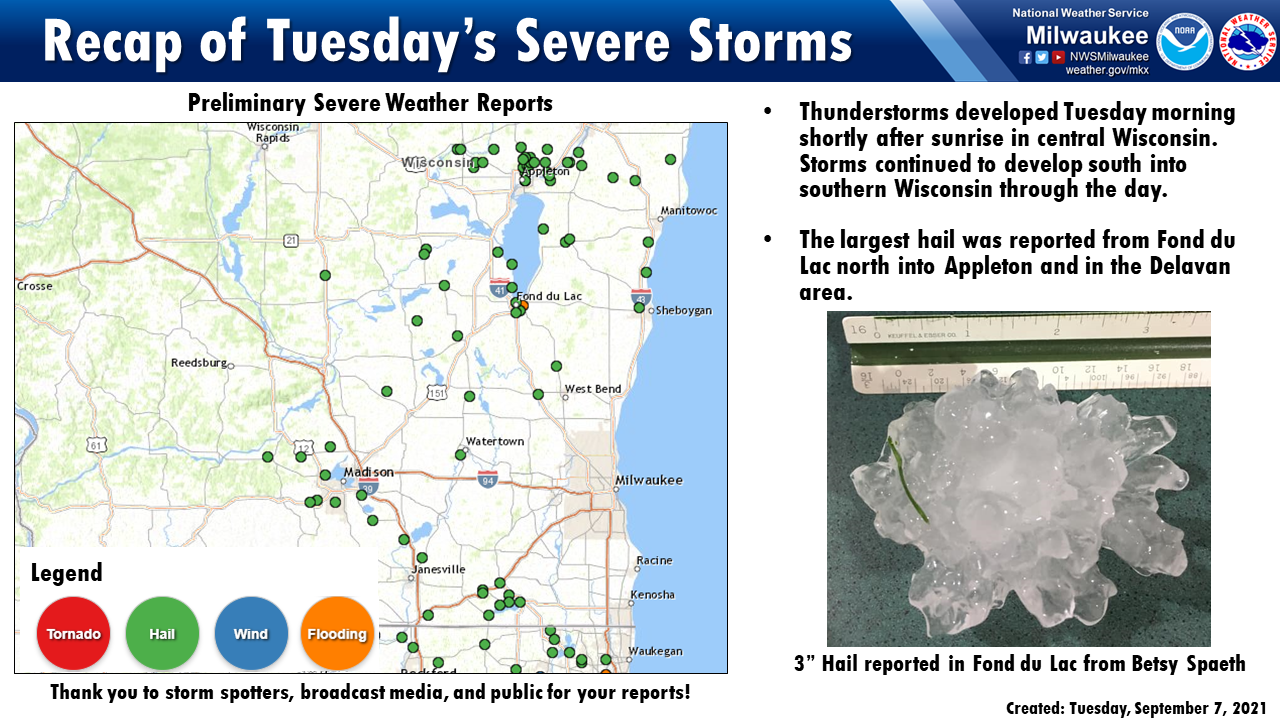
A cold front moved it's way south across Wisconsin on Tuesday with storms developing quickly over north-central Wisconsin shortly after sunrise. These storms quickly became severe in the NWS Green Bay forecast area. Large hail was reported in the Appleton area with hail approaching 4 inches in diameter. Storms continued south to southeast along the front and hail of 2 to 3 inches was reported in Fond du Lac. Additional storms developed along the southern flank of the front near Madison and produced hail around 1 inch. These southern storms continued to strengthen and hail closer to 2 inches was reported in Rock and Walworth counties. While the storms were very strong there was enough of a stable layer near the surface to prevent strong wind gusts from these storms from reaching the surface. These storms did produce very frequent and intense lightning and a couple of houses were struck and caught fire from the lightning strikes. |
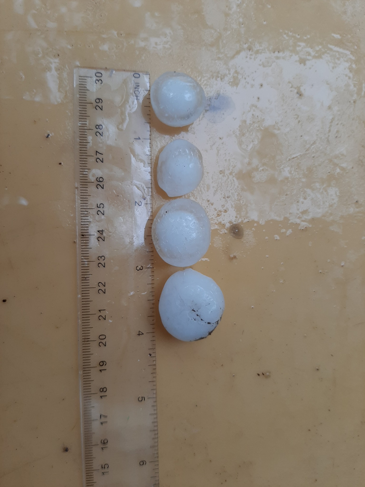
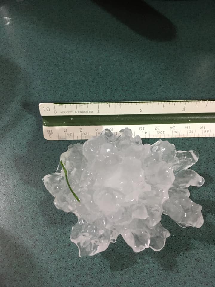 Large Hail up to 3" in Fond du Lac from Betsy Spaeth |
Radar
 |
| Radar loop of storms as they moved across central and southern Wisconsin Tuesday morning into the early afternoon hours. |
Hail Photos
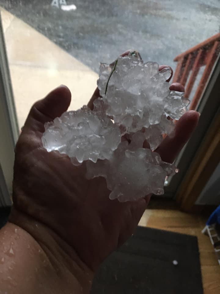
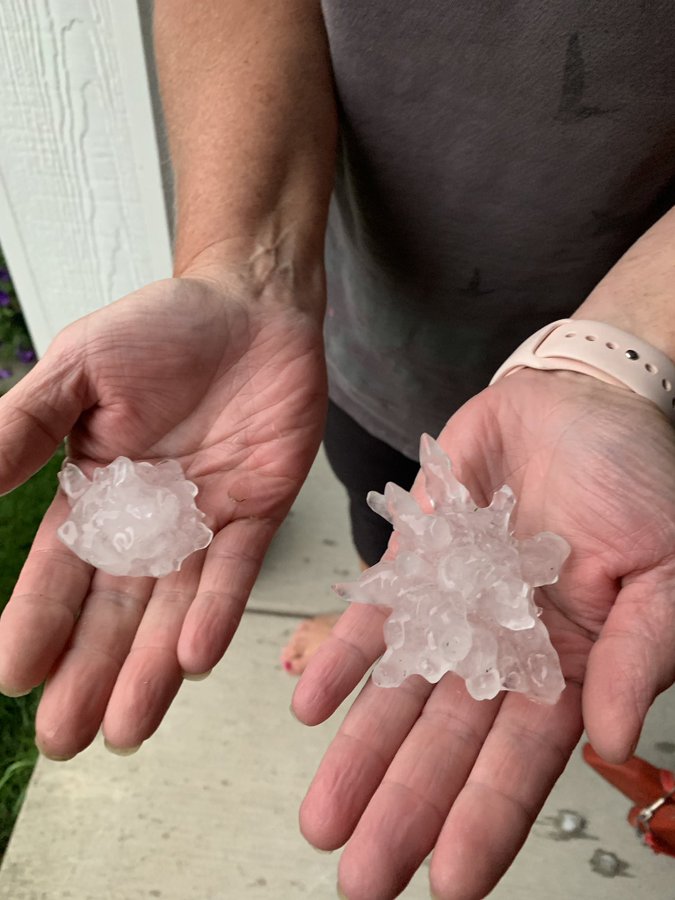
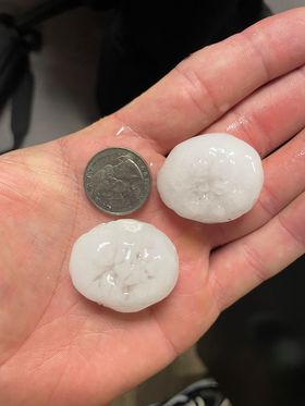
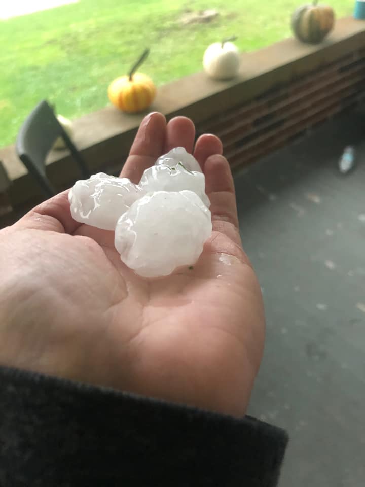
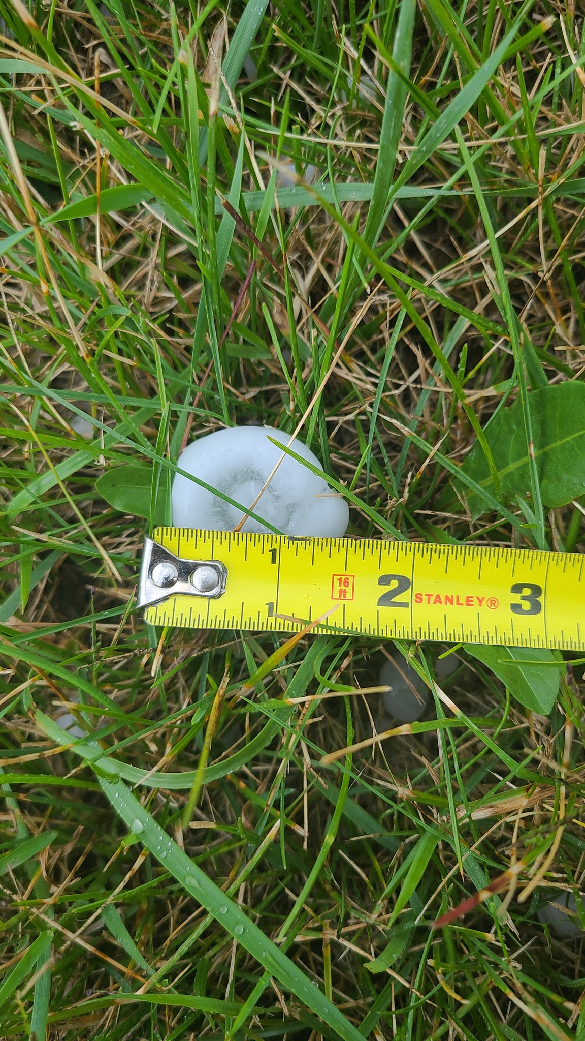
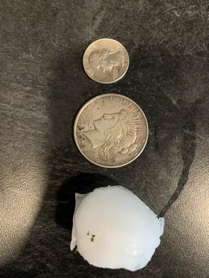
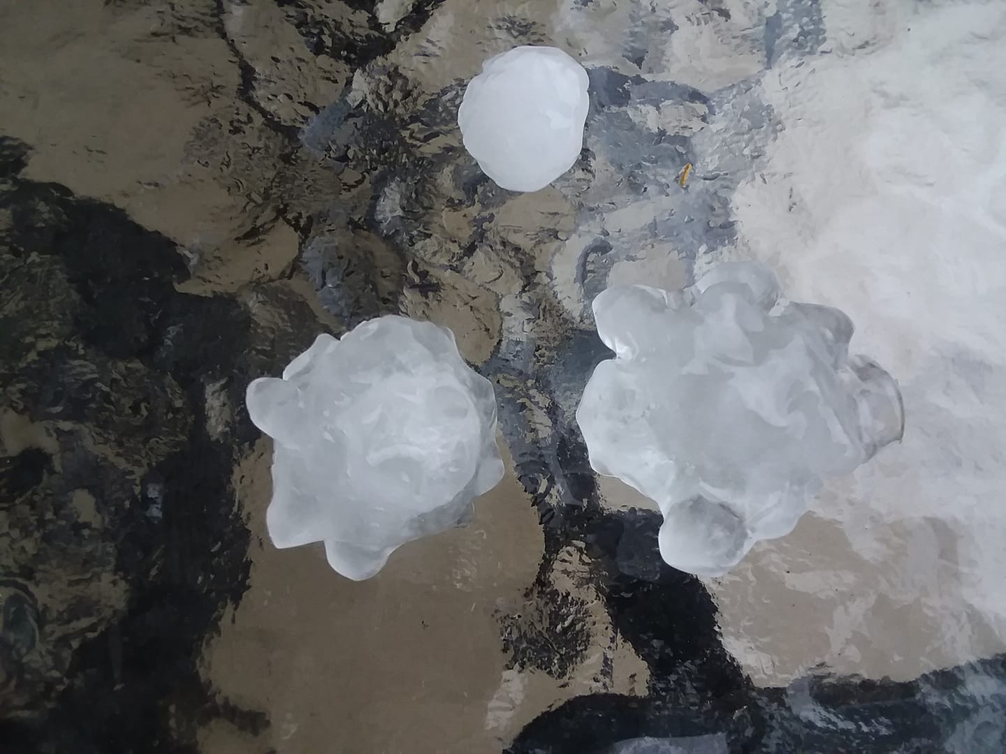
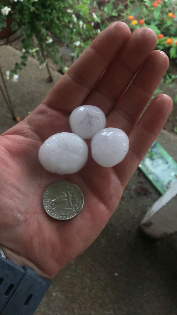
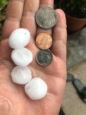
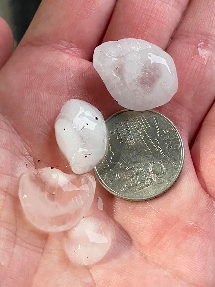
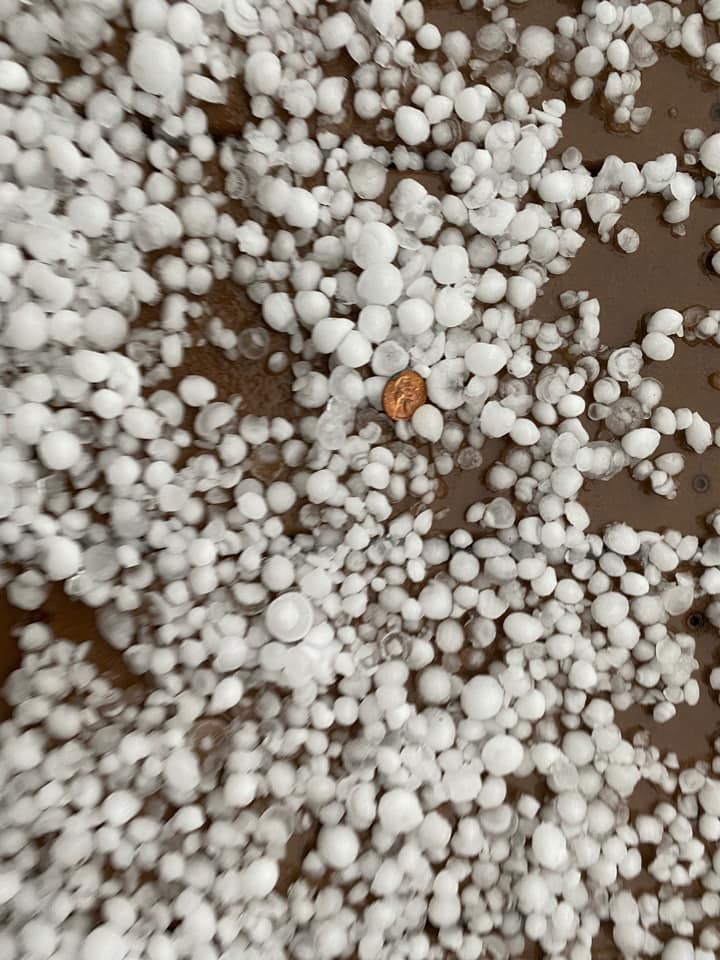
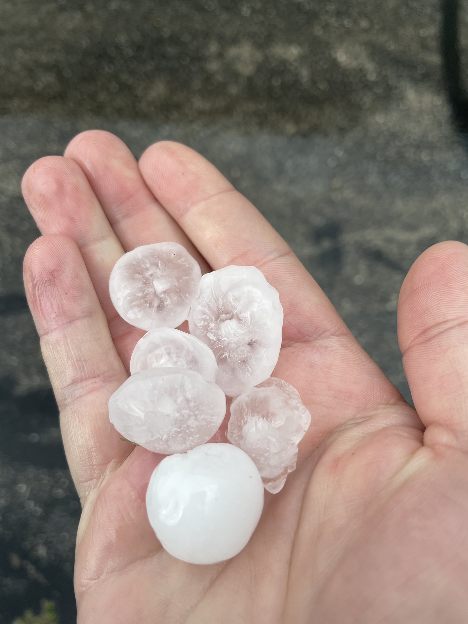
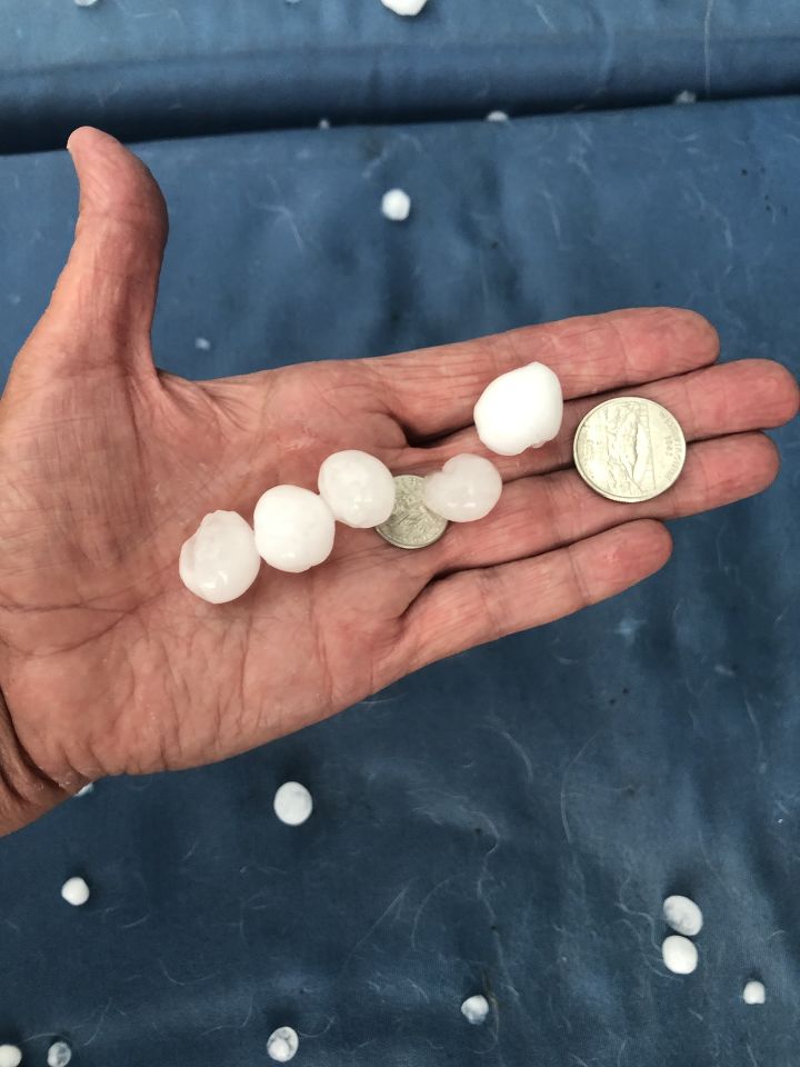
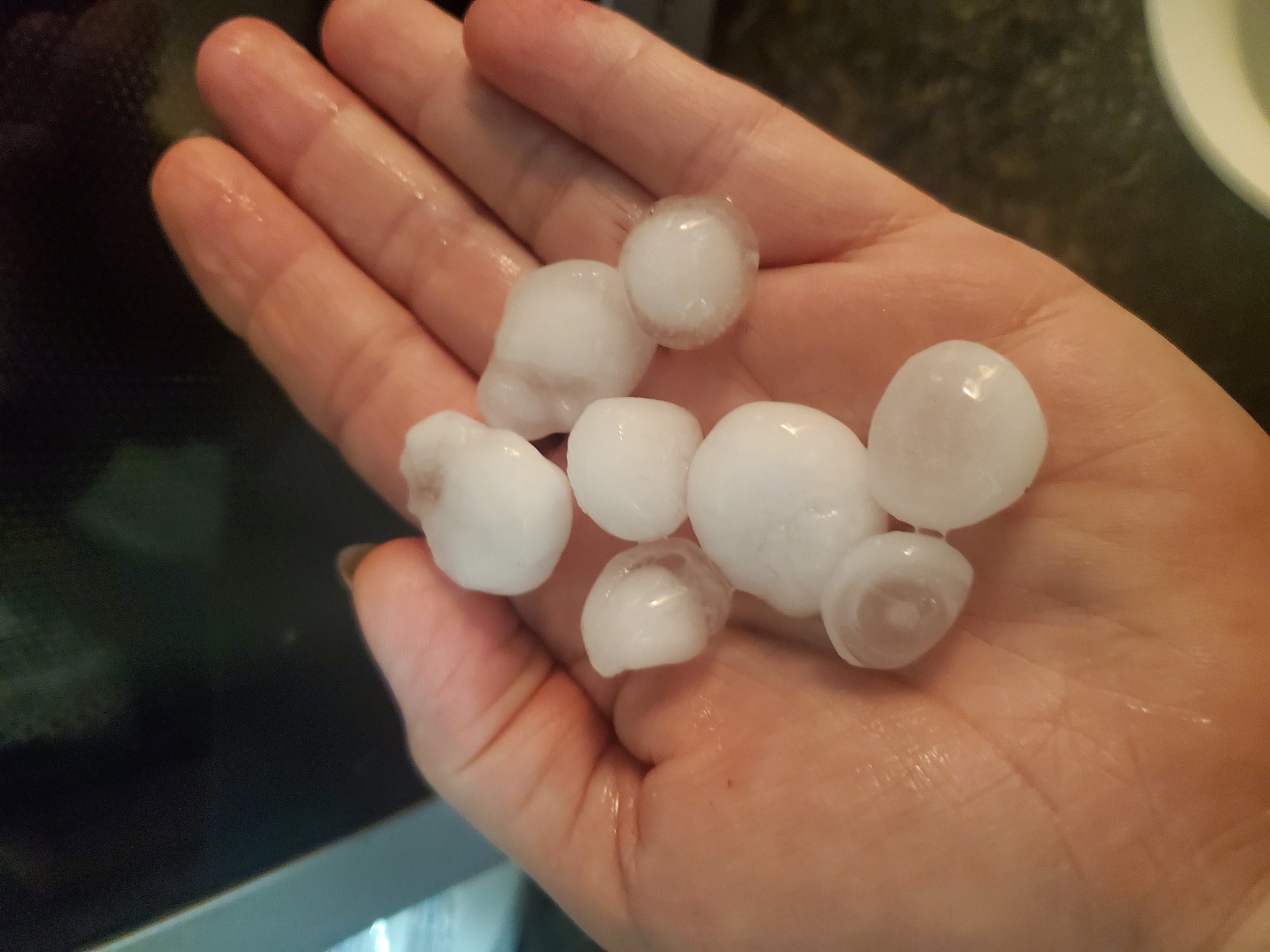
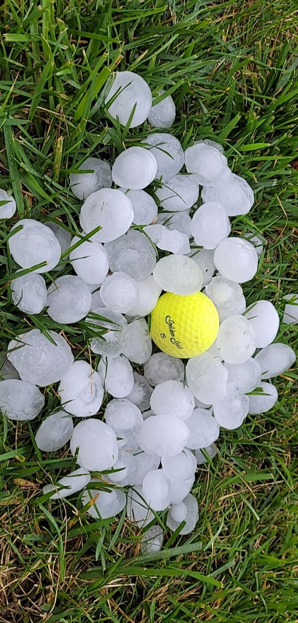
Hail ranged from pea size for most locations all the way up to Teacup size hail which is around 3 inches. The largest hail stones were reported in Fond du Lac.
|
 |
 |
 |
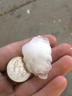
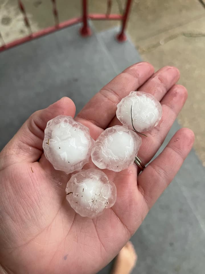
| 3" hail in Fond du Lac from Betsy Spaeth | 2" to 2.75" hail in Fond du Lac from Betsy Spaeth | Golfball Hail Fond du Lac from DDeumer via Twitter | Golfball Hail Ripon from SarahS relayed from WKOW27 |
 |
 |
 |
 |
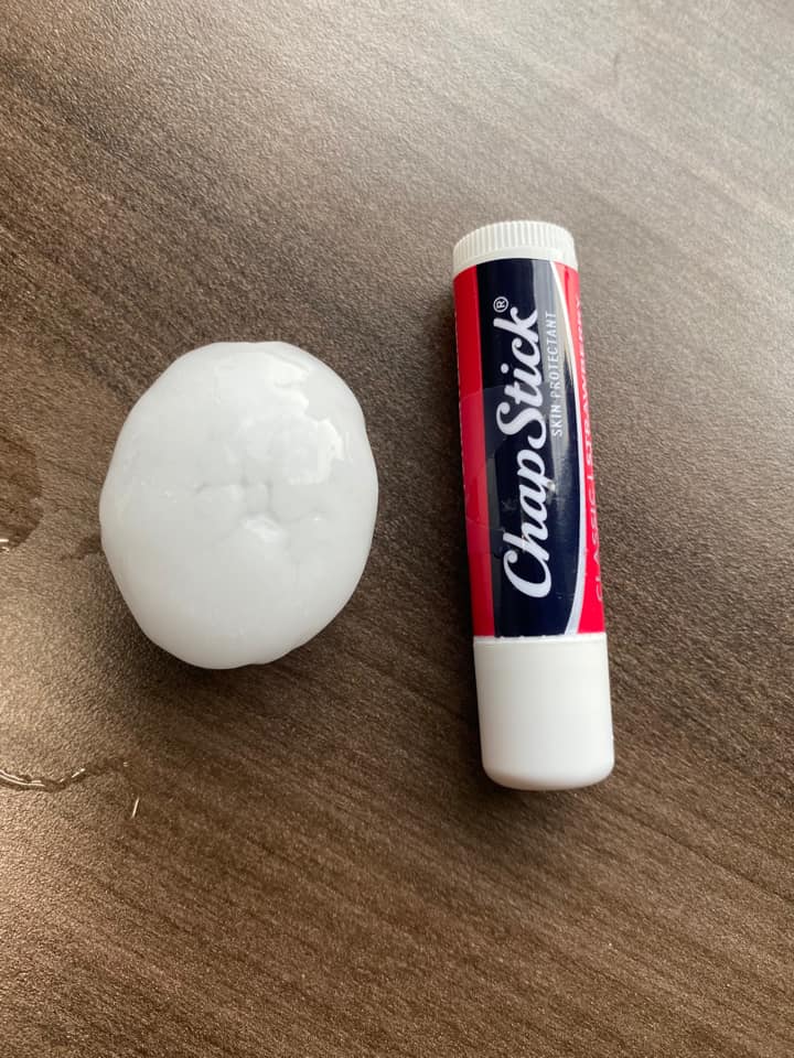
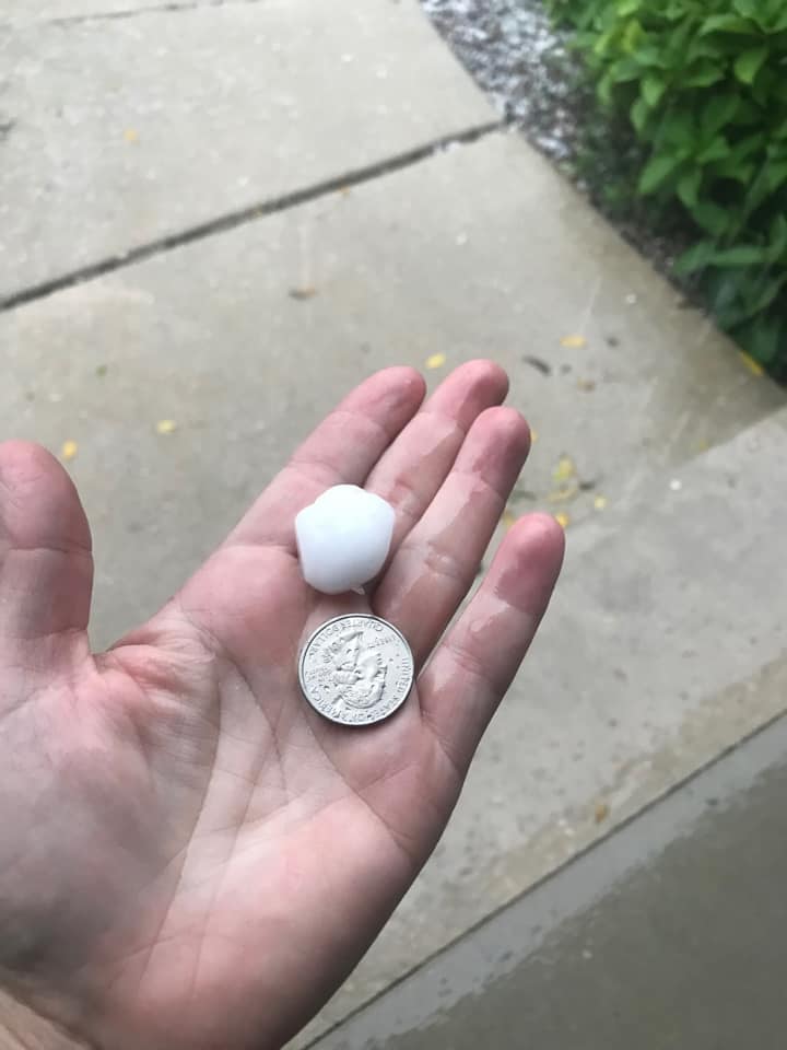
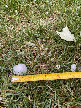
| Half Dollar hail in Fond du Lac from Jason Michael | Ping Pong Ball hail in Cleveland from Sara Tremblay | Ping Pong Ball hail in Delavan from Bridgett Zerbach | Ping Pong Ball hail in Delavan from Jeff Coblentz |
 |
 |
 |
 |
| Ping Pong Ball hail in Delavan from Tom Russ | Ping Pong Ball hail in Doylestown from Bonnie Langsdorf | Ping Pong Ball hail in Fond du Lac from Sharky Berenz | Quarter size hail in Juneau from Ashley Rabehl |
 |
 |
 |
 |
| Quarter size hail in Lake Geneva from Melissa McKay | Quarter size hail in Mazomanie from Anita Robinson | Quarter size hail in Town of Geneva from Kelly Herwald | Quarter size hail in Edgerton from Abby Mazuk relayed from WKOW27 |
 |
 |
 |
 |
| Penny size hail in Lake Geneva from Sara Wahlstedt | Quarter size hail in Milton from Michael Gouvin | Quarter size hail in Kristin Behring relayed from NBC15 | Quarter size hail in Westfield from Dana Rae Neufeld relayed from WKOW |
 |
 |
 |
 |
| Golfball hail in Delavan from David Eucker relayed from TMJ4 | 1.5" hail in Delavan from Meg Syves | 1.25" hail in Delavan from Josh Schmirler | Ping Pong ball size hail in Ripon from Kimberly Young |
Storm Reports
 |
| Link to Map of storm reports |
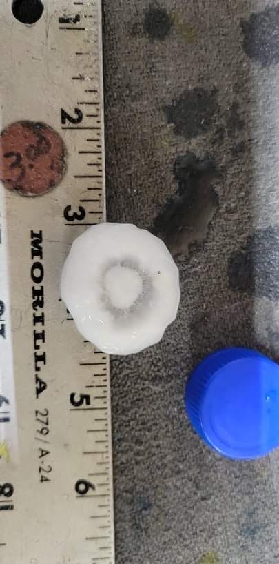
				000
				NWUS53 KMKX 072035
				LSRMKX

				PRELIMINARY LOCAL STORM REPORT...SUMMARY
				NATIONAL WEATHER SERVICE MILWAUKEE/SULLIVAN WI
				335 PM CDT TUE SEP 7 2021

				..TIME...   ...EVENT...      ...CITY LOCATION...     ...LAT.LON...
				..DATE...   ....MAG....      ..COUNTY LOCATION..ST.. ...SOURCE....
				            ..REMARKS..

				1045 AM     HAIL             1 N KEWASKUM            43.53N 88.23W
				09/07/2021  E1.00 INCH       WASHINGTON         WI   PUBLIC


				1122 AM     HAIL             ALLENTON                43.42N 88.33W
				09/07/2021  M1.00 INCH       WASHINGTON         WI   LAW ENFORCEMENT

				            SHERIFFS OFFICE REPORTED QUARTER SIZE HAIL
				            IN ALLENTON.

				1232 PM     HAIL             DELAVAN                 42.63N 88.63W
				09/07/2021  E1.25 INCH       WALWORTH           WI   TRAINED SPOTTER

				            CORRECTS PREVIOUS HAIL REPORT FROM DELAVAN.
				            1.0 TO 1.25 INCH HAIL REPORTED BY TRAINED
				            SPOTTER.

				1233 PM     HAIL             1 N DELAVAN             42.64N 88.63W
				09/07/2021  M1.50 INCH       WALWORTH           WI   PUBLIC

				            MULTIPLE REPORTS OF 1.0 TO 1.5 INCH HAIL
				            REPORTED AROUND DELAVAN WI.

				1242 PM     HAIL             ELKHORN                 42.67N 88.54W
				09/07/2021  E1.00 INCH       WALWORTH           WI   PUBLIC


				1244 PM     HAIL             WILLIAMS BAY            42.58N 88.54W
				09/07/2021  M1.50 INCH       WALWORTH           WI   PUBLIC

				            PENNY SIZE TO PING PONG BALL SIZE. TIME
				            ESTIMATED FROM RADAR.

				1244 PM     HAIL             1 NNE COMO              42.62N 88.49W
				09/07/2021  E1.00 INCH       WALWORTH           WI   PUBLIC


				1246 PM     HAIL             1 S COMO                42.59N 88.49W
				09/07/2021  E1.00 INCH       WALWORTH           WI   PUBLIC


				1248 PM     HAIL             1 NNW WALWORTH          42.54N 88.60W
				09/07/2021  E1.00 INCH       WALWORTH           WI   PUBLIC


				1112 AM     HAIL             2 N KOHLER              43.76N 87.78W
				09/07/2021  E1.00 INCH       SHEBOYGAN          WI   PUBLIC


				1135 AM     HAIL             EDGERTON                42.84N 89.06W
				09/07/2021  M1.00 INCH       ROCK               WI   PUBLIC


				1152 AM     HAIL             MILTON                  42.77N 88.96W
				09/07/2021  U1.00 INCH       ROCK               WI   PUBLIC

				            REPORT FROM MPING: QUARTER (1.00 IN.).

				1235 PM     HAIL             4 WSW CLINTON           42.54N 88.93W
				09/07/2021  M1.00 INCH       ROCK               WI   PUBLIC


				0847 AM     HAIL             WESTFIELD               43.89N 89.49W
				09/07/2021  E1.00 INCH       MARQUETTE          WI   PUBLIC

				            TIME ESTIMATED FROM RADAR.

				1124 AM     HAIL             2 WSW WATERTOWN         43.18N 88.75W
				09/07/2021  E1.00 INCH       JEFFERSON          WI   PUBLIC


				0918 AM     HAIL             BERLIN                  43.97N 88.95W
				09/07/2021  M1.00 INCH       GREEN LAKE         WI   LAW ENFORCEMENT


				1024 AM     HAIL             MARKESAN                43.71N 88.99W
				09/07/2021  E1.00 INCH       GREEN LAKE         WI   PUBLIC

				            PENNY TO QUARTER SIZE HAIL.

				0943 AM     HAIL             RIPON                   43.85N 88.84W
				09/07/2021  E2.00 INCH       FOND DU LAC        WI   PUBLIC

				            REPORTS OF 3/4 INCH UP TO 2 INCH HAIL.

				1010 AM     HAIL             2 NNE NORTH FOND DU LAC 43.84N 88.47W
				09/07/2021  M3.00 INCH       FOND DU LAC        WI   PUBLIC

				            IMAGE SHARED WITH US ON SOCIAL MEDIA.

				1024 AM     HAIL             2 SSE ALTO              43.65N 88.77W
				09/07/2021  M0.88 INCH       FOND DU LAC        WI   PUBLIC


				1037 AM     HAIL             FOND DU LAC             43.78N 88.45W
				09/07/2021  M0.88 INCH       FOND DU LAC        WI   PUBLIC


				1039 AM     HAIL             3 S FOND DU LAC         43.74N 88.45W
				09/07/2021  E1.50 INCH       FOND DU LAC        WI   TRAINED SPOTTER

				            SPOTTER REPORTED PING PONG BALL SIZE HAIL
				            NEAR THE INTERSECTION OF.

				1042 AM     HAIL             2 SSE FOND DU LAC       43.75N 88.43W
				09/07/2021  M1.00 INCH       FOND DU LAC        WI   PUBLIC


				1045 AM     HAIL             FOND DU LAC             43.78N 88.45W
				09/07/2021  E1.75 INCH       FOND DU LAC        WI   PUBLIC


				1056 AM     HEAVY RAIN       2 ESE FOND DU LAC       43.77N 88.41W
				09/07/2021  M0.80 INCH       FOND DU LAC        WI   PUBLIC

				            0.8 INCHES OF RAIN REPORTED OVER HALF HOUR
				            DURATION IN EASTERN FOND DU LAC.

				1107 AM     HAIL             JUNEAU                  43.41N 88.70W
				09/07/2021  M1.00 INCH       DODGE              WI   LAW ENFORCEMENT

				            NICKEL TO QUARTER SIZE HAIL.

				1030 AM     HAIL             MAZOMANIE               43.17N 89.80W
				09/07/2021  M1.00 INCH       DANE               WI   PUBLIC

				            REPORT OF QUARTER SIZE HAIL FROM MAZOMANIE.
				            TIME ESTIMATED FROM RADAR.

				1051 AM     HAIL             4 NNE CROSS PLAINS      43.17N 89.62W
				09/07/2021  E1.00 INCH       DANE               WI   PUBLIC


				1055 AM     HAIL             1 ESE MIDDLETON         43.10N 89.49W
				09/07/2021  E1.00 INCH       DANE               WI   PUBLIC


				1055 AM     HAIL             1 NNW WAUNAKEE          43.21N 89.46W
				09/07/2021  M0.88 INCH       DANE               WI   PUBLIC


				1057 AM     HAIL             1 NNE VERONA            43.00N 89.53W
				09/07/2021  M1.00 INCH       DANE               WI   PUBLIC


				1058 AM     HAIL             2 W VERONA              42.99N 89.57W
				09/07/2021  E1.50 INCH       DANE               WI   PUBLIC


				1108 AM     HAIL             MCFARLAND               43.02N 89.29W
				09/07/2021  M1.00 INCH       DANE               WI   BROADCAST MEDIA

				            TIME ESTIMATED FROM RADAR.

				1110 AM     HAIL             FITCHBURG               42.99N 89.43W
				09/07/2021  M1.00 INCH       DANE               WI   PUBLIC


				1122 AM     HAIL             STOUGHTON               42.92N 89.23W
				09/07/2021  M1.00 INCH       DANE               WI   TRAINED SPOTTER

				            SPOTTER REPORTED QUARTER SIZE HAIL IN
				            STOUGHTON.

				1038 AM     HAIL             DOYLESTOWN              43.43N 89.15W
				09/07/2021  M1.50 INCH       COLUMBIA           WI   PUBLIC

				            TIME ESTIMATED FROM RADAR.


				&&

				$$
Rain Reports
Map of rainfall reports from Co-op, CoCoRaHS, and airport observations.
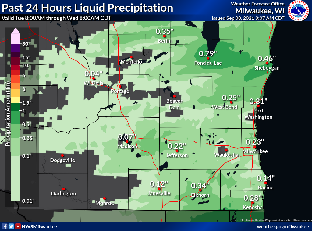 |
| Event total rainfall |

