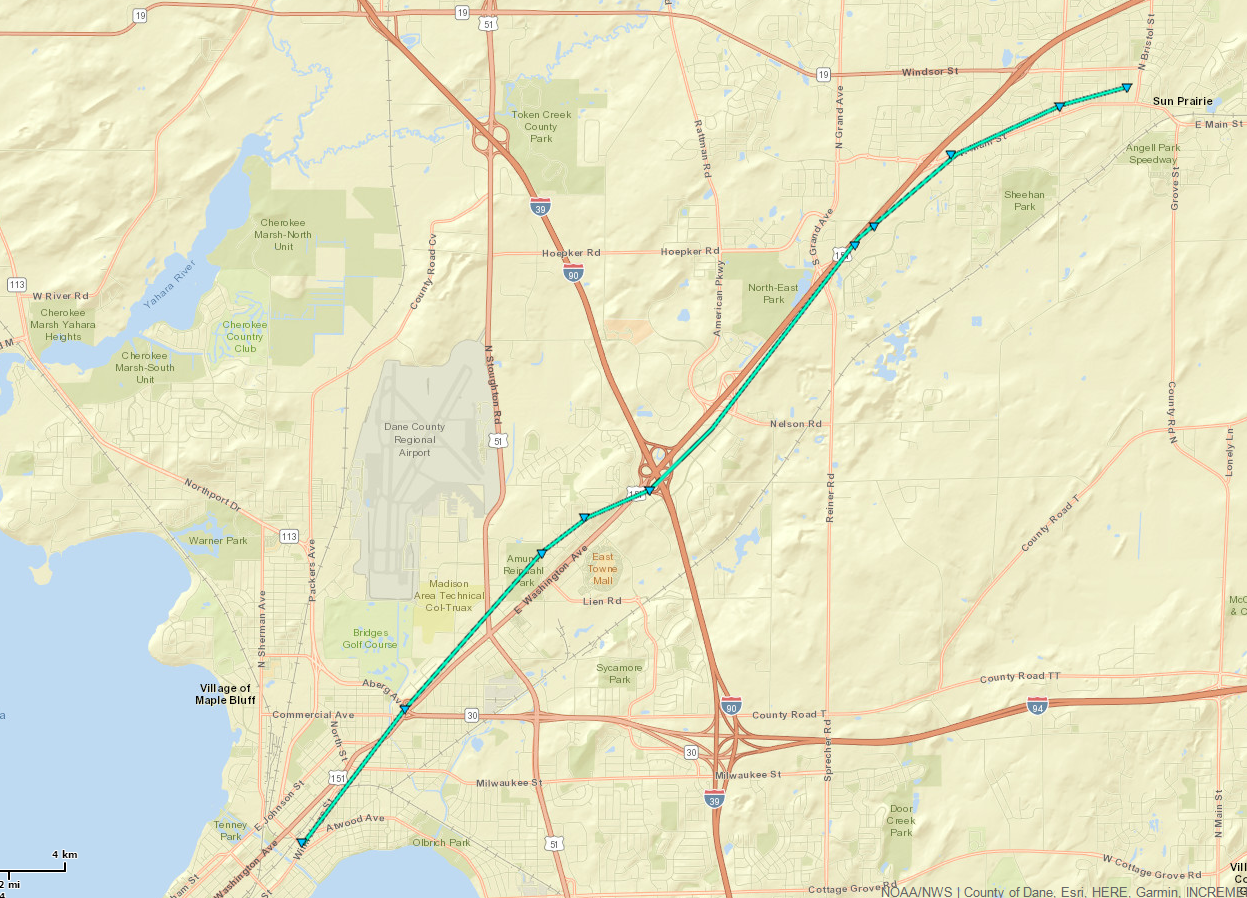
Location: 1 SE Maple Bluff to 1 E Sun Prairie
Date: 10/7/17
Rating: EF-0
Estimated Peak Wind Speed: 80 mph
Path Length: 9.9 miles
Peak Path Width: 100 yards
Start Time: 4:59 PM CDT
End Time: 5:15 PM CDT
Fatalities: 0
Injuries: 0
Tornadoes in Wisconsin in October aren't common, but not unprecedented. Late Saturday (October 7, 2017) afternoon, a line of showers developed along a frontal boundary pushing northeast through southern Wisconsin. See the surface weather analysis map below (click to enlarge)

These showers weren't big/tall enough to produce lightning, but there was enough shear (changing wind directions and wind speeds) and instability, coupled with a very moist atmosphere, to cause many of the showers to rotate. The shower that moved through the east side of Madison was strong enough to produce a tornado along East Washington Ave, tracking northeast to Sun Prairie.
Below are a series of radar images (4 panel) that begin at around 4:58 pm and end around 5:12 pm in the Sun Prairie area. The top left quadrant is reflectivity, top right is velocity, bottom left is reflectivity and bottom right is Correlation Coefficient (CC). CC is is a dual-pol product that allows us to see if debris is being lofted into the storm from a tornado. You'll see at around 5:02 there is a good CC signature of the debris (mostly leaves).
Tornado genesis around 4:58 PM (click to enlarge):

At 5:02 PM:

At 5:06 PM:

At 5:11 PM:

We have received reports of several trees down, some trees on homes, and damage to a few businesses.
The pictures below are from John Marion and provided to us by Milwaukee SKYWARN:
 |
  |
|
 |
 |
 |
 |
|
|
|
Pictures below are from our NWS Storm Survey |
|
 |
 |
 |
 |
 |
 |
 |
Below are pictures of thunderstorm wind damage in Pardeeville from storm spotter David Casper:
 |
 |
 |
Davis/Halbach

