National Weather Service United States Department of Commerce

Heavy Snow from the Midwest into the Great Lakes; Locally Heavy Rain in the Western Gulf Coast

A significant winter storm will produce a broad area of moderate to heavy snow from the Midwest through the western Great Lakes. Significant snow accumulations of 6-12 inches, and locally more than 1 foot, and gusty wind may cause hazardous travel conditions. Thunderstorms, some severe, and showers may produce locally heavy rain and isolated flash flooding along the western Gulf Coast. Read More >

Click a location below for detailed forecast.

Last Map Update: Sun, Nov 30, 2025 at 12:10:49 pm EST


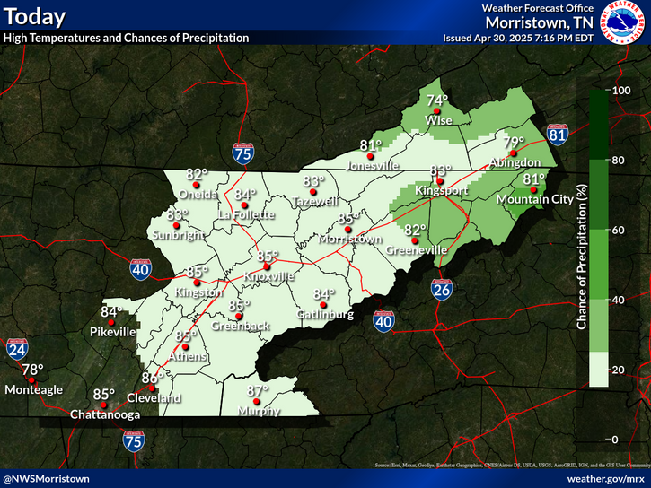
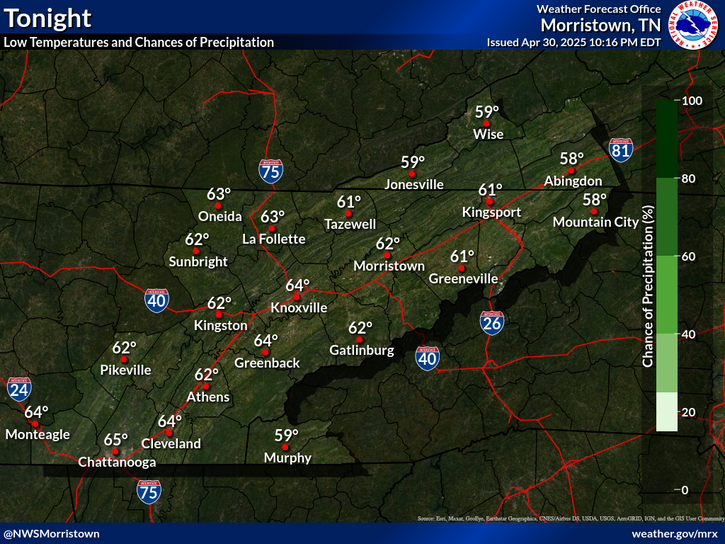
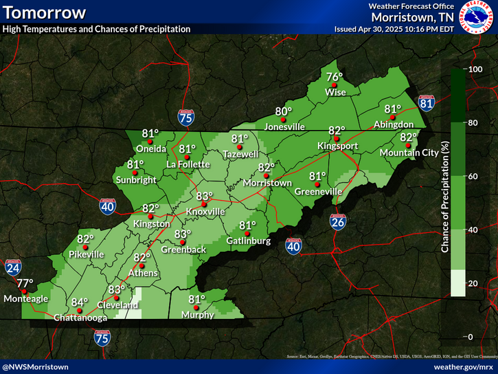
The 3-day outlook.
Windy conditions continue across the mountains and foothills through sunrise. Scattered showers expected across the entire area until this afternoon. Widespread rain moves back into the Tennessee valley and southern Appalachians Monday night and Tuesday.
Daily climate data (normals and records) for today for the sites plotted. The current normals period is 1991-2020.
Each observation point is apart of our COOP program (Cooperative Observer Program). Each site has a 24 hour observation period that ends and begins at 8 am local time. Each site records temperature, precipitation, and snowfall data. More information about the COOP program can be found here www.nws.noaa.gov/om/coop/ Data began being collected at: Cades Cover on 01/01/1999 || Mount LeConte on 07/01/1987 || Newfound Gap on 01/01/1991 || Sugarlands Visitor Center on 12/01/1921

 Current Weather Observations...
Location Time
(EST)
Weather Vsby.
(SM)
Temp.
(ºF)
Dewpt.
(ºF)
Hum.
(%)
Wind
(mph)
Wind Chill / Heat Index
(ºF)
Pres.
(in)
Abingdon VA11:55Light Drizzle \ Mist34141100WSW 736 [WC]30.16
Andrews-Murphy NC11:35Light Drizzle10413993CALM-30.26
Chattanooga TN11:53Light Rain \ Mist3424091SSE 538 [WC]30.27
Crossville TN11:53Mist54141100VRB 736 [WC]30.22
Dalton GA11:55Overcast94242100W 538 [WC]30.29
Knoxville TN (McGhee-Tyson)11:53Light Rain \ Mist2413992SW 935 [WC]30.23
Middlesboro KY11:55Overcast10454290CALM-30.20
Monroe Cnty TN11:35Mist1 1/44141100VRB 736 [WC]30.25
Morristown TN11:35Overcast73939100SW 833 [WC]30.23
Oak Ridge TN11:53Mist4434296-30.24
Tazewell Cnty VA11:55Light Rain1 1/2393997W 12G2131 [WC]30.15
Tri-Cities TN11:53Light Rain \ Mist6413992W 736 [WC]30.20
Wise VA11:55Overcast103737100WSW 1527 [WC]30.15
Greeneville, TN11:35Overcast7393793W 535 [WC]30.21


Local Weather History For November 30th...
Three tornadoes moved through SE TN in 2016 with 2 fatalities in Polk County.


Briefing Hydrology Past Weather Events Graphical Hazardous Weather Outlook for East Tennessee East Tennessee Observations
Decision Support Hydrology Past Weather Events GHWO Observations Gridded Forecast
Daily Climate for Middle Tennessee Local East Tennessee Climate Tornado Database Tropical Weather Information NOAA Weather Radio
IDSS Point Forecasts Daily Climate Local Climate Tornado Database Tropical Weather Radio
Daily Climate for Middle Tennessee Probabilistic Data for East Tennessee Virtual Tour of the NWS Morristown Office Skywarn Spotter Training for East Tennessee  
Being Prepared Estar Perparado Probabilistic Virtual Tour Spotter Training