Overview
A rare April snow was observed in the Quad State Region. As surface low pressure moved from east Texas into Mississippi and Alabama, the bulk of the precipitation on the afternoon and evening of Friday April 6th missed our region to the south. However, a secondary wave developed and interacted with enough leftover moisture to develop a band of precipitation overnight into the morning hours on April 7th. Cold air funneled into the region through the night, allowing precipitation to quickly change over to snow, with a very brief transition period of sleet for some locations. Many locations picked up anywhere from 0.5" to 1.5" of snow, particularly from far southeast Missouri into far southern Illinois and portions of western Kentucky. Some isolated locales picked up close to 2 inches. This was the 1st measurable snow in the month of April since 1983 for many locations, including Paducah, Kentucky. The last time we received any measurable snow during the month of April anywhere in our forecast area was back in 2004, when far southern portions of Kentucky from Murray to Hopkinsville were blanketed with snow.
Snow
Click here for an interactive map of snow reports we received.
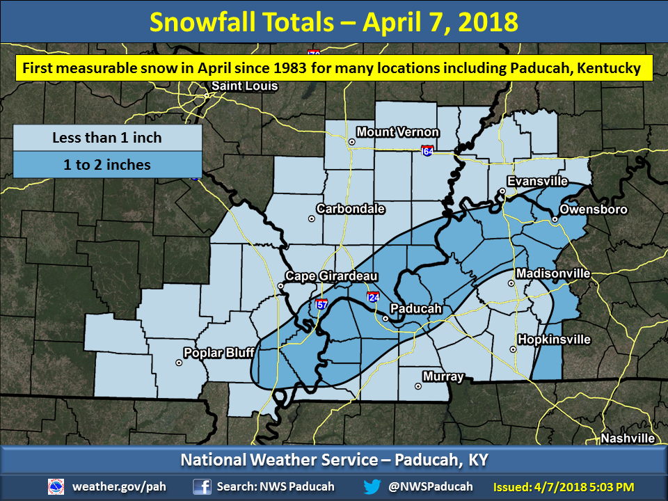 |
| The highest amounts around 1 to 1.5 inches were observed from Sikeston, Missouri east/northeastward to Paducah, Marion, and just south of Owensboro, Kentucky. |
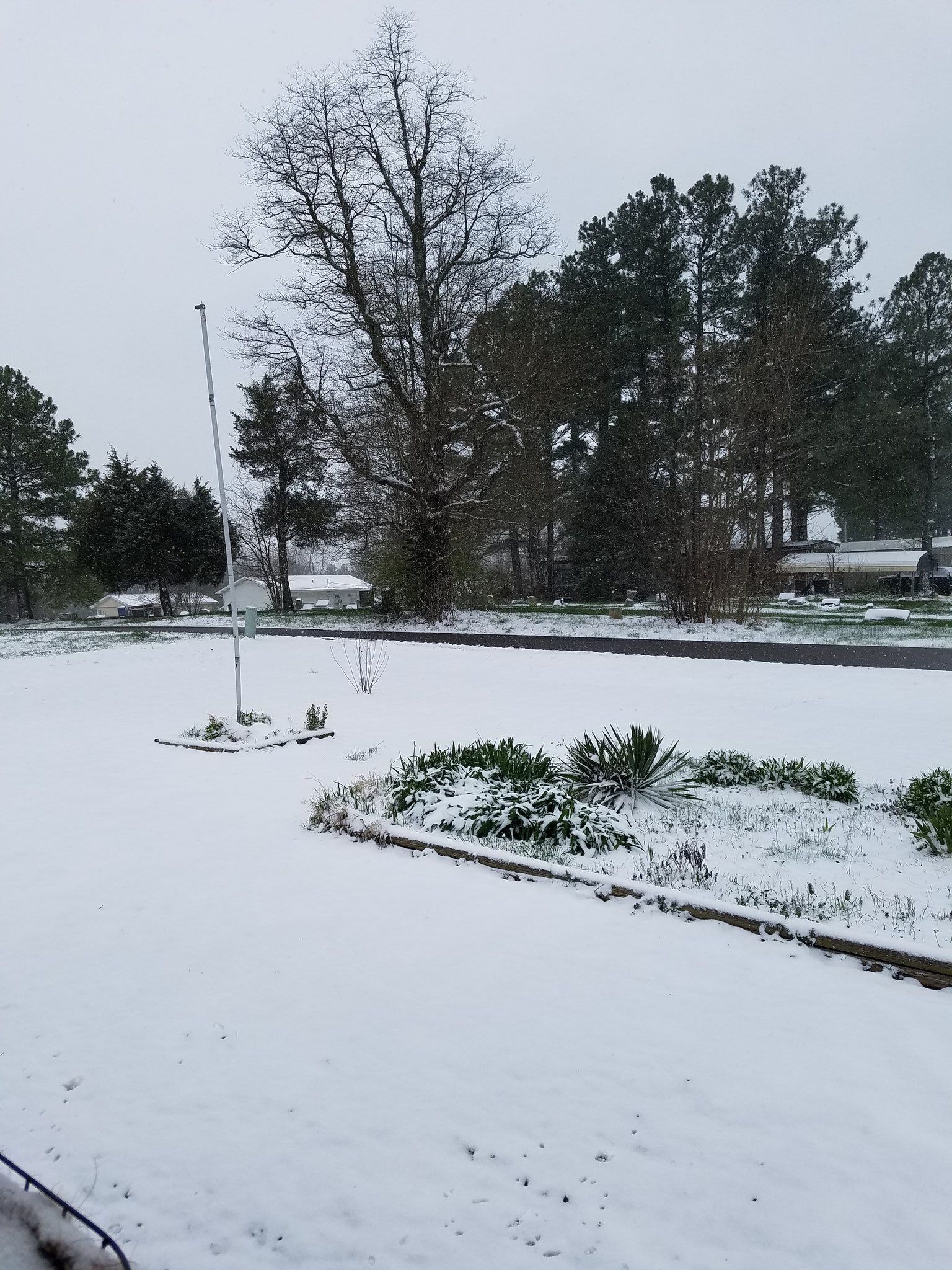
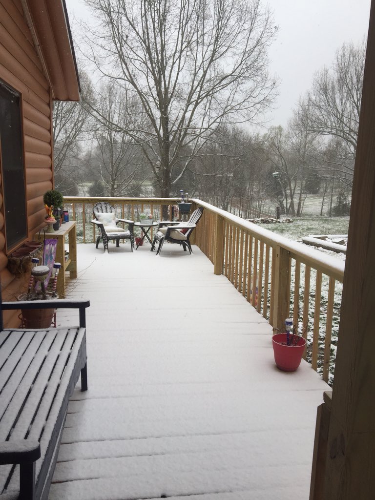
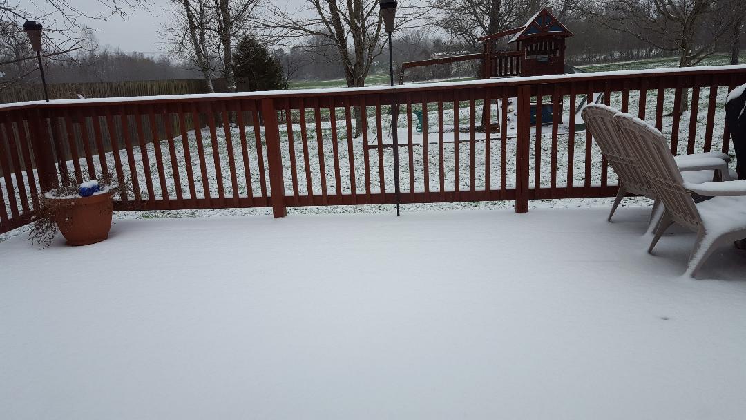
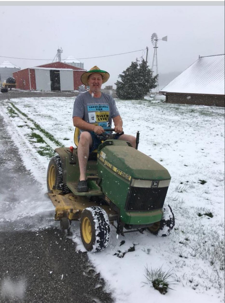
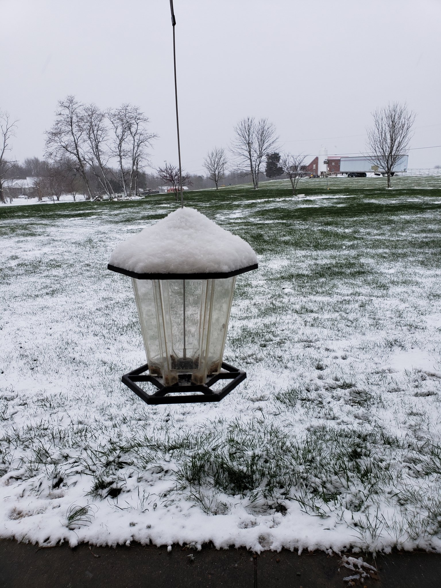
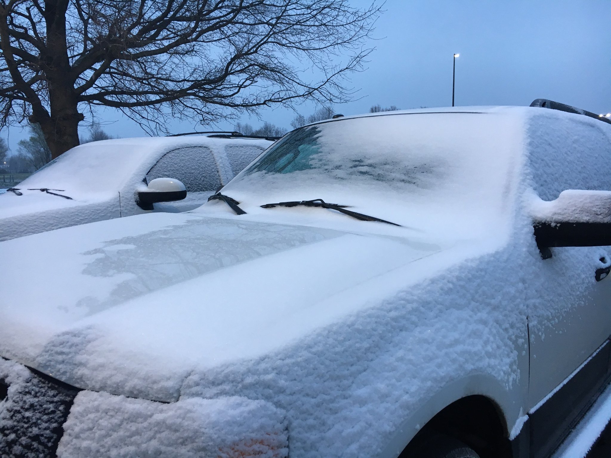
Photos:
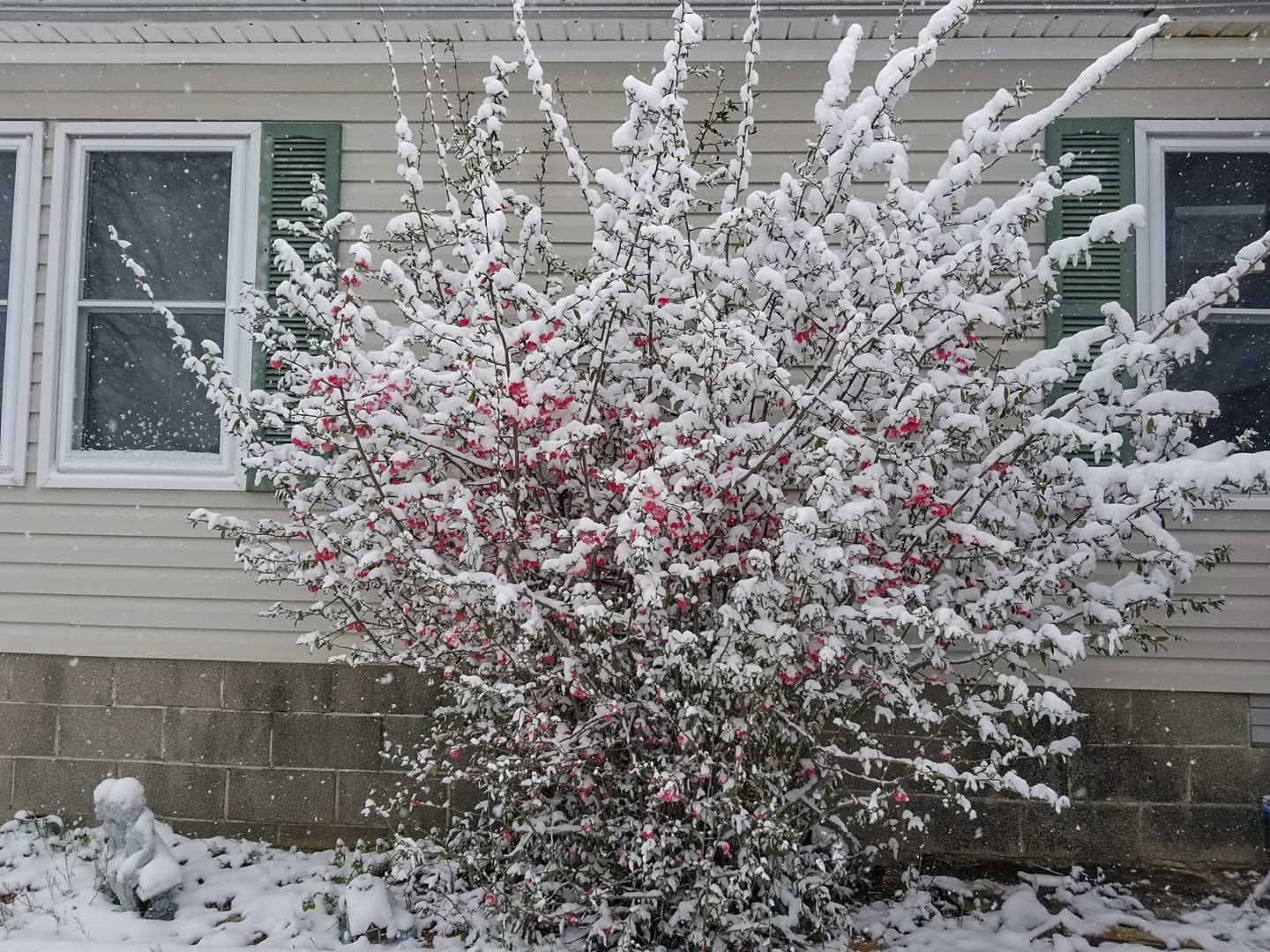
Here are some photos we received from this rare late season snow:
 |
 |
 |
 |
| Marion, Kentucky via Kim Moddy | Benton, Kentucky via Curt Curtner | Lyon County, Kentucky via Tina Foss Bernot | Lone Oak, Kentucky via NWS Employee |
 |
 |
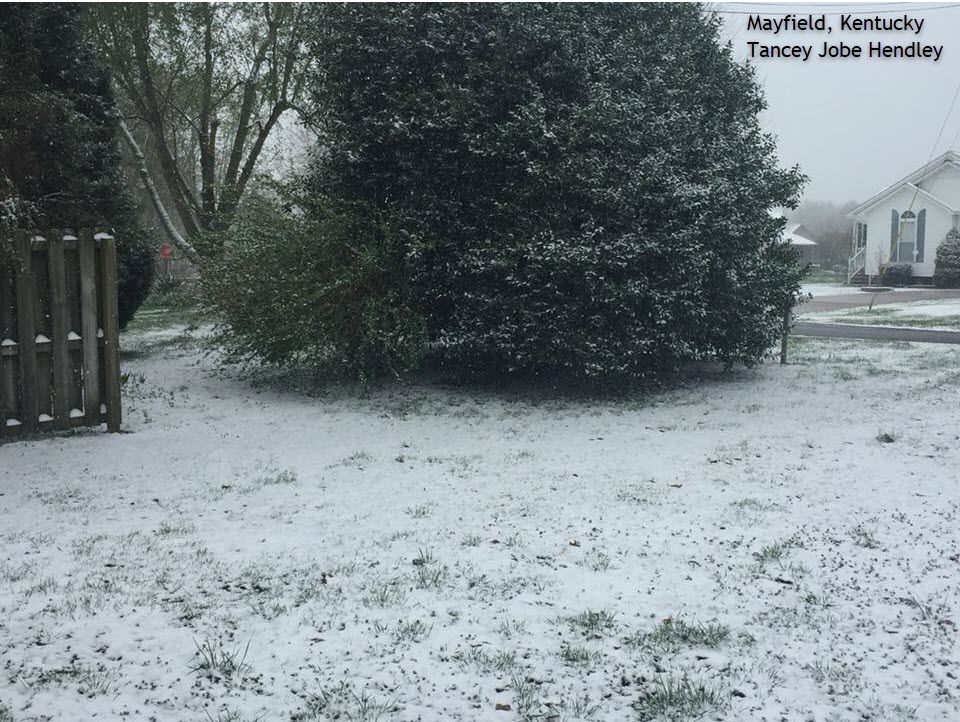 |
 |
| Massac County, Illinois via Darrell Logeman | Massac County, Illinois via Michelle Cochran | Mayfield, Kentucky via Tancey Jobe Hendley | Morganfield, Kentucky via Kenny Overton |
 |
 |
 |
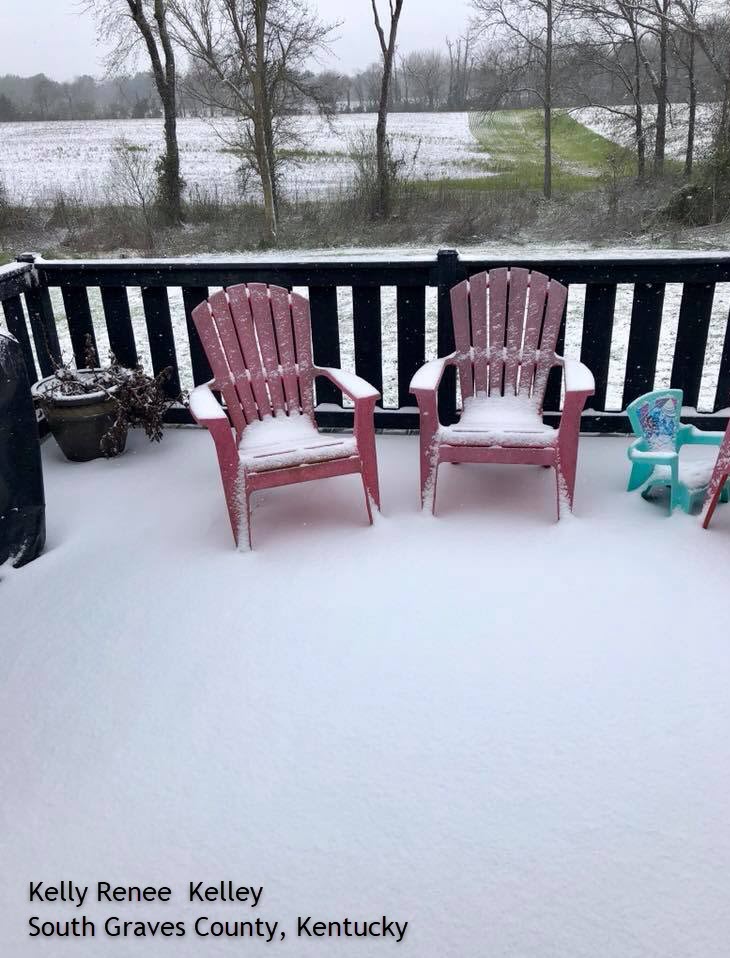 |
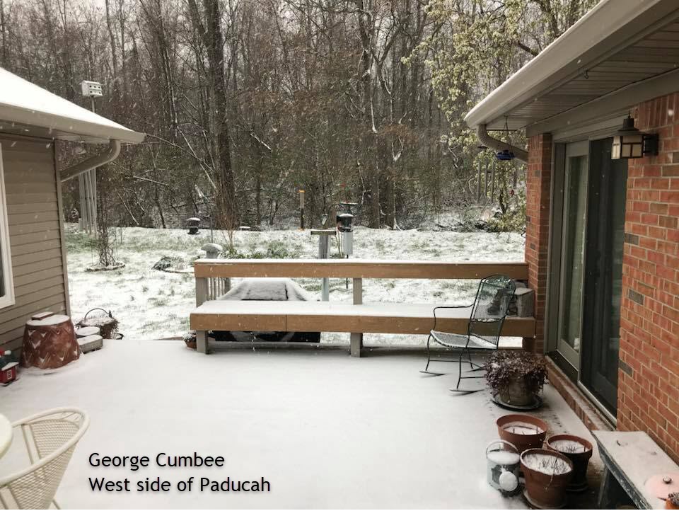
| NWS Paducah Office | Paducah, Kentucky via George Cumbee | Rosebud, Illinois via Terry Dotson Konemann | South Graves County, Kentucky via Kelly Renee |
Radar:
Here is a radar loop from 12 AM through 12 PM on Saturday morning. The precipitation that developed during the overnight hours quickly changed over to snow.
Storm Reports
PRELIMINARY LOCAL STORM REPORT...SUMMARY
NATIONAL WEATHER SERVICE PADUCAH KY
617 PM CDT SAT APR 7 2018

..TIME...   ...EVENT...      ...CITY LOCATION...     ...LAT.LON...
..DATE...   ....MAG....      ..COUNTY LOCATION..ST.. ...SOURCE....
            ..REMARKS..

0650 AM     SNOW             NE METROPOLIS           37.15N 88.71W
04/07/2018  M0.8 INCH        MASSAC             IL   NWS EMPLOYEE

            STILL SNOWING. TEMPERATURE 29.1F.

0700 AM     SNOW             WEST PADUCAH            37.08N 88.74W
04/07/2018  M1.0 INCH        MCCRACKEN          KY   NWS EMPLOYEE

            MEASURED AT THE NWS OFFICE. 1 INCH SNOW DEPTH.

0742 AM     SNOW             5 ENE DRAFFENVILLE      36.97N 88.26W
04/07/2018  E0.5 INCH        MARSHALL           KY   PUBLIC

            REPORT RELAYED FROM SOCIAL MEDIA.

0800 AM     SNOW             ELKTON                  36.81N 87.16W
04/07/2018  E1.3 INCH        TODD               KY   PUBLIC

0830 AM     SNOW             PADUCAH                 37.07N 88.64W
04/07/2018  M1.0 INCH        MCCRACKEN          KY   TRAINED SPOTTER

            MEASURED 1.4 INCH SNOWFALL, 1 INCH SNOW DEPTH.

0854 AM     SNOW             6 W DEXTER              36.79N 90.07W
04/07/2018  M0.3 INCH        STODDARD           MO   TRAINED SPOTTER

0859 AM     SNOW             BENTON                  36.85N 88.36W
04/07/2018  M0.5 INCH        MARSHALL           KY   BROADCAST MEDIA

0900 AM     SNOW             EDDYVILLE               37.08N 88.08W
04/07/2018  E1.0 INCH        LYON               KY   PUBLIC

0909 AM     SNOW             FAIRDEALING             36.66N 90.62W
04/07/2018  M0.5 INCH        RIPLEY             MO   PUBLIC

0922 AM     SNOW             COBDEN                  37.53N 89.25W
04/07/2018  M0.4 INCH        UNION              IL   PUBLIC

0933 AM     SNOW             MARION                  37.33N 88.08W
04/07/2018  M0.8 INCH        CRITTENDEN         KY   PUBLIC

0942 AM     SNOW             PADUCAH                 37.07N 88.64W
04/07/2018  M1.6 INCH        MCCRACKEN          KY   TRAINED SPOTTER

1000 AM     SNOW             MATTOON                 37.41N 87.97W
04/07/2018  E1.5 INCH        CRITTENDEN         KY   PUBLIC

1000 AM     SNOW             NEWBURGH                37.95N 87.40W
04/07/2018  E1.0 INCH        WARRICK            IN   PUBLIC

1000 AM     SNOW             CAPE GIRARDEAU          37.31N 89.55W
04/07/2018  M0.5 INCH        CAPE GIRARDEAU     MO   BROADCAST MEDIA

1000 AM     SNOW             SIKESTON                36.88N 89.58W
04/07/2018  E1.0 INCH        SCOTT              MO   PUBLIC

1000 AM     SNOW             4 NNE EVANSVILLE        38.14N 88.82W
04/07/2018  M0.3 INCH        JEFFERSON          IL   TRAINED SPOTTER

            OFFICIAL SNOWFALL TOTAL FOR EVANSVILLE OBSERVED AT
            AIRPORT

1000 AM     SNOW             2 SW LONE OAK           37.02N 88.69W
04/07/2018  M1.3 INCH        MCCRACKEN          KY   NWS EMPLOYEE

1000 AM     SNOW             2 W PADUCAH             37.07N 88.67W
04/07/2018  M1.3 INCH        MCCRACKEN          KY   NWS EMPLOYEE

1000 AM     SNOW             UTICA                   37.61N 87.11W
04/07/2018  E1.0 INCH        DAVIESS            KY   PUBLIC

1000 AM     SNOW             MCCUTCHANVILLE          38.06N 87.52W
04/07/2018  M0.4 INCH        VANDERBURGH        IN   BROADCAST MEDIA

1009 AM     SNOW             EAST PRAIRIE            36.78N 89.38W
04/07/2018  M1.0 INCH        MISSISSIPPI        MO   TRAINED SPOTTER

1009 AM     SNOW             GOLCONDA                37.36N 88.49W
04/07/2018  M1.2 INCH        POPE               IL   TRAINED SPOTTER

            ...NOTE...SHOULD BE GOLCONDA IN POPE COUNTY ILLINOIS.

1042 AM     SNOW             MURRAY                  36.61N 88.32W
04/07/2018  M0.5 INCH        CALLOWAY           KY   TRAINED SPOTTER
A look back at some other April snow events in our region:
| Apr. 5-7, 1971 |
| Apr. 7-8, 1982 |
| Apr. 20, 1904 |
| Apr. 24-25, 1910 |
 |
Media use of NWS Web News Stories is encouraged! Please acknowledge the NWS as the source of any news information accessed from this site. |
|

