A storm system moving over the Rockies today will bring marginal risks for excessive rainfall and severe thunderstorms from parts of New Mexico into western South Dakota. Heavy snow expected from northwestern Wyoming into southern Montana. Ongoing heavy showers and thunderstorms from Invest 96W could result in localized flash flooding, particularly in central or southern Guam early this morning. Read More >
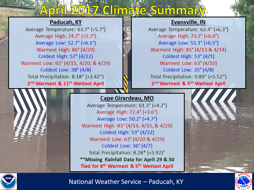
April 2017 was a warm and wet month across our region. Precipitation was above to well above normal across the vast majority of the area, the only exception was over portions of the Pennyrille region of Kentucky which saw near to slightly below normal rainfall. Highest amounts were from southeast Missouri into southern Illinois and southwest Indiana, generally from around Van Buren, MO to Carbondale, IL and Stendal, IN. Monthly rainfall totals in this area were anywhere from 10-15+ inches, or 5 to 10+ inches above normal. The highest observed total was in Williamsville, MO with 17.88 inches.
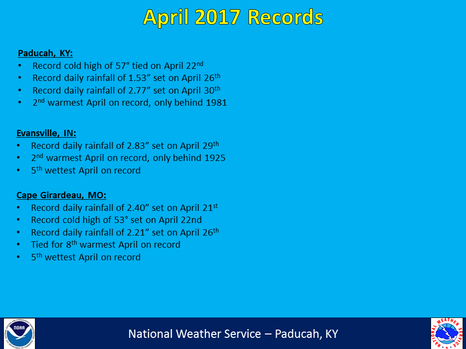
Our region experienced another month with above normal temperatures, marking the 11th consecutive month with temperatures above normal. Readings were generally 4 to 6 degrees above normal. It was the 2nd warmest April on record in Paducah, KY and Evansville, IN. We had several notable storm systems impact our area with severe weather and heavy rain, including on April 5th, April 27th, and April 28-30th. Excessive rainfall during the last week, particularly the last 3 days of the month, resulted in moderate to record river flooding occurring on over a dozen river locations in our area. The worst flooding occurred over sections of southeast Missouri and southern Illinois.


| April 2017 Review: Precipitation and Temperature Maps |
 |
| Climate Maps are from the Northeast Regional Climate Center |