Overview
Surface low pressure deepened as it tracked from southern Missouri into the Ohio Valley on Wednesday April 5th. A cold front came through during the afternoon hours and set the stage for thunderstorm initiation over portions of southeast Missouri and southern Illinois. The environment was favorable for rotating supercells to develop, with ample wind shear to work with. Some hail, mainly pea to dime sized, was reported with several of the storms. Although hail up to half dollar size was reported in McLeansboro, IL. There were some reports of wind damage from the storms along with a brief EF-1 tornado that touched down in far southwest Williamson County shortly after 2 PM. One storm also produced a microburst, with 90 mph winds, in the town of Enfield, IL around 3:30 PM.
Tornado and Microburst:
|
|
||||||||||
|
||||||||||
|
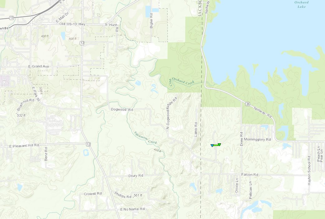
Tornado - Carbondale SE
Track Map
Public Information Statement National Weather Service Paducah, KY 225 PM CDT Thu Apr 6 2017 ...NWS DAMAGE SURVEY FOR April 5 2017 TORNADO EVENT... .Williamson County Tornado... Rating: EF-1 Estimated peak wind: 105 mph Path length /Statute/: 0.1 miles Path width /Maximum/: 25 yards Fatalities: 0 Injuries: 0 Start date: April 5 2017 Start time: 210 PM CDT Start location: 4 miles east southeast of Carbondale IL End date: April 5, 2017 End time: 210 PM CDT End location: 4 miles east southeast of Carbondale IL A brief tornado touchdown along Cameron rd in southwest Williamson county. Two residences were damaged. The first sustained minor shingle damage. Between the residences trees were snapped and thrown. The trunk of one was impaled into the side of the garage of the second residence. The second residence sustained damage to the eastward facing side of the house. The cupola was destroyed and the roof was uplifted. This was the only part of the roof that was not secured by hurricane clips. Debris from the house were thrown a couple hundred yards and insulation was stuck in nearby trees. No trees were damaged on either side of the homes. |
||||||||||||||||
|
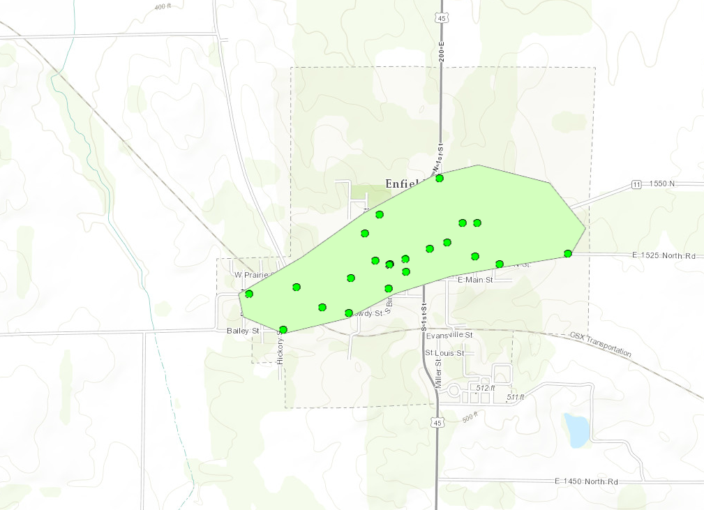
Microburst - Enfield IL
Track Map
Public Information Statement National Weather Service Paducah, KY 407 PM CDT Thu Apr 6 2017 ...NWS DAMAGE SURVEY FOR April 5 2017 MICROBURST WIND EVENT... .Enfield Illinois Microburst (White County)... Peak wind: 90 mph Path length /Statute/: 1.1 miles Path width /Maximum/: 1/3 mile Fatalities: 0 Injuries: 0 Start date: April 5 2017 Start time: 333 PM CDT Start location: 0.5 miles WSW of Enfield IL End date: April 5 2017 End time: 335 PM CDT End location: 0.5 miles ENE of Enfield IL A microburst containing peak winds near 90 mph downed dozens of trees and large limbs, almost entirely within the city limits of Enfield. Some minor roof damage occurred at several houses, an apartment building, and a school. A section of the covering of the roof, approximately 60 to 100 feet in length, was blown off the school. A large tarp was torn off a very large grain pile. NOTE: The information in this statement is PRELIMINARY and subject to change pending final review of the event and publication in NWS Storm Data. |
||||||||||||||||
The Enhanced Fujita (EF) Scale classifies tornadoes into the following categories:
| EF0 Weak 65-85 mph |
EF1 Moderate 86-110 mph |
EF2 Significant 111-135 mph |
EF3 Severe 136-165 mph |
EF4 Extreme 166-200 mph |
EF5 Catastrophic 200+ mph |
 |
|||||
 |
Media use of NWS Web News Stories is encouraged! Please acknowledge the NWS as the source of any news information accessed from this site. |
|