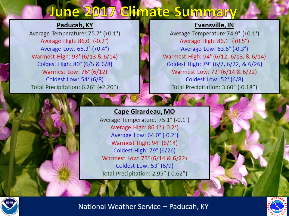
June 2017 Climate Summary: Temperatures were near normal to slightly below normal while precipitation varied across the region. Rainfall was below normal across much of southeast Missouri, southern Illinois, southwest Indiana, and northwest Kentucky (Henderson, Owensboro area). However, there were some locations that picked up higher amounts due to thunderstorms. Portions of Perry County Missouri along with parts of Perry, Jackson, and White counties in Illinois and Pike County Indiana experienced heavier rainfall amounts due to thunderstorms. South of the Ohio River over much of west Kentucky, rainfall was generally above normal with amounts of 5 to 7 inches in many locations.
For June standards, temperatures never really took off, as we didn’t experience any prolonged heat waves. In fact, Paducah, KY only observed 4 days with temperatures of 90 or higher. Evansville, IN observed 7 such days while Cape Girardeau, MO experienced 5. Typically in June, we will observe somewhere around 9 to 12 days with temperatures in the 90s. You likely remember the extended stretch of lower humidity the region experienced toward the end of the month. Evansville observed 111 consecutive hours with dewpoints below 60 degrees from June 24-28. This was rather remarkable for this time of year! One of the notable weather events in June was the interaction of the remnants of Tropical Storm Cindy with a frontal boundary moving through the area on June 22-23. Another system produced some strong to isolated severe thunderstorms on June 18th, which included a brief microburst in Marshall County Kentucky with winds up to 85 mph in the Draffenville area.
| June 2017 Review: Precipitation and Temperature Maps |
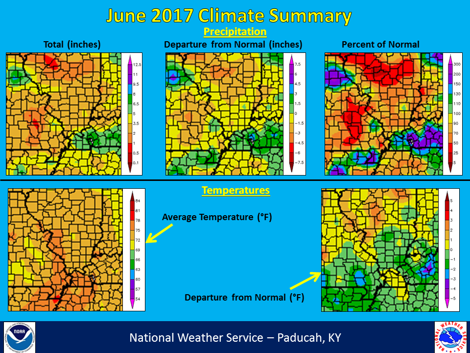 |
| Climate Maps are from the Northeast Regional Climate Center |
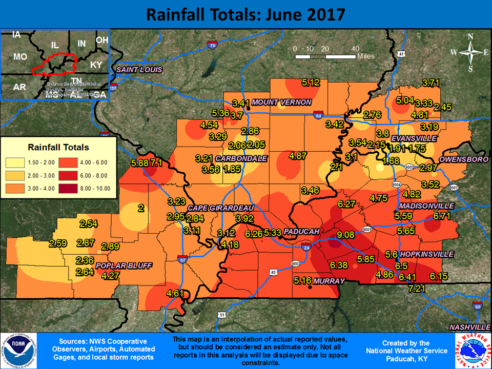
The graphic below is an interpolated rainfall map using actual observations. Please note that there are likely discrepancies in between observations, since the values are estimated based on nearest reports. Due to the convective nature of rainfall in the summer, amounts are more likely to vary over shorter distances, compared to the cooler months.
 |