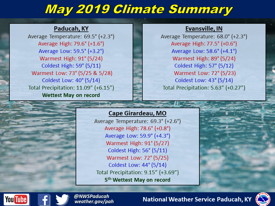
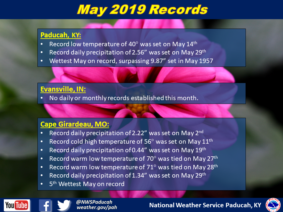
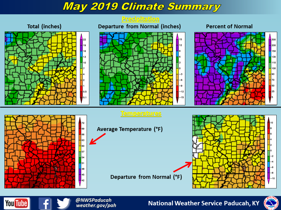
May 2019 Climate Review: The main headline for the month was the excessively wet conditions observed over a large majority of the region. Widespread rainfall amounts of 5 to 9 inches were observed across southeast Missouri, southern Illinois, southwest Indiana, and much of western Kentucky, with some locations picking up 10 to 12 inches. With 11.09” falling in Paducah, it became the wettest May on record for the city. Cape Girardeau checked in as the 5th wettest May there. There was a very sharp cutoff to the heavy rainfall amounts across western Kentucky though, with drier than normal conditions observed in much of Calloway, Trigg, Christian, and Todd Counties. Some of this area only received a little over 2 inches of rain for the month.
Temperatures were above normal by around 2 to 3 degrees. Low temperatures were particularly warmer than normal and this was largely due to increased cloud cover and wetter conditions across the region helping to keep overnight lows up.
While we did have some severe thunderstorms during the month, overall it was yet another month with below normal severe thunderstorm coverage across the region. The two most notable severe weather events occurred on May 21 and May 29.
The graphic below is an interpolated rainfall map using actual observations. Please note that there are likely discrepancies in between observations, since the values are estimated based on nearest reports.

| May 2019 Review: Precipitation and Temperature Maps (Click on image to enlarge) |
 |
| Climate Maps are from the Northeast Regional Climate Center |