Overview
|
On the afternoon of Friday, June 13, 2025, slow-moving thunderstorms produced torrential rainfall and a brief EF-0 tornado on the westside of Evansville, Indiana.
|
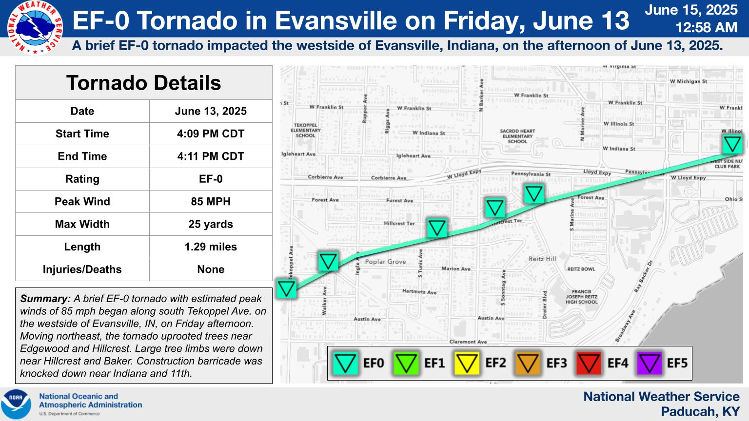 Evansville EF-0 Tornado Details |
 |
 |
 |
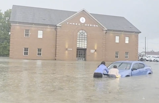
| Car stranded on St. Joseph Ave. in Evansville (Sharon Taylor/Vanderburgh County ARES) |
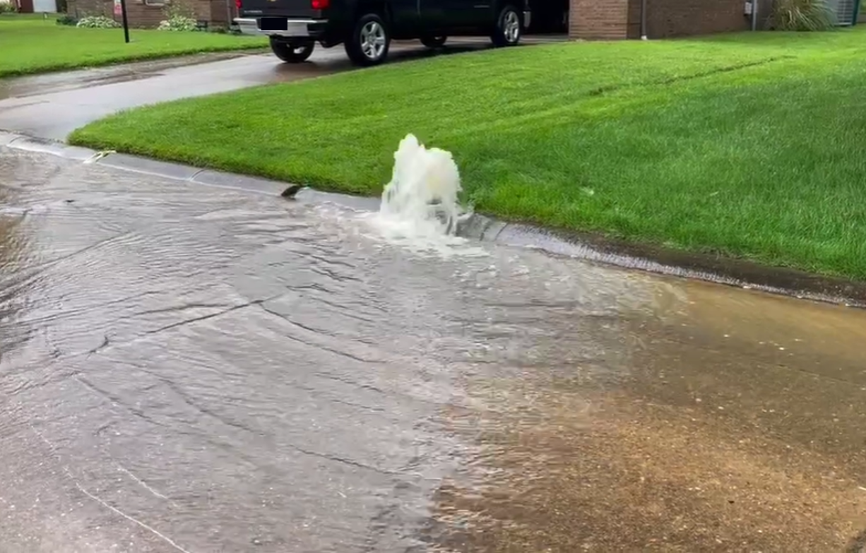
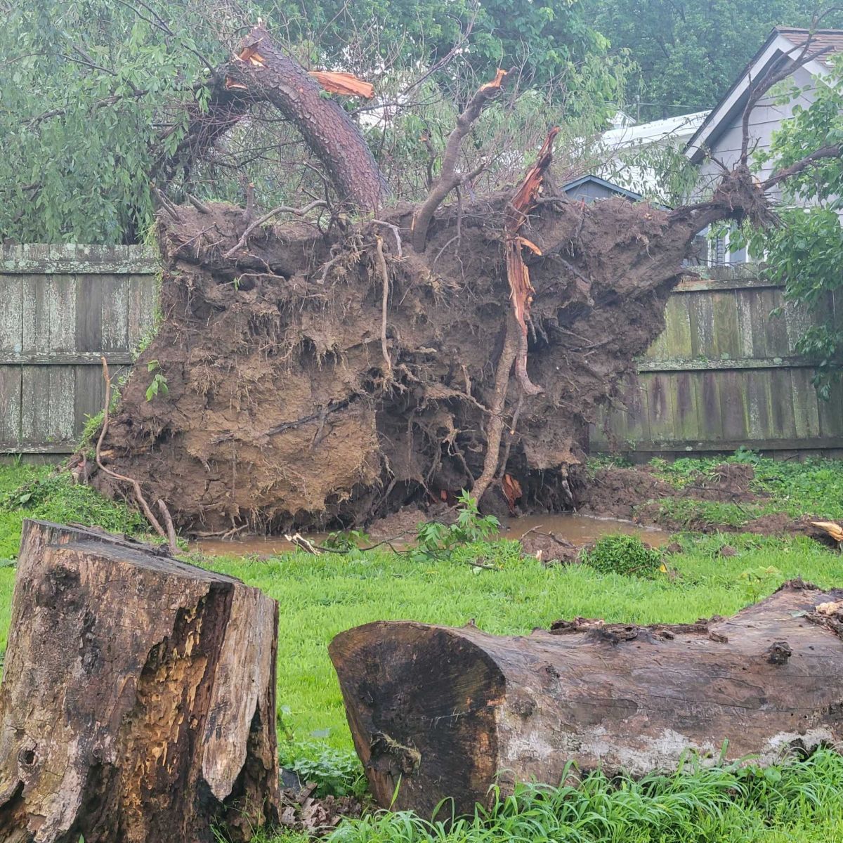
Overflowing sewers on Cromwell Drive in Evansville (Walt Egenmaier) | Uprooted tree on Tekoppel Ave. in Evansville. (Shane Lynn/Vanderburgh County EMA) |
Tornadoes
Select a tornado from the table to zoom into the track and view more information. The default table view is limited to 8 tracks, but can be scrolled by a mouse wheel or dynamically expanded. Additionally, the table can fill the entire window by clicking the small circular expanding arrow icon at the very top right of the table and returned to its original size by clicking the button again. The side information panel that opens over the map can be closed using the "X" on the upper right corner of the pop-up. Zoom into the map and click damage points to see detailed information and pictures from the surveys.
|
NOTE: times shown below are local to your device's time zone. |

The Enhanced Fujita (EF) Scale classifies tornadoes into the following categories:
| EF0 Weak 65-85 mph |
EF1 Moderate 86-110 mph |
EF2 Significant 111-135 mph |
EF3 Severe 136-165 mph |
EF4 Extreme 166-200 mph |
EF5 Catastrophic 200+ mph |
 |
|||||
| Tornadoes that fail to impact any ratable damage indicators on the EF-Scale are rated EF-Unknown (EF-U) | |||||
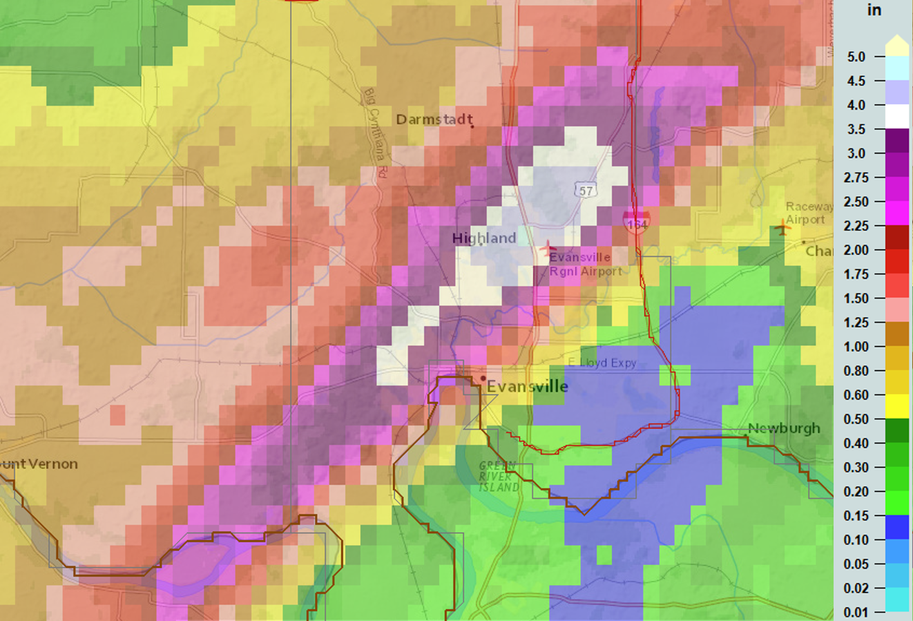
Rain Reports
Estimated rainfall map across Evansville on June 13, 2025. This map was made using a combination of rain gauge reports and radar esimates.
Preliminary Local Storm Report
National Weather Service Paducah KY
710 PM CDT Fri Jun 13 2025

..TIME...   ...EVENT...      ...CITY LOCATION...     ...LAT.LON...
..DATE...   ....MAG....      ..COUNTY LOCATION..ST.. ...SOURCE....
            ..REMARKS..

0538 PM     Flash Flood      1 NW Melody Hill        38.03N 87.52W
06/13/2025                   Vanderburgh        IN   Public

            Report from mPING: Street/road flooding;
            Street/road closed; Vehicles stranded.

0553 PM     Flash Flood      2 NNW Melody Hill       38.05N 87.52W
06/13/2025                   Vanderburgh        IN   Public

            Water covering SR 57 near Evansville
            Regional Airport.

0612 PM     Flash Flood      3 NW Melody Hill        38.06N 87.54W
06/13/2025                   Vanderburgh        IN   Public

            Report from mPING: Street/road flooding;
            Street/road closed; Vehicles stranded.

0625 PM     Flash Flood      3 W Evansville          37.98N 87.60W
06/13/2025                   Vanderburgh        IN   Amateur Radio

            Streets and parking lots covered with at
            least one stranded vehicle at St Joseph
            Ave/W Indiana St.

0626 PM     Flash Flood      3 NW Melody Hill        38.05N 87.55W
06/13/2025                   Vanderburgh        IN   Public

            Neighborhoods off of Strawberry Hill Rd
            including Midway Drive have water almost
            higher than the mailboxes in spots.

0633 PM     Flash Flood      3 NW Evansville         38.01N 87.58W
06/13/2025                   Vanderburgh        IN   Public

            Widespread flooding at N First Ave and West
            Buena Vista Rd with multiple cars in a
            parking lot taking on high water.
 |
Media use of NWS Web News Stories is encouraged! Please acknowledge the NWS as the source of any news information accessed from this site. |
|

