Overview
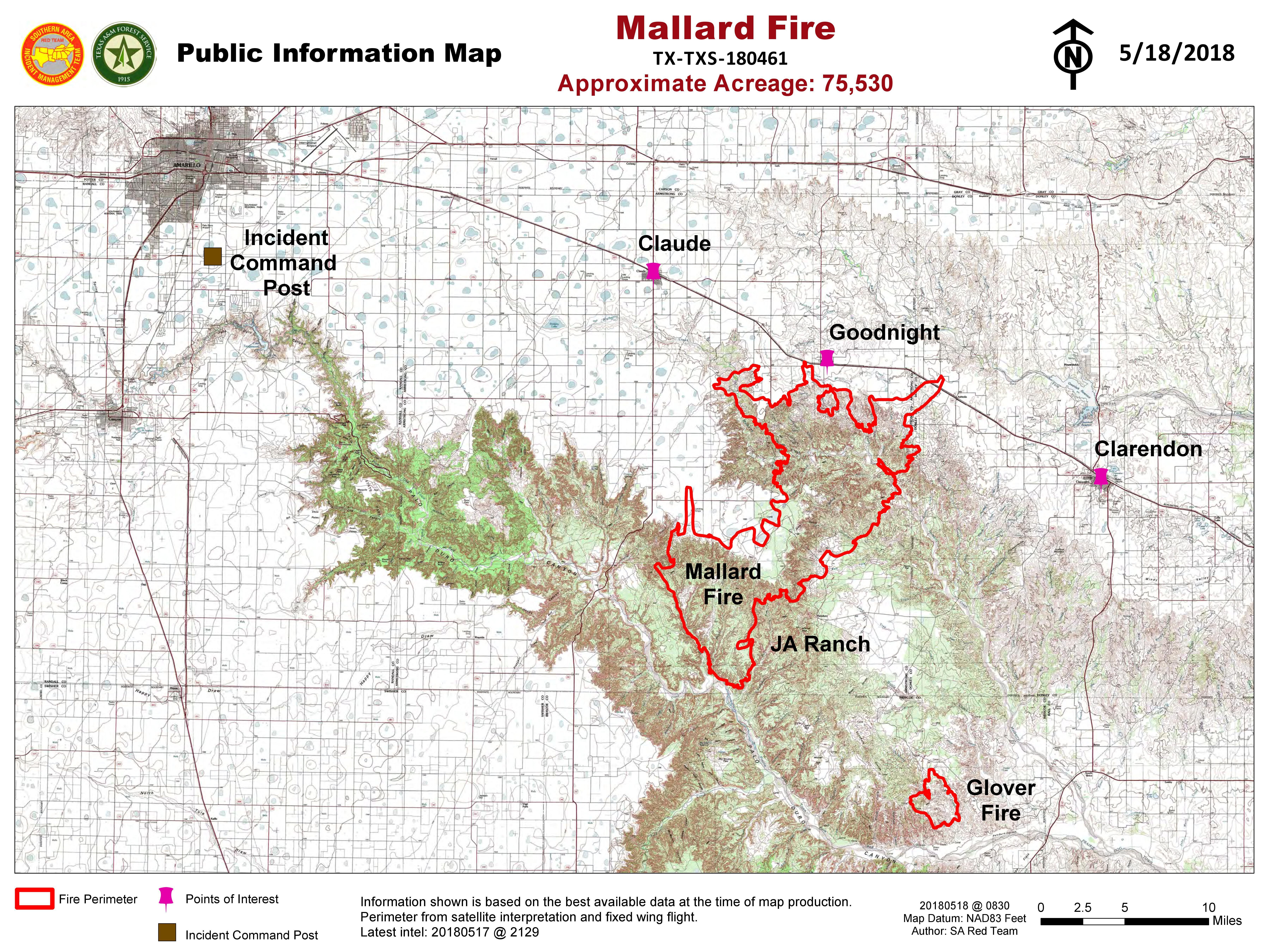
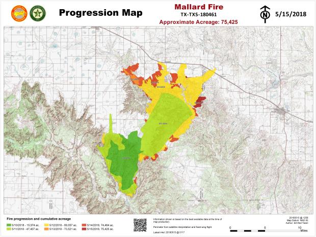
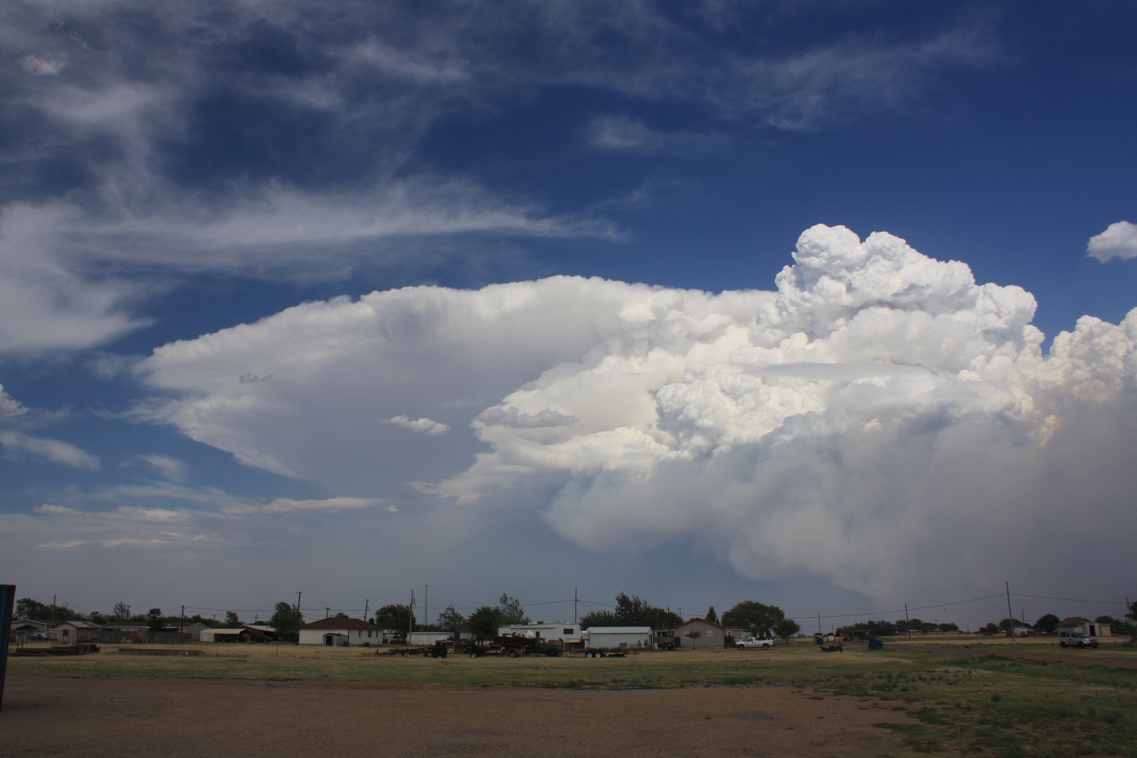
A large wildfire formed on May 8th east of Palo Duro Canyon that would eventually consume over 75 thousand acres by the time it was contained on May 29th. On May 11th, the environment and fire interacted to produce pyrocumulonimbus clouds which eventually became a severe thunderstorm.

From a Pyrocumulus to a Severe Thunderstorm: An Environmental Analysis of an Anomalous Southern Plains Wildfire
A rare pyrocumulonimbus (pyroCb) formed over the 30,566 hectares (ha) Mallard Fire in the Texas Panhandle on 11 May 2018, later becoming a severe thunderstorm that produced 2.5 cm hail 155 km east of Amarillo, TX. This is the second documented instance of a pyroCb-severe thunderstorm evolution on the Great Plains, where the previous was with the Jasper Fire in South Dakota on 27 August 2000. Recent improvements in remote sensing (e.g. GOES-16) allowed unprecedented observation of this highly anomalous transition. A pyroCb typically forms over a wildland fire in an unstable environment with a relatively deep and dry boundary layer characterized by dry-adiabatic temperature lapse rates and constant mixing ratio. Extreme fire conditions combined with the local terrain and an unstable environment supported pyrocumulus (pyroCu) along the dryline. By the afternoon, the pyroCu matured into a pyroCb just east of the dryline in the eastern Texas Panhandle. Mixed layer convective available potential energy values of 2000-2500 J kg-1 and effective bulk wind shear of 15-20 m s-1 supported an environment conducive for sustained convection and potential severe storm development. Given the complex, non-linear wildfire-atmosphere interactions, it is difficult to predict severe pyroCb development. This study will utilize GOES-16 satellite imagery and WSR-88D observations to examine the transition from pyroCu to a severe thunderstorm. Additionally, analysis will demonstrate the real-time Impact-Based Decision Support Services between the Amarillo National Weather Service, core partners, and the general public. The main objective is to discuss the atmospheric, fuel, and terrain considerations associated with the Mallard Fire severe pyroCb.
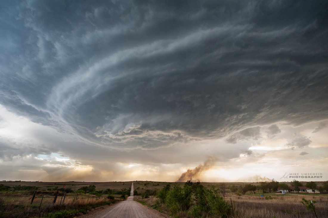
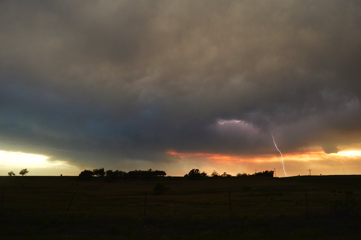
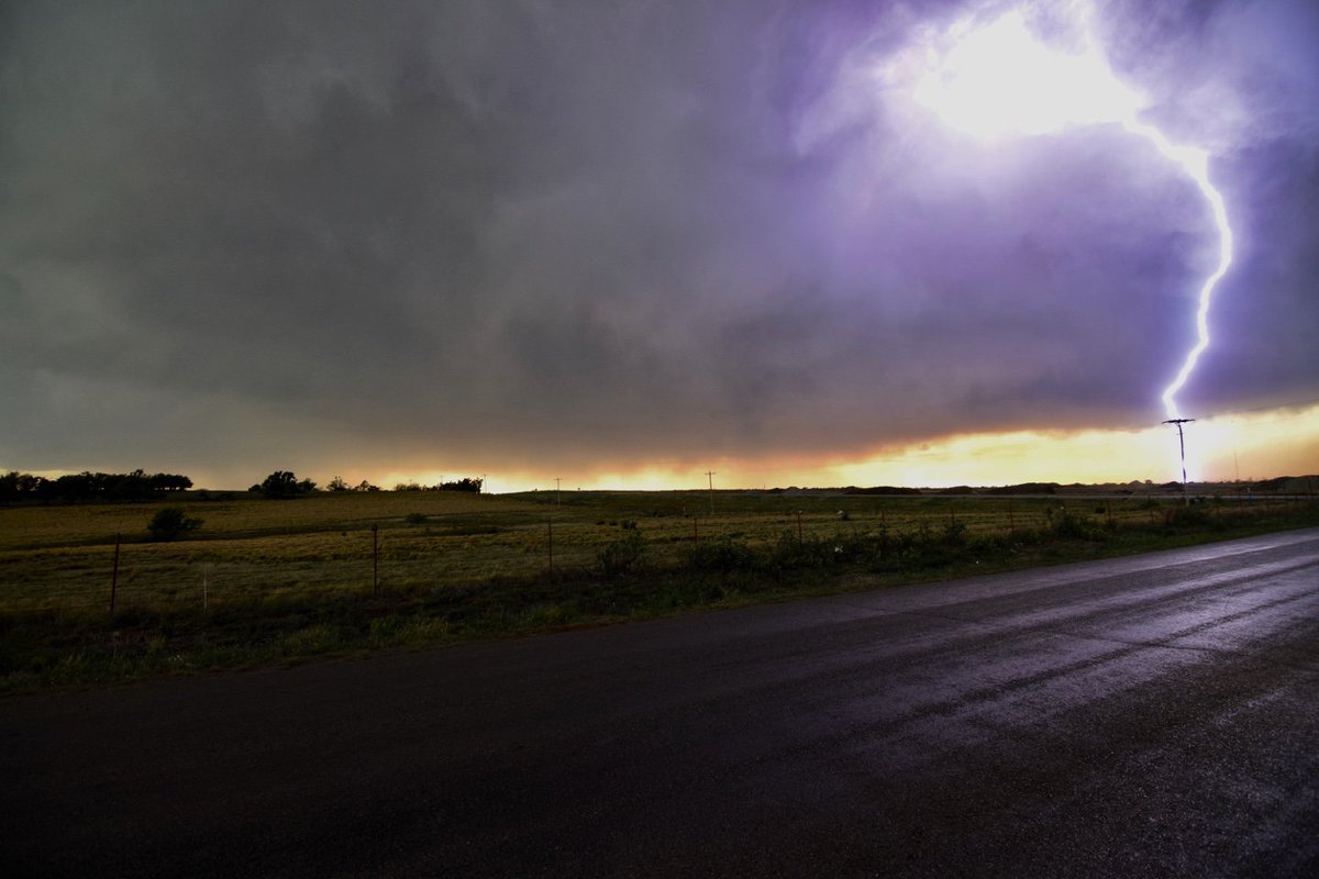
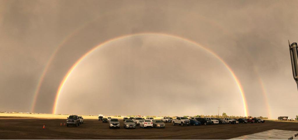
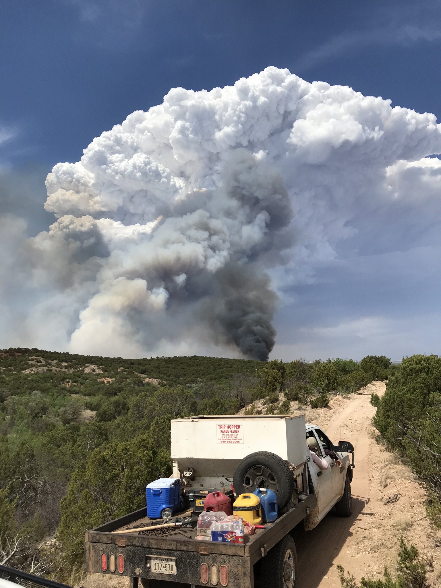
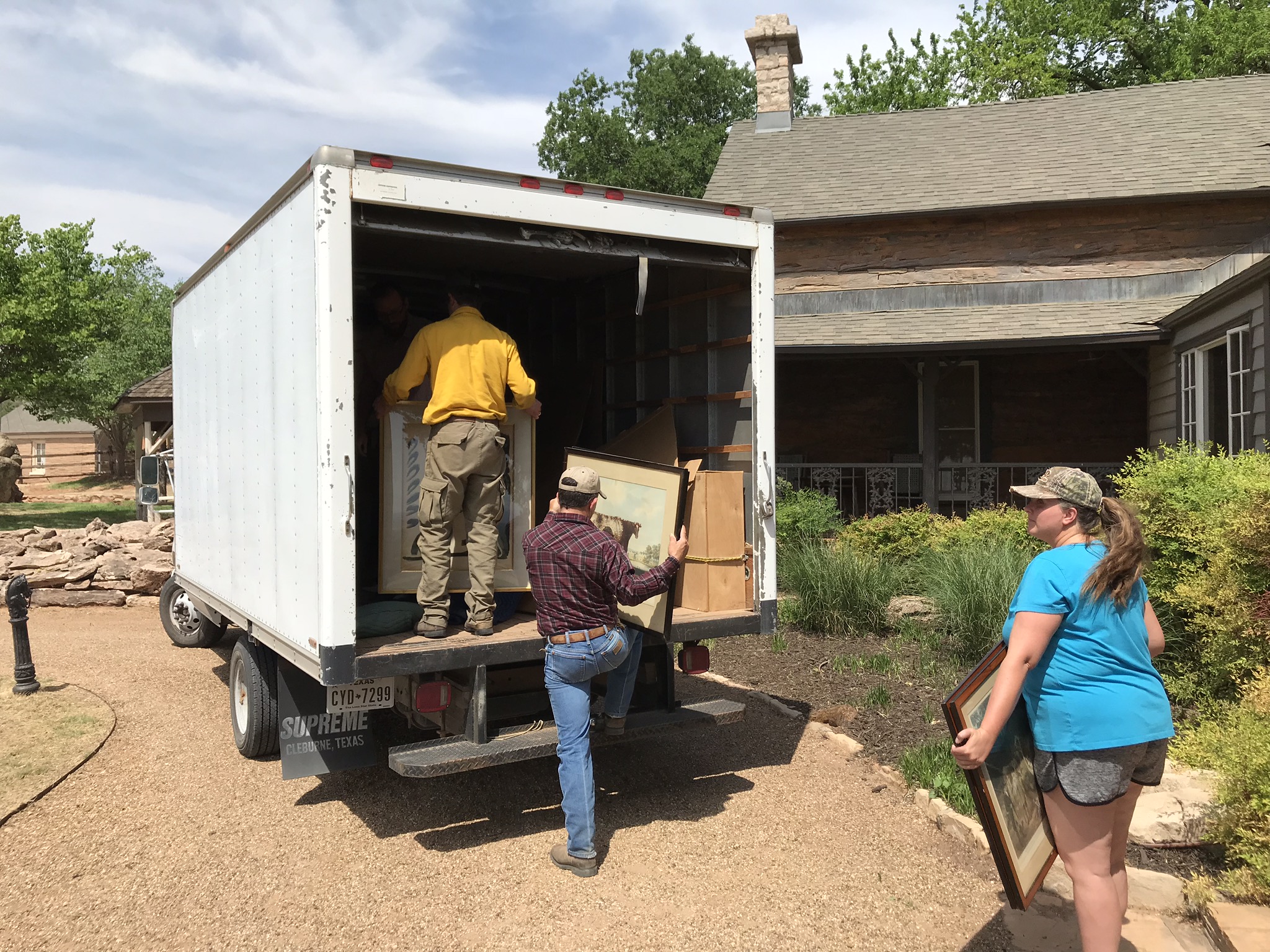
Photos
 |
 |
 |
 |
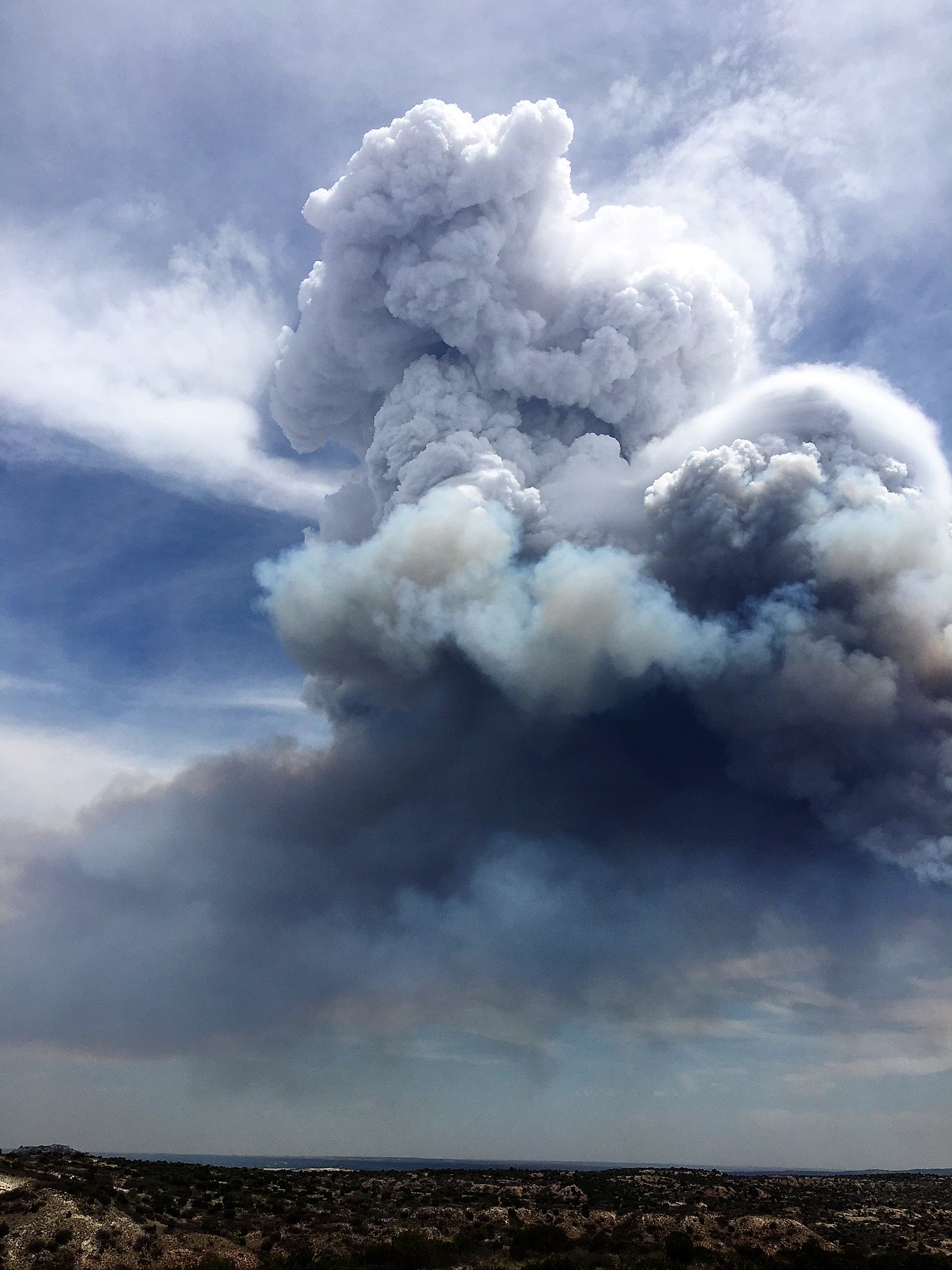
| (Photo Credit: Fire Specialist James Buhrkuhl Austin Fire Department) |
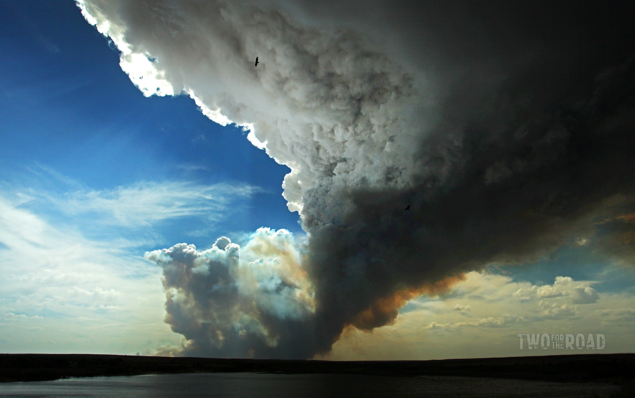
(Photo Credit: Two for the Road) |
(Photo Credit: Trent Hoffeditz) | (Photo Credit: Mike Umscheid) |
 |
 |
 |
 |
| (Photo Credit: Matthew Cappucci) |
(Photo Credit: Matthew Cappucci) |
(Photo Credit: NWS Southern Region HQ IMET) | (Photo Credit: Andrew Bivins) |
 |
 |
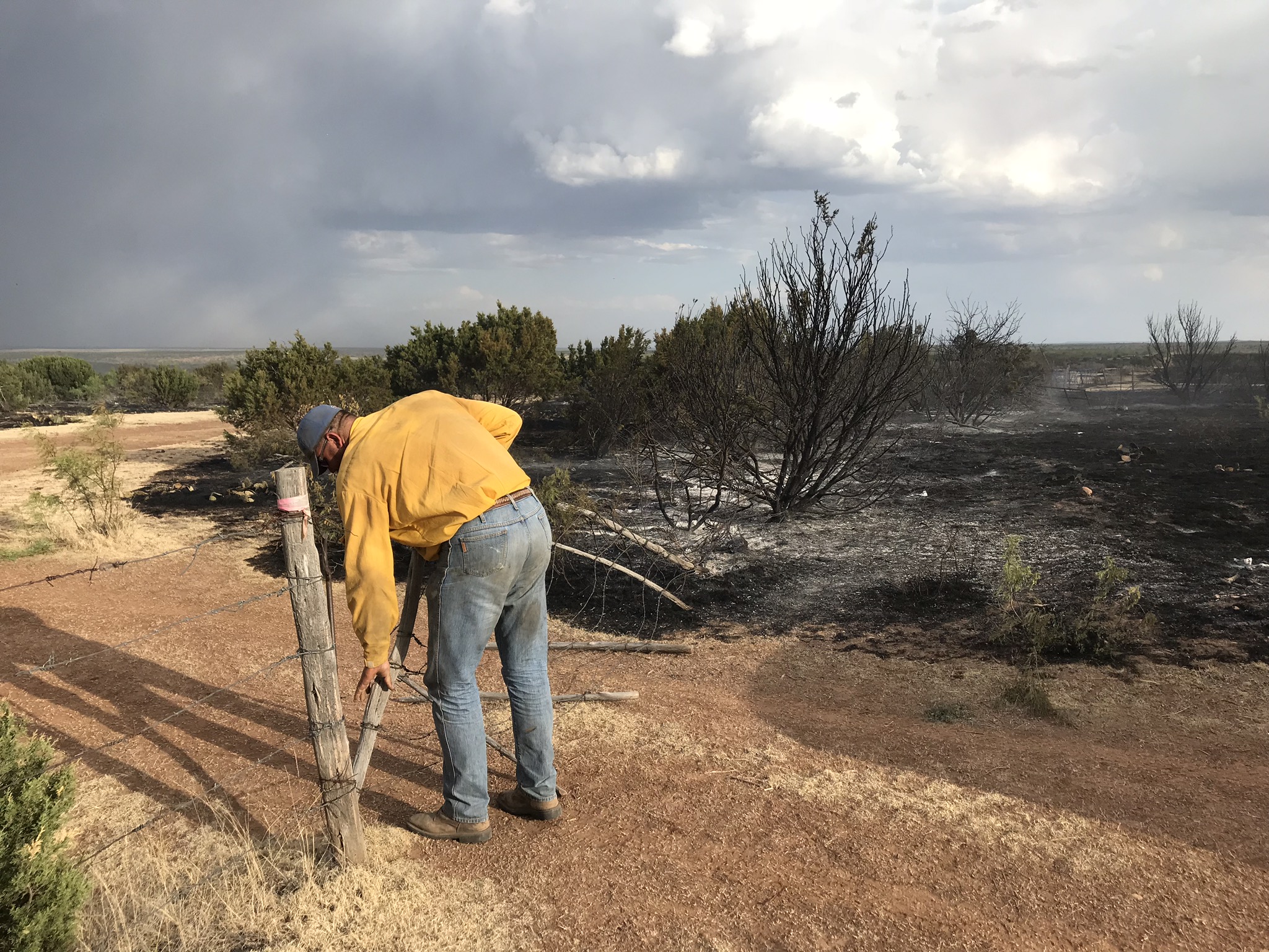 |
| (Photo Credit: Andrew Bivins) |
(Photo Credit: Andrew Bivins) |
(Photo Credit: Andrew Bivins) |
Fuels
 |
 |
 |
 |
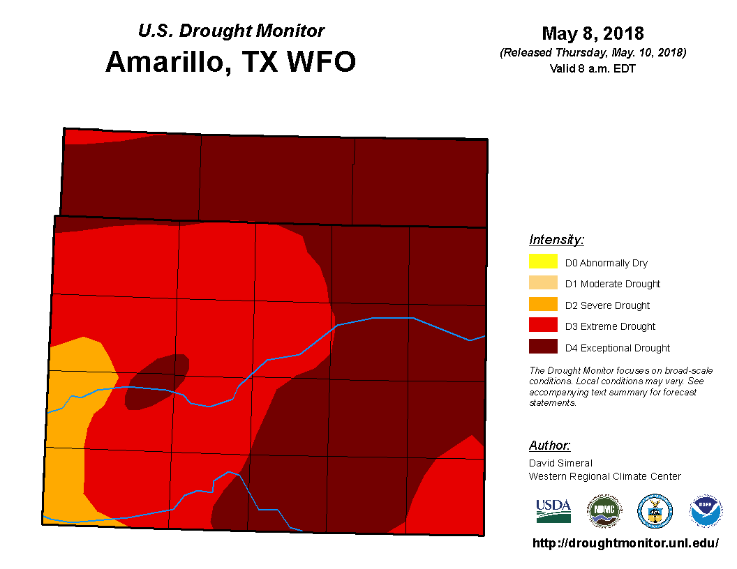
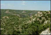
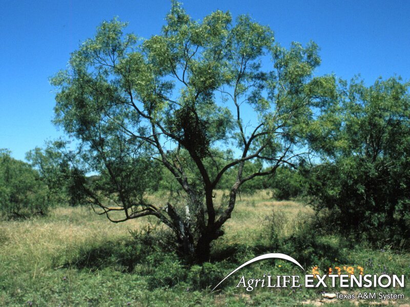
| Drought Monitor | Brush (2 feet) | Juniper, Mesquite and Cedar | Tall Grass (2.5 feet) |
 |
 |
 |
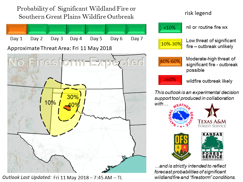 |
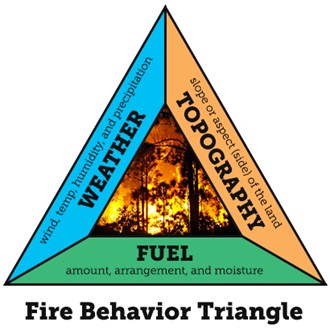
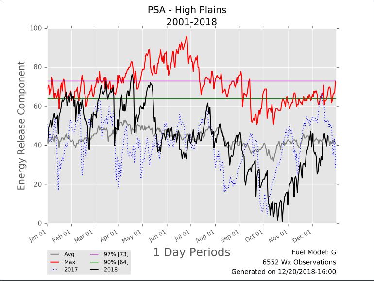
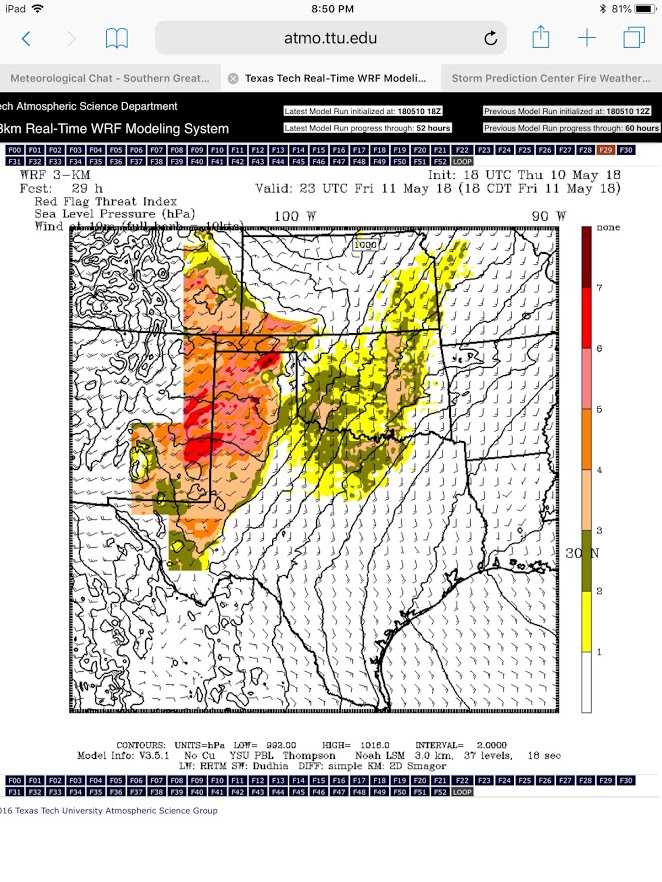
| Fire Behavior Triangle | Energy Release Component (ERC) | Texas Tech Real-time WRF Red Flag Threat | Southern Great Plains Wildfire Outbreak (SGPWO) Outlook |
 |
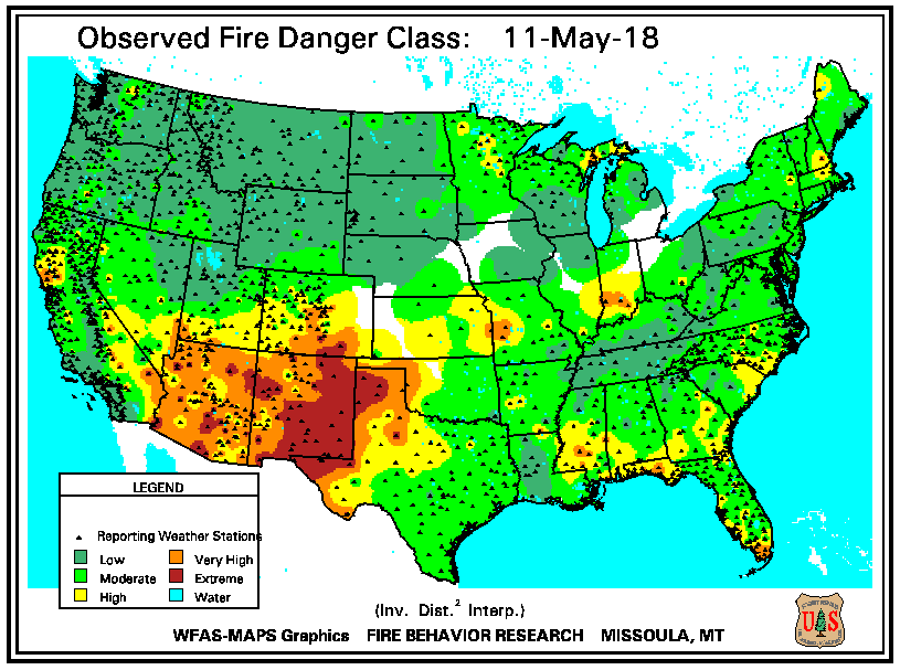 |
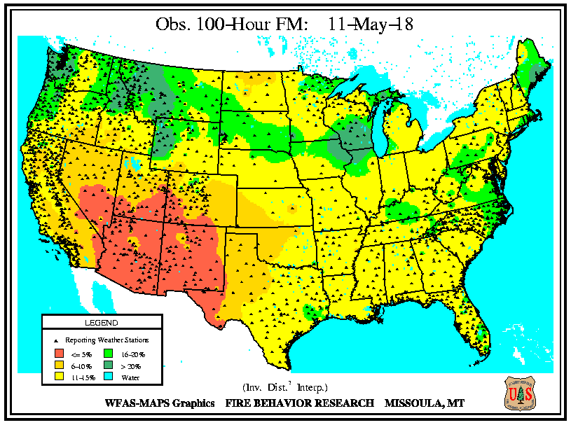
| Observed 100-hour Fuel Moisture | Observed Fire Danger Class |
Environment
 |
 |
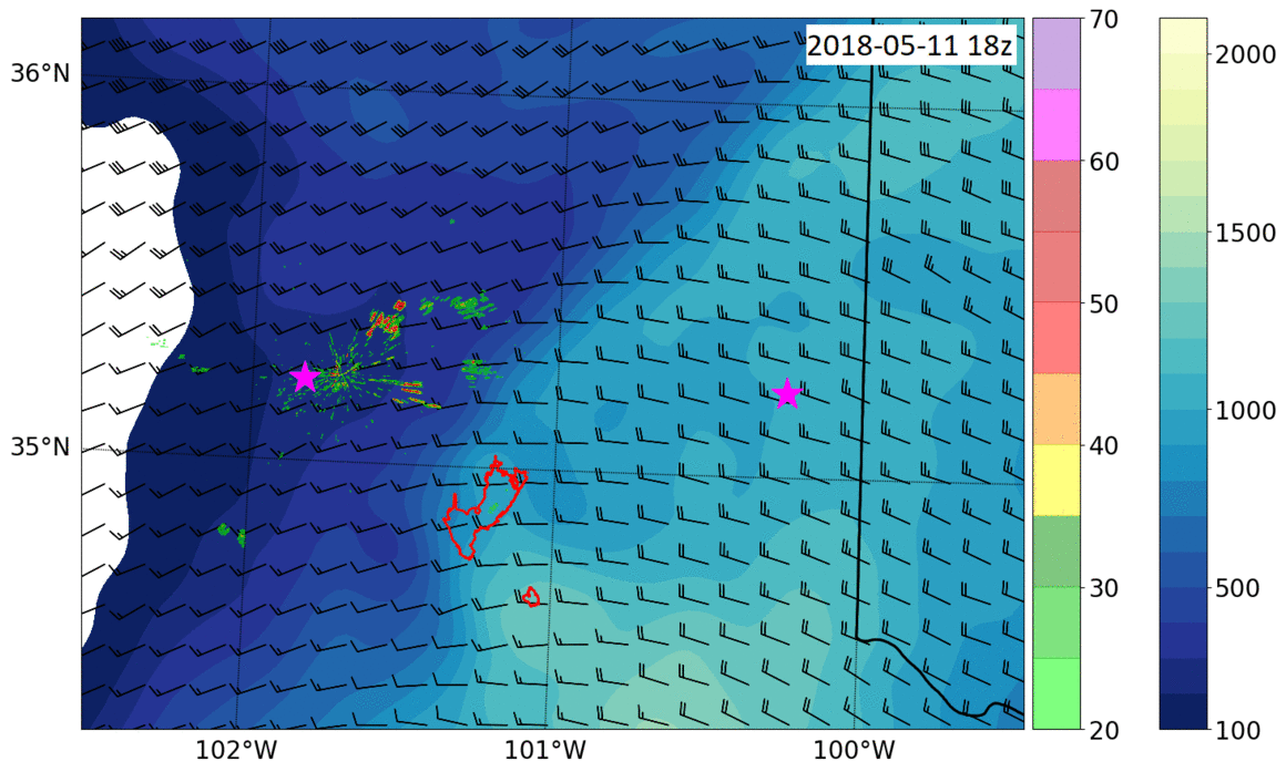 |
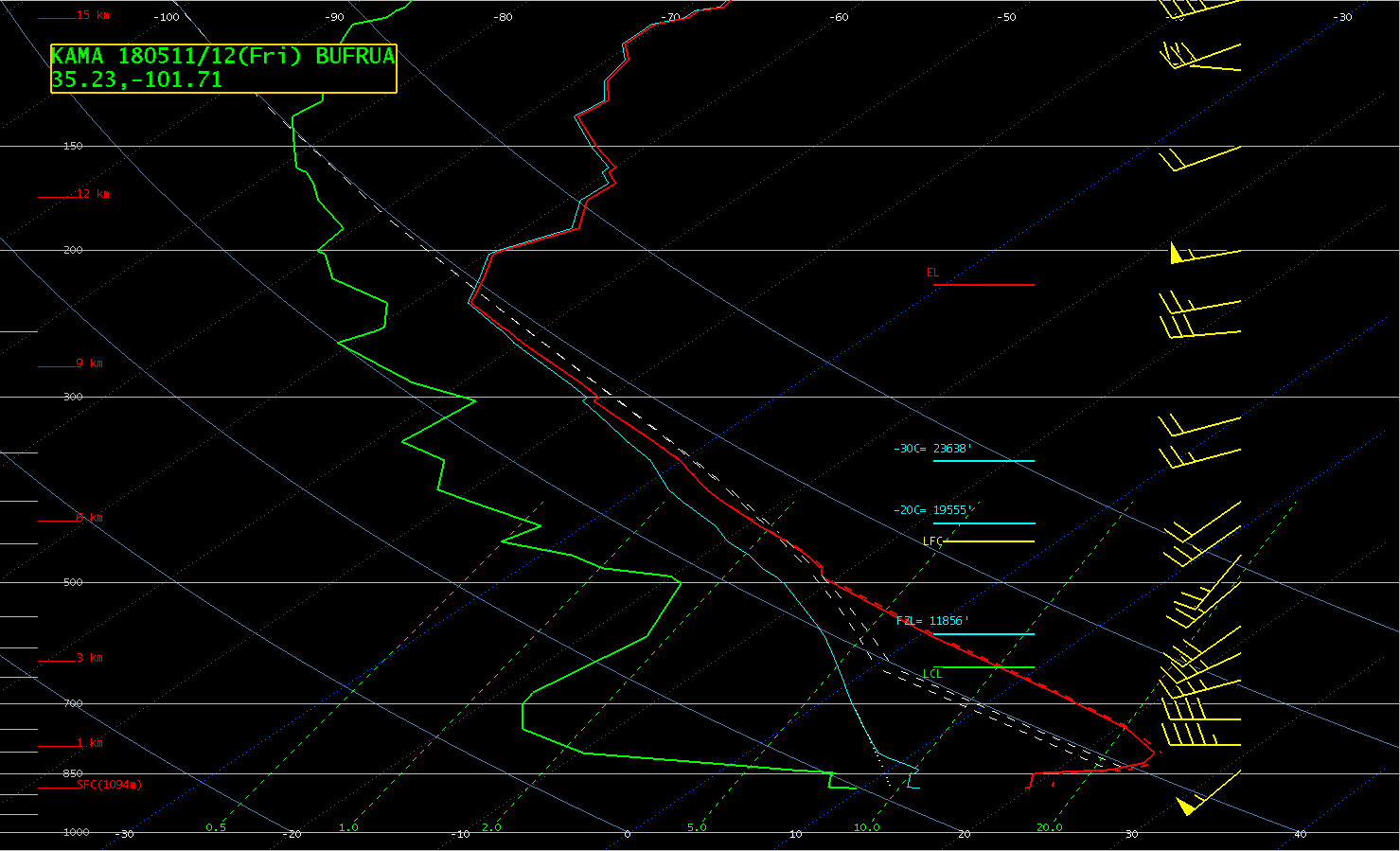
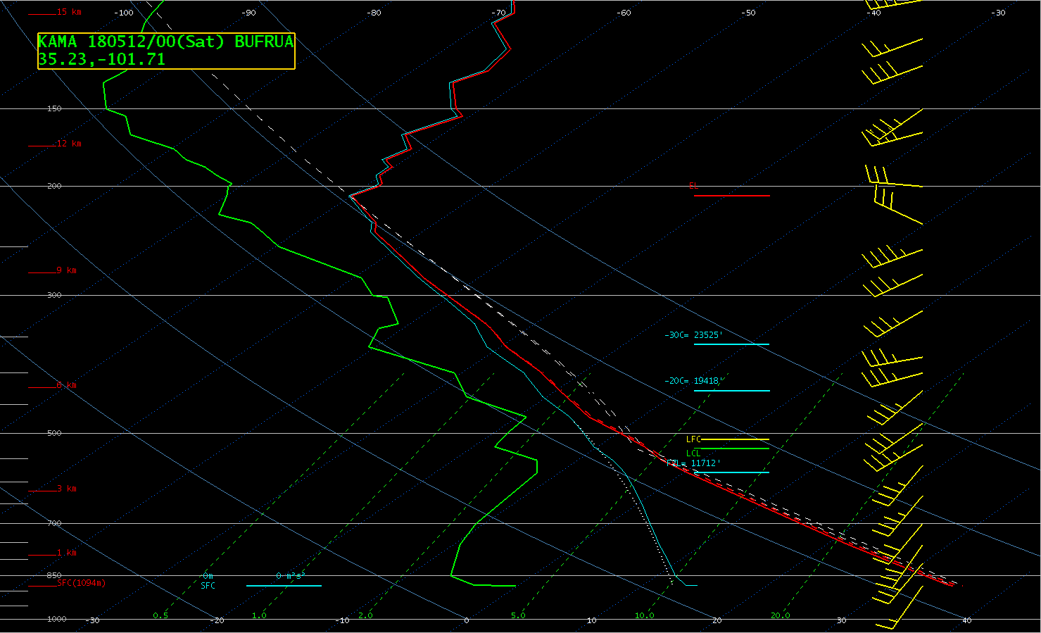
| 12z Amarillo Sounding | 00z Amarillo Sounding | 0-Hour HRRR MLCAPE (Shaded, J/kg) and 0-6 km Shear (barbs, knots) with Level II Radar Reflectivity (dBZ) overlayed |
 |
 |
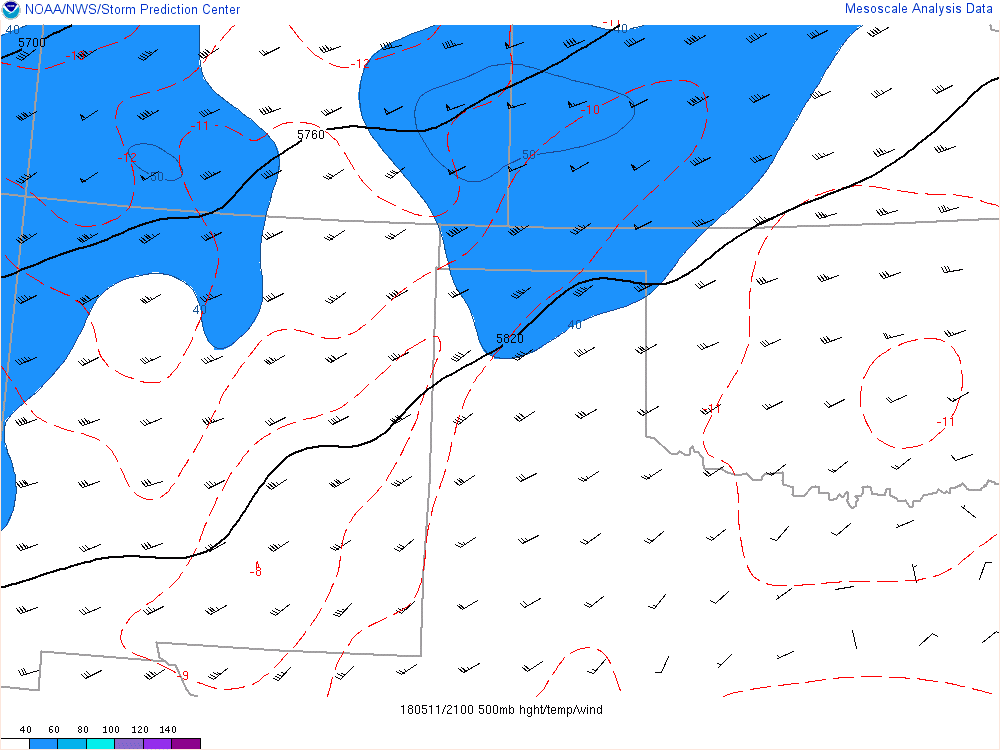 |
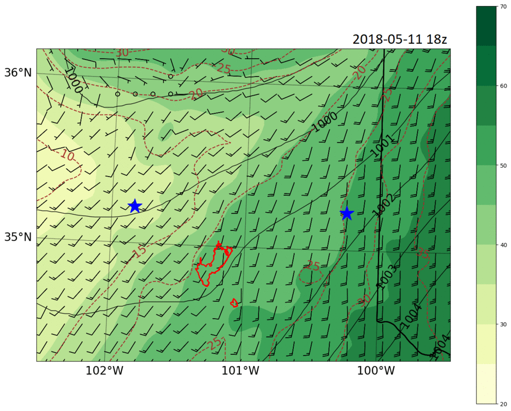
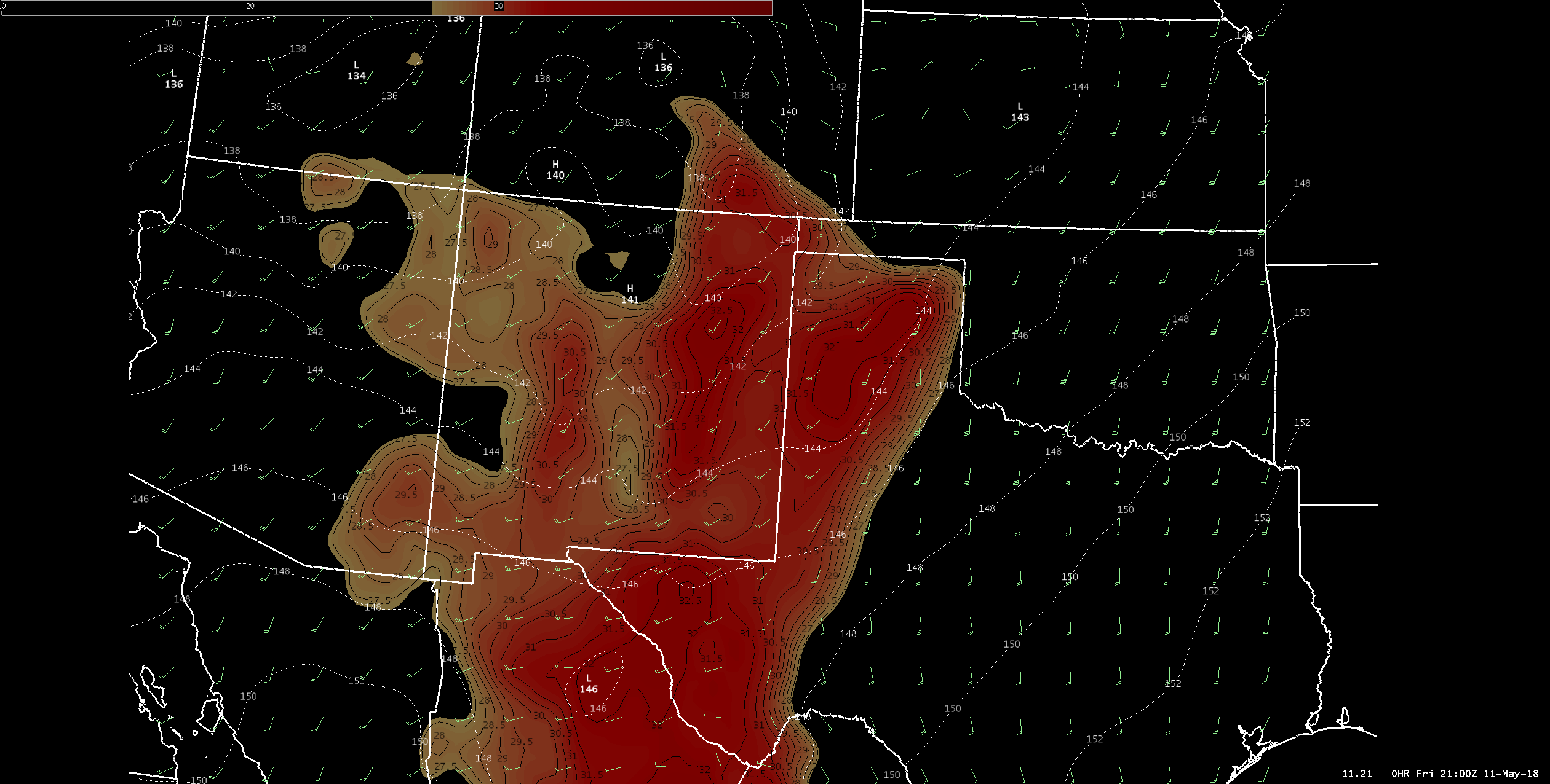
| 0-Hour HRRR Dewpoint (shaded, Fahrenheit), Surface Relative Humidity (brown contours, percent) and Surface Pressure (black contour, millibars) | RAP 850mb Heights (white contour, millibars), 850mb Temperatures (shaded, Celsius) and Winds (barbs, knots) | 500mb Heights (black contour, millibars), 500mb Temperatures (red dashed, Celsius) and Winds (barbs and shaded, knots) |
Outlooks
 |
 |
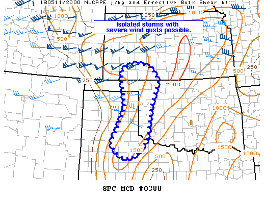 |
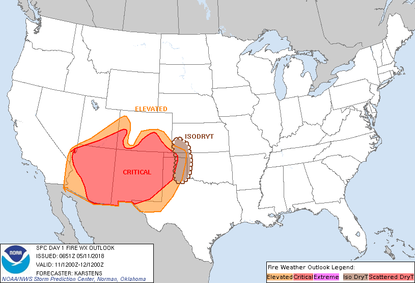
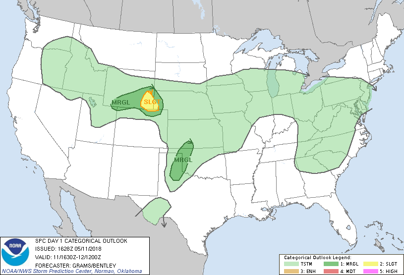
| 1200z Storm Prediction Center (SPC) Fire Outlook | 1430z Storm Prediction Center (SPC) Categorical Outlook | Storm Prediction Center (SPC) Mesoscale Discussion |
National Weather Service Messaging
 |
 |
 |
|
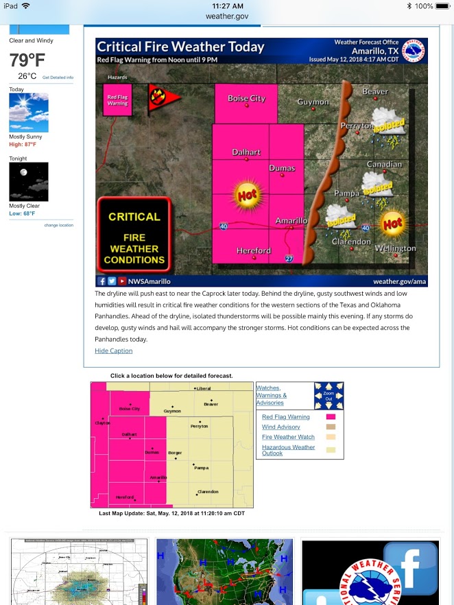
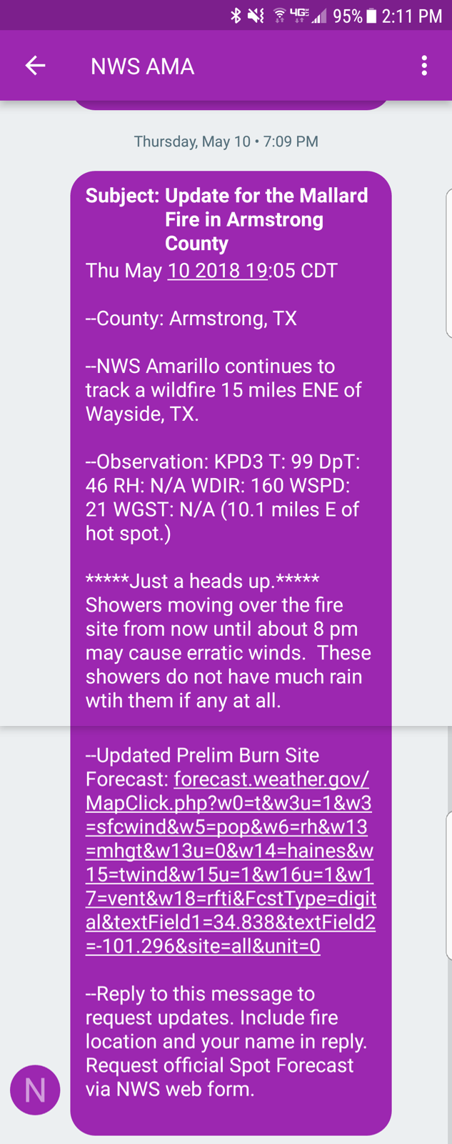
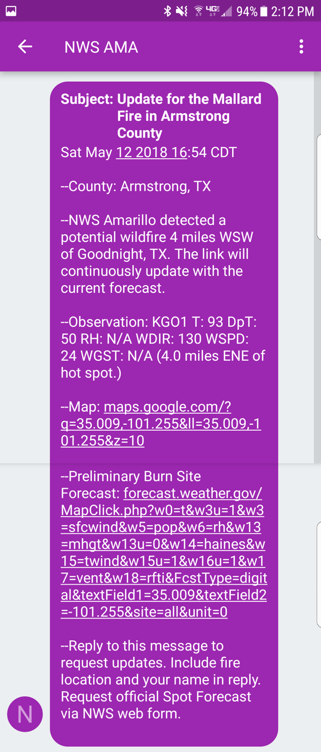
| NWS Amarillo Graphic | Hot Spot Notification Tool May 10, 2018 | Hot Spot Notification Tool May 12, 2018 | Hot Spot Notification Tool May 14, 2018 |
 |
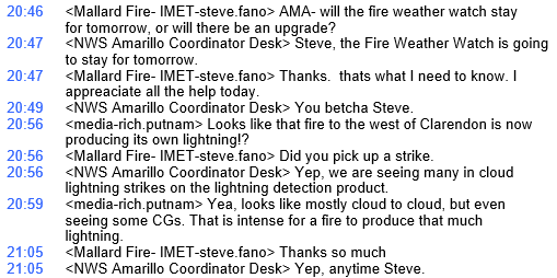 |
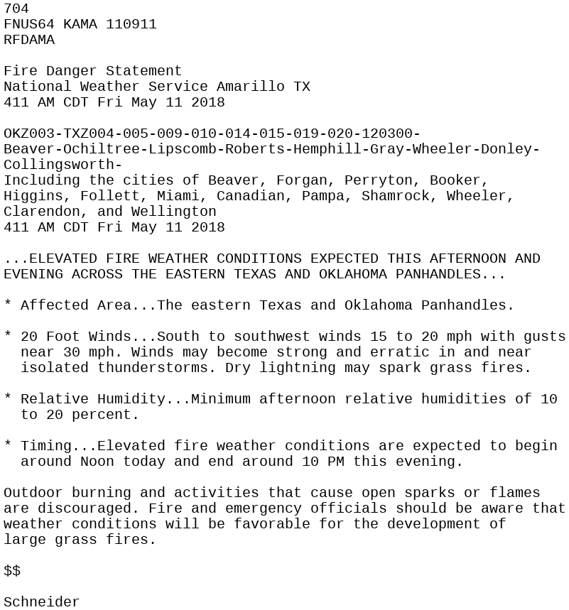
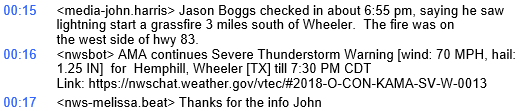
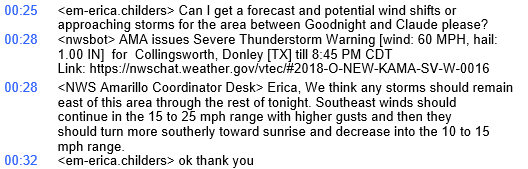
| Fire Danger Statement (RFD) | NWS Amarillo Chatroom May 11, 2018 |
 |
 |
| NWS Amarillo Chatroom May 12, 2018 | NWS Amarillo Chatroom May 13, 2018 |
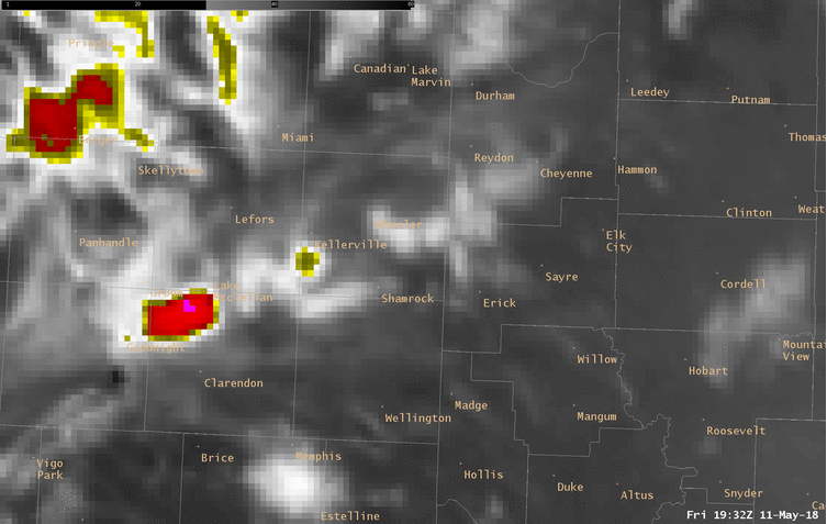
Results & Analysis
 |
 |
.gif) |
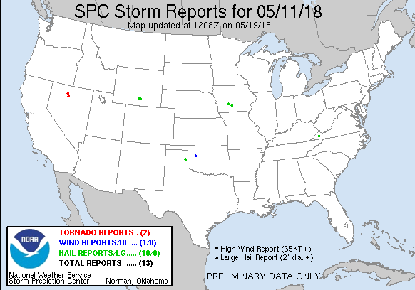
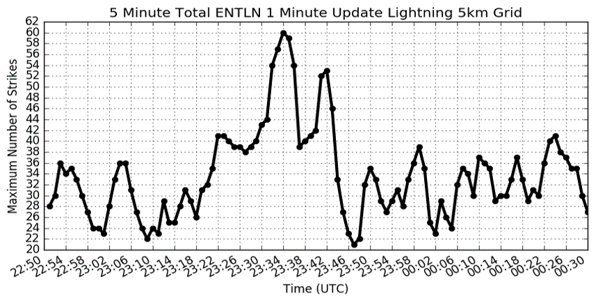
| Storm Reports | 5 Minute Total ENTLN 1 Minute Update Lightning (5 km grid) | Radar Reflectivity and Total Cloud Flashes |
 |
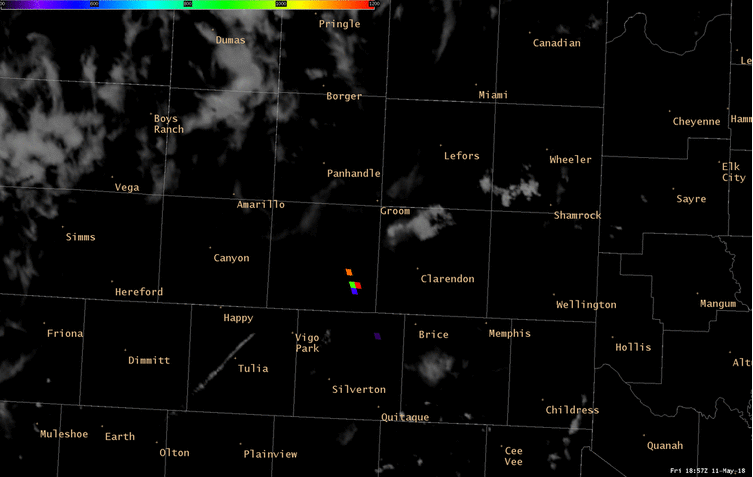 |
| GOES16 Cloud Top Phase IR Band and ENTLN 5 km grid with 5 minute total flash density (1 minute updates) | GOES16 Visible Satellite and GOES16 Fire Temperature |
 |
 |
|
NLDN Cloud to Ground and Intra-Cloud Pulse Data for 20z May 11, 2018 to 00z May 12, 2018 (Photo Credit: Chris Vagasky) |
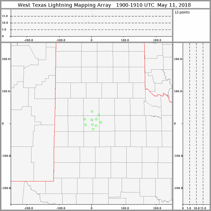
West Texas Lightning Mapping Array (LMA) |
 |
Media use of NWS Web News Stories is encouraged! Please acknowledge the NWS as the source of any news information accessed from this site. |
|

