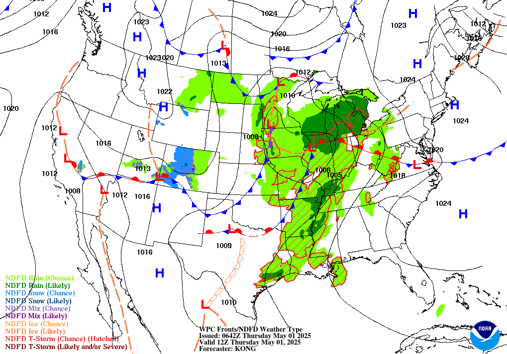
Widespread, life-threatening considerable flash flooding is expected in south-central Texas through at least Friday. Catastrophic river flooding and rapid rises on small streams, arroyos, and typically dry washes are expected in the Texas Hill Country. Wildfire smoke is impacting air quality across much of the Great Lakes region into the Northeast U.S. with Air Quality Alerts in effect. Read More >
|
|||||||||||||
| 6 to 10 Day 8 to 14 Day 30 Day |
90 Day Threats Assessment |
|
|
|
|||||||||||||
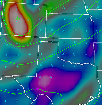
| Texas and Oklahoma Panhandles Central and Northern New Mexico Southeast and South Central Colorado |
Southwest Kansas Western and Central Oklahoma South and Low Rolling Plains of Texas |
|
|
|||||||||||||
| Texas and Oklahoma Panhandles Central and Northern New Mexico Southeast and South Central Colorado |
Southwest Kansas |
|
|
|||||||||||||
| Texas and Oklahoma Panhandles Central and Northern New Mexico Southeast and South Central Colorado |
Southwest Kansas Western and Central Oklahoma South and Low Rolling Plains of Texas |
|
|
|
|||||||||||||
| Texas and Oklahoma Panhandles Central and Northern New Mexico Southeast and South Central Colorado |
Southwest Kansas Western and Central Oklahoma South and Low Rolling Plains of Texas |
|
|
|||||||||||||
| Surface Features 12 Hour Forecast 24 Hour Forecast 36 Hour Forecast 48 Hour Forecast Precipitation Day 1 Day 2 Day 3 Days 4 and 5 |
 |
![]() Note: This product is not issued routinely. Please check the date and time carefully.
Note: This product is not issued routinely. Please check the date and time carefully.