
A heat wave over the Southwest will intensify this week, peaking and expanding into the Intermountain West and northern High Plains this weekend. Critical to extremely critical fire weather conditions are forecast from the Northwest and the northern Great Basin this weekend. Particularly Dangerous Situation Red Flag Warnings have been issued. Read More >
Arkansas-Red Basin
River Forecast Center
ABRFC River Flood Summary: Minor: 0 (0%)
Moderate: 0 (0%)
Major: 0 (0%)
Use the map below to view forecast locations experiencing flooding and link to detailed forecast information.
US Dept of Commerce
National Oceanic and Atmospheric Administration
National Weather Service
Arkansas-Red Basin
10159 E. 11th Street, Suite 300
Tulsa, OK 74128-3050
Comments? Questions? Please Contact Us.


 ABRFC Storymaps
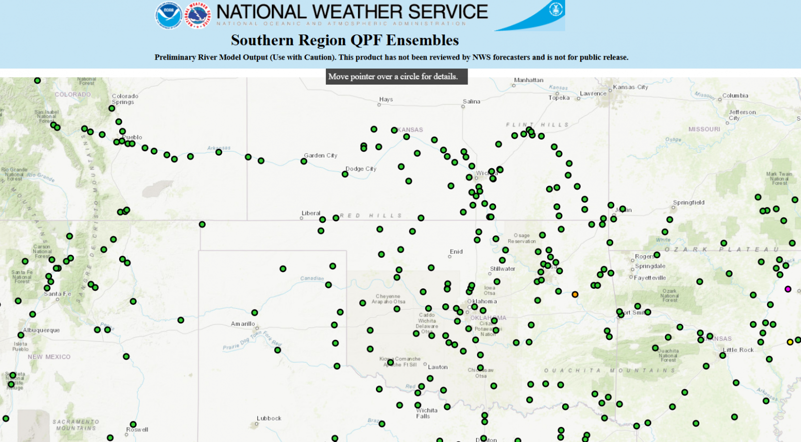 QPF Ensemble Forecasts
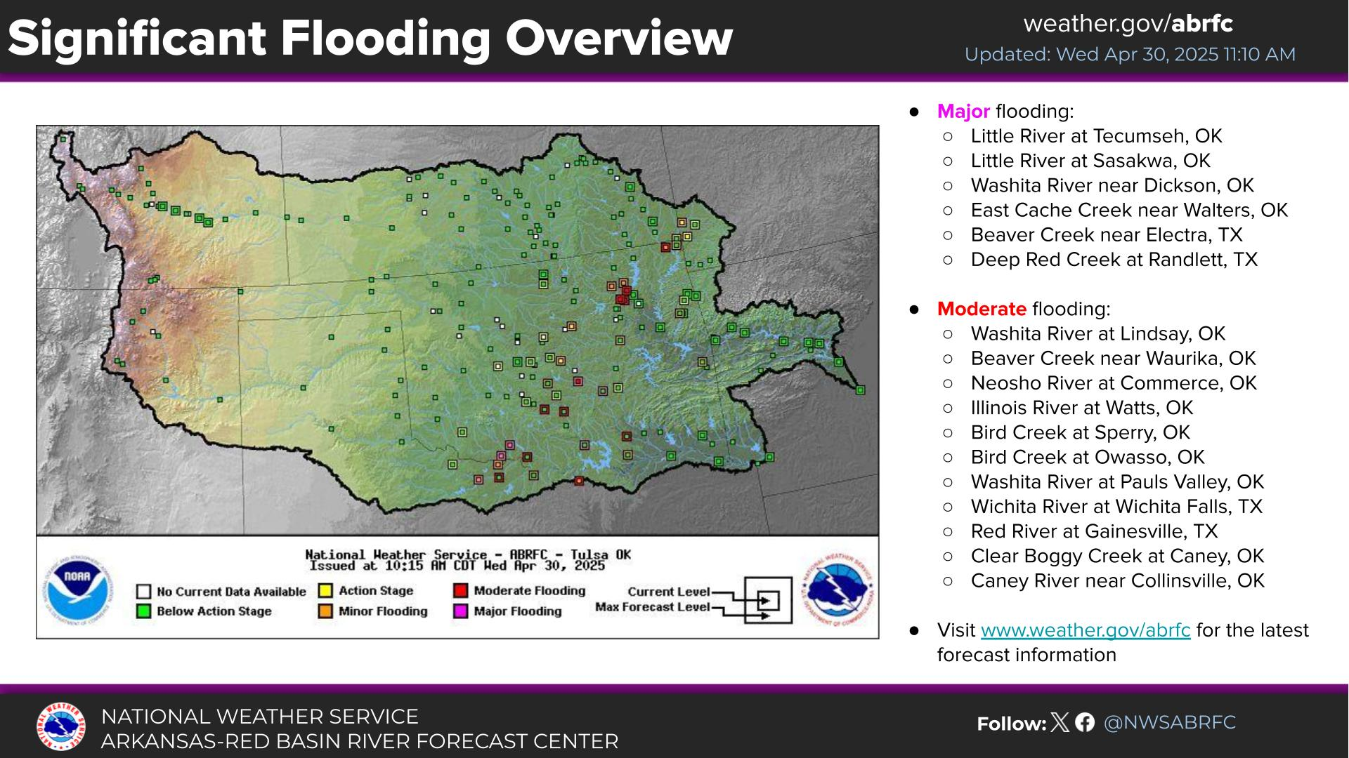 Weather Story
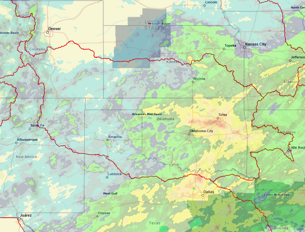 NWS GIS Viewer
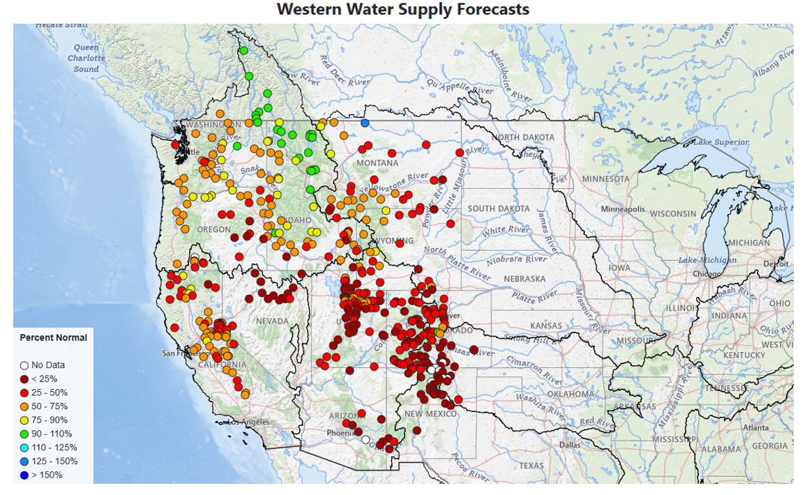 Western Water Supply