
Wildfires and poor air quality continue for the Pacific Northwest, Rockies and extended into the Plains. Severe thunderstorms possible for the northern Plains and upper Midwest on Monday along a frontal boundary. Another boundary will focus showers and thunderstorms for the eastern seaboard with localized heavy rainfall possible. For Alaska, a strong Bering Sea storm will bring winds and rainfall. Read More >
Arkansas-Red Basin
River Forecast Center
ABRFC River Flood Summary: Minor: 0 (0%)
Moderate: 0 (0%)
Major: 0 (0%)
Use the map below to view forecast locations experiencing flooding and link to detailed forecast information.
US Dept of Commerce
National Oceanic and Atmospheric Administration
National Weather Service
Arkansas-Red Basin
10159 E. 11th Street, Suite 300
Tulsa, OK 74128-3050
Comments? Questions? Please Contact Us.


 ABRFC Storymaps
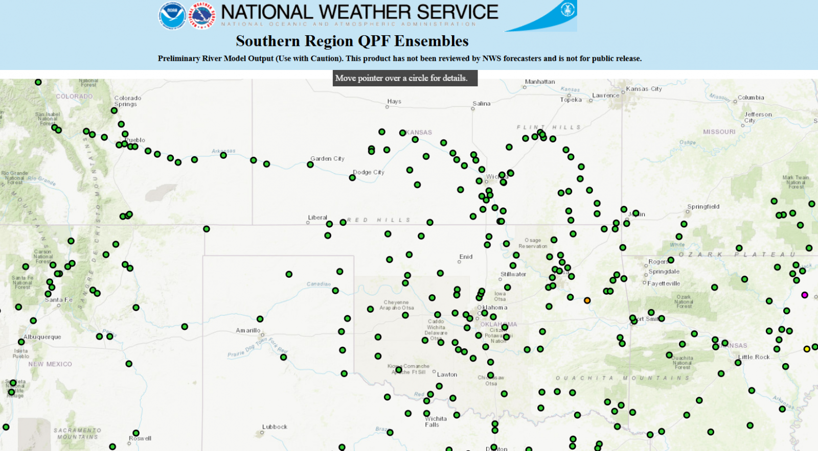 QPF Ensemble Forecasts
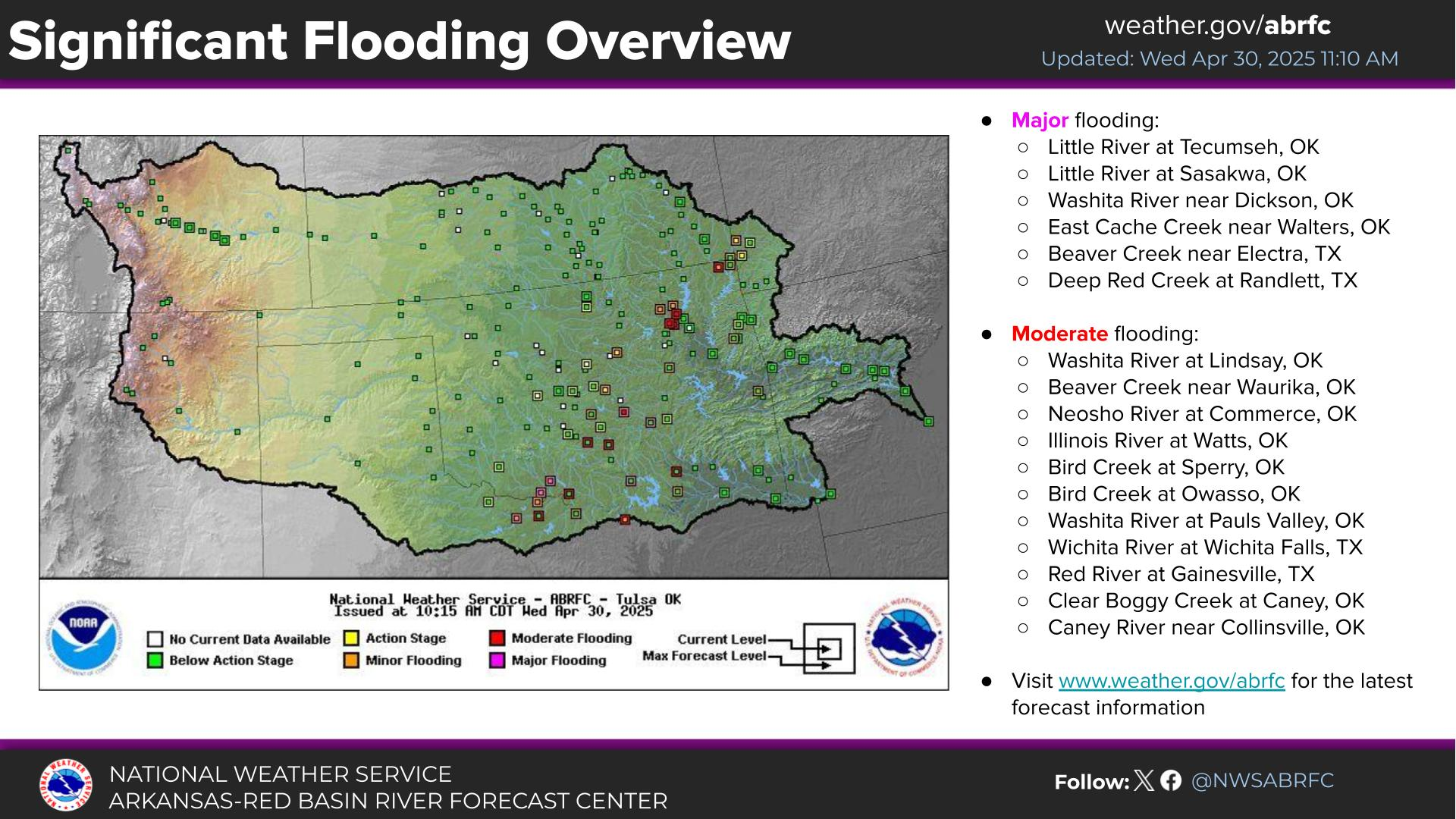 Weather Story
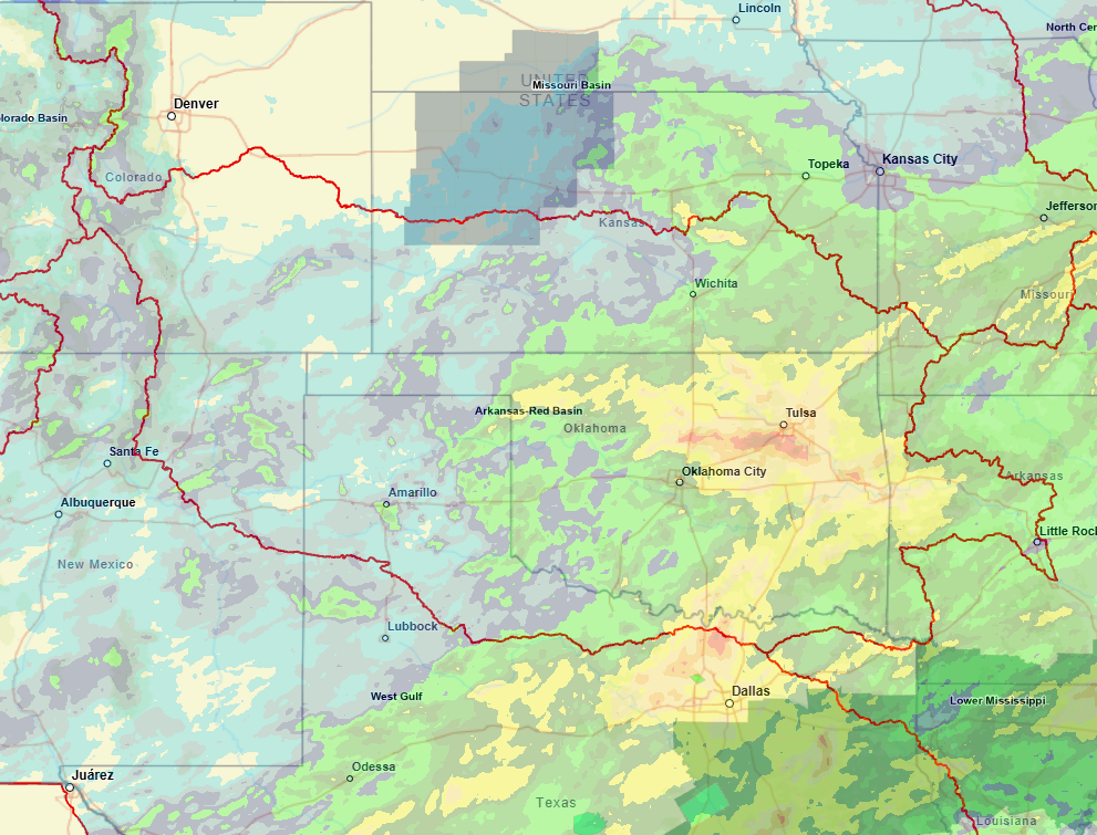 NWS GIS Viewer
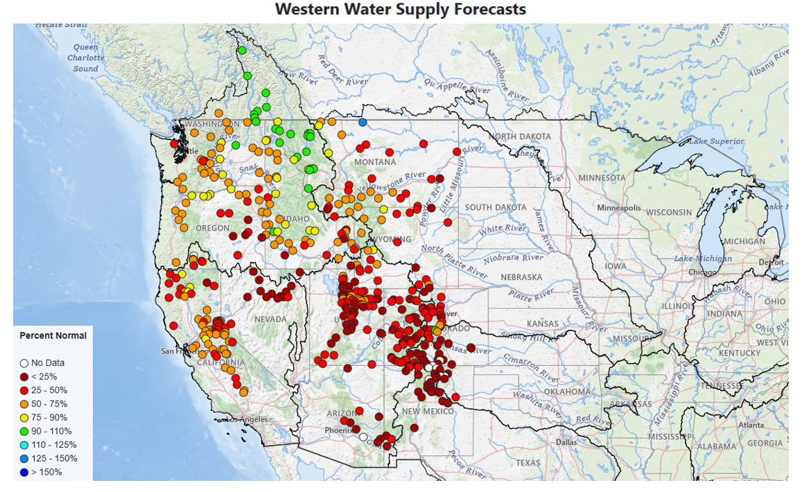 Western Water Supply