
A cold front will sweep eastward today accompanied by strong to severe thunderstorms for the mid-Atlantic and Northeast today. In the wake of this cold front, autumn like temperatures and gusty winds from the Plains, Mississippi Valley, Great Lakes to most of the eastern seaboard. Fire weather conditions for lower Mississippi Valley into portions of California. For Guam, a typhoon is approaching. Read More >
Overview
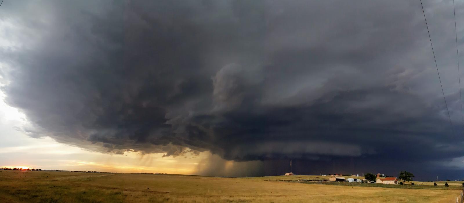
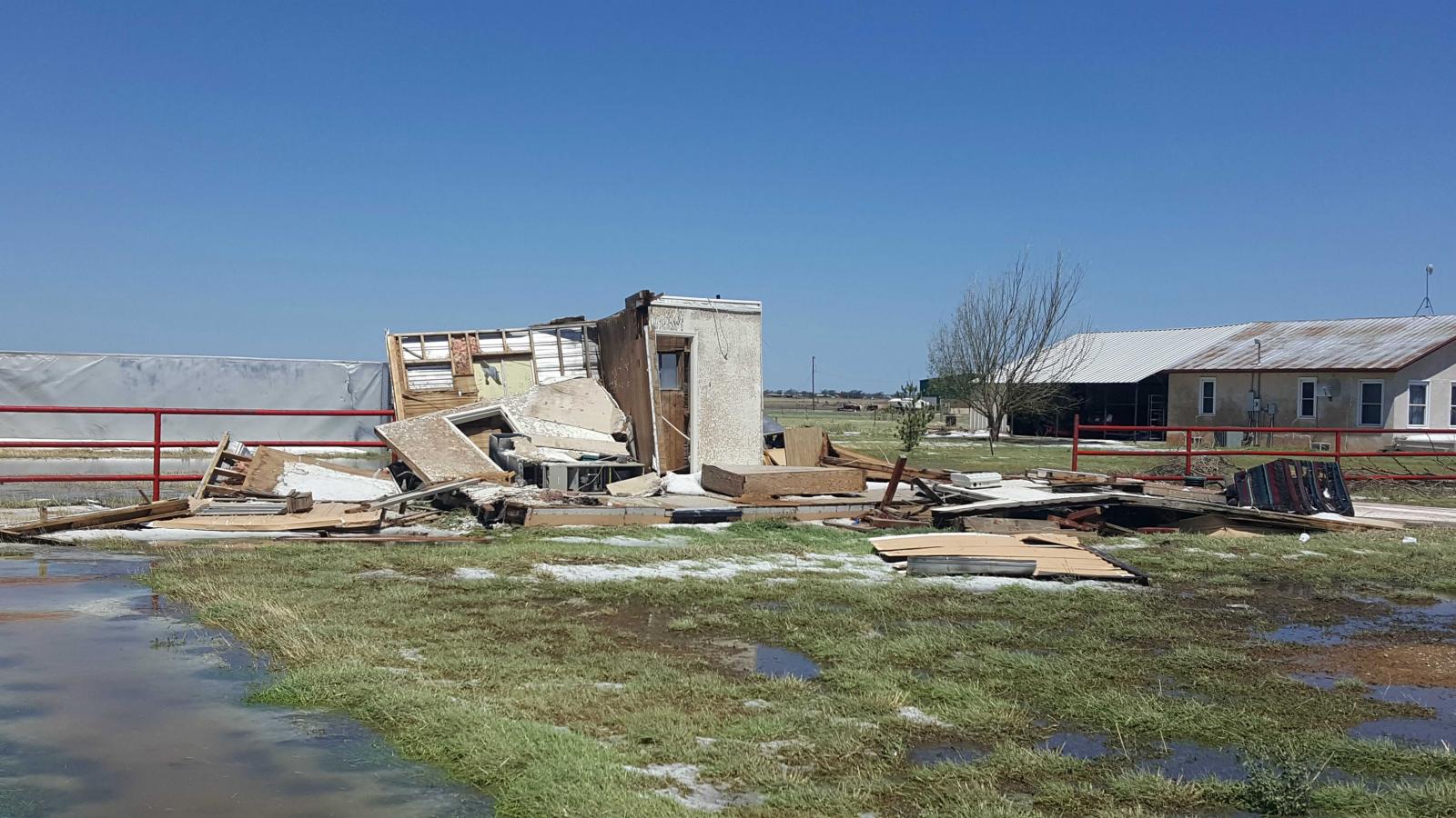
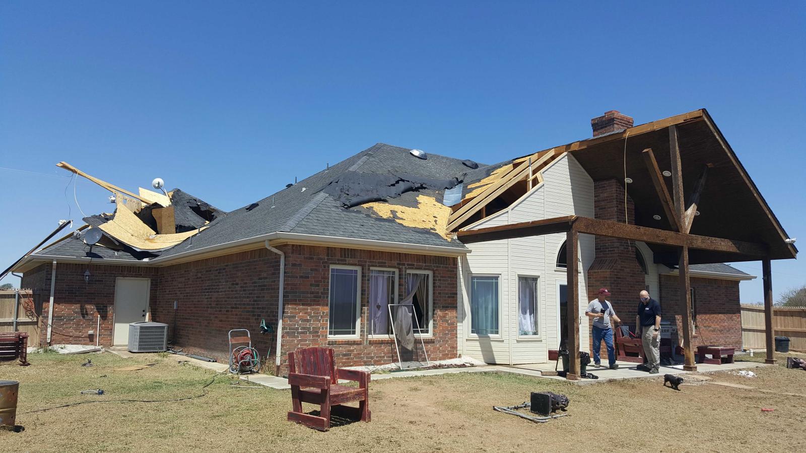
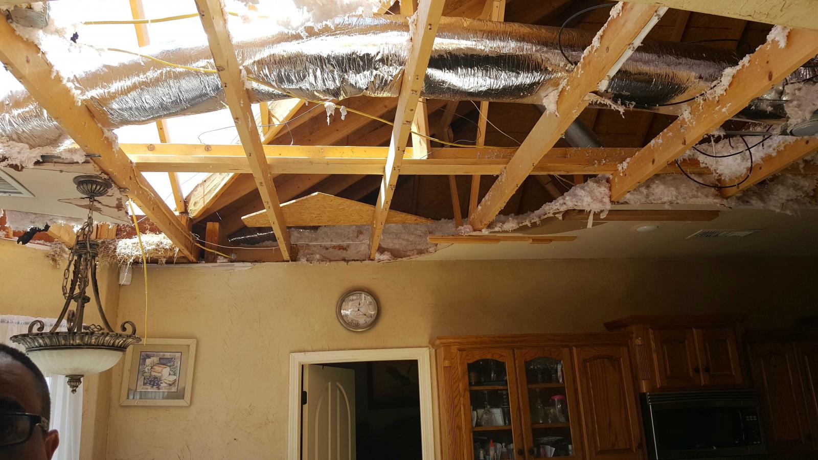
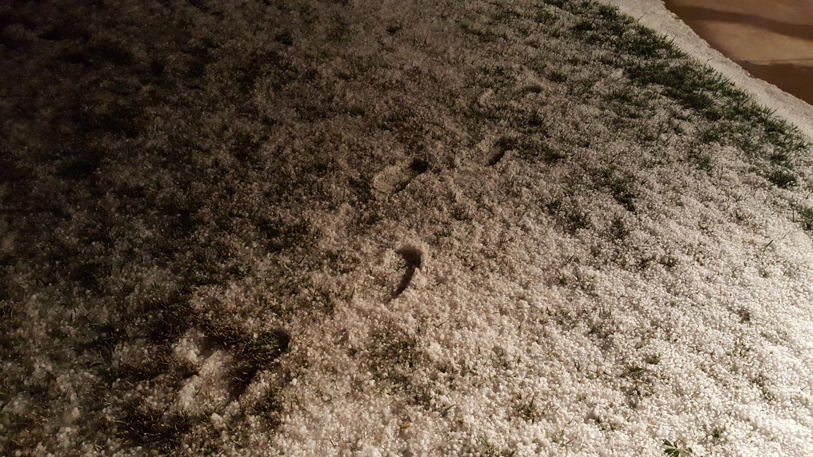
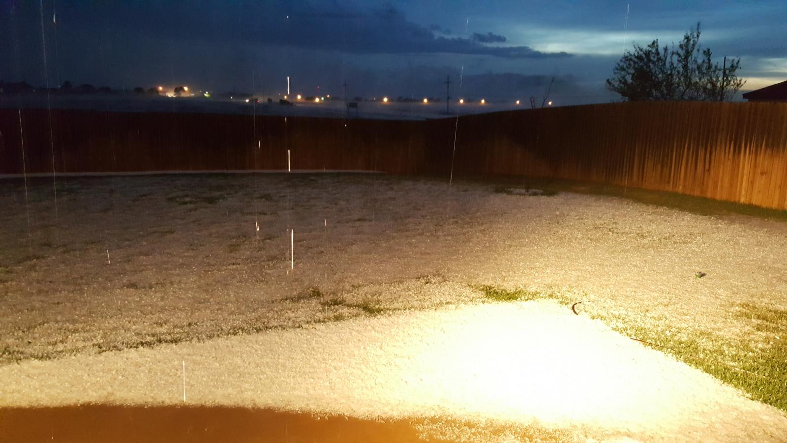
This "northwest flow" event (i.e. flow aloft was from the northwest) lead to a number of damaged houses, outbuildings, power poles, trees and other vegetation due to strong outflow winds and two separate microbursts originating from the same supercell thunderstorm. This supercell developed just east of Dumas, Texas and moved south through Amarillo and Canyon. Initially the supercell produced very large hail to the size of baseballs north of Amarillo, and would drop 2 inch hail in Amarillo. The storm produced its first microburst as it started becoming outflow dominant in southern Amarillo where some power poles were damaged. The second more powerful microburst occurred just south of Amarillo and would lead to some considerable damage with winds up to 90 mph estimated based on damage between Amarillo and Canyon along and near county road 1541. During this time, the storm also dumped 2 to 6 inches of mostly dime size hail (although the were some reports of hail up to the size of golf balls as well) along its path. Another storm would become severe briefly near Spearman producing ping-pong ball size hail, but dissipated within an hour or so.
 |
 |
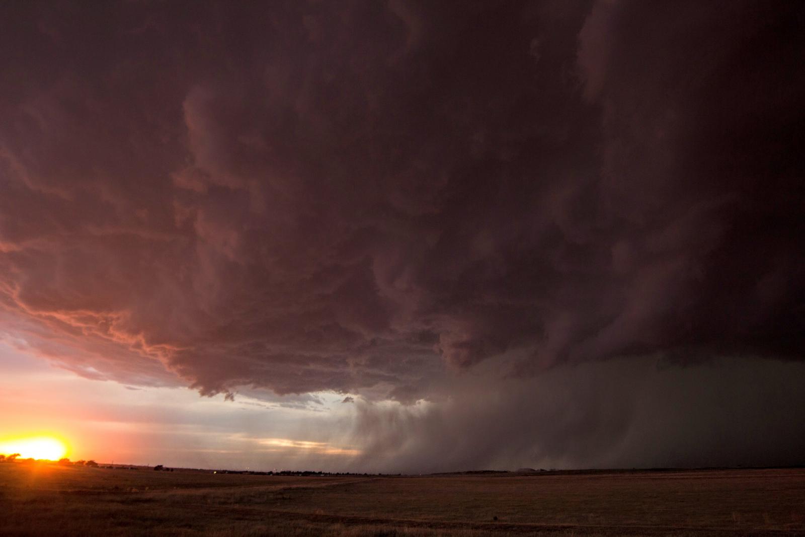 |
| Looking north from 3 east of Canyon around 8:45 PM CDT by Aaron Ward | Radar reflectivity and base velocity of the storm at 8:53 PM CDT. | Looking north from 3 east of Canyon around 8:55 PM CDT by Aaron Ward |
Wind & Hail Photos:
 |
 |
 |
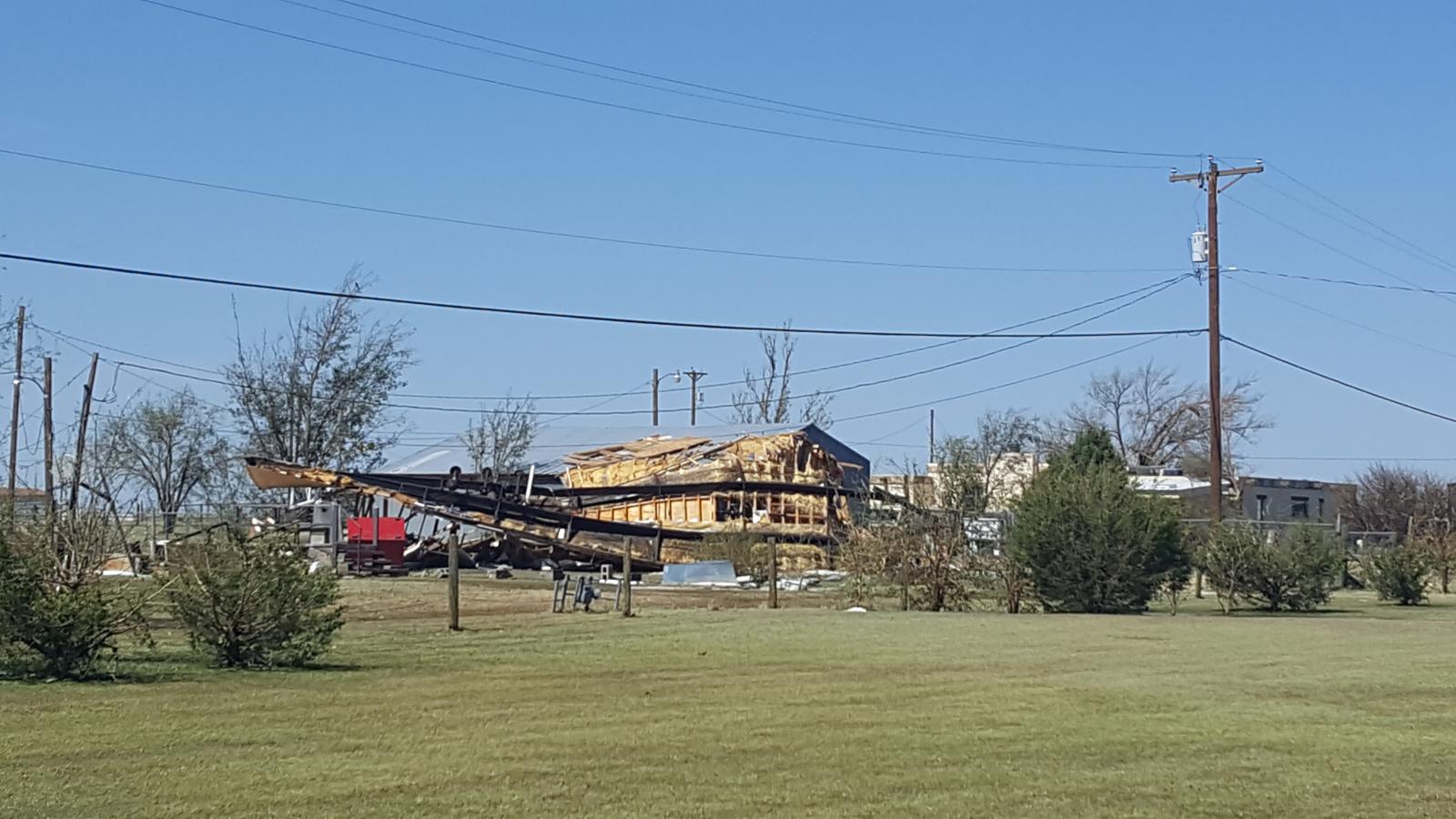 |
| Storm Survey: Badly damaged outbuilding west of FM 1541. | Storm Survey: Wind damage to home near S. Georgia St. and W McAfee Rd. | Storm Survey: Wind damage to home near S. Georgia St. and W McAfee Rd. | Storm Survey: Flipped mobile home near FM 1541 and Plantation Rd. |
 |
 |
||
| Dime size hail around 2-3 inches deep 3 east of Canyon by Aaron Ward | Dime size hail around 2-3 inches deep 3 east of Canyon by Aaron Ward | Caption | Caption |
Radar (coming Soon):
| Caption | Caption | Caption | Caption |
Storm Reports (coming soon)
PRELIMINARY LOCAL STORM REPORT...SUMMARY
NATIONAL WEATHER SERVICE AMARILLO TX
123 AM CDT SAT JUN 10 2017

..TIME...   ...EVENT...      ...CITY LOCATION...     ...LAT.LON...
..DATE...   ....MAG....      ..COUNTY LOCATION..ST.. ...SOURCE....
            ..REMARKS..

0708 PM     HAIL             8 E FOUR WAY            35.69N 101.82W
06/08/2017  E2.75 INCH       MOORE              TX   TRAINED SPOTTER

0710 PM     HAIL             9 SE DUMAS              35.78N 101.86W
06/08/2017  M1.50 INCH       MOORE              TX   NWS EMPLOYEE

0726 PM     HAIL             4 SE GRUVER             36.22N 101.36W
06/08/2017  E1.50 INCH       HANSFORD           TX   PUBLIC

0756 PM     TSTM WND GST     14 N AMARILLO           35.41N 101.82W
06/08/2017  M64 MPH          POTTER             TX   BROADCAST MEDIA

0819 PM     TSTM WND GST     6 ENE AMARILLO          35.22N 101.72W
06/08/2017  M59 MPH          POTTER             TX   ASOS

0831 PM     HAIL             8 N AMARILLO            35.32N 101.83W
06/08/2017  M1.00 INCH       POTTER             TX   TRAINED SPOTTER

            GIVENS AVE. AND HWY 87

0832 PM     HAIL             5 N AMARILLO            35.27N 101.83W
06/08/2017  E1.00 INCH       POTTER             TX   PUBLIC

0835 PM     HAIL             7 N AMARILLO            35.30N 101.82W
06/08/2017  E2.00 INCH       POTTER             TX   TRAINED SPOTTER

0835 PM     HAIL             1 NE AMARILLO           35.21N 101.81W
06/08/2017  E1.75 INCH       POTTER             TX   NWS EMPLOYEE

            9TH AND ROSS

0837 PM     HAIL             2 NNE AMARILLO          35.23N 101.81W
06/08/2017  M1.00 INCH       POTTER             TX   TRAINED SPOTTER

            MARTIN ROAD LAKE

0837 PM     HAIL             4 NNE AMARILLO          35.26N 101.79W
06/08/2017  M1.75 INCH       POTTER             TX   AMATEUR RADIO

            24TH AND GRAND ST

0840 PM     HAIL             1 W AMARILLO            35.20N 101.83W
06/08/2017  E1.25 INCH       POTTER             TX   BROADCAST MEDIA

            QUARTER TO HALF DOLLAR SIZE HAIL REPORTED.

0840 PM     TSTM WND GST     3 SSE AMARILLO          35.16N 101.80W
06/08/2017  E70 MPH          RANDALL            TX   NWS STORM SURVEY

            A BRIEF MICROBURST OCCURRED ON THE SOUTH SIDE OF
            AMARILLO.

0841 PM     HAIL             2 SW AMARILLO           35.18N 101.84W
06/08/2017  M1.50 INCH       RANDALL            TX   TRAINED SPOTTER

            WASHINGTON AND I27

0843 PM     HAIL             4 SSW AMARILLO          35.14N 101.86W
06/08/2017  M1.00 INCH       RANDALL            TX   NWS EMPLOYEE

0843 PM     TSTM WND GST     4 SSW AMARILLO          35.14N 101.86W
06/08/2017  E60 MPH          RANDALL            TX   NWS EMPLOYEE

0846 PM     HAIL             3 SSW AMARILLO          35.16N 101.84W
06/08/2017  M1.75 INCH       RANDALL            TX   TRAINED SPOTTER

            58TH AND WASHINGTON

0847 PM     TSTM WND DMG     4 N TIMBERCREEK CANYON  35.11N 101.82W
06/08/2017                   RANDALL            TX   NWS STORM SURVEY

            A MICROBURST ASSOCIATED WITH A SEVERE THUNDERSTORM
            CAUSED DAMAGE TO A NUMBER OF TREES...POWER
            POLES...INDUSTRIAL BUILDINGS...AND RESIDENTIAL HOMES IN
            PORTIONS OF NORTHERN RANDALL COUNTY. THE WORST DAMAGE
            WAS OBSERVED NEAR SOUTH GEORGIA STREET AND WEST MCAFEE
            ROAD WHERE A WELL BUILT HOUSE HAD A PATIO AWNING LIFTED
            OVER THE HOUSE AND LANDED ON THE GARAGE. THE DAMAGE PATH
            ASSOCIATED WITH THE MICROBURST HAD A PATH LENGTH OF 8.3
            MILES...A MAXIMUM PATH WIDTH OF 2.0 MILES...AND ENDED
            AROUND 912 PM CDT

0848 PM     HAIL             5 S AMARILLO            35.13N 101.82W
06/08/2017  E1.00 INCH       RANDALL            TX   PUBLIC

0848 PM     TSTM WND GST     2 NNW LAKE TANGLEWOOD   35.08N 101.80W
06/08/2017  M75 MPH          RANDALL            TX   PUBLIC

            LATE REPORT. TIME ESTIMATED BY RADAR.

0849 PM     HAIL             AMARILLO                35.20N 101.82W
06/08/2017  E1.25 INCH       POTTER             TX   TRAINED SPOTTER

            QUARTER TO HALF DOLLAR SIZE HAIL REPORTED.

0850 PM     TSTM WND GST     4 NNW LAKE TANGLEWOOD   35.11N 101.80W
06/08/2017  M67 MPH          RANDALL            TX   MESONET

0855 PM     TSTM WND GST     4 NNW LAKE TANGLEWOOD   35.11N 101.80W
06/08/2017  M70 MPH          RANDALL            TX   MESONET

0859 PM     HAIL             2 SW TIMBERCREEK CANYON 35.04N 101.85W
06/08/2017  M1.00 INCH       RANDALL            TX   TRAINED SPOTTER

            6 - 8 INCHES OF HAIL COVERING BOTH SIDES OF WASHINGTON
            JUST NORTH OR CAMP DON HARRINGTON

0900 PM     TSTM WND DMG     2 WNW TIMBERCREEK CANYO 35.07N 101.85W
06/08/2017                   RANDALL            TX   PUBLIC

            1000 LB. BUILDING BLOWN OVER... PIECES OF METAL TORN
            OFF ROOF

0903 PM     TSTM WND GST     2 N CANYON              35.02N 101.92W
06/08/2017  M66 MPH          RANDALL            TX   BROADCAST MEDIA

0910 PM     TSTM WND GST     3 E CANYON              34.98N 101.87W
06/08/2017  E70 MPH          RANDALL            TX   NWS EMPLOYEE

0912 PM     TSTM WND GST     CANYON                  34.98N 101.92W
06/08/2017  E60 MPH          RANDALL            TX   TRAINED SPOTTER
Environment (coming soon):
Insert synoptic summary.
| Figure 1: Caption | Figure 2: Caption | Figure 3: Caption |
Near-storm environment summary.
| Figure 4: Caption | Figure 5: Caption | Figure 6: Caption |
 |
Media use of NWS Web News Stories is encouraged! Please acknowledge the NWS as the source of any news information accessed from this site. |
|



 Follow us on X
 Follow us on Facebook
 AMA RSS Feed