
Dangerous heat will expand from the Gulf Coast into the Southern Plains and Desert Southwest through week's end. Additional extreme heat impacting the Pacific Northwest will shift to the northern Plains by the weekend. Tropical Storm Bertha is expected to continue to impact portions of the northwestern Gulf Coast from south central Louisiana to the upper Texas coast today. Read More >
Overview
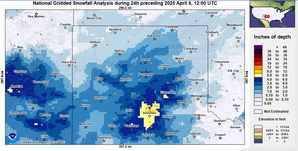
An upper level low pressure system moving east across far west Texas northeast on Saturday towards the Red River valley area of NW Texas by Saturday night resulted in good moisture advection into the Panhandles region. This resulted in light snow to develop early Saturday morning for the NW Panhandles where 1-2" of snow accumulated in the early morning hours. Later in the morning hours and continuing into the evening hours, a series of mesoscale bands of snow developed across the central and southern Texas Panhandle pivoting east to west at first, just north of the main system passing south of the area. Later in the evening, these bands of snow then shifted back east as the main low pressure system finally exited the region. Within these bands of snow, snowfall rates of 0.5-0.7"/hour were reported for several hours in some locations. Winds gusts of 35-45 mph at times also caused areas of blowing snow with snow drifts over a foot in some locations. Highest snowfall totals for this event occurred across portions of Deaf Smith, Randall, and Armstrong counties as a result of hours under mesoscale banding, along with north winds with upslope flow across portions of Palo Duro Canyon. Highest values of reported snowfall totals were 4-8" along the Highway 60 corridor from just east of Hereford to portions of south and west Amarillo.Snow/Ice
Even though temperatures ranged from the upper 20s to around freezing, the higher April sun angle helped maintain melting which kept snowfall amounts limited despite several hours of moderate snowfall. Strong winds did result in blowing snow and visibility fell below 1 mile for many locations. Some locations even fell below 1/2 miles at times. The heaviest snowfall occurred in the upslope favored regions of the Canadian River Valley and along the Caprock south of Palo Duro Canyon.
Photos & Video
.png) |
 |
.png) |
.png) |
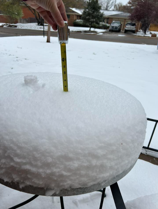
| Taken at NWS Amarillo - Snow started early Saturday morning (NWS Amarillo) |
Areas in on the north and west sides of Amarillo picked up 5+ inches. (Meredith Reis) |
Near the Greenways in Amarillo (Pamela Thomas Yoder) |
At MERUS Adventure Park, around 15 miles SW of Claude (April Landry) |
Rain Reports
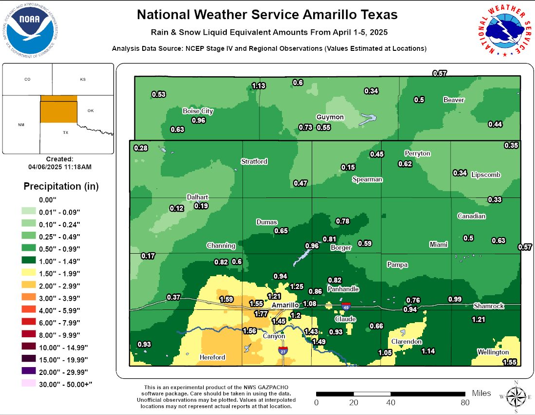
Rain actually started Thursday night and continued through Friday evening before finally transitioning to snow early Saturday morning. The combined liquid equivalent for this event was 1.0" to 1.5" for many locations across the southern Texas Panhandle. The northern combined Panhandles saw the lower amounts with most locations under 0.5".
Environment
 |
 |
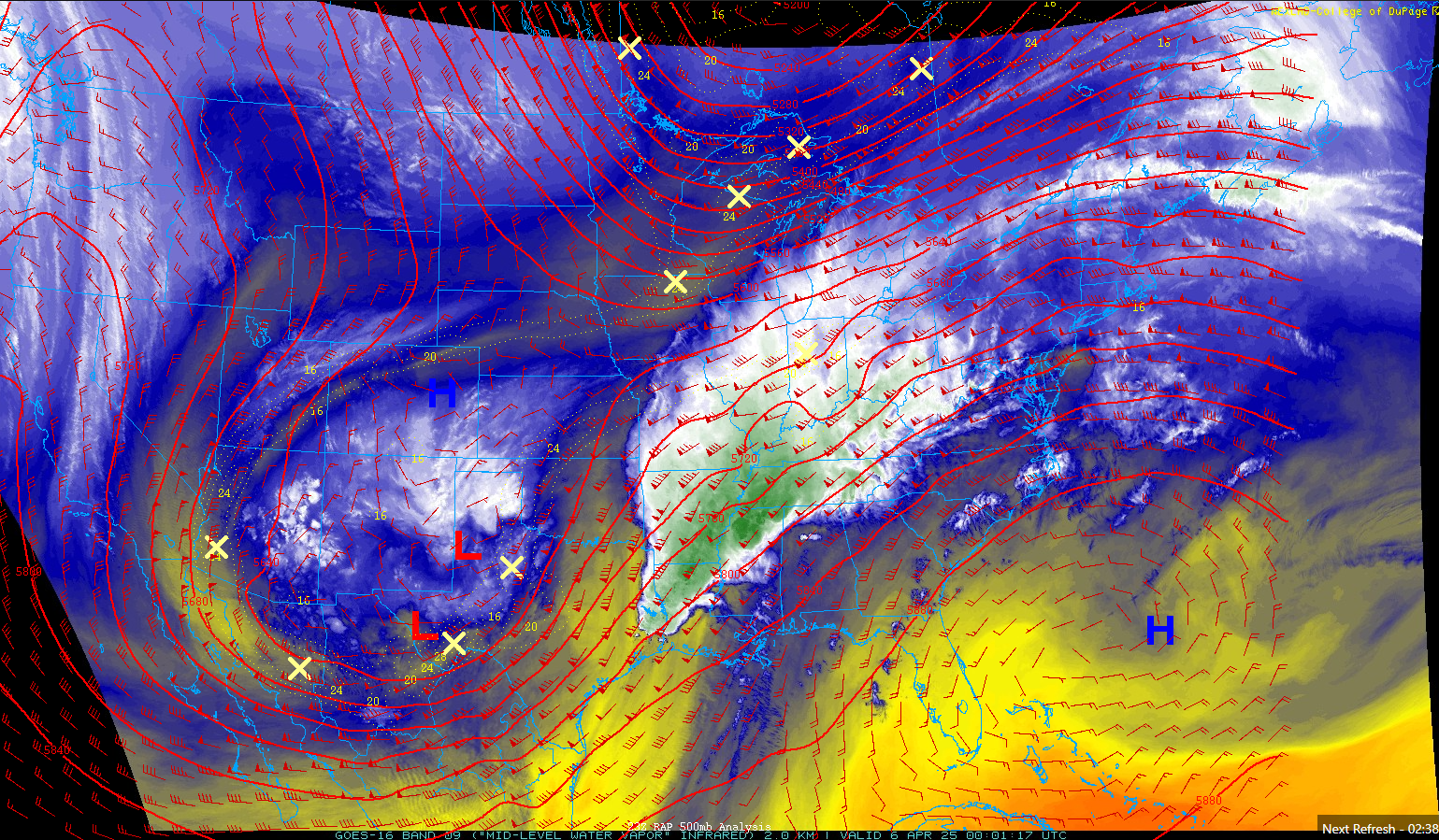 |
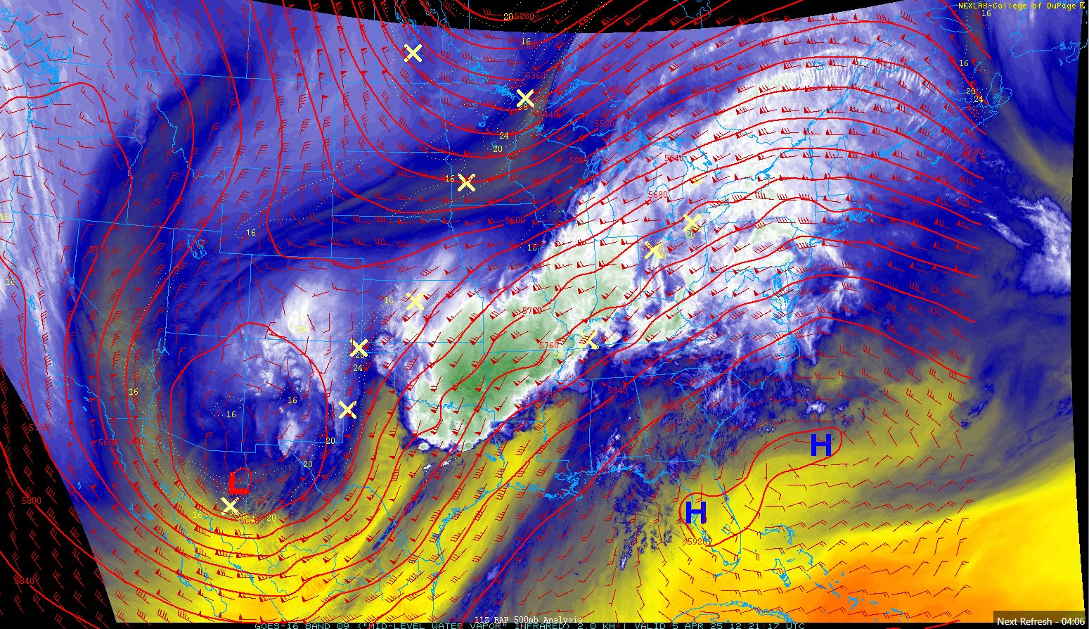
| Figure 1: The upper level system started producing rain across the western plains by Friday as it pulled in pacific and gulf moisture. | Figure 2: By Saturday morning, the system really hadn't moved much and was bringing a second round of moisture with the main low. By this time, a cold front had dropped temperatures below freezing for most of the Panhandles switching rain to snow. | Figure 3: By Saturday evening, the system was finally crossing over the plains. While precip was ending from north to south as drier near surface are invaded, some of the heaviest snowfall rates occurred in upslope favored regions south of Palo Duro Canyon into Lubbock's area near Silverton. |
 |
Media use of NWS Web News Stories is encouraged! Please acknowledge the NWS as the source of any news information accessed from this site. |
|

