
Dangerous heat will expand from the Gulf Coast into the Southern Plains and Desert Southwest through week's end. Additional extreme heat impacting the Pacific Northwest will shift to the northern Plains by the weekend. Tropical Storm Bertha is expected to continue to impact portions of the northwestern Gulf Coast from south central Louisiana to the upper Texas coast today. Read More >
Overview
An anomalous August 2-3 severe weather event unfolded during the late evening and overnight Saturday into Sunday morning. The combination of ample moisture, instability, and highly anomalous wind shear provided the needed ingredients for severe storms, and an impulse in the northwest flow aloft helped produce the storms as a low level jet intensified. By 11 PM, scattered severe storms developed from Cimarron County, with additional storms pushing east into Oldham County from NM. These storms became severe quickly producing large to very large hail and damaging to destructive straight line winds. The worst storm rapidly strengthened as it moved towards Cactus, Sunray, and Dumas producing what was likely 90 to 100 mph straight line winds. Widespread damage was reported in Sunray to Dumas. The storms went on to produce damage consistent with 70-80 mph winds in Fritch and parts of Borger. The storm finally weakened later in the morning, but maintained severe status all the way to the southeast corner of the outlook area.Photos & Video
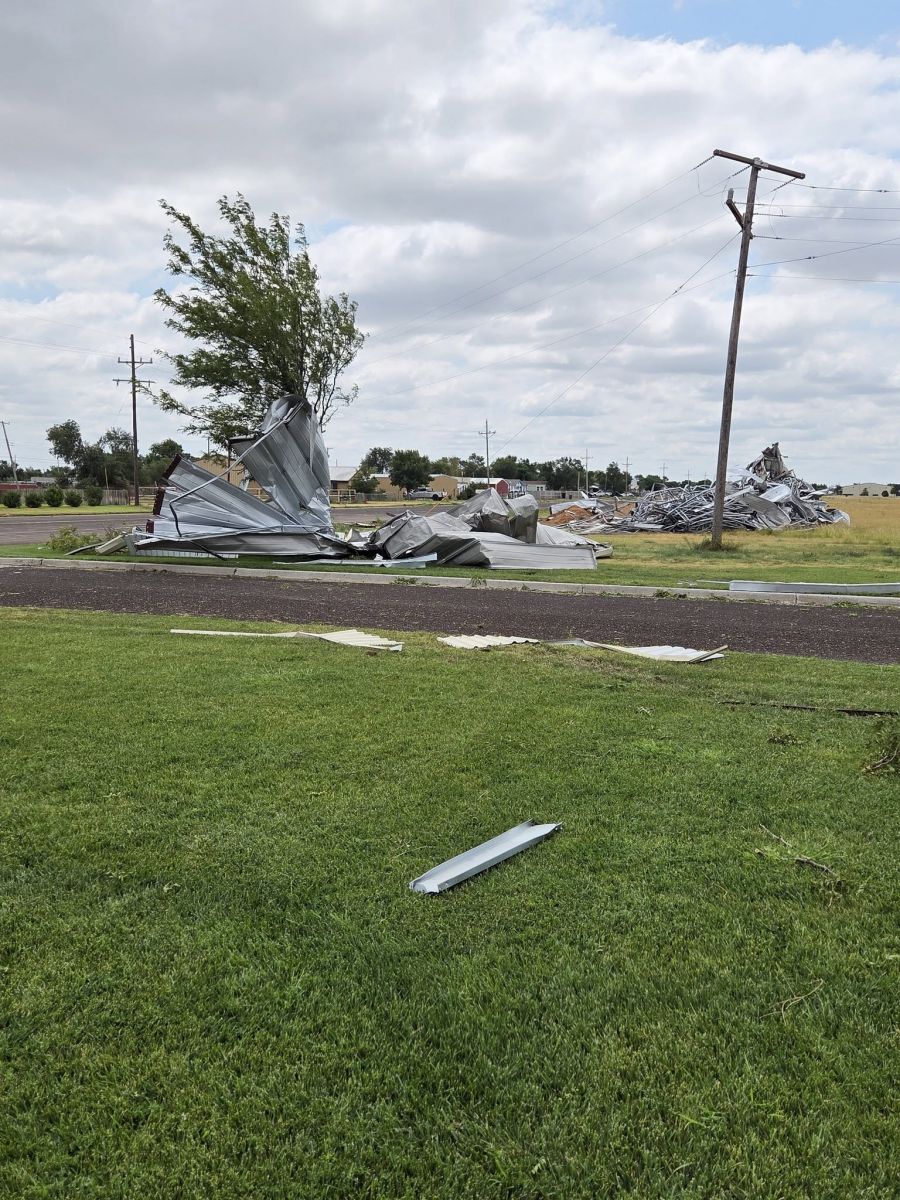
Widespread damage from Sunray to Dumas. Additional damage in Borger to Fritch (not shown).
 |
 |
.jpg) |
.jpg) |
| Severe storm near I-40 west of Vega (Wesley Luginbyhl) |
Severe storm southwest of Vega, Texas around 1:00 AM (Wesley Luginbyhl) |
Sunray football stadium damaged (Kate Griffin) |
Shed destroyed in Sunray (Corbin Voges / KVII) |
 |
.jpg) |
.jpg) |
.jpg) |
| Metal building destroyed in Sunray (Leslie Jinkins) | Powerlines snapped between Sunray and Dumas (Corbin Voges / KVII) |
Circle irrigation blown over between Sunray and Dumas (Corbin Voges / KVII) |
Large tree blown over in Sunray (Kate Griffin) |
Radar
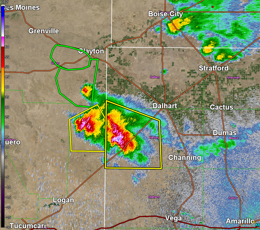
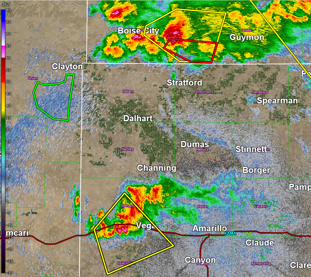
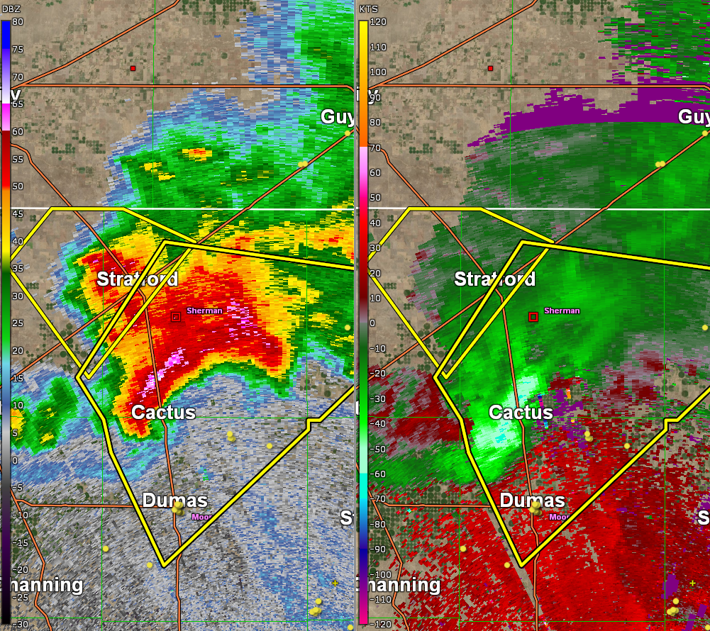
Severe storms gradually moved from northwest to southeast, increasing in coverage overnight.
 |
 |
 |
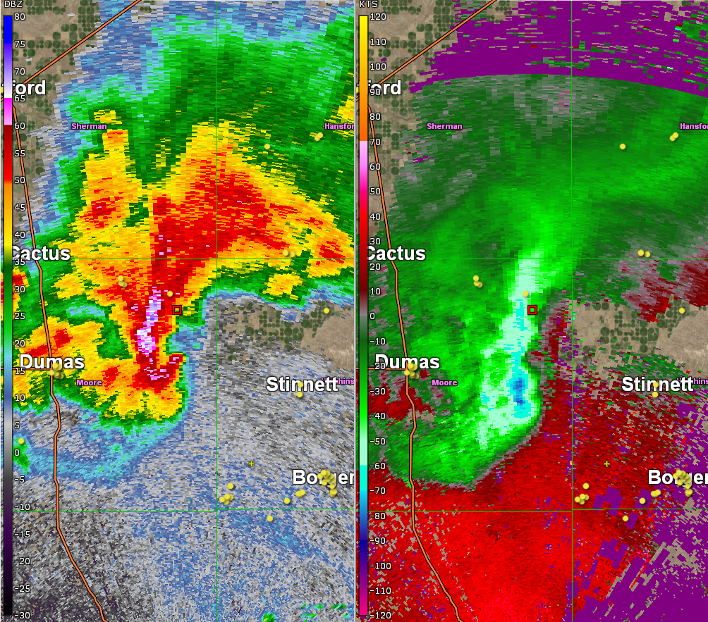 |
| Isolated severe storms began moving into the western TX Panhandle from NM | Storm coverage increased late in the evening, a couple storms even prompted tornado warnings. | A large severe storm showed very strong outflow wind on radar, prompting a "destructive wind" tag in the warning. | The storm produced widespread straight line wind damage from Sunray to Dumas, with additional damage as far south as Borger to Fritch. |
Storm Reports


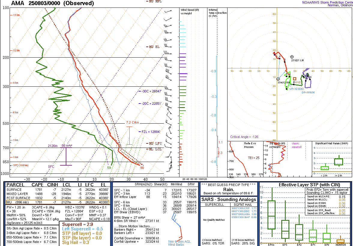
Environment
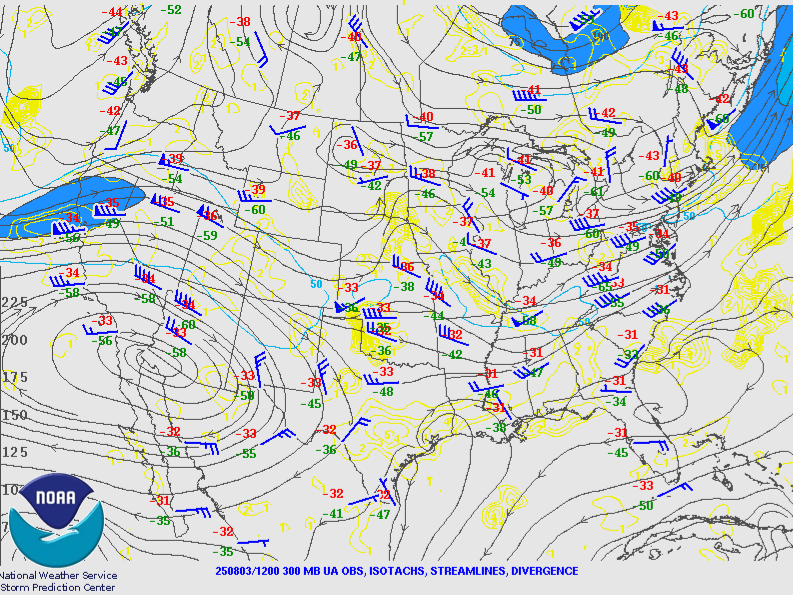
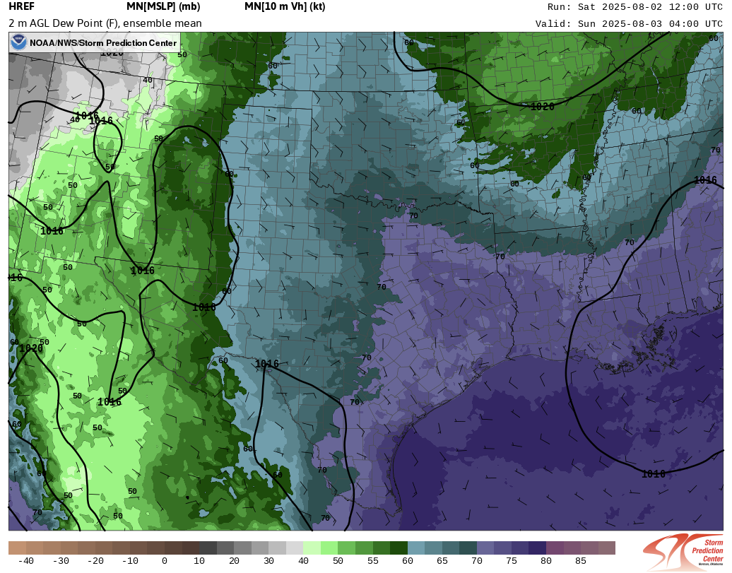
A subtle perturbation in the mid level flow was enough to generate storms as moisture increased overnight. Instability was sufficient for strong updrafts, while shear was sufficient for organization helping updrafts persist.
 |
 |
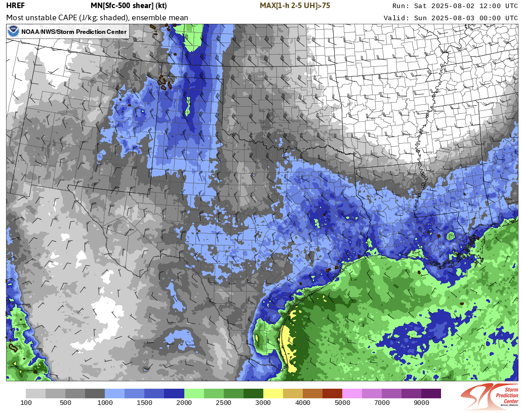 |
| Figure 1: The 500mb map shows high pressure over the far southwest US, helping steer monsoon moisture and subtle waves into the Panhandles from the northwest. | Figure 2: Models showed increasing near surface moisture ahead of the storm activity. | Figure 3: Instability (filled contours) and shear (wind barbs) were more than sufficient for organized severe storms. |
The Saturday evening balloon launch from NWS Amarillo verified what models were showing: Increasing moisture, instability, and shear.
 |
Media use of NWS Web News Stories is encouraged! Please acknowledge the NWS as the source of any news information accessed from this site. |
|

