
Flash flooding threatens areas from the Tennessee Valley to the Carolinas as storms repeat along a stalled front. Monsoonal storms may trigger flooding in the Southwest. Dangerous heat expands across the Desert Southwest, Plains, mid-Mississippi Valley and Southern Tier. Critical fire weather for interior Pacific Northwest. Cooler, drier air brings brief relief to the Great Lakes and Northeast. Read More >
Overview
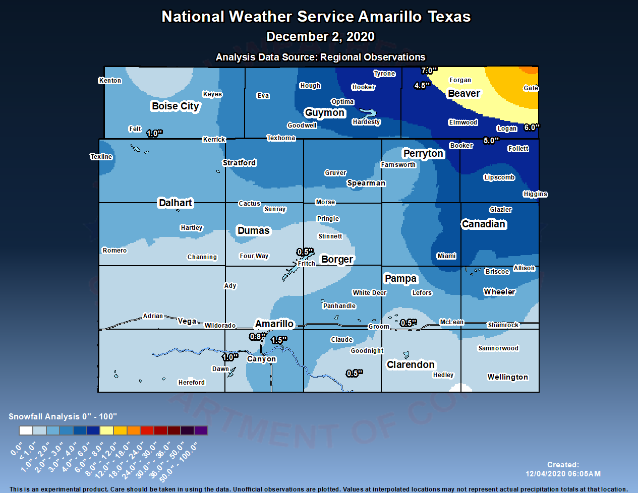
A rapidly evolving winter storm impacted the Panhandles on December 2nd, 2020. Communities across the Panhandles saw forecast snowfall amounts increase significantly over a 48 hour period as a rare south/southeastward moving storm system trekked over the forecast area. Rare in the fact these upper level disturbances do not usually take a southward movement through the spine of the Rockies and produce much--if any--precipitation across the combined Panhandles. In fact, the progression of the upper disturbance usually cuts off moisture and we end up dry; however, this was not the case with this system. This storm system was able to pull in a decent amount of Gulf moisture which eventually wrapped around an area of low pressure and dumped heavy snowfall amounts in the far northeast section of the forecast area. Final snowfall amounts ranged anywhere from an inch in the south central Texas Panhandle to around 6 - 12 inches the eastern Oklahoma Panhandle and far northeast Texas Panhandle. In addition to the snowfall, north winds of 20 to 30 mph with gusts exceeding 40 mph at times lead to reduced visibility due to blowing snow. There were periods where conditions got close to that of a blizzard in the northeast combined Panhandles, as visibility dropped to around 1/2 mile with blowing snow (persistent 1/4 mile needed for a true blizzard). Snowfall was still on the ground in the far northeast combined Panhandles three days after the event occurred.
Snow
We lack timely observations across many areas in the Panhandles, so we rely heavily on satellite and the few observations we do have to interpolate precipitation across the Panhandles. When it comes to estimating snowfall, interpolation can become very difficult. Below are a few examples of estimated snowfall across the area.
 |
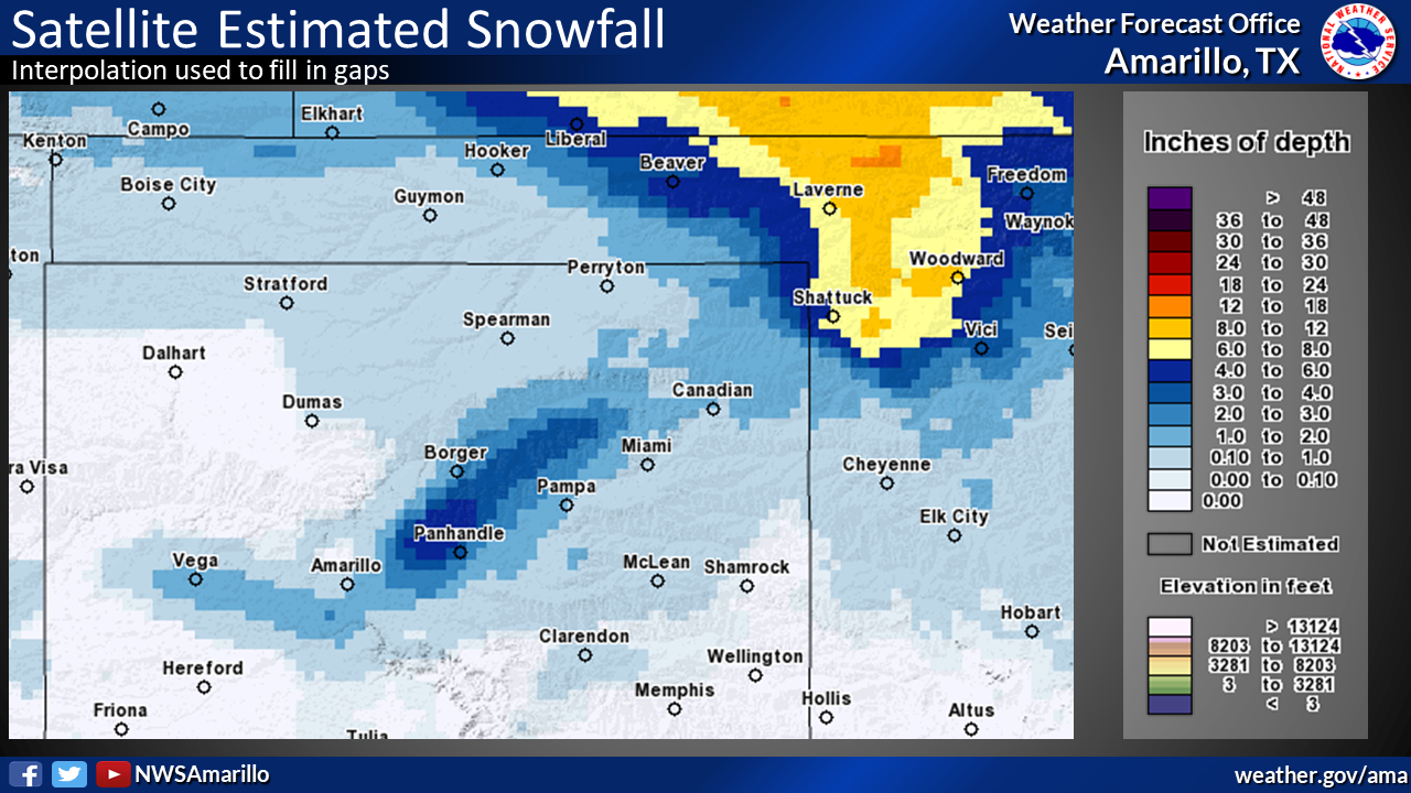 |
| Figure 1: Snowfall Estimate: Observations | Figure 2: Snowfall Estimate: Satellite |
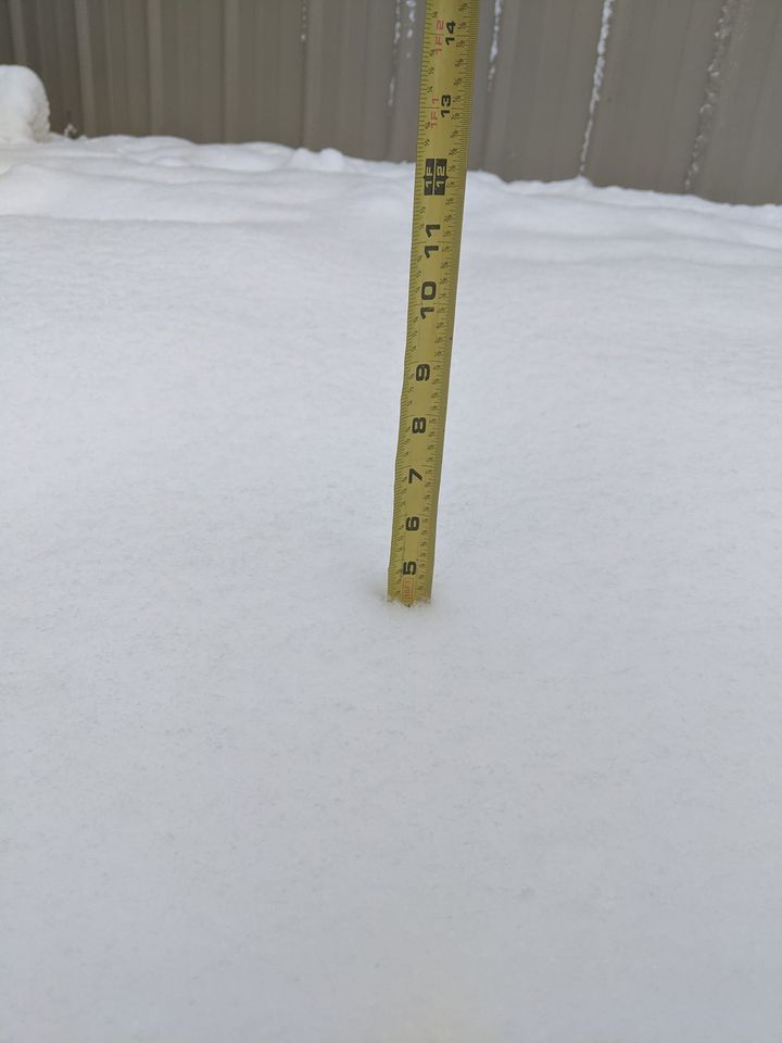
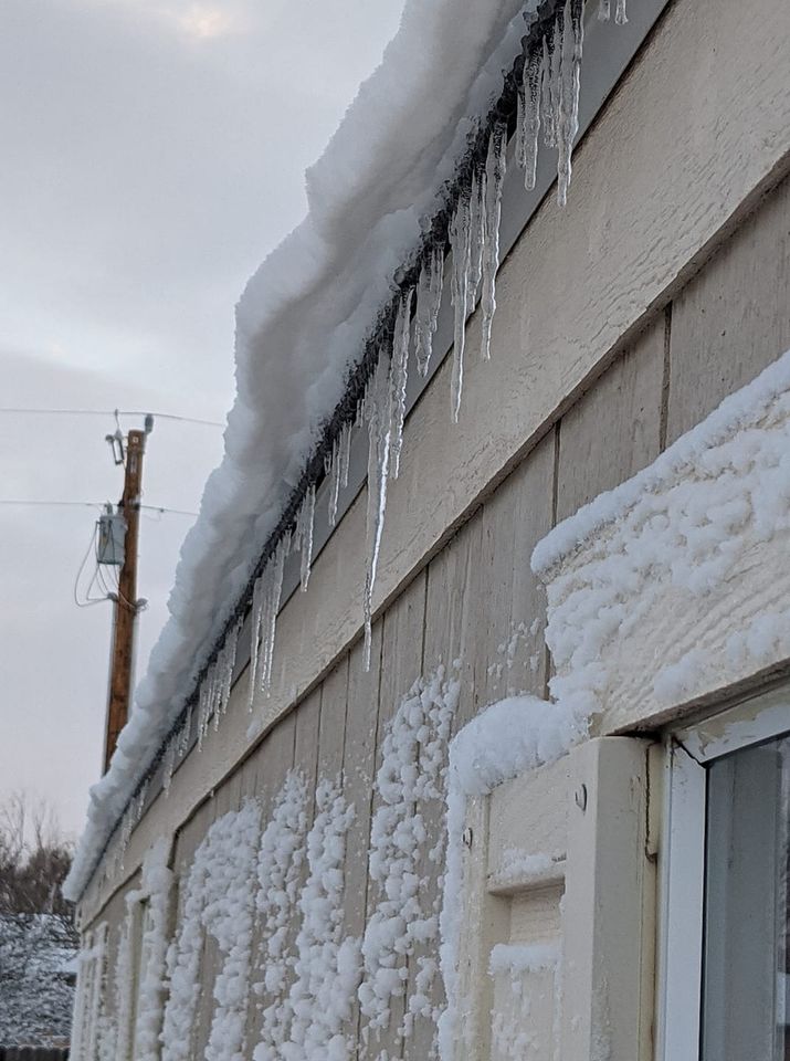
Photos & Video
 |
 |
 |
 |
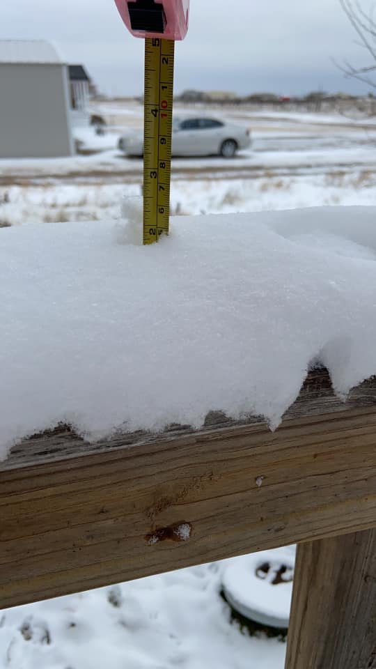
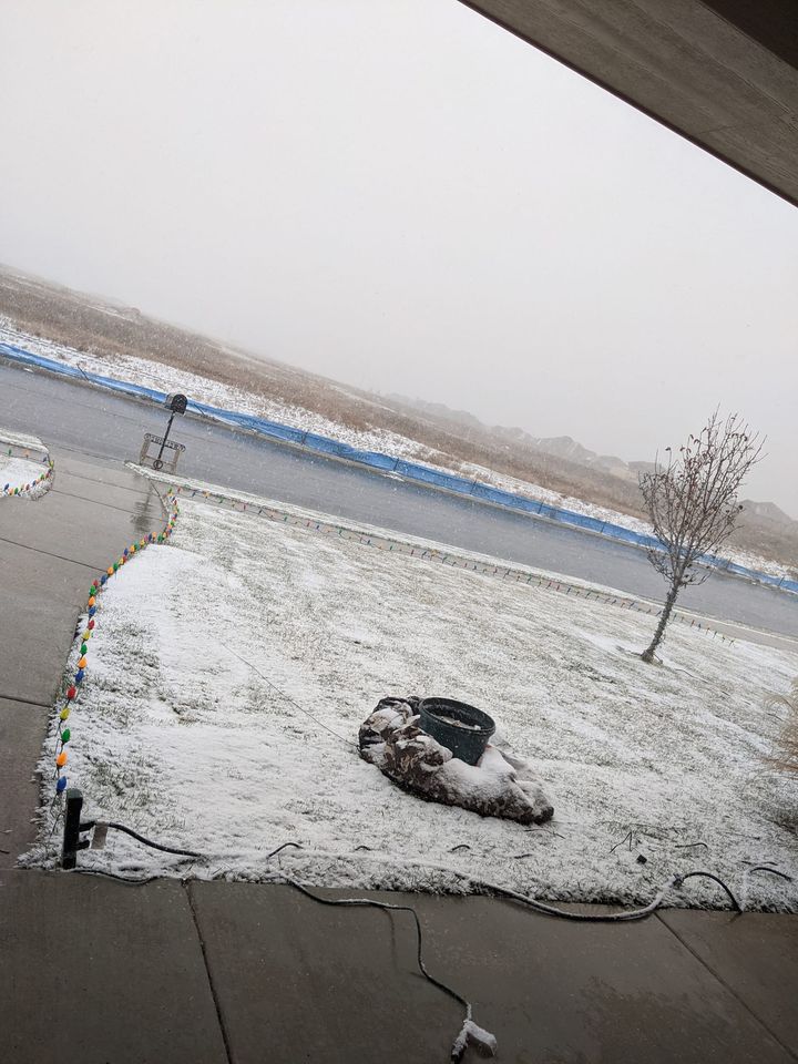
| Turpin, OK (Credit: Abigail Marie Bruner) |
Turpin, OK (Credit: Abigail Marie Bruner) |
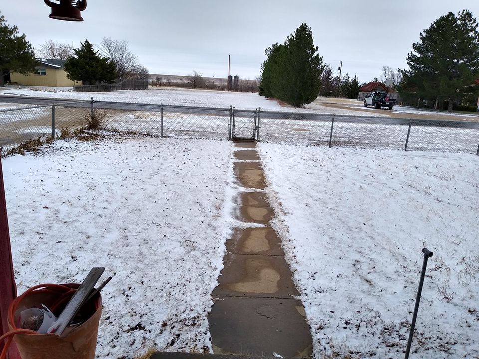
Panhandle, TX (Credit: Christen Jack) |
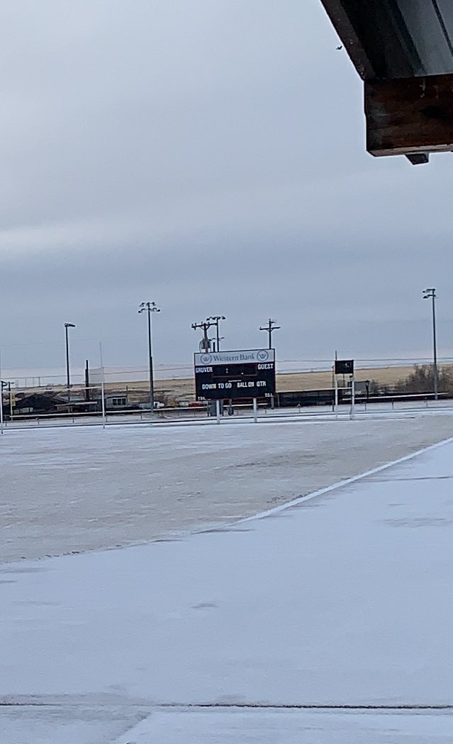
Gruver Football Field (Credit: Greyhounds Booster Club) |
 |
 |
 |
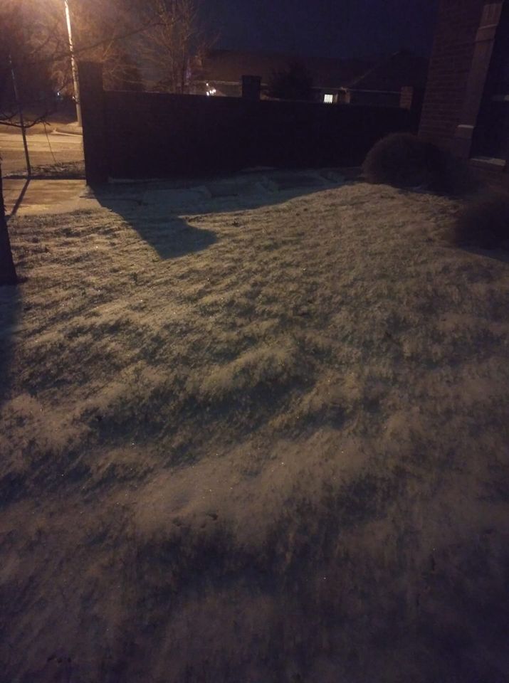 |
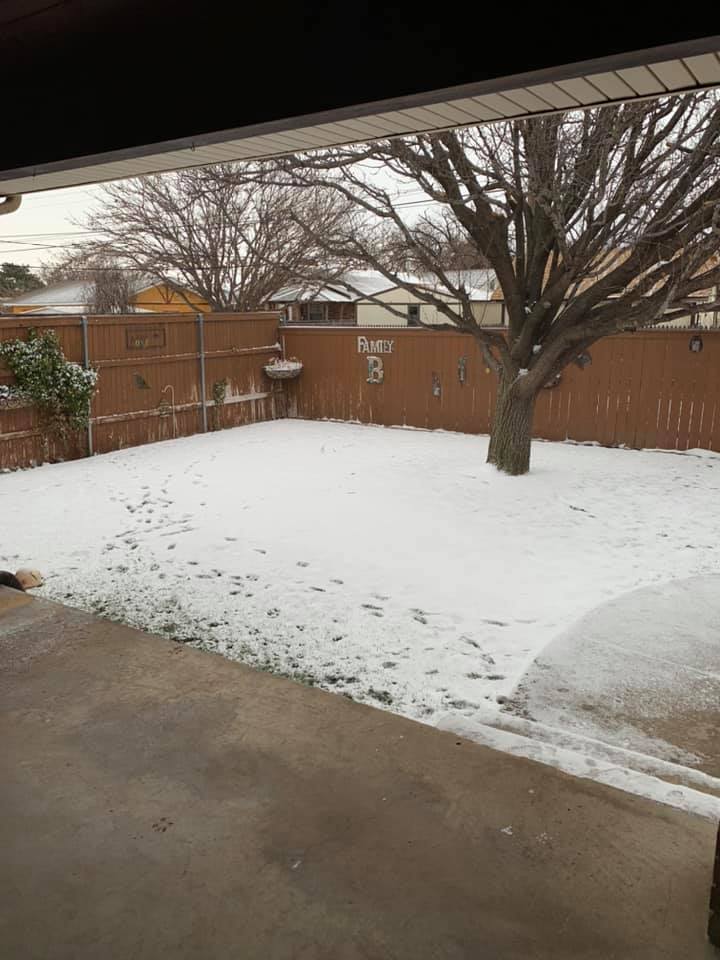
| Morse, TX (Credit: Debbie Brown) |
Pampa, TX (Credit: Josh and Courtney Blackmon) |
Caption (Credit: Megs Jephcott) |
SW Amarillo (Credit: Megan Aplin Jeter) |
Radar
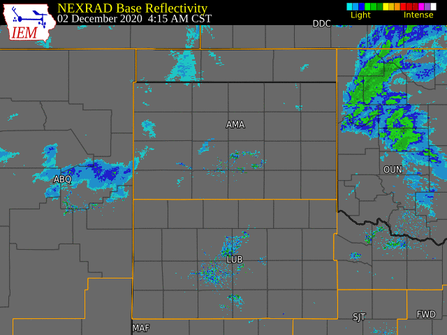 |
| ~24 Hour Radar Loop Ending at 5am Dec 3rd |
Storm Reports
PUBLIC INFORMATION STATEMENT
NATIONAL WEATHER SERVICE AMARILLO TX
224 PM CST THU DEC 3 2020

...SNOWFALL REPORTS FOR DECEMBER 2ND TO 3RD...

LOCATION                     AMOUNT    TIME/DATE       PROVIDER
GATE                         12.0 IN   0800 PM 12/02   EMERGENCY MNGR
8 N FLORIS                   7.0 IN    0700 AM 12/03   COCORAHS
3 S SLAPOUT                  6.0 IN    0530 PM 12/02   PUBLIC
DARROUZETT                   5.0 IN    1238 PM 12/03   FIRE DEPT/RESCUE
2 E FORGAN                   5.0 IN    1030 PM 12/02   EMERGENCY MNGR
HOOKER                       5.0 IN    1256 PM 12/03   EMERGENCY MNGR
TURPIN                       4.5 IN    0852 AM 12/03   PUBLIC
7 N TURPIN                   4.0 IN    0915 PM 12/02   EMERGENCY MNGR
MIAMI                        3.5 IN    1242 PM 12/03   FIRE DEPT/RESCUE
GLAZIER                      3.0 IN    1241 PM 12/03   FIRE DEPT/RESCUE
GUYMON                       3.0 IN    0107 PM 12/03   EMERGENCY MNGR
LIPSCOMB                     3.0 IN    1240 PM 12/03   FIRE DEPT/RESCUE
TEXHOMA                      3.0 IN    0106 PM 12/03   EMERGENCY MNGR
0.6 NE GRUVER                2.0 IN    0654 AM 12/03   COOP
PANHANDLE                    2.0 IN    1059 AM 12/03   PUBLIC
3 E CANYON                   1.7 IN    1015 PM 12/02   NWS EMPLOYEE
4 SSW AMARILLO               1.5 IN    1040 PM 12/02   NWS EMPLOYEE
TEXLINE                      1.5 IN    0530 AM 12/03   COCORAHS
6 ENE AMARILLO               1.3 IN    0158 AM 12/03   OFFICIAL NWS OBS
1 S CANYON                   1.0 IN    0700 AM 12/03   COCORAHS
5 NW CANYON                  1.0 IN    1009 PM 12/02   PUBLIC
DAWN                         1.0 IN    0554 AM 12/03   PUBLIC
1 E FARNSWORTH               1.0 IN    0400 PM 12/02   PUBLIC
3 ESE FELT                   1.0 IN    0800 AM 12/03   COCORAHS
VEGA                         1.0 IN    0114 PM 12/03   LAW ENFORCEMENT
5 SW AMARILLO                0.9 IN    0545 AM 12/03   NWS EMPLOYEE
AMARILLO 4.8 WSW (COCORAHS)  0.8 IN    0700 AM 12/03   COCORAHS
CANADIAN                     0.5 IN    1244 PM 12/03   LAW ENFORCEMENT
3.7 SW LAKE MCCLELLAN        0.5 IN    0738 AM 12/03   COOP
SANFORD                      0.5 IN    0600 AM 12/03   COOP
SUNRAY                       0.5 IN    1050 AM 12/03   PUBLIC
AMARILLO 8.9 SW              0.4 IN    0700 AM 12/03   COCORAHS
PAMPA 2 NNW                  0.2 IN    0630 AM 12/03   COOP
FRITCH 5.1 E                 0.1 IN    0700 AM 12/03   COCORAHS
HEREFORD 1.1 N (COCORAHS)    0.1 IN    0630 AM 12/03   COCORAHS
USDA-ARS (COOP)              0.1 IN    0800 AM 12/03   COOP
WHEELER                      0.1 IN    1240 PM 12/03   EMERGENCY MNGR

OBSERVATIONS ARE COLLECTED FROM A VARIETY OF SOURCES WITH VARYING
EQUIPMENT AND EXPOSURES. WE THANK ALL VOLUNTEER WEATHER OBSERVERS
FOR THEIR DEDICATION. NOT ALL DATA LISTED ARE CONSIDERED OFFICIAL.
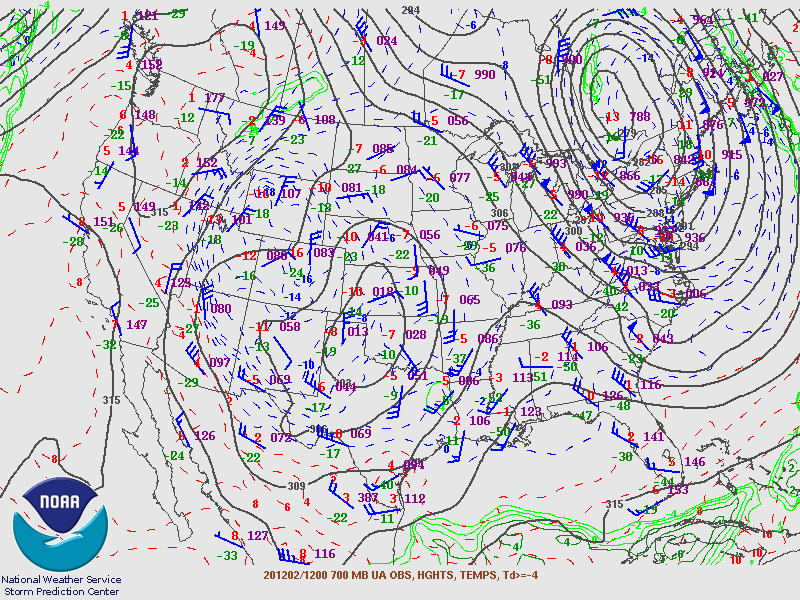
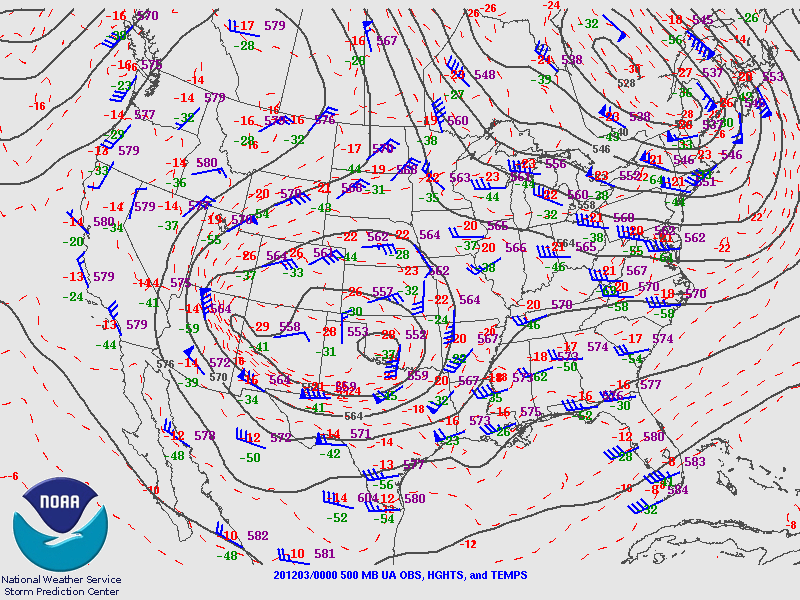
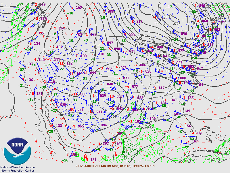
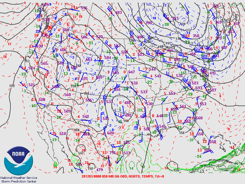
Environment
The two most prominent features for snow production with this storm system lied within the 700mb to 850mb layer where a zone of deformation formed on the back side of an upper low. Frontogenesis in this area was strong and it was coupled with good wrap around moisture from the Gulf of America. Broad large scale lift was lacking due to the position of both the 500mb low and the upper level jet; however, models were picking up on smaller pockets of positive vorticity advection wrapping around the 500mb low lining up over the aforementioned frontogenetic zone. This was also seen in forecast soundings which showed favorable omega values in a moist dendritic growth zone (DGZ). The latter feature was lacking in previous forecasts and was one of the reasons our snowfall amounts were low initially. The day of the event some of the short term/HiRes models started to pick up on strong forcing for ascent occurring through a moist DGZ. Combining the moist atmospheric column and 700/850mb frontogenesis enhancing ascent in the DGZ, it became rather clear there was going to be heavy snowfall very close to the deformation zone.
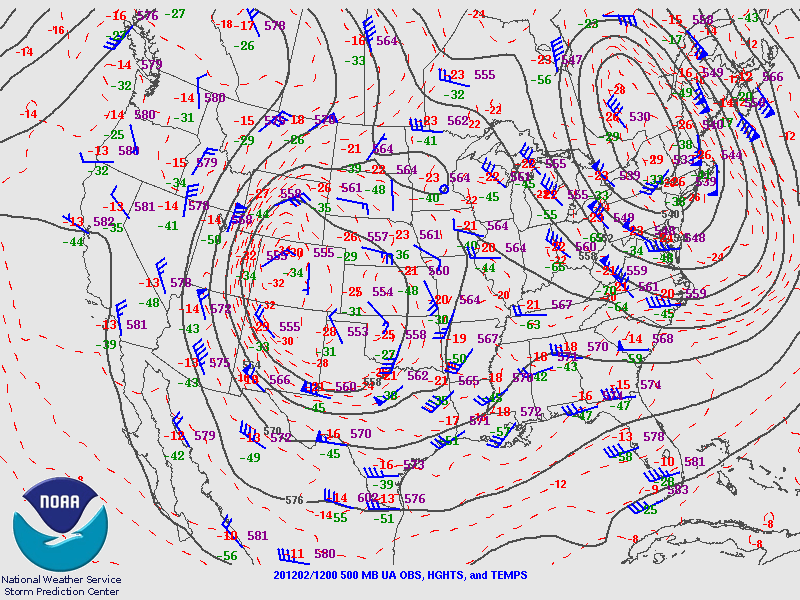 |
 |
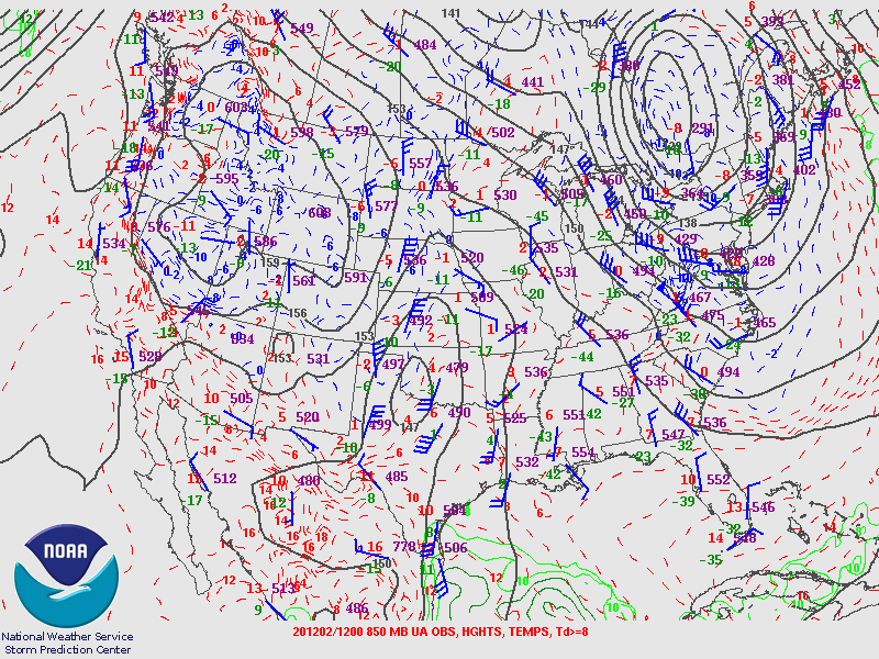 |
| Figure 1: 500mb Heights and Temps | Figure 2: 700mb Heights and Temps | Figure 3: 850 Heights and Temps |
 |
 |
 |
| Figure 1: 500mb Heights and Temps | Figure 2: 700mb Heights and Temps | Figure 3: 850 Heights and Temps |
 |
Media use of NWS Web News Stories is encouraged! Please acknowledge the NWS as the source of any news information accessed from this site. |
|

