
Extreme heat continues today from the central Plains to the lower Mississippi River Valley, over southeast Montana, and from southern California into the Southwest Deserts. Extreme Heat Warnings remain in effect. Severe thunderstorms capable of strong to severe wind gusts and large hail are possible across the Great Lakes into the Ohio Valley today into tonight. Read More >
Overview
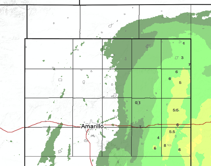
On Jan 3rd, 2019, a compact but vigorous southern stream closed low moved across west Texas and slowed down as it approached the Red River Valley. This allowed plentiful moisture and lift to wrap around the system as it strengthened. Cold air on the backside of the low interacted with increasing moisture to produce a persistent band of snow across the far eastern Texas Panhandle. The heavier snow (6 to 8 inches) fell from Higgins to Canadian to Wheeler to near and west of Wellington. However, areas along and west of Borger to Amarillo stayed high and dry with just a few mid level clouds.
Fig 1: Mid-level water vapor imagery from GOES 16 shows the low pressure system as it moves east along the Red River Valley.
Fig 2: GOES 16 CIRA Geocolor reveals snow over the eastern Texas Panhandle and western Oklahoma as the sun rises on Jan 4th.
Snow/Ice
Up to 8 inches of snow fell in the eastern Panhandles on January 3rd.
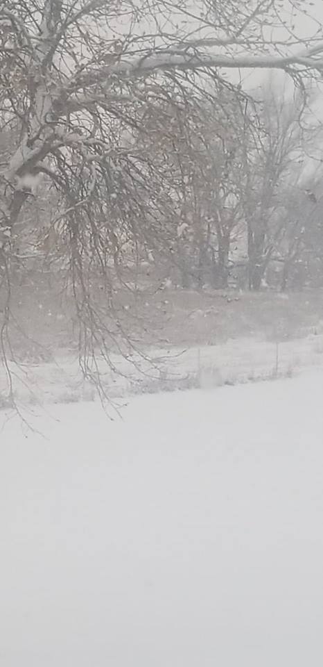
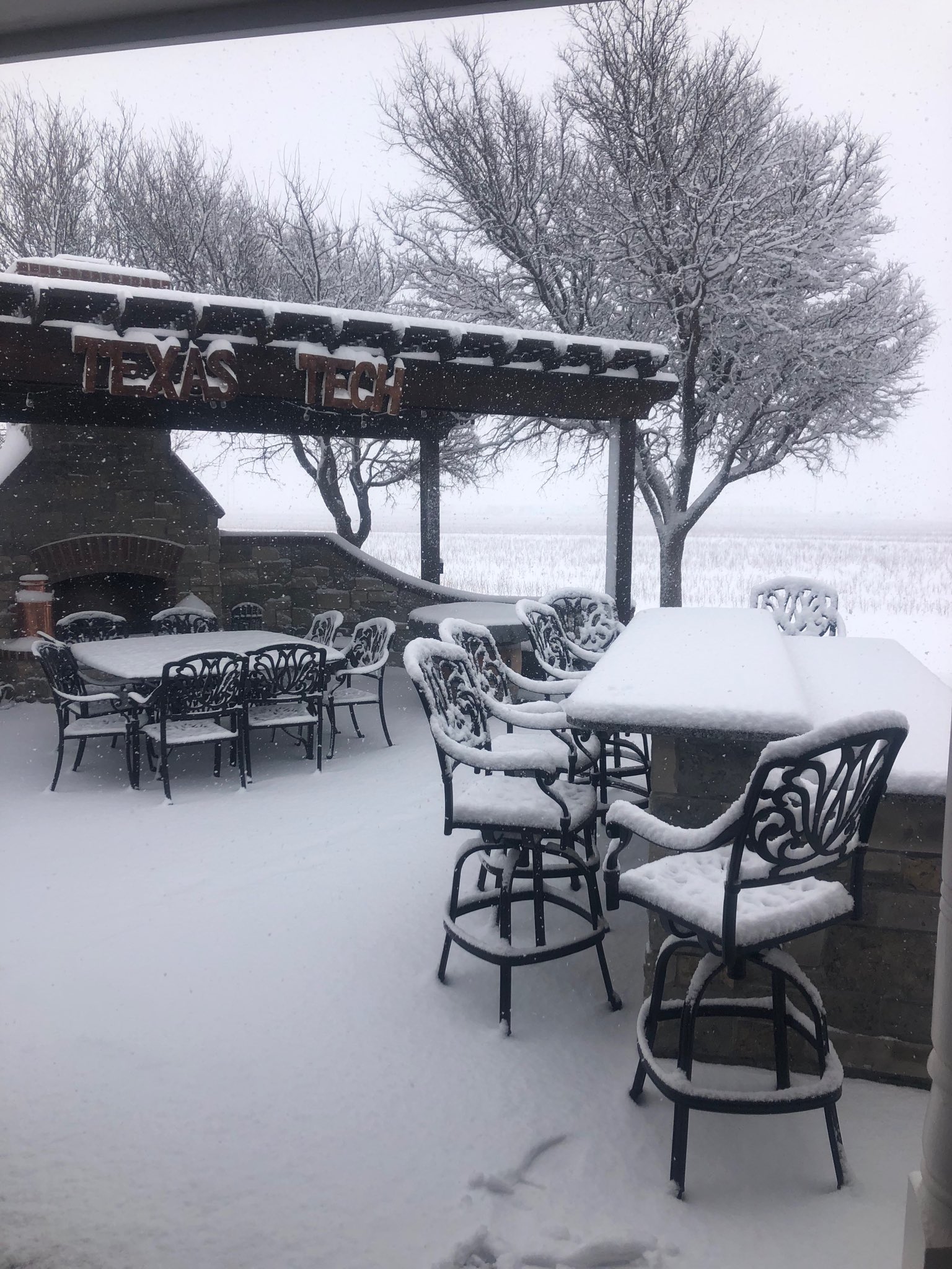
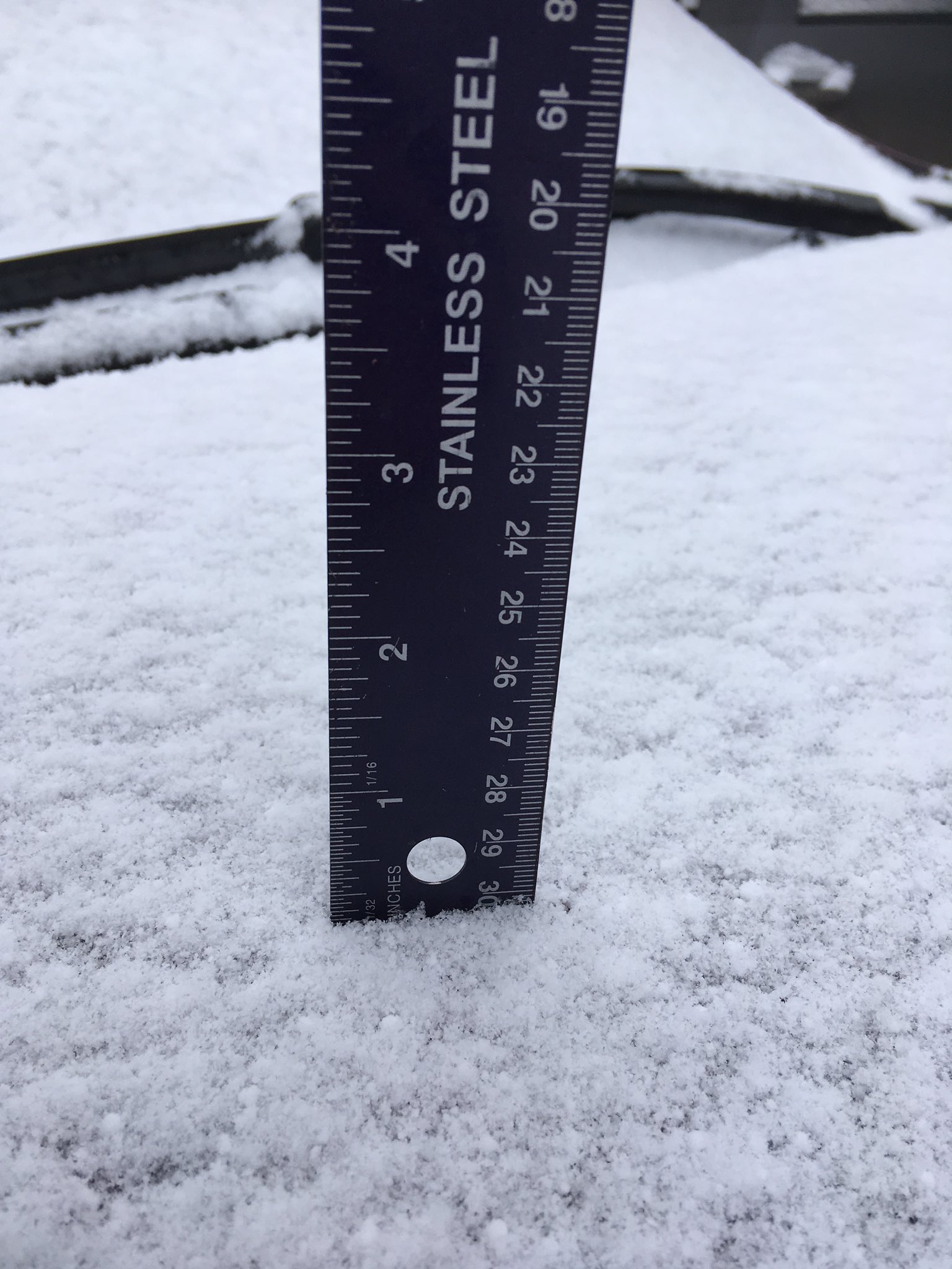
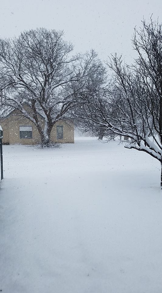
Photos & Video
 |
 |
 |
|
Heavy Snow in Lela, TX
|
2.5 inches early on in Wellington, TX
|
Light snow in Slapout, OK
|
 |
|
More than 5" snow in Hedley, TX
|
Storm Reports
PRELIMINARY LOCAL STORM REPORT...SUMMARY
NATIONAL WEATHER SERVICE AMARILLO TX
1001 AM CST FRI JAN 04 2019
..TIME... ...EVENT... ...CITY LOCATION... ...LAT.LON...
..DATE... ....MAG.... ..COUNTY LOCATION..ST.. ...SOURCE....
..REMARKS..
1007 AM SNOW 1 E WHEELER 35.44N 100.26W
01/03/2019 E2.5 INCH WHEELER TX TRAINED SPOTTER
SNOW ONGOING
1020 AM SNOW WELLINGTON 34.85N 100.21W
01/03/2019 E3.0 INCH COLLINGSWORTH TX EMERGENCY MNGR
SNOW ONGOING
1050 AM SNOW 6 E LIPSCOMB 36.22N 100.16W
01/03/2019 E3.0 INCH LIPSCOMB TX TRAINED SPOTTER
1110 AM SNOW WELLINGTON 34.85N 100.21W
01/03/2019 E5.5 INCH COLLINGSWORTH TX PUBLIC
SECONDHAND REPORT. EXACT LOCATION ESTIMATED. SNOW
ONGOING.
1122 AM SNOW ALLISON 35.61N 100.10W
01/03/2019 E3.5 INCH WHEELER TX FIRE DEPT/RESCUE
FIRE CHIEF REPORTS 3 TO 4 INCHES WITH SNOW STILL
FALLING.
1124 AM SNOW CANADIAN 35.91N 100.38W
01/03/2019 E2.5 INCH HEMPHILL TX LAW ENFORCEMENT
SHERIFF'S OFFICE REPORTS AN ESTIMATE OF 2 TO 3 INCHES
WITH SNOW CONTINUING TO FALL.
1129 AM SNOW 14 S MCLEAN 35.03N 100.60W
01/03/2019 E4.0 INCH DONLEY TX TRAINED SPOTTER
REPORT FROM TRAINED SPOTTER OF AN ESTIMATED 4 INCHES
WITH SNOW ONGOING.
1134 AM SNOW SHAMROCK 35.22N 100.25W
01/03/2019 M5.0 INCH WHEELER TX BROADCAST MEDIA
BROADCAST MEDIA RELAY OF A PUBLIC REPORT. MEASUREMENT
WITH PICTURE.
1202 PM SNOW WHEELER 35.44N 100.28W
01/03/2019 E4.0 INCH WHEELER TX TRAINED SPOTTER
SNOW ONGOING
1239 PM HEAVY SNOW SHAMROCK 35.22N 100.25W
01/03/2019 E6.0 INCH WHEELER TX TRAINED SPOTTER
1242 PM SNOW WELLINGTON 34.85N 100.21W
01/03/2019 E5.0 INCH COLLINGSWORTH TX EMERGENCY MNGR
EMERGENCY MANAGER REPORTS AN ESTIMATED 5 INCHES WITH A
BREAK IN THE SNOW.
1248 PM SNOW HEDLEY 34.87N 100.66W
01/03/2019 M5.5 INCH DONLEY TX PUBLIC
REPORT VIA SOCIAL MEDIA WITH PICTURE
0107 PM SNOW HIGGINS 36.12N 100.03W
01/03/2019 E4.5 INCH LIPSCOMB TX TRAINED SPOTTER
TRAINED SPOTTER REPORTS AN ESTIMATED 4 TO 5 INCHES OF
SNOW WITH HEAVY SNOW ONGOING.
0109 PM SNOW 2 NNE DOZIER 35.11N 100.33W
01/03/2019 M4.5 INCH COLLINGSWORTH TX TRAINED SPOTTER
TRAINED SPOTTER MEASURED MULTIPLE SPOTS WITH 4.5 INCHES
AND SNOW IS STILL ONGOING.
0139 PM SNOW WHEELER 35.44N 100.28W
01/03/2019 M5.5 INCH WHEELER TX BROADCAST MEDIA
BROADCAST MEDIA RELAY OF A PUBLIC REPORT. MEASUREMENT
WITH PICTURE
0217 PM SNOW 4 SSW LAKE MARVIN 35.85N 100.20W
01/03/2019 E5.0 INCH HEMPHILL TX TRAINED SPOTTER
0221 PM HEAVY SNOW HIGGINS 36.12N 100.03W
01/03/2019 E7.0 INCH LIPSCOMB TX TRAINED SPOTTER
SPOTTER ESTIMATES 6 TO 8 INCHES OF SNOW IN HIGGINS.
ROADS SNOW PACKED.
0301 PM HEAVY SNOW CANADIAN 35.91N 100.39W
01/03/2019 E6.0 INCH HEMPHILL TX TRAINED SPOTTER
0325 PM SNOW 3 N DOZIER 35.12N 100.35W
01/03/2019 M5.5 INCH COLLINGSWORTH TX TRAINED SPOTTER
0400 PM HEAVY SNOW HEDLEY 34.87N 100.66W
01/03/2019 E6.0 INCH DONLEY TX PUBLIC
CHATTED WITH PUBLIC THAT MEASURED 5.5 INCHES EARLIER ON
SOCIAL MEDIA. PERSON NOTED THAT SNOW CONTINUED AFTER THE
MEASUREMENT AND IT LIKELY REACHED 6 INCHES OR SLIGHTLY
MORE BEFORE THE MELTING TOOK PLACE IN THE LATE
AFTERNOON.
0427 PM SNOW 1 N DOZIER 35.10N 100.34W
01/03/2019 M5.5 INCH COLLINGSWORTH TX TRAINED SPOTTER
FINAL MEASUREMENT. SNOW HAS ENDED.
0800 PM HEAVY SNOW 4 W QUAIL 34.91N 100.48W
01/03/2019 M8.0 INCH COLLINGSWORTH TX PUBLIC
LATE REPORT: MEASURED 8 INCHES ON FLAT GROUND AFTER
SNOW HAD ENDED.
0800 PM HEAVY SNOW WELLINGTON 34.85N 100.21W
01/03/2019 E6.0 INCH COLLINGSWORTH TX EMERGENCY MNGR
LATE REPORT: FINAL MEASUREMENT WAS 5.5 INCHES WITH AN
ESTIMATED ADDITIONAL HALF INCH BEFORE SNOW ENDED FOR A
TOTAL OF 6 INCHES.
 |
Media use of NWS Web News Stories is encouraged! Please acknowledge the NWS as the source of any news information accessed from this site. |
|

