
Dangerous and extreme heat will remain across portions of the Central U.S. this week, persisting across the Mid to Lower Mississippi Valleys, Gulf Coast, Southern Plains and portions of Texas. A heat wave over the Southwest will intensify late this week. Severe thunderstorms and flash flooding will spread from the Great Lakes/Ohio Valley to the Mid-Atlantic and Northeast the next few days. Read More >
Overview
A strong low pressure system brought severe winds and snow to the combined Panhandles. With sustained winds reaching 35 to 45 mph with gusts up to 74 mph combined with snow, much of the area saw blizzard to near blizzard conditions. The Oklahoma and Texas Departments of Transportation were forced to shutdown roadways as motorists got stranded in the snow with near zero visibiltiy and no way for emergency personnel to reach them. Roads west and north of Amarillo, TX were impacted for much of the afternoon through evening hours of the 8th. Amarillo east and southeastward, while experiencing the same strong winds, only experienced shorter durations of low visibility and less impact from the snow compared to the northwestern Panhandles.
Snow and Blizzard
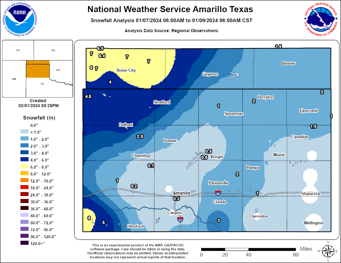 |
| Map of estimated snowfall amounts during the January 8th, 2024 blizzard based on reports we received. Snowfall amounts are highly uncertain due to the high amount of drifting that occurred during the event. (Reports collated by NWS; map by NWS GAZPACHO) |
Due to the strong winds, accurately measuring snowfall was a challenge. We greatly thank trained spotters, CoCoRaHs observers, and COOP observers for their efforts.
| Time (CST) | Location | Event Type | Amount | Source | Remarks |
| 2024/01/09 17:00 | Boise City | SNOW | 6.5 | Trained Spotter | Spotter estimated 6 to 7 inches of snow in Boise City. |
| 2024/01/09 08:00 | 4 NNE Black Mesa Park | SNOW | 6.4 | Cocorahs | Cocorahs station OK-CM-9 Kenton 6.1 E. |
| 2024/01/08 15:53 | 1 SE Dalhart | SNOW | 4.7 | CO-OP Observer | |
| 2024/01/09 07:00 | 1 SE Dalhart | SNOW | 4.7 | CO-OP Observer | CO-OP Observer station DHRT2 Dalhart 2SE. |
| 2024/01/09 05:30 | Texline | SNOW | 4.5 | Cocorahs | Cocorahs station TX-DL-1 Texline 0.3 WNW. |
| 2024/01/09 06:30 | Dalhart | SNOW | 4 | Public | Observed snow depth report. Photo submitted via social media. |
| 2024/01/09 08:00 | 3 ESE Felt | SNOW | 4 | Cocorahs | Cocorahs station OK-CM-11 Felt 2.8 ESE. |
| 2024/01/08 11:30 | Texline | SNOW | 3 | CO-OP Observer | |
| 2024/01/08 14:00 | Hartley | SNOW | 2.5 | Public | Photo submitted via social media. |
| 2024/01/08 13:30 | Dalhart | SNOW | 2 | Public | Photo submitted via social media. |
| 2024/01/09 07:00 | Farnsworth | SNOW | 2 | Cocorahs | Cocorahs station TX-OC-6 Perryton 10.4 WSW. |
| 2024/01/09 06:00 | Glazier | SNOW | 1.5 | CO-OP Observer | CO-OP Observer station GLZT2 Glazier. |
| 2024/01/09 07:00 | 8 N Floris | SNOW | 1.5 | Cocorahs | Cocorahs station OK-BV-5 Forgan 10.4 NW (COCORAHS). |
| 2024/01/09 06:30 | 1 NW Pampa | SNOW | 1 | CO-OP Observer | CO-OP Observer station PAPT2 Pampa. |
| 2024/01/09 06:30 | 1 NE Gruver | SNOW | 1 | CO-OP Observer | CO-OP Observer station GRUT2 Gruver. |
| 2024/01/09 07:31 | 4 WSW Lake Mcclellan | SNOW | 1 | CO-OP Observer | CO-OP Observer station JERT2 Jericho. |
| 2024/01/09 08:00 | 1 NNE Higgins | SNOW | 1 | CO-OP Observer | CO-OP Observer station HIGT2 Higgins. |
| 2024/01/08 07:40 | Texline | BLIZZARD | Dept of Highways | Snow and reduced visibility was observed on a sky camera in Texline before 8 AM. A Texline mesonet observed 35 mph winds starting around 0740CST and lasting through 2140CST. US 87 from Dalhart to the New Mexico state line was closed by TXdot starting around 1045CST due to low or zero visibility. | |
| 2024/01/08 10:40 | Boise City | BLIZZARD | Emergency Mngr | Cimarron County started experiencing winds of 35 mph or greater around 1040CST. Combination of snow and winds resulted in near zero visibility with multiple stranded motorist and emergency personnel unable to reach them. Roads remained closed well into the 9th of Jan. Blizzard winds ended around 0120CST on the 9th. | |
| 2024/01/08 10:45 | 4 SW Dalhart | BLIZZARD | Dept of Highways | US Highway 54 and 87/387 were closed by TXdot during the early afternoon hours due to motorist getting stranded in low to zero visibility. The ASOS at the Dalhart Airport started reporting 1/4 mile visibility from 1045CST to 1735CST with blowing snow and winds greater than 35 mph in this time period as well. | |
| 2024/01/08 12:45 | 2 W Vega | BLIZZARD | Dept of Highways | Blizzard level winds were reached starting at 1245CST and lasted through 1819CST. Snow and winds leading to near zero visibility and snow covered surfaces led to TXdot shutting down I-40 from Soncy Rd in Amarillo westward all the way to the New Mexico Stateline starting around 1330CST and lasting through much of the evening. | |
| 2024/01/08 15:37 | 2 SW Hereford | BLIZZARD | Dept of Highways | Both westbound US60 and southbound 385 coming out of Hereford are close. | |
| 2024/01/08 16:54 | Dumas | BLIZZARD | Law Enforcement | White conditions being reported across Moore County. Stranded motorists have gotten stuck with snow up to floor boards of the vehicles. Emergency personnel are unable to rescue the stranded motorists at this time due to the white conditions. | |
| 2024/01/08 23:35 | Stratford | BLIZZARD | Dept of Highways | TXDot closed all major roads through Sherman County due to motorists getting stranded in near zero visibility. Blizzard level winds were reached at a mesonet around 1135CST and lasted through 2205CST. | |
| 2024/01/08 23:40 | 1 N Guymon | BLIZZARD | Dept of Highways | OK DoT closed all major roads in Texas County due to motorists getting stranded in near zero visibility during the afternoon. Many roads stayed closed well into the morning of the 9th. Blizzard level winds started around 1140CST with snow ongoing, and lasted through about 0130CST on the 9th. | |
| 2024/01/09 00:55 | Boise City | BLIZZARD | Emergency Mngr | Several stranded motorists. All roads are closed. Several 4 to 5 foot drifts north and south of Boise City and between Boise City and Keyes. 10 foot drift around a vehicle 2 miles southeast of Boise City. Several 3 to 4 foot drifts in Kenton. Snowfall estimated at 6 to 8 inches from Keyes to Boise City. Still zero visibility in blowing snow. |
Wind
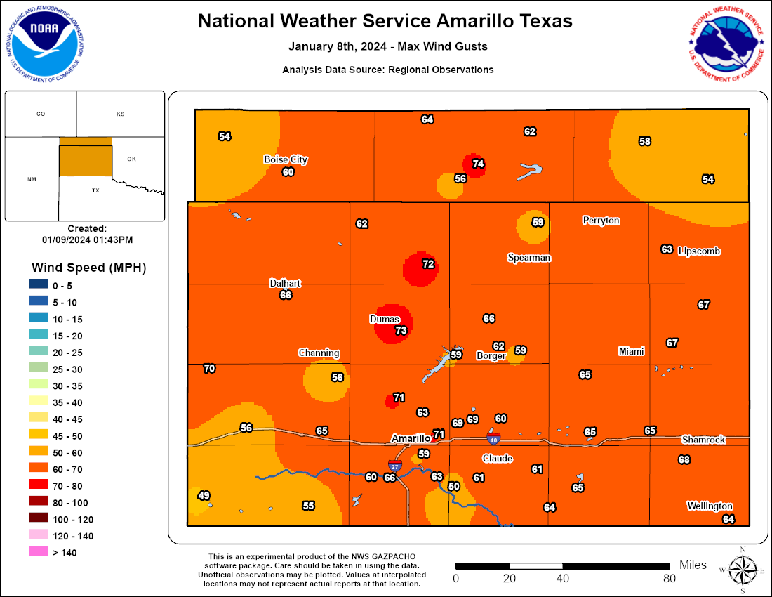 |
| Map of peak gusts across the Oklahoma and Texas Panhandles on January 8th, 2024. (Reports collected by NWS Amarillo using NWS/FAA ASOS/AWOS, West Texas Mesonet, and Oklahoma Mesonet equipment) |
| Time (CST) | Location | State | Gust (mph) | Source |
| 2024/01/08 13:30 | 2 W Guymon | OK | 74 | ASOS |
| 2024/01/08 14:49 | 3 SE Dumas | TX | 73 | Mesonet |
| 2024/01/08 13:31 | 9 NNE Sunray | TX | 72 | Mesonet |
| 2024/01/08 15:37 | 6 ENE Amarillo | TX | 71 | ASOS |
| 2024/01/08 16:02 | Borger | TX | 70 | ASOS |
| 2024/01/08 12:25 | 11 SSW Romero | TX | 69 | Mesonet |
| 2024/01/08 14:01 | 4 WSW Pantex | TX | 69 | Mesonet |
| 2024/01/08 15:54 | 1 ESE Pantex | TX | 69 | Mesonet |
| 2024/01/08 12:58 | 3 SE Dumas | TX | 68 | Mesonet |
| 2024/01/08 13:19 | 11 ESE Valley de Oro | TX | 68 | Mesonet |
| 2024/01/08 20:11 | 3 W Dozier | TX | 68 | Mesonet |
| 2024/01/08 17:29 | 10 E Miami | TX | 67 | Mesonet |
| 2024/01/08 18:09 | 6 E Canadian | TX | 67 | Mesonet |
| 2024/01/08 14:33 | 1 W Canyon | TX | 66 | Mesonet |
| 2024/01/08 14:26 | 4 E Vega | TX | 65 | Mesonet |
| 2024/01/08 15:21 | 1 NNW Stinnett | TX | 65 | Mesonet |
| 2024/01/08 15:55 | 2 WSW Clarendon | TX | 65 | Mesonet |
| 2024/01/08 16:07 | 12 SW Claude | TX | 65 | Mesonet |
| 2024/01/08 16:29 | 7 SSE Amarillo | TX | 65 | Mesonet |
| 2024/01/08 16:52 | 2 NW Lake Mcclellan | TX | 65 | Mesonet |
| 2024/01/08 17:30 | 1 E Mclean | TX | 65 | Mesonet |
| 2024/01/08 18:40 | 2 E Pampa | TX | 65 | Mesonet |
| 2024/01/08 13:45 | 12 NE Eva | OK | 64 | Mesonet |
| 2024/01/08 16:06 | 14 E Wayside | TX | 64 | Mesonet |
| 2024/01/08 16:15 | Spearman | TX | 64 | AWOS |
| 2024/01/08 16:24 | 7 E Borger | TX | 64 | Mesonet |
| 2024/01/08 19:29 | 6 SE Wellington | TX | 64 | Mesonet |
| 2024/01/08 11:47 | 3 SW Dalhart | TX | 63 | ASOS |
| 2024/01/08 14:18 | 9 NNE Amarillo | TX | 63 | Mesonet |
| 2024/01/08 15:31 | 3 NNW Palo Duro Canyon | TX | 63 | Mesonet |
| 2024/01/08 13:55 | Dumas | TX | 62 | AWOS |
| 2024/01/08 15:15 | 1 W Hooker | OK | 62 | Mesonet |
| 2024/01/08 16:49 | 8 W Lipscomb | TX | 62 | Mesonet |
| 2024/01/08 13:32 | 4 WNW Stratford | TX | 61 | Mesonet |
| 2024/01/08 15:32 | Goodnight | TX | 61 | Mesonet |
| 2024/01/08 13:45 | 3 SSE Boise City | OK | 60 | Mesonet |
| 2024/01/08 14:24 | 3 NNE Umbarger | TX | 60 | Mesonet |
| 2024/01/08 16:35 | 6 SSW Lake Meredith | TX | 60 | AWOS |
| 2024/01/08 17:14 | 1 SSW Panhandle | TX | 60 | Mesonet |
| 2024/01/08 11:48 | 2 N Texline | TX | 59 | Mesonet |
| 2024/01/08 15:14 | 10 NW Waka | TX | 59 | Mesonet |
| 2024/01/08 15:50 | 1 SSW Beaver | OK | 59 | Mesonet |
| 2024/01/08 17:01 | 1 WNW Fritch | TX | 59 | Mesonet |
| 2024/01/08 17:15 | Pampa | TX | 59 | AWOS |
Photos & Video
 |
 |
 |
 |
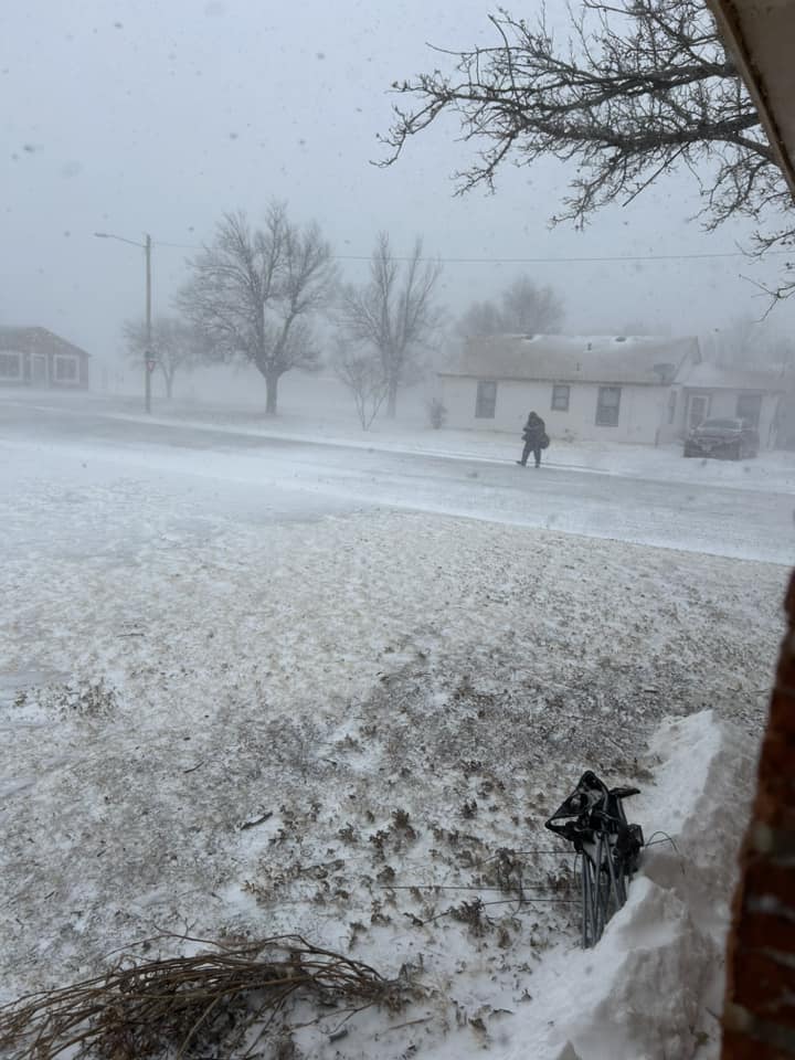
| Neither snow nor rain nor heat nor gloom of night stays these couriers from the swift completion of their appointed rounds in Dumas, Texas (Damian and Kandra Dominguez) |
Snow and low visibility in Stratford, Texas (Savannah Copley) |
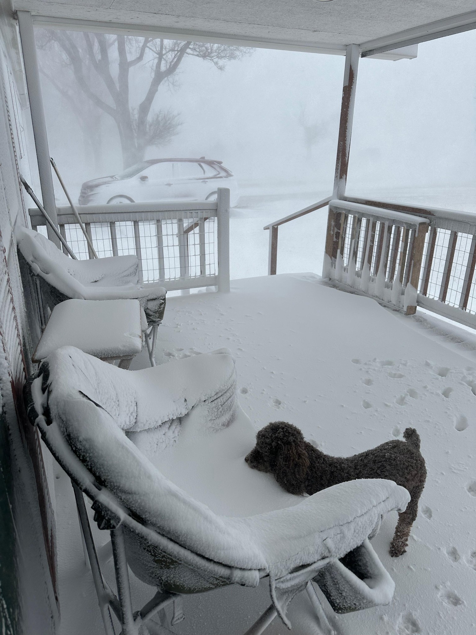
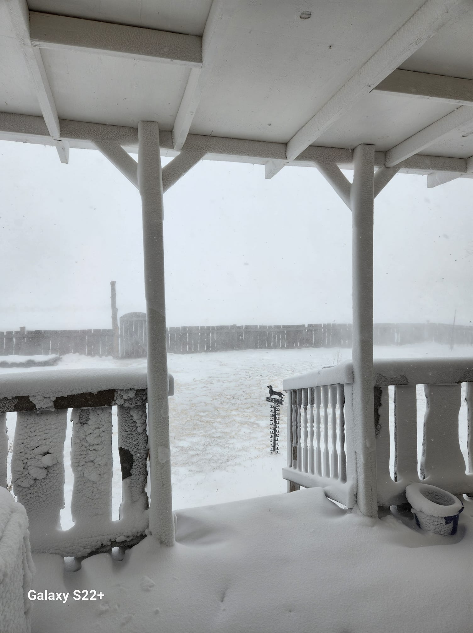
Snowy porch and canine friend around 10 miles west of Hooker, Oklahoma (Lori Judd Kraft) |
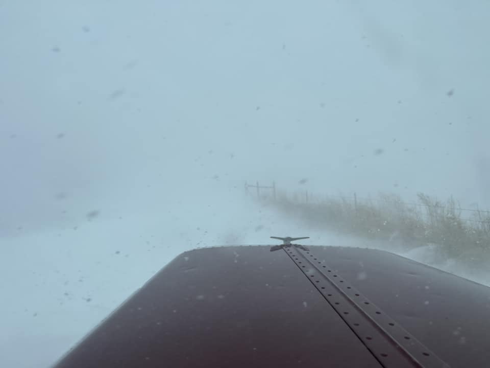
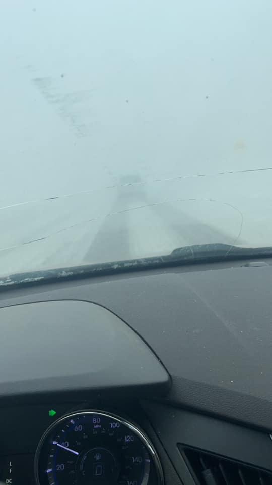
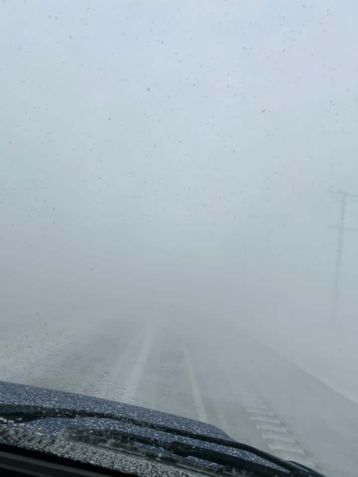
Trucker stuck in very low visibility between Dumas and Hartley (Sam C. Bezner) |
 |
 |
 |
 |
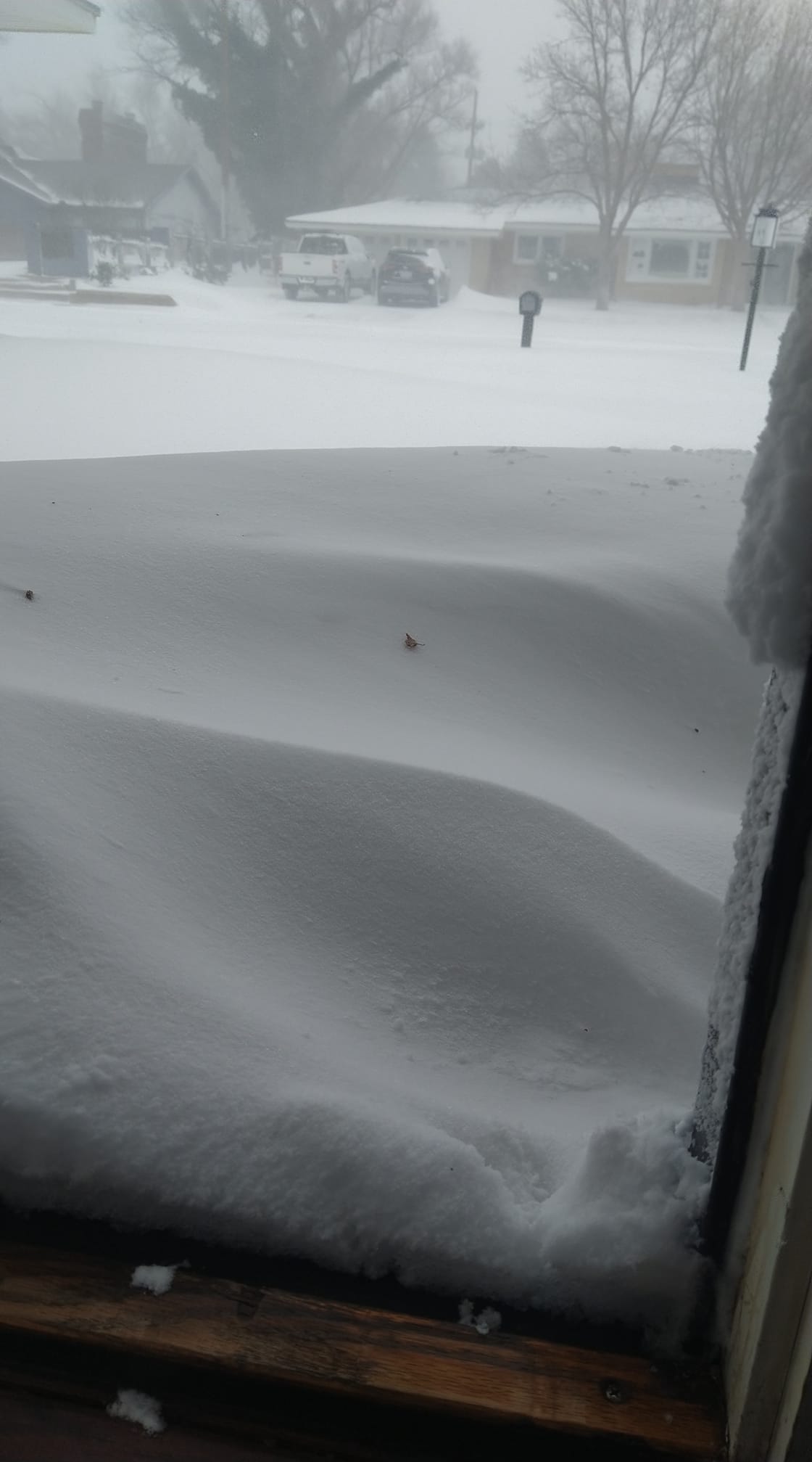
| Snow drifts in Dalhart, Texas (Amanda Miller) |
Snow covered lawn in Boise City, Oklahoma (Dakota Hawkins) |
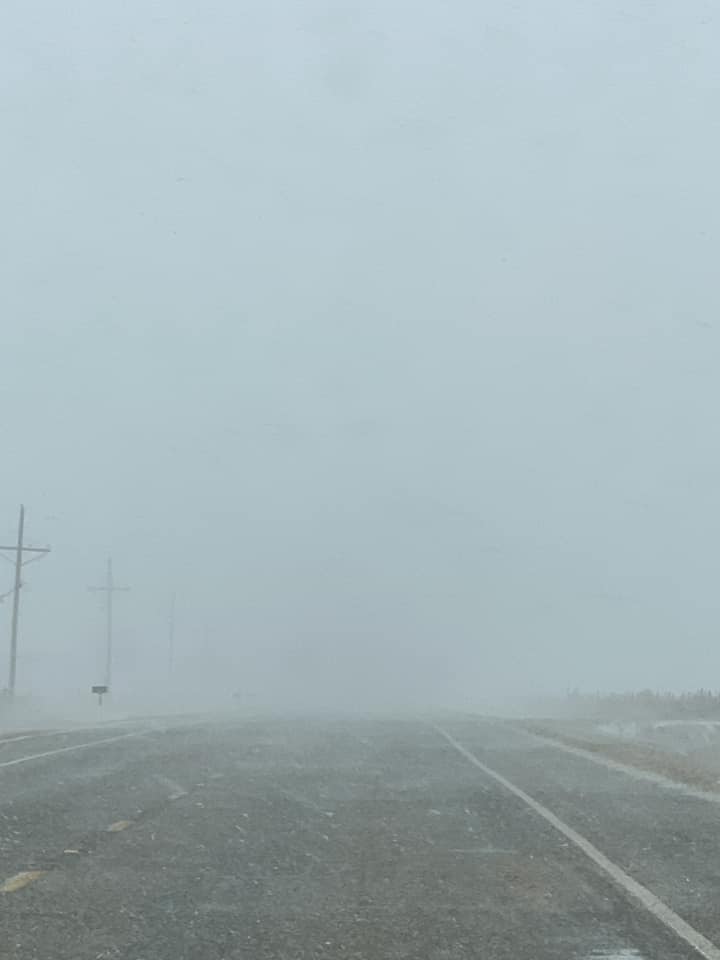
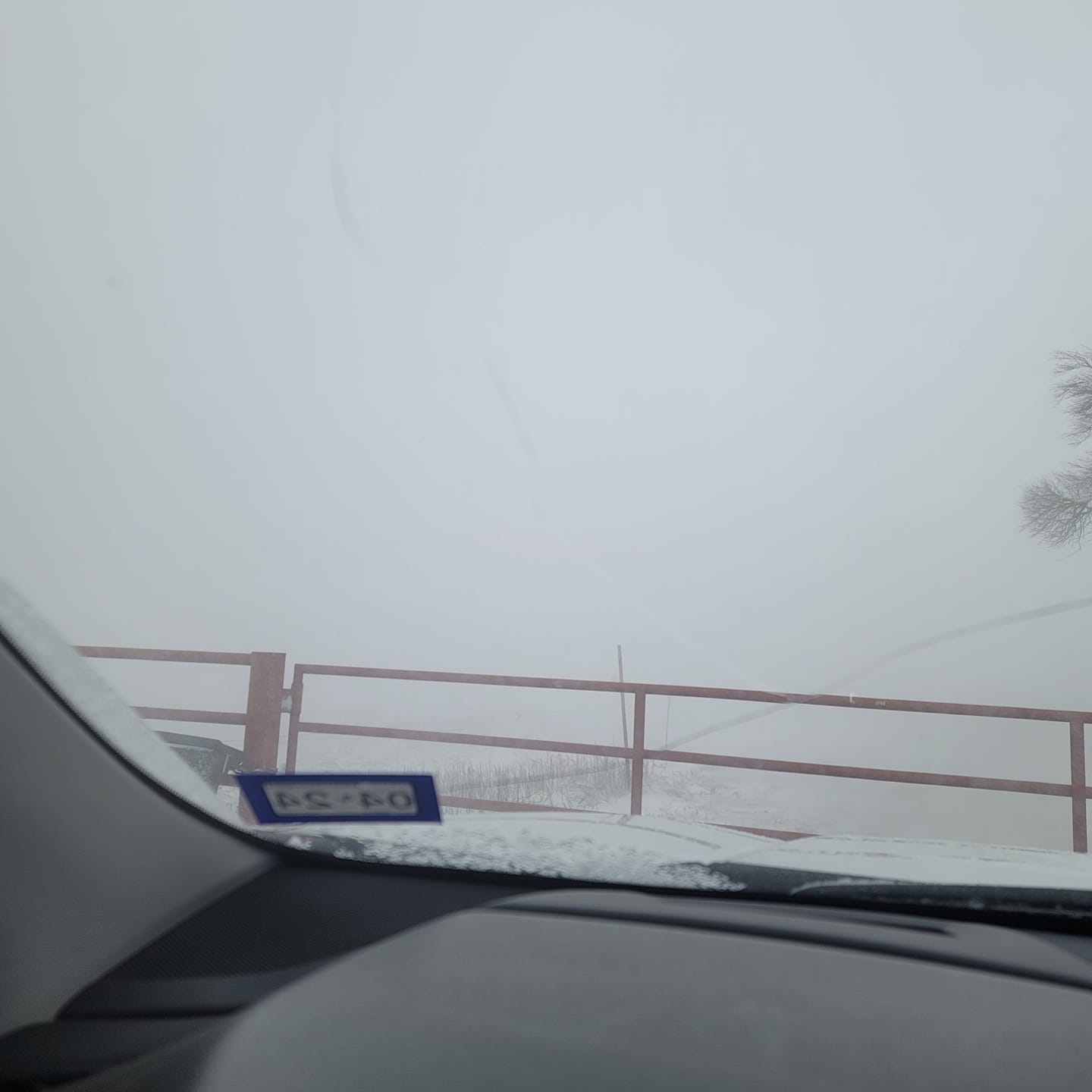
Dangerously low visibility due to blizzard in Cactus, Texas (Jonathon Faux) |
Reduced visibility and snowy roads in White Deer, Texas (Wendy Hull) |
 |
 |
 |
 |
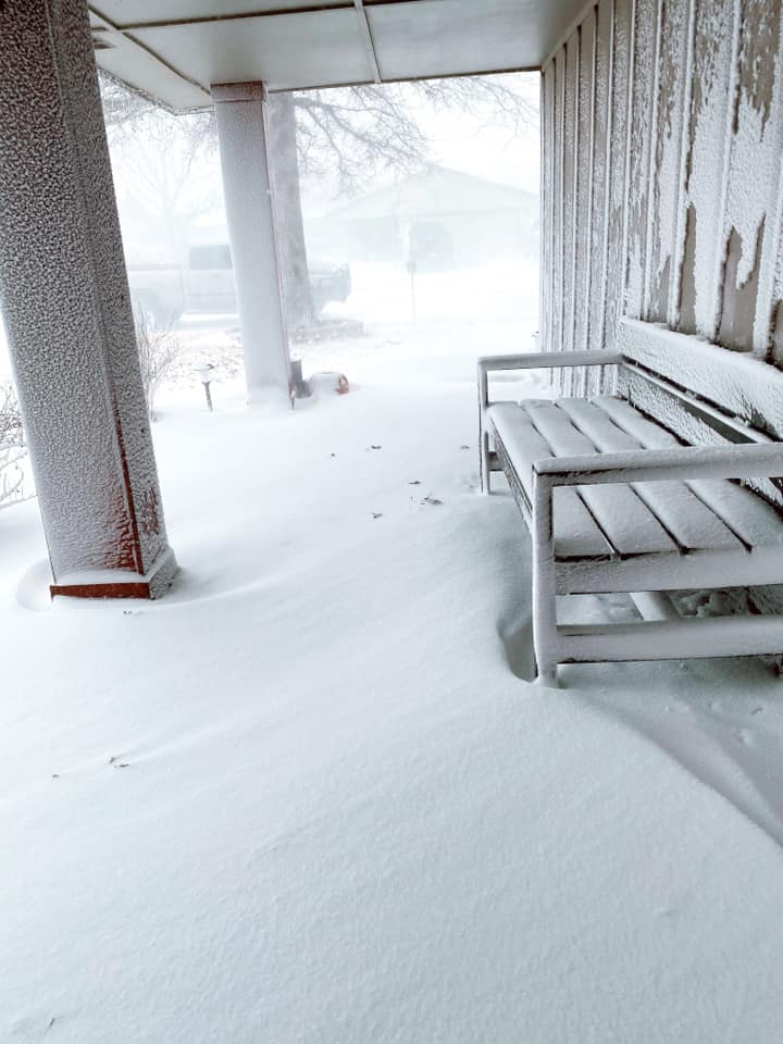
| Snow drifts on porch in Dumas, Texas (Brittany Jones) |
Blowing snow infiltrating covered porch in Turpin, Oklahoma (Lluvia Gomez Drennan) |
Low visibility due to blizzard between Canyon and Umbarger on FM 1062 (Christina Green-Farley) |
Snowy porch in Channing, Texas (Squawma Eaton) |
 |
 |
 |
 |
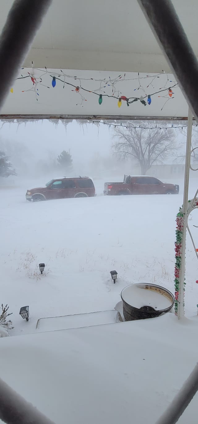
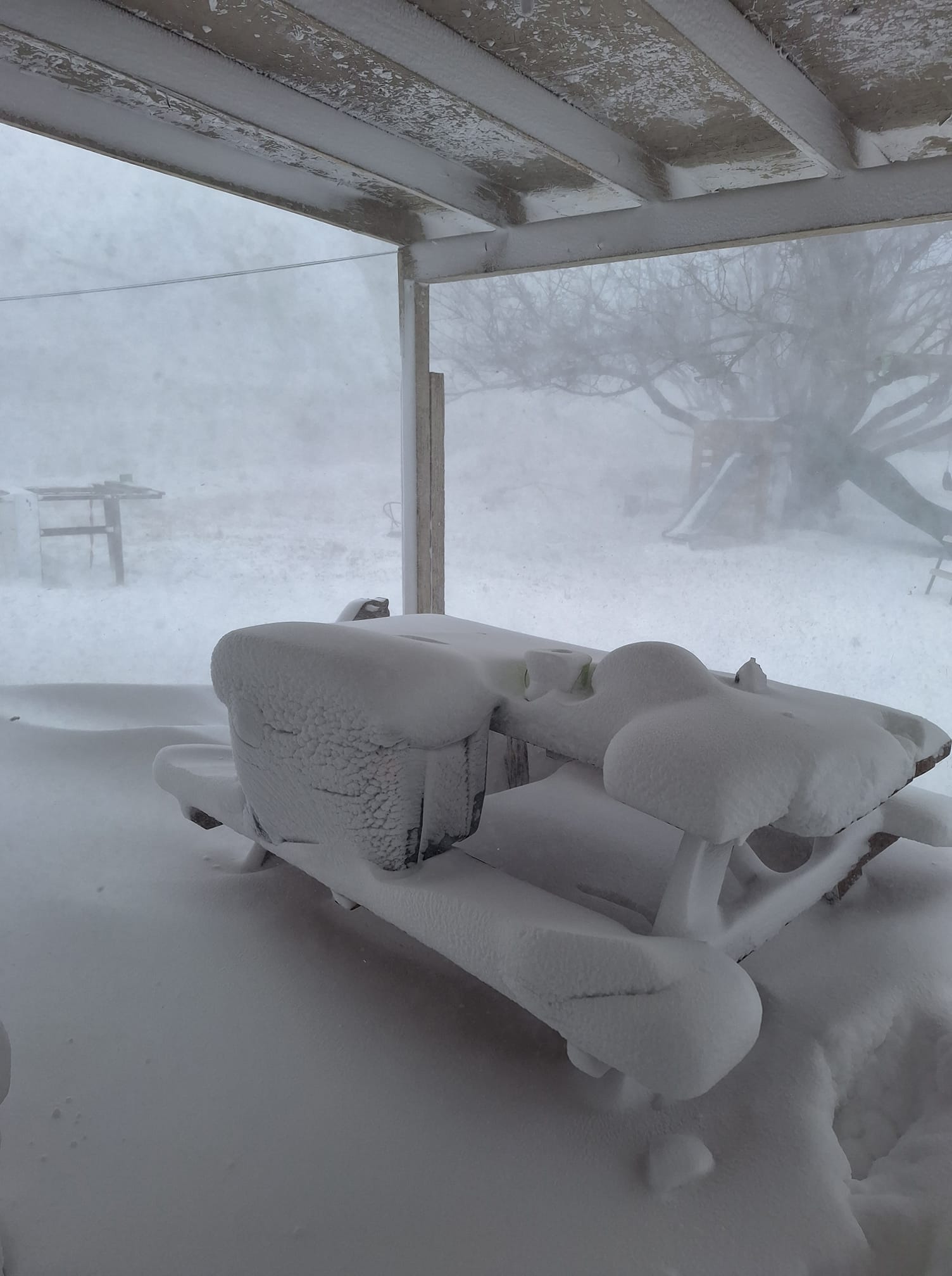
| Snow covering outdoor furniture despite a covered porch in Dumas, Texas (Melissa Bennett-Erlenbach) |
Mounds of snow on grill and outdoor furniture in Dalhart, Texas (Nikkole Nelson) |
Very low visibility due to blizzard conditions in Hereford, Texas (Meghann Owen) |
Very low visibility due to blizzard conditions east of Dalhart, Texas (Tyler Smith) |
Impacts and Safety
Don't drive through blizzards!
The January 8th, 2024 blizzard resulted in numerous motorists getting stuck and requiring rescue. These blizzard conditions were not a surprise and had been called for in our forecasts for at least 48 hours prior. At the height of the blizzard, all roads in Cimarron County were closed and rescue attempts had to be halted due to the hazardous conditions, stranding persons in their cars. At the request of Cimarron County Emergency Management, we issued a Civil Emergency Message to convey that first responders would be unable to assist and reiterating that travel should be postponed.
Timeline:
Saturday, January 6th, 2024 @ 3:26 AM CST - Initial Winter Storm Watch for possible blizzard conditions on January 8th issued
Sunday, January 7th, 2024 @ 1:33 PM CST - Winter Storm Watch is converted to a Blizzard Warning covering 3 AM Monday, January 8th to 6 AM Tuesday, January 9th
Monday, January 8th, 2024 morning hours - scores of motorists attempt to drive through the blizzard and become stuck, with rescue not possible in some cases
Monday, January 8th, 2024 @ 1:43 PM CST - rescue attempts in Cimarron County abandoned; Civil Emergency Message issued
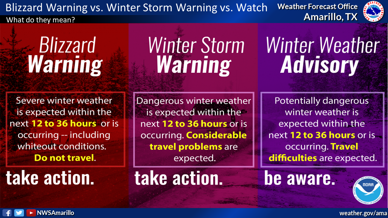
We issue Blizzard Warnings when we forecast snow in the presence of strong winds, conditions that lead to under a quarter mile of visibility and life threatening travel. Roads may become impassable due to drifting. Visibility from under a quarter mile to zero is expected in a Blizzard Warning, potentially leading to death due to car collisions. In many cases, rescue becomes impossible until conditions improve, potentially leading to death from hypothermia as stuck vehicles run out of fuel. In some cases, drifting blocks tailpipes of stuck cars, resulting in death due to carbon monoxide inhalation. In summary, attempting to drive through a blizzard may lead to death. Don't drive through a blizzard.
|
|
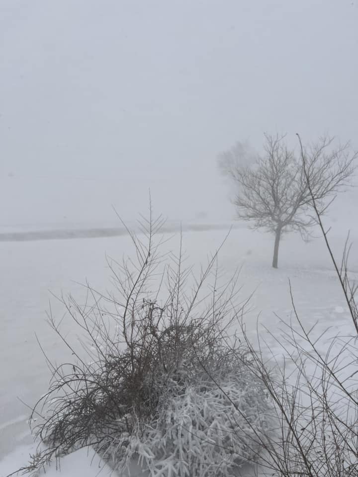
Visibility in a blizzard is extremely low. If a car in front of you has slowed or stopped, you may not be able to see them until it is too late. If a snow drift is covering the road, you may not see it in time to avoid it and could get stuck. Photo credit: Tyler Smith |
|
|
This large and capable truck nonetheless got stuck between Dumas and Hartley on January 8th. How would a smaller car fare? Not well. See the poor visibility? First responders may not be able to get to you. You'd could be stuck hoping you have enough fuel to last for potentially 12+ hours. Photo credit: Sam C. Bezner |
 |
|
A Blizzard Warning is the most serious winter weather product we issue. Do not travel! |
Environment
A large scale upper trough quickly translated eastward and deepened as it approached, driving the development of a strong low pressure system east of the Rockies. Strong winds at the ground developed leading to low visibility as snow fell, resulting in blizzard conditions in the northwestern Panhandles.
| Four panel (250/500/700/850mb) analysis of the atmosphere during the January 8th, 2024 blizzard. |
Near-storm environment summary.
 |
 |
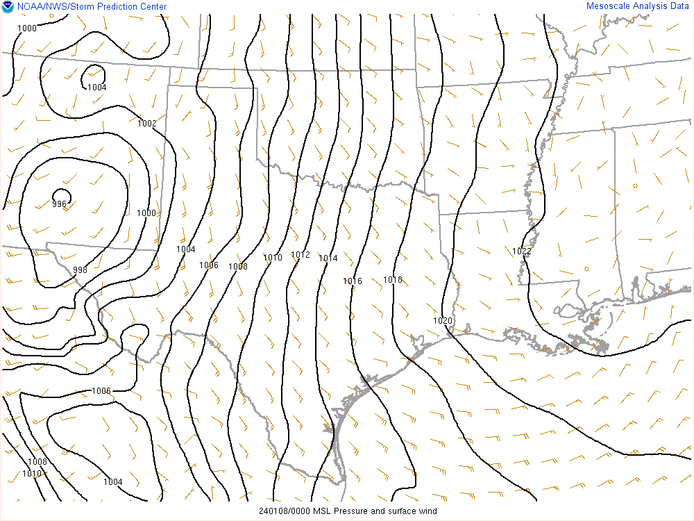
 |
| Surface pressure analysis during the January 8th, 2024 blizzard event. The solid lines are isobars, lines of constant pressure. When these are closer together, stronger winds result. Notice the tightly packed isobars over the Panhandles on January 8th. | Another 700mb analysis, this time focusing on available moisture. Sufficient moisture was wrapped around the low pressure center for snow to occur in the Panhandles. | Analysis of surface wet bulb temperature. In the absence of above freezing air aloft (sometimes called a "warm nose"), these at or below freezing suggest the dominant precip type will be snow. With little warm air aloft and these at or below 32 for much of the event, nearly all precip fell as snow. |
 |
Media use of NWS Web News Stories is encouraged! Please acknowledge the NWS as the source of any news information accessed from this site. |
|

