
Dangerous heat will expand from the Gulf Coast into the Southern Plains and Desert Southwest through week's end. Additional extreme heat impacting the Pacific Northwest will shift to the northern Plains by the weekend. Tropical Storm Bertha is expected to continue to impact portions of the northern Gulf Coast from the western Florida Panhandle to southeastern Louisiana through tonight. Read More >
Overview
Friday, June 2nd-3rd 2017
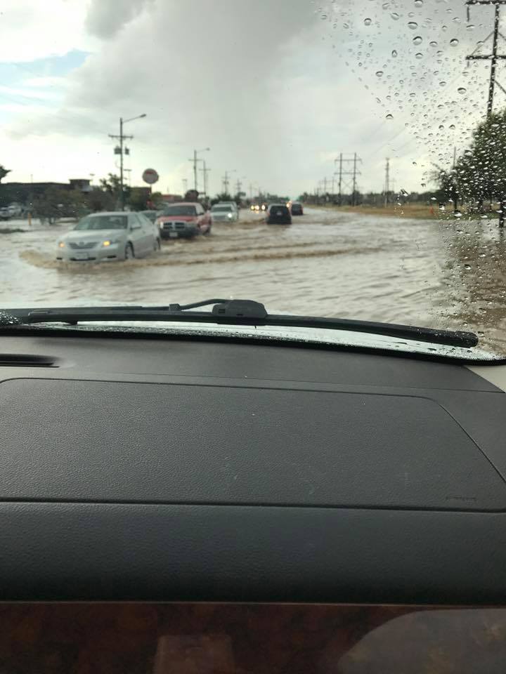
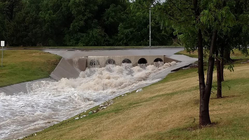
Plenty of moisture was being brought northwest on southeast surface winds. The winds aloft were very light. A small upper level disturbance was nearly stationary just to the southwest of Hereford, TX. This disturbance teamed up with the abundant moisture to help produce thunderstorms across the south central and southwest Texas Panhandle Friday afternoon. The activity initially developed over western Potter and western Randall Counties into eastern Oldham and eastern Deaf Smith Counties. The thunderstorms moved very slowly west away from Amarillo. Then an outflow boundary started moving east from the initial activity. More storms started to develop eastward behind the eastward moving boundary. The heavy rain producing thunderstorms slowly moved and developed eastward into the western half of Amarillo. The thunderstorms then remained almost stationary or slowly drifted off to the south. The intense rainfall (at least 2 inch an hour rainfall rates) fell over the western half of Amarillo and caused flash flooding in this area. Rainfall amounts were generally in the 2 to 4 inch range with locally higher amounts. All of the rain fell in less than a 2 hour time span. On Saturday, the 3rd, an upper level disturbance moved southward toward the panhandles. This disturbance helped to produce heavy rain producing thunderstorms again over western and central Amarillo. Rainfall amounts were generally in the 1 to 2 inch range.
| Radar Animation from June 2nd |
| Radar Animation from June 3rd |
Flooding
Add a written summary if needed.
Radar/Photos
 |
 |
 |
 |
| Caption | Caption | Caption | Caption |
Storm Reports
Rain Reports
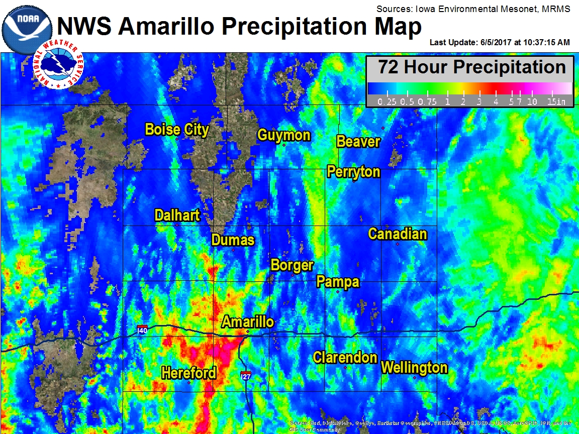
Although most of the rainfall fell June 2nd and June 3rd, this was a 72 hour rainfall total map ending at 10:30 am on June 5th which captured all the rainfall from Friday (2nd) and Saturday (3rd). Data here are interpolated from actual observational data and should be used as an estimate only.
 |
| 72 Hour Rainfall ending at 10:30 am June 5th |
 |
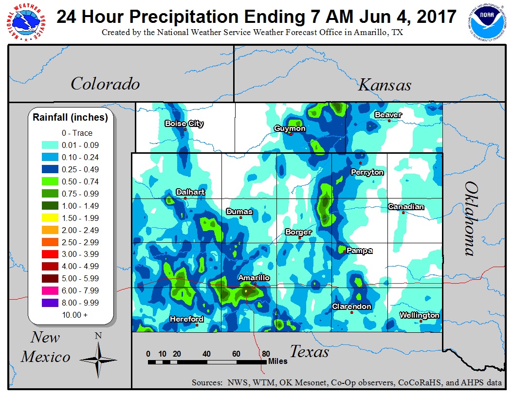 |
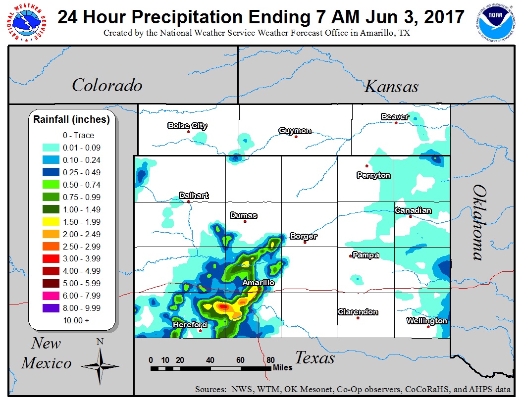
| 24 Hour Rainfall Ending at 7 am June 3rd | 24 Hour Rainfall Ending at 7 am June 4th |
Environment
Insert synoptic summary.
| Figure 1: Caption | Figure 2: Caption | Figure 3: Caption |
Near-storm environment summary.
| Figure 4: Caption | Figure 5: Caption | Figure 6: Caption |
Additional environmental data.
| Figure 7: Caption | Figure 8: Caption | Figure 9: Caption |
 |
Media use of NWS Web News Stories is encouraged! Please acknowledge the NWS as the source of any news information accessed from this site. |
|

