
Severe weather and flooding threats will continue for portions of the central U.S. over the next couple of days, with multiple rounds of thunderstorms expected. Dangerous heat will persist across the southern and western U.S. through mid-week. Hot and dry conditions will fuel fire weather concerns for the Intermountain West, where dry thunderstorms may spark additional wildfires. Read More >
Overview
|
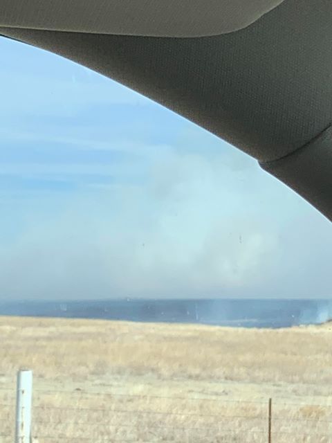
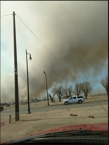
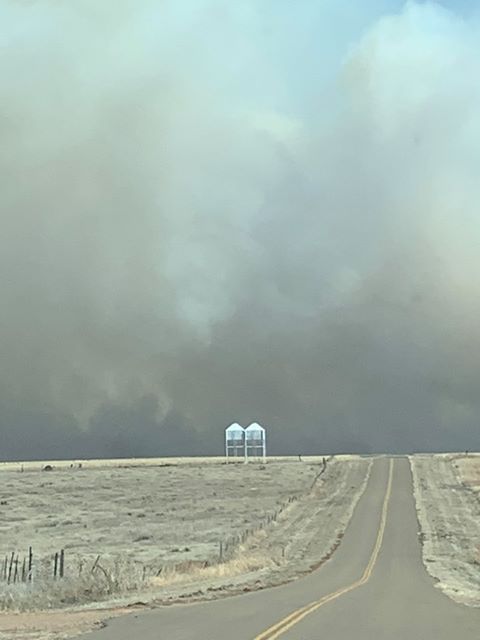
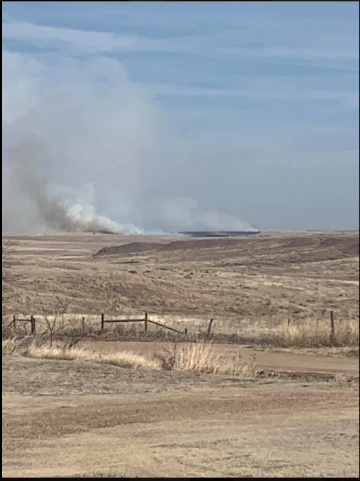
On March 7th, 2020 a significant wildfire occurred in Beaver County, Oklahoma. The fire started about 4 miles east of Balko during the late morning and quickly spread northeast towards the city of Beaver. The fire spread at a rate of 103 feet per minute. The towns of Beaver and Forgan eventually had to be evacuated as the fire continued to jump containment lines. Several homes were destroyed or damaged in and around Beaver. The weather conditions that day were favorable for the spread of wildfires, however it was not a pattern favorable for a Southern Great Plains Wildfire Outbreak. The upper level pattern was characterized by zonal flow aloft ahead of a trough to the west and ridging over the Mississippi Valley. There were no jet streaks in the area, but the cross barrier flow over the southern Rocky Mountains did promote strong lee surface troughing. In turn, the pressure gradient promoted southwest winds of 25 to 35 mph with occasional gusts around 40 mph. The winds started around 9 AM Saturday morning (March 7th), and did not decrease until late Saturday night. A thermal ridge was present which aided temperature rising into the mid 60s to low 70s. This resulted in relative humidity values falling into the 20 to 25 percent range. Moreover, the Red Flag Threat Index (RFTI) was mostly wind driven and maxed out around 4 in Beaver County. Probably the biggest factor that supported the extreme fire behavior was the fuels. Fuel loading was high and the energy release component (ERC) percentiles were above the 70th percentile. The means the grass was overgrown and very receptive to fire spread. Some terrain may have also enhanced the fire spread as well. |
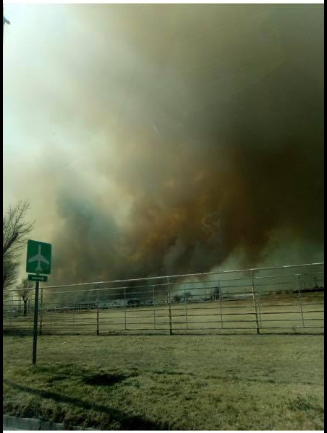 Fire SW of Beaver, OK - Photo by Tarrah Dawn Barclay |
 |
 |
 |
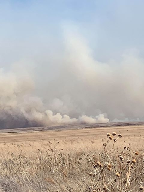
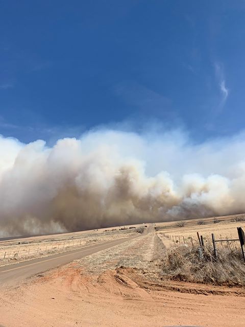
| Burn Scar - Photo by Daisy Farr | Fire Outside of Beaver, OK - Photo by Mandy Lou Brown | Wall Of Smoke - Photo by Daisy Farr |
Preliminary Fire Perimeter
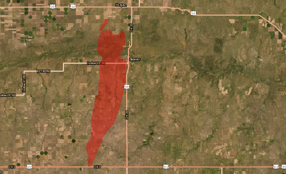 |
| Preliminary burn perimeter (courtesy of Oklahoma Forestry Services) |
Embedded Tweets
Illuminated by moonlight, the dark southwest-to-northeast oriented burn scar from the #412wildfire or #BeaverFire in the Oklahoma Panhandle was evident in #VIIRS Day/Night Band imagery at 0857 UTC (3:57 am Central time): https://t.co/7y3xAfdECf @NWSAmarillo #OKwx pic.twitter.com/OeLdAGsgVe
— Scott Bachmeier (@CIMSS_Satellite) March 8, 2020
Officials just informed me there has been structural damage in the area and that the fire isn’t letting up due to high winds. @KSNNews pic.twitter.com/TDyT6pHFuH
— Hunter Funk (@hunterkfunk) March 7, 2020
— O’Malley GaL âï¸âï¸âï¸Text TRUMP to 88022 (@spradlinok) March 7, 2020
@NWSDodgeCity @NWSAmarillo photos taken at 4:49 4:53 and 4:55 PM about 4 miles N of the KS-OK State line. Best view of the pyroCu I’ve had. pic.twitter.com/j2nQyGqd6a
— C W (@wilscale) March 7, 2020
— Matt McCune (@ksufearless) March 7, 2020
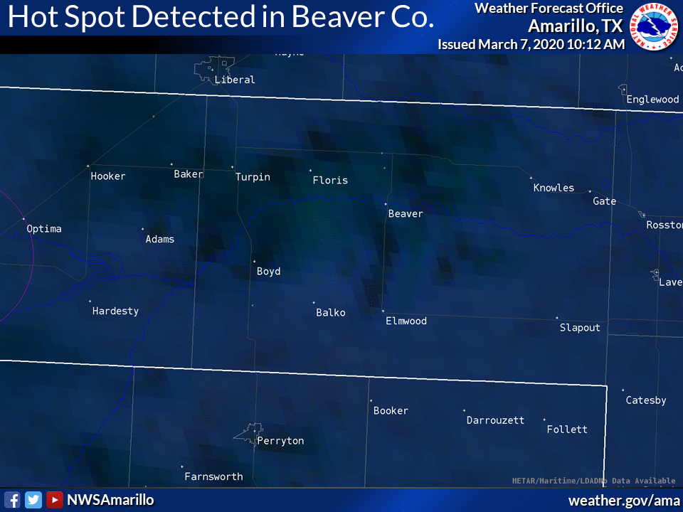
A hot spot has been detected as seen on this Fire Temperature satellite imagery. Please avoid the area. #phwx #okwx #txwx #GOESEast #FireWX pic.twitter.com/wQzNAhUFBU
— NWS Amarillo (@NWSAmarillo) March 7, 2020
Photos & Video
 |
 |
 |
 |
|
(Courtesy of Daisy Farr) |
(Courtesy of Daisy Farr) |
Initial "Hot Spot" detected from satellite (Courtesy of NWS) |
(Courtesy of Amanda Bell) |
 |
Media use of NWS Web News Stories is encouraged! Please acknowledge the NWS as the source of any news information accessed from this site. |
|

