Overview
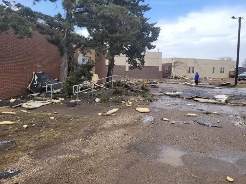
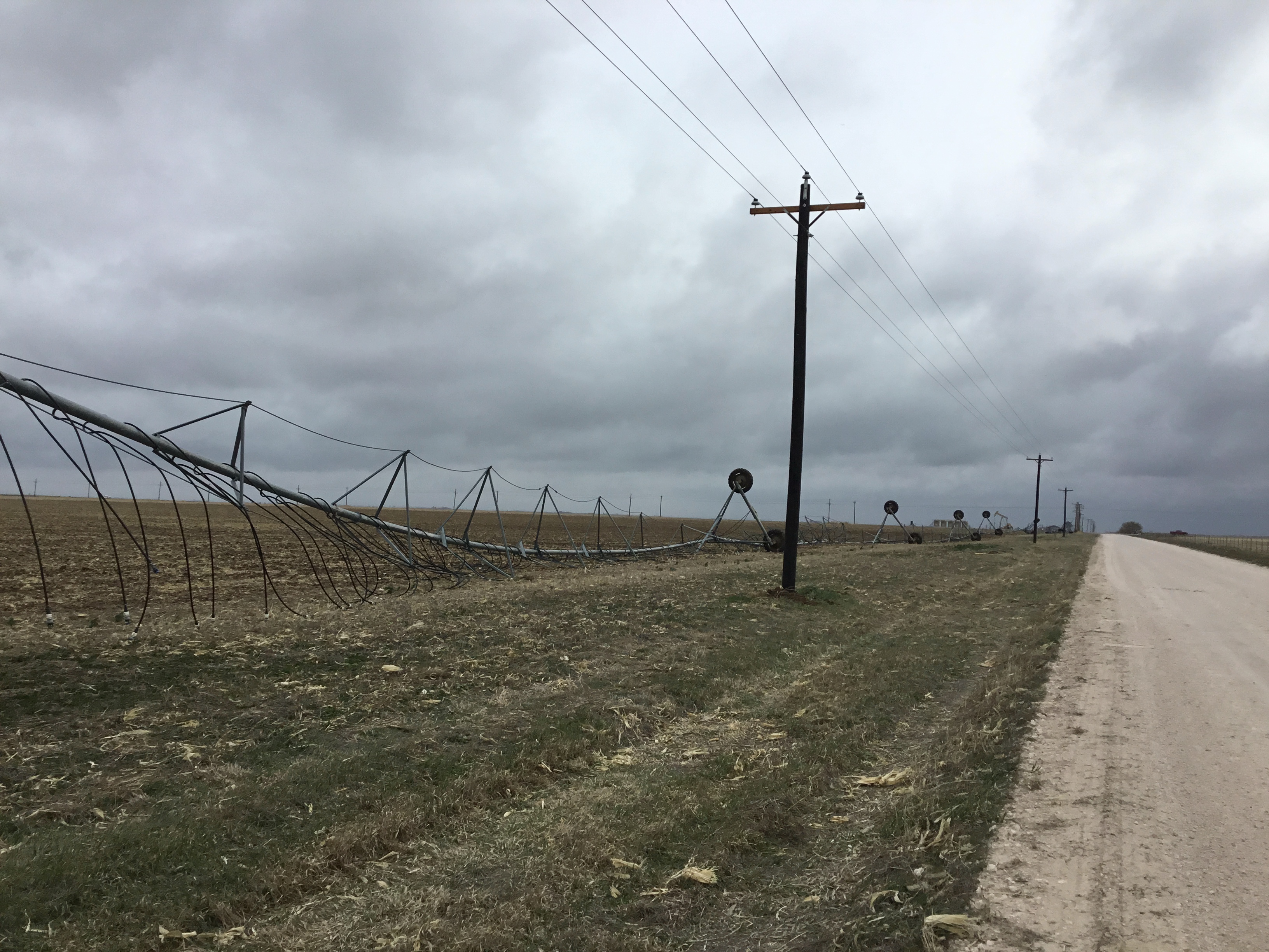
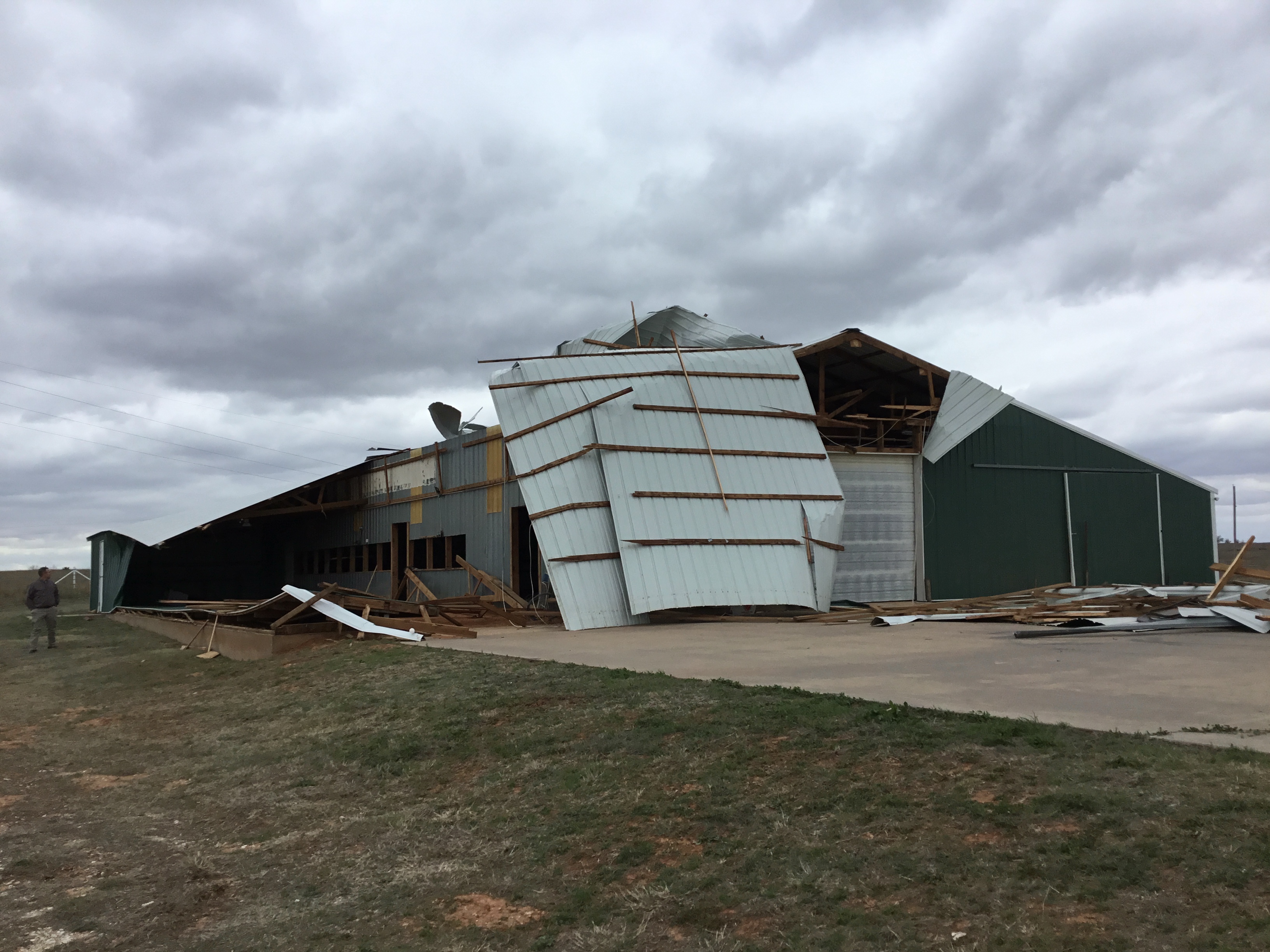
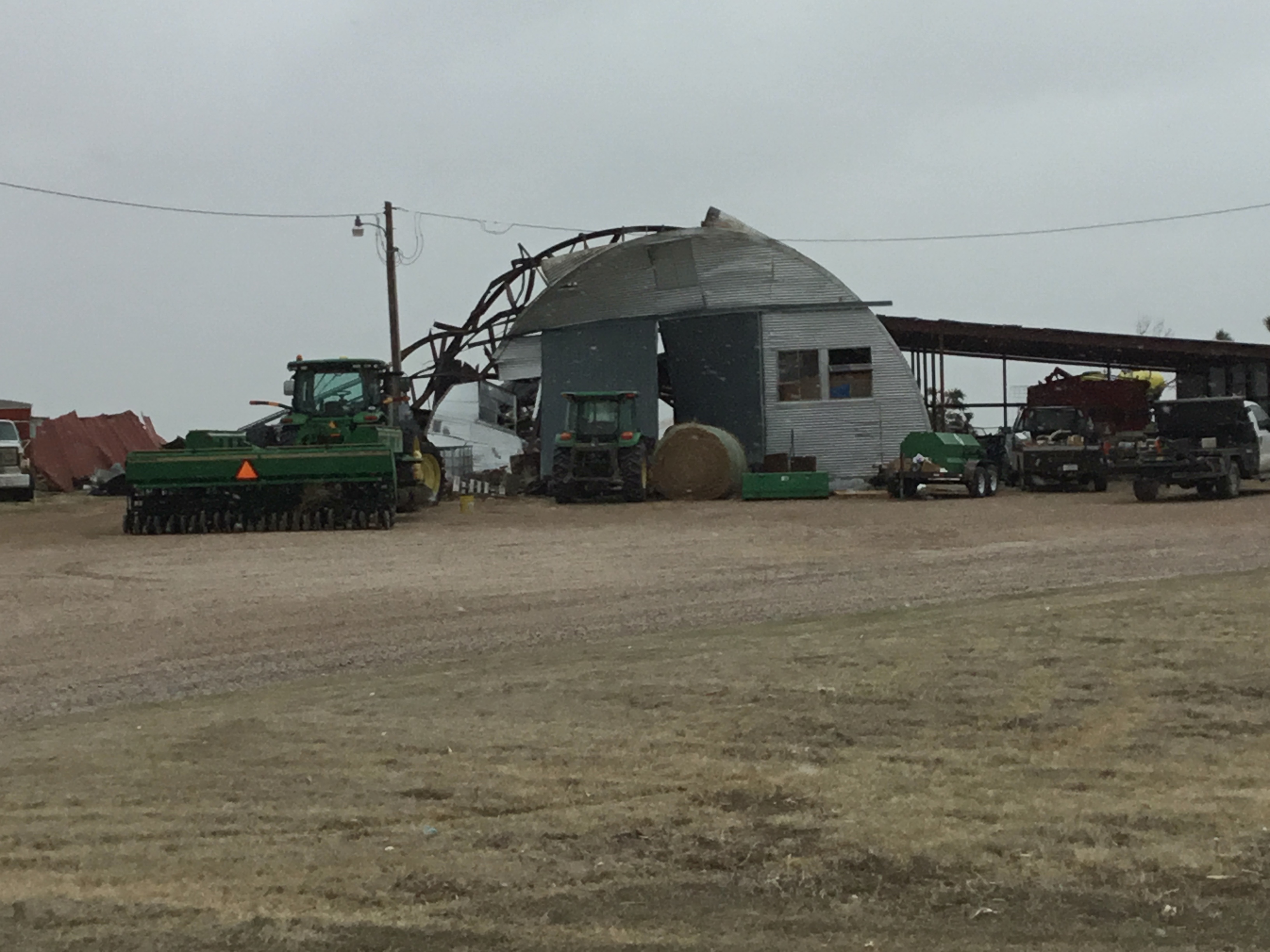
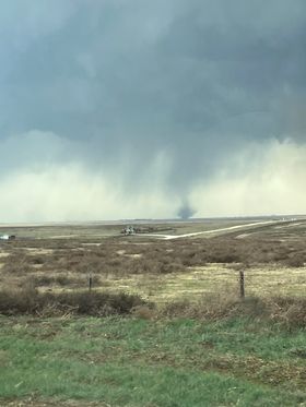
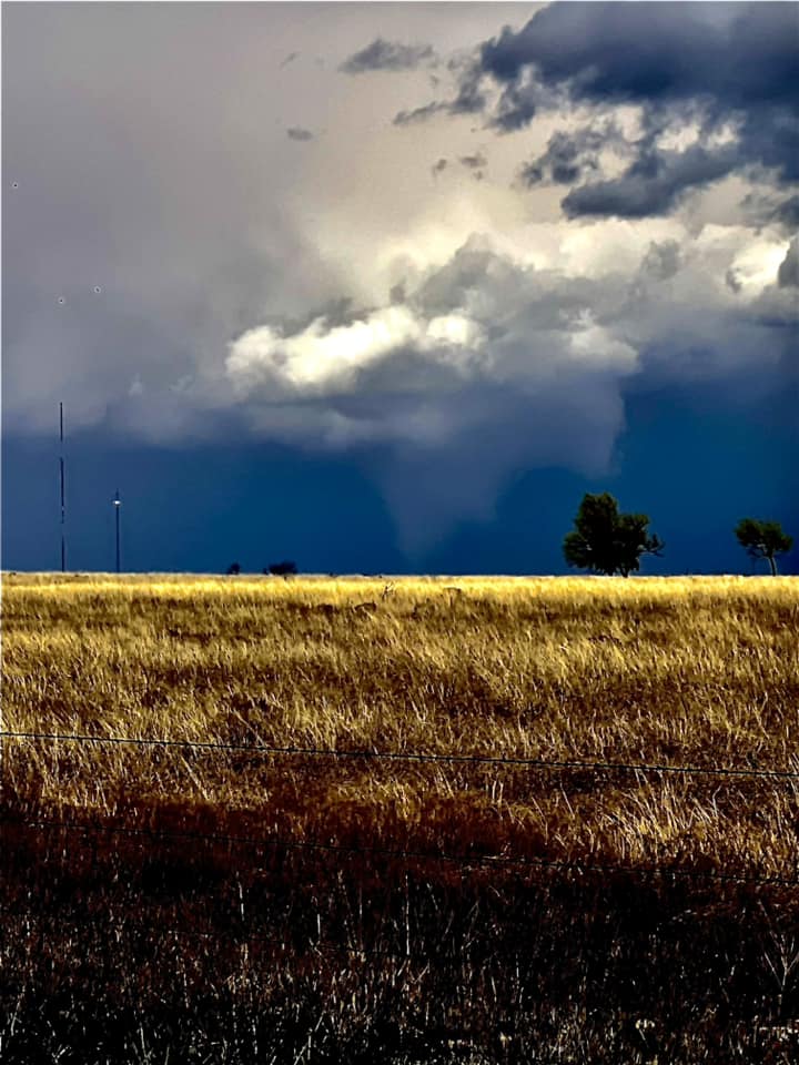
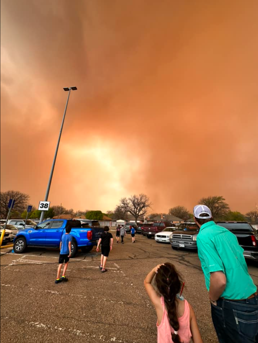
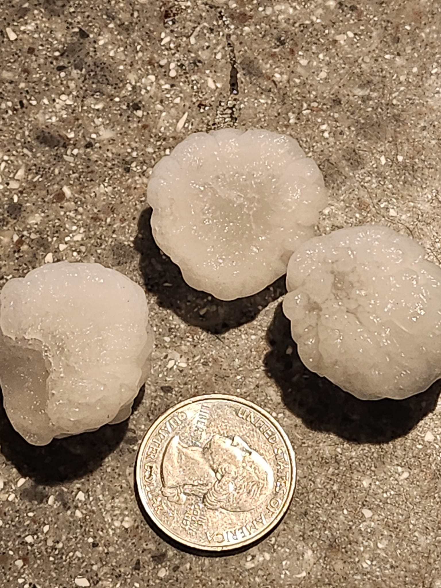
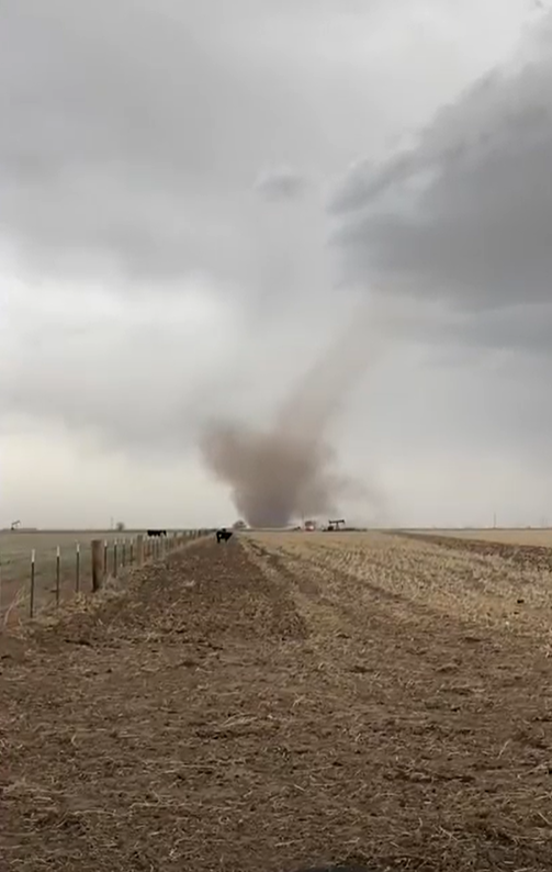
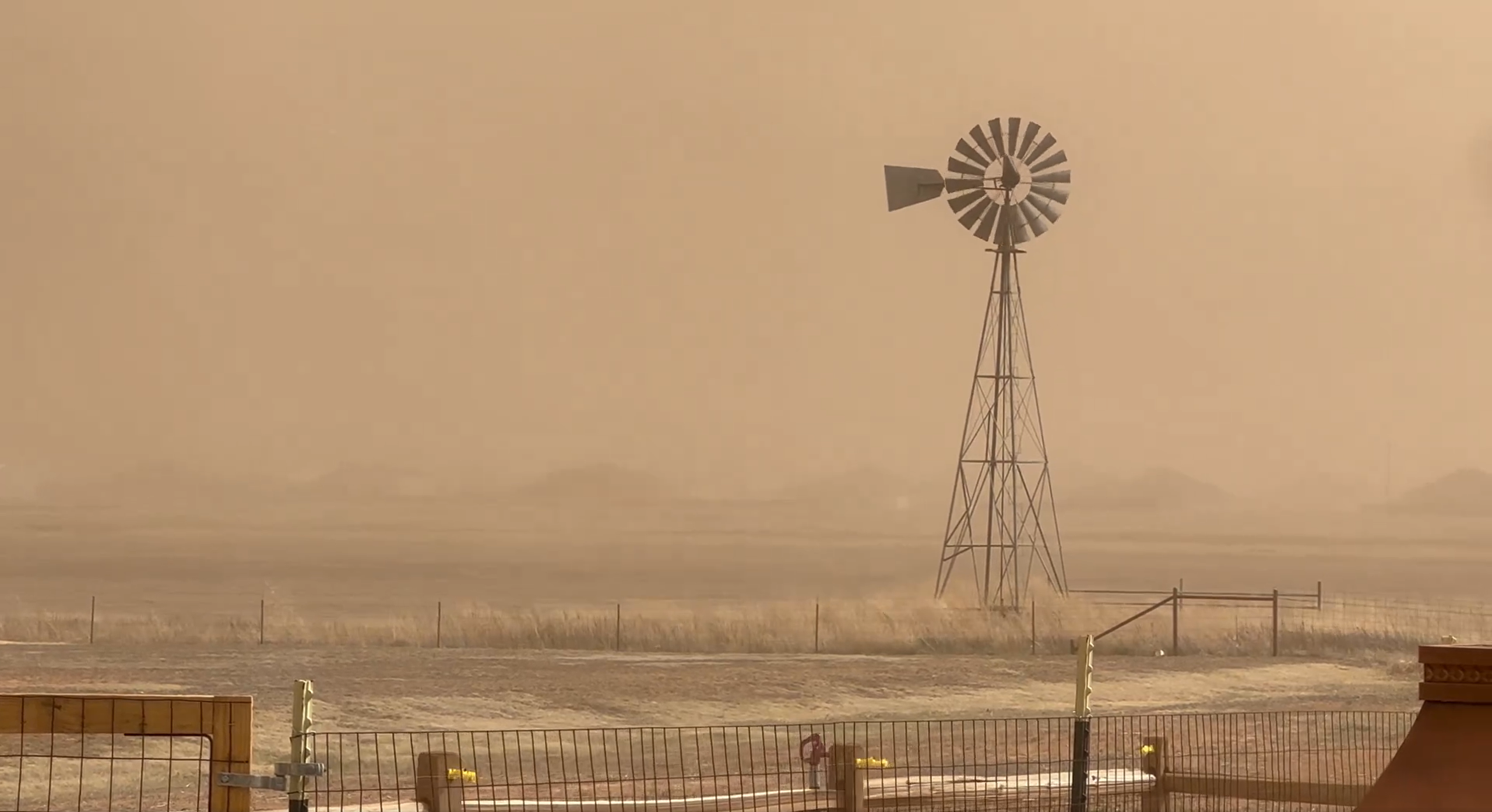
On March 24, 2024, a strong upper level system was positioned north of the Texas and Oklahoma Panhandles. A diffuse dryline held in place further west than initially forecast, helping to initiate isolated thunderstorms in the moist sector across the eastern Panhandles. Despite marginal moisture, these storms went on to produce four tornadoes, large hail, and damaging straight-line winds. Three tornadoes were confirmed in Ochiltree County, the strongest of which produced EF-1 damage a few miles south of Perryton, Texas. Another isolated supercell also produced an EF-1 tornado near Shamrock, Texas, damaging the rodeo barn near town. The largest hail observed was golf ball size from the south Perryton storm, and the strongest wind gust observed was 67 mph in Clarendon, Texas. West of the dryline, strong southwest winds developed in the dry sector through the afternoon and early evening hours. As a result, several gusts over 58 mph ushered in plumes of blowing dust to portions of the southwest and central Texas Panhandle.Tornadoes
|
Tornado - South Perryton
Track Map 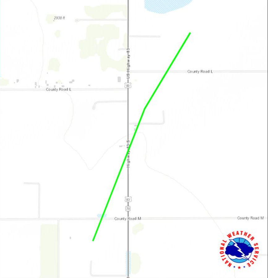 
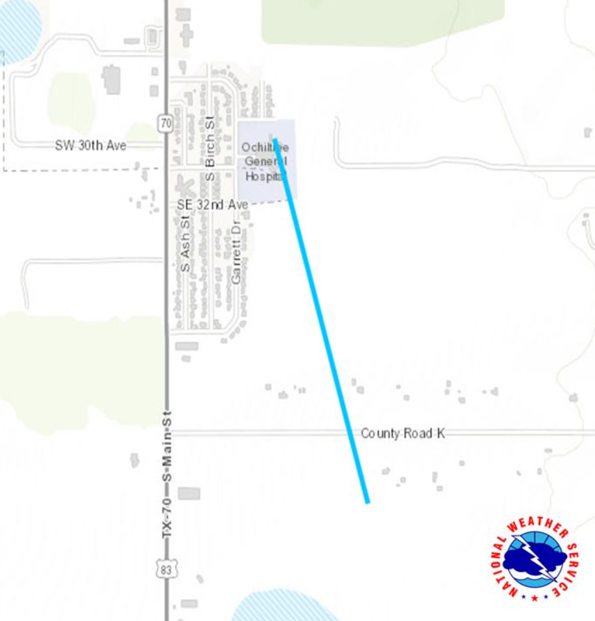
Tornado - Ochiltree General Hospital
Track Map
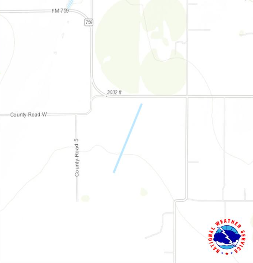
Tornado - West Ochiltree County
Track Map
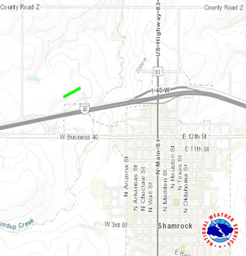
Tornado - Northwest Shamrock
Track Map
|
||||||||||||||||||||||||||||||||||||||||||||||||||||||||||||||||
|
||||||||||||||||||||||||||||||||||||||||||||||||||||||||||||||||
The Enhanced Fujita (EF) Scale classifies tornadoes into the following categories:
| EF0 Weak 65-85 mph |
EF1 Moderate 86-110 mph |
EF2 Significant 111-135 mph |
EF3 Severe 136-165 mph |
EF4 Extreme 166-200 mph |
EF5 Catastrophic 200+ mph |
 |
|||||
Photos & Video
 |
 |
 |
 |
| The South Perryton Tornado taken from 3 miles south of US-83 on SH-70. (David Hyrum Vaughn) |
Tornado near Shamrock, TX (Dominic Ruiz) |
Cloud of dust moving into Amarillo with high based showers. (Sherri Gannaway) |
Dust cloud moving into Amarillo. (Chelsea Gallagher) |
 |
 |
 |
 |
| Quarter sized hail in S Perryton (Perryton Fire EMS) |
Outflow dust cloud from I-40 in Amarillo. (Angelina Marie) |
West Ochiltree County tornado (Matt Corells) |
Blowing dust moving through Bushland at 3:45 PM (Diana Penn) |
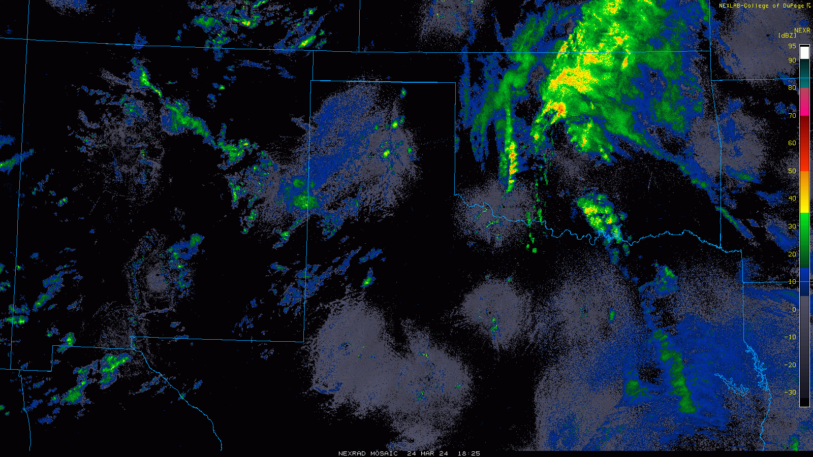
Radar
 |
 |
 |
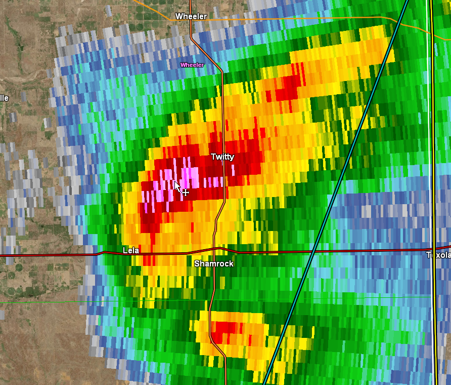 |
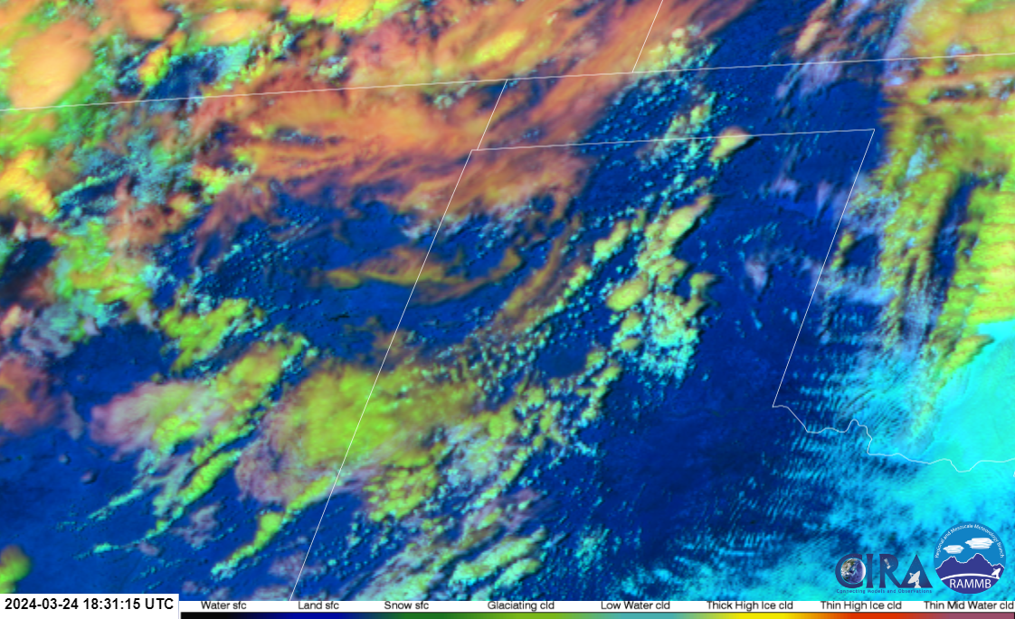
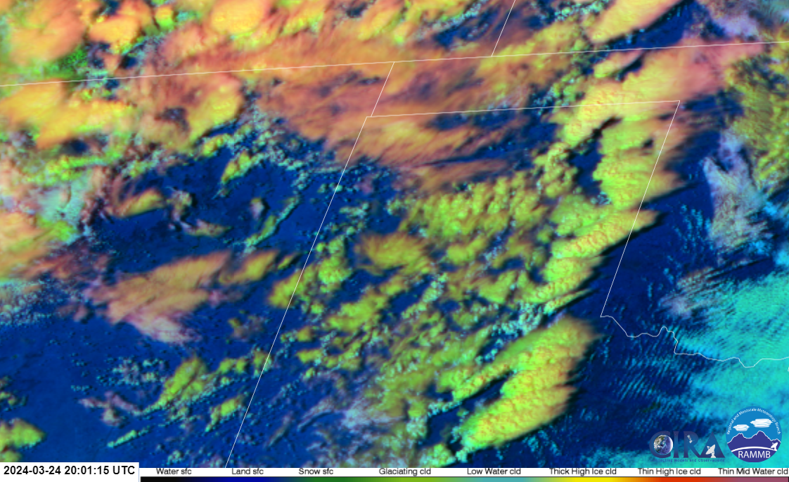
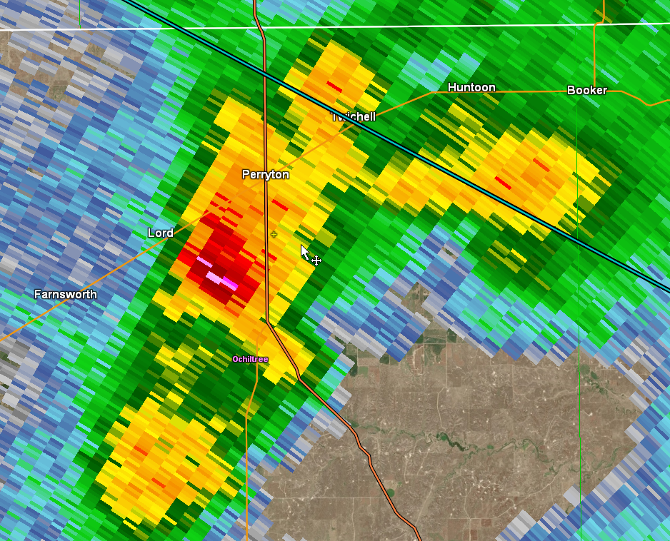
| GOES 16 Day Cloud Phase RGB showed storms developing after 1 PM along the dryline. | Mature storms tracked across the plains, moving toward the OK state line by 5 PM. Other high based cells developed in the dry sector, resulting in wind and dust. | The Perryton storm was a low topped tornadic supercell briefly, before weakening northeast of Perryton. | The Shamrock storm took on supercell characteristics fairly early in its lifecycle, and remained supercellular well into western OK. |
Environment
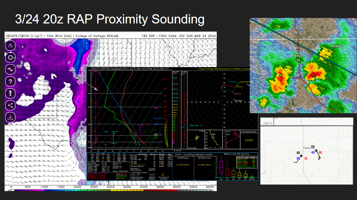
Fig 1 (above): A storm system moved across the area resulting in a surface low near the Raton Mesa. This low helped pull moisture into the central and eastern Panhandles by mid-day, with a diffuse dryline forming by early afternoon. Storms developed along the dryline, and by 2 PM initiation was under way. Instability and shear were marginal for a tornado threat, but the backing of low level winds behind the dryline helped to locally enhance storm relative low level shear, and intense lift helped overcome the limited instability. Cloud bases were also high with moisture also being marginal, but some storm mergers helped to locally reduce the cloud bases, thus increasing the tornado threat. Very cold air aloft was present, so it didn't take super tall/strong updrafts to produce severe hail.
 |
Media use of NWS Web News Stories is encouraged! Please acknowledge the NWS as the source of any news information accessed from this site. |
|