Numerous severe thunderstorms are expected across a broad region from the Ohio Valley to the Mid-Atlantic and Northeast States today into tonight. Swaths of damaging wind gusts are expected and some tornadoes are possible. Bertha is expected to bring tropical storm conditions to portions of the Gulf Coast from the Florida Panhandle westward to southeastern Louisiana later today and Wednesday. Read More >
Overview
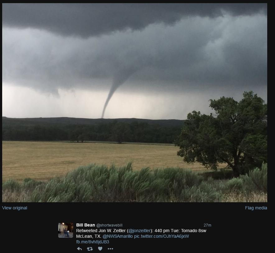
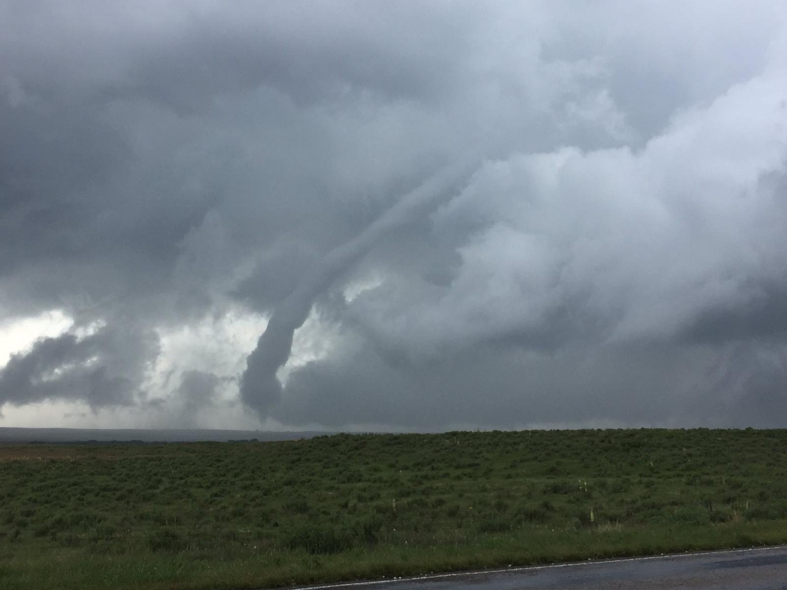
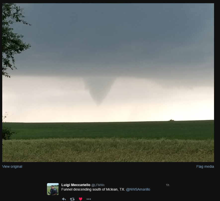
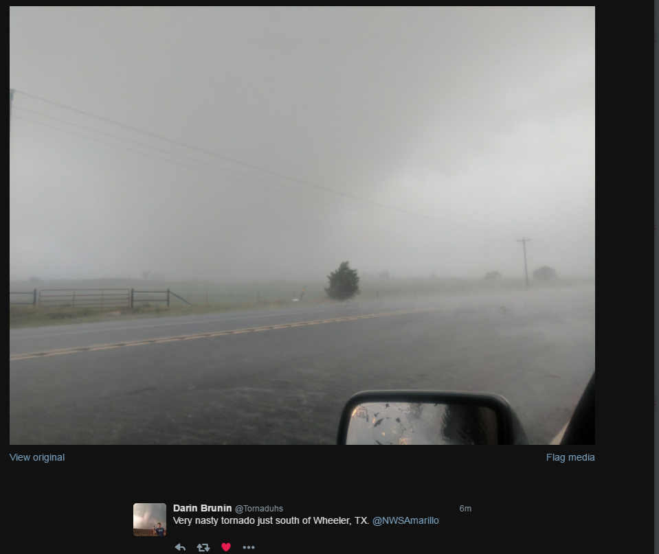
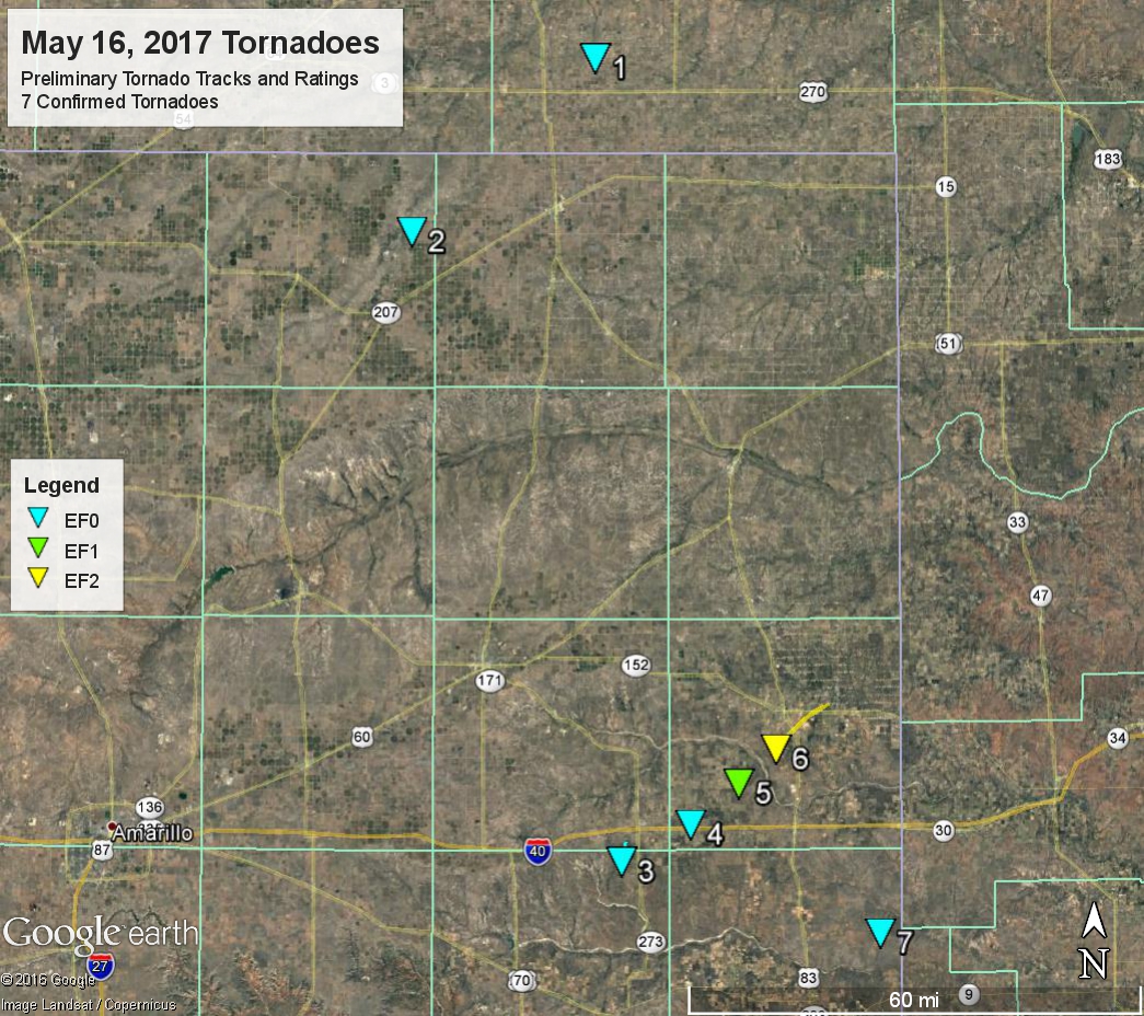
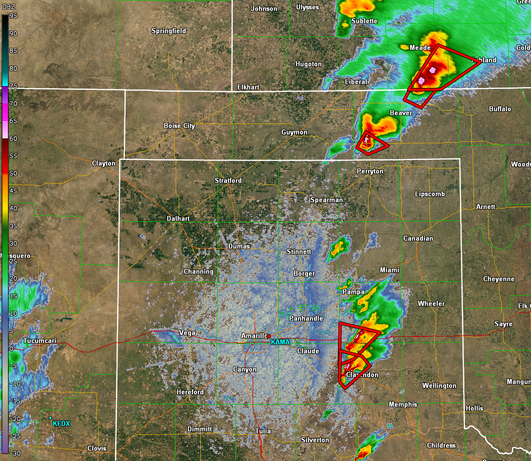
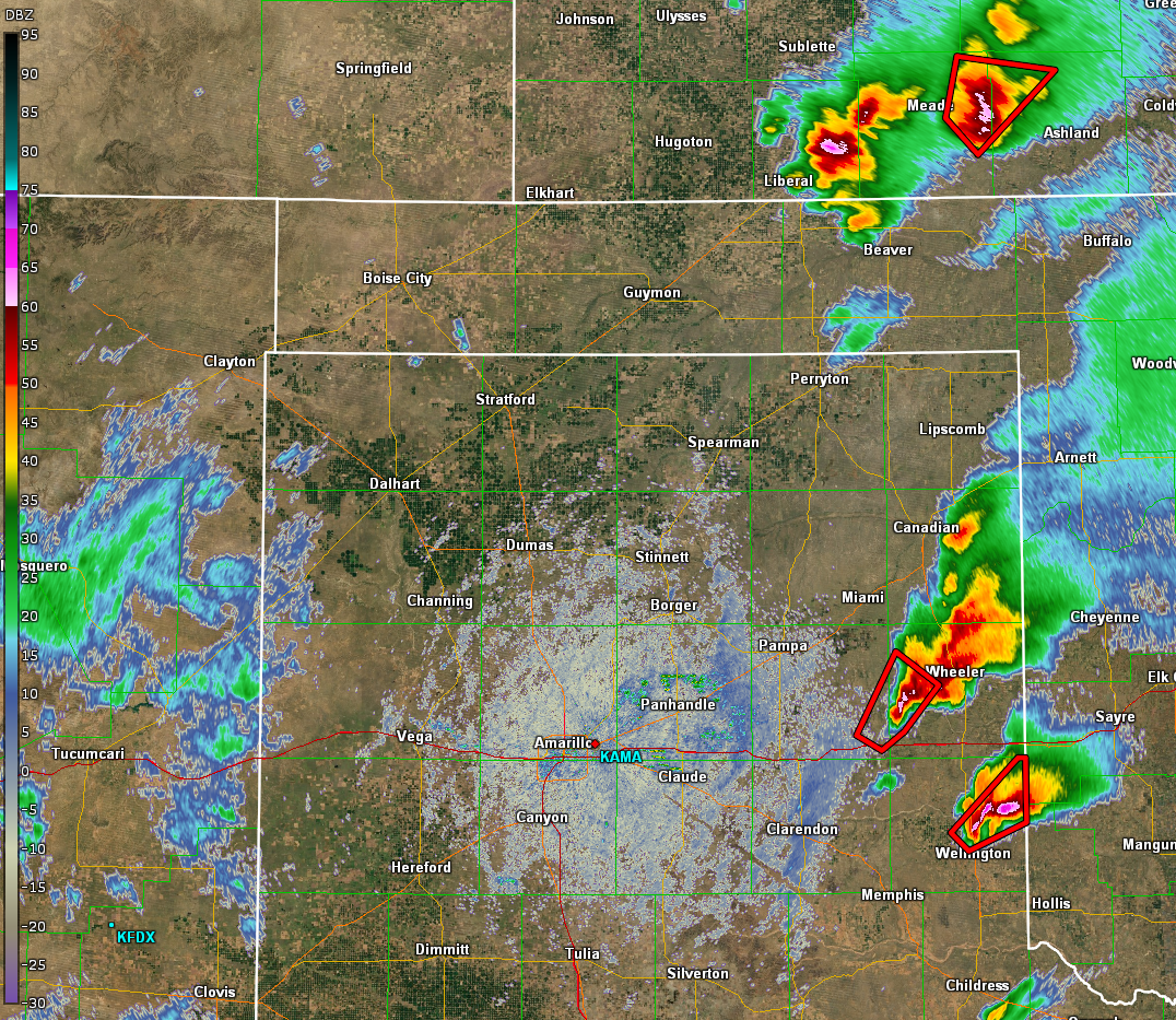
On Tuesday, May 16th, environmental conditions supported the development of a number of severe supercell thunderstorms across the eastern Texas and Oklahoma Panhandles. Early in the afternoon, the first few storms initiated near Spearman to Stinnett off the dryline and moved northeast through Hansford, Ochiltree and eventually into Beaver County. Two brief tornadoes touched down with these storms along with baseball size hail and one report of 3.5 inch hail north of Beaver. Additional storms fired further south on the dryline in eastern Carson and Armstrong County. These storms would go on to produce very large hail up to tennis ball size and a few tornadoes. The most notable tornadoes were the "elephant trunk" tornado that touched down near McLean and the "wedge" tornado that touched down near Wheeler. Another tornadic supercell moved into Collingsworth county towards the end of the event and would produce baseball size hail and a weak tornado just west of the state line 10 miles east of Lutie. This storm would go on to produce the Elk City, OK tornado later during the evening. All in all, there were seven confirmed tornadoes in the Texas and Oklahoma Panhandles and numerous large to very large hail reports. Tornado damage was also noted mainly with the Wheeler Tornado which was rated a high end EF-2. For specific information see the attached photos, text products and graphics.
| Radar and warnings Tuesday, May 16th, 2017 |
Tornadoes:
Downloadable KMZ File |
||||||||
|
The Enhanced Fujita (EF) Scale classifies tornadoes into the following categories:
| EF0 Weak 65-85 mph |
EF1 Moderate 86-110 mph |
EF2 Significant 111-135 mph |
EF3 Severe 136-165 mph |
EF4 Extreme 166-200 mph |
EF5 Catastrophic 200+ mph |
 |
|||||
Wind & Hail:
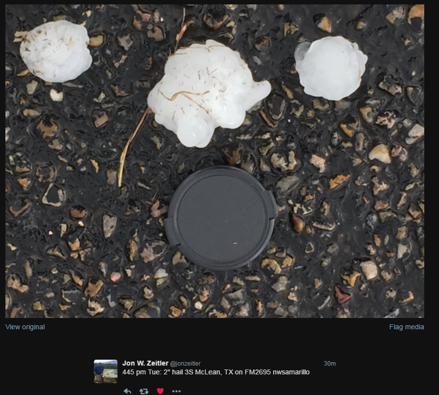
Hail Photos
 |
 |
 |
 |
| 3 Inch Hail 5 miles East of McLean by Misa Freeman | 2.35" Hail by Kiel Ortega | 2" Hail 3S of McLean by Jon Zeitler |
Tennis Ball size hail west of Wellington by Dan Nelson |
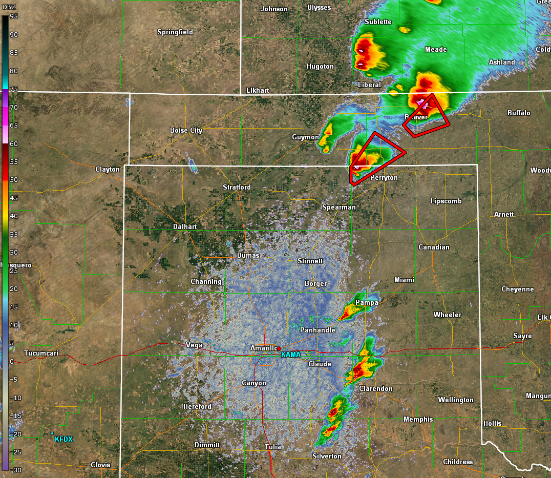
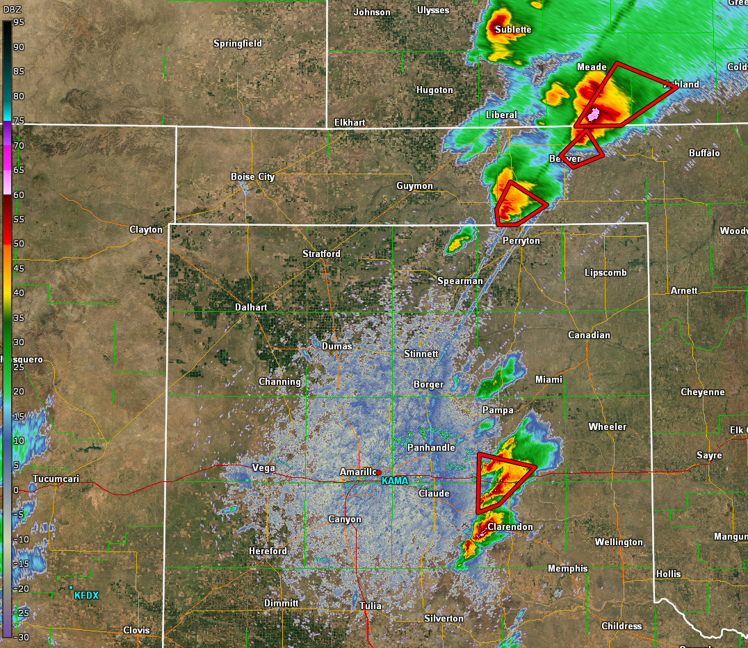
Radar:
Header
 |
 |
 |
 |
| First Round of TOR warnings | The southern storm produced an EF-2 |
Storms in the south continue to intensify. | Fortunately, Wheeler missed a direct hit. |
Storm Reports
Below is an interactive map that you can zoom, pan, or click on images to find more information on the local storm reports. Please click on the Tornado, Hail, or Wind Damage icons for more information.
Environment
 |
 |
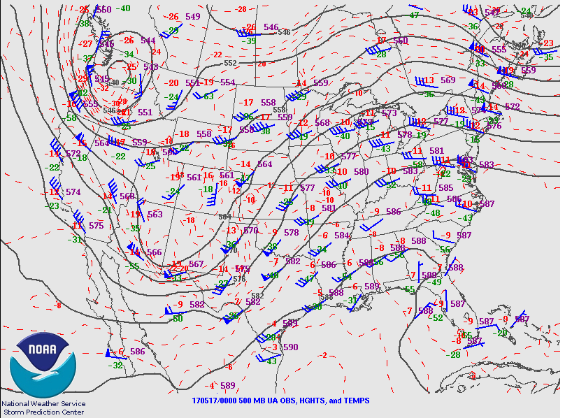 |
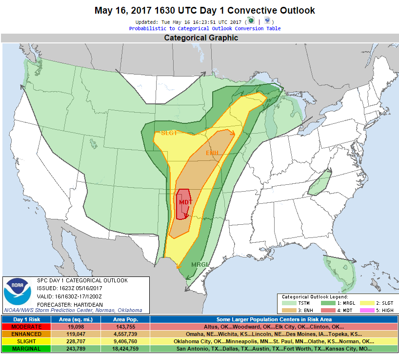
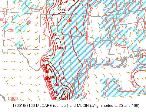
| Figure 1: A dryline and approaching upper level wave lead to favorable conditions for supercells capable of producing tornadoes | Figure 2: Moderate risk issued for the SPC Day 1 Convective Outlook | Figure 3: A mid level trough with leading strong jet streak provided additional lift and support for strong shear profiles. |
 |
 |
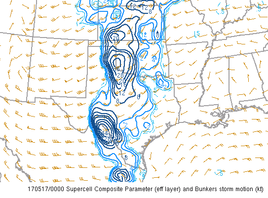 |
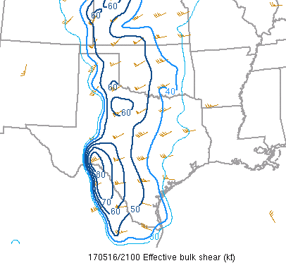
| Figure 4: Instability along and east of the dryline was very favorable for strong updrafts. | Figure 5: Effective shear increased as a mid-level jet moved over the Panhandles and a low level jet developed east of the dryline. Shear values over 50 knots supported the development of rotating updrafts (supercells). | Figure 6: The "Supercell Composite" via SPC mesoanalysis were anomolously high. |
 |
Media use of NWS Web News Stories is encouraged! Please acknowledge the NWS as the source of any news information accessed from this site. |
|