Overview
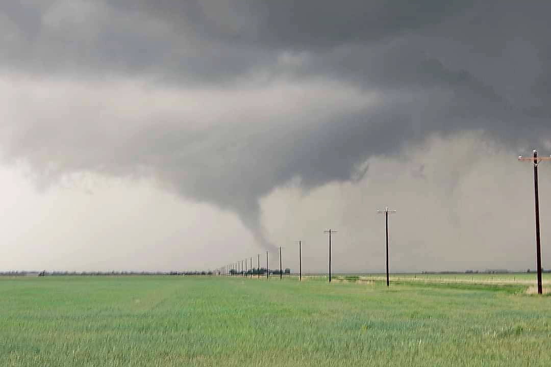
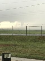
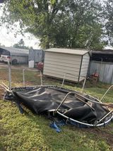
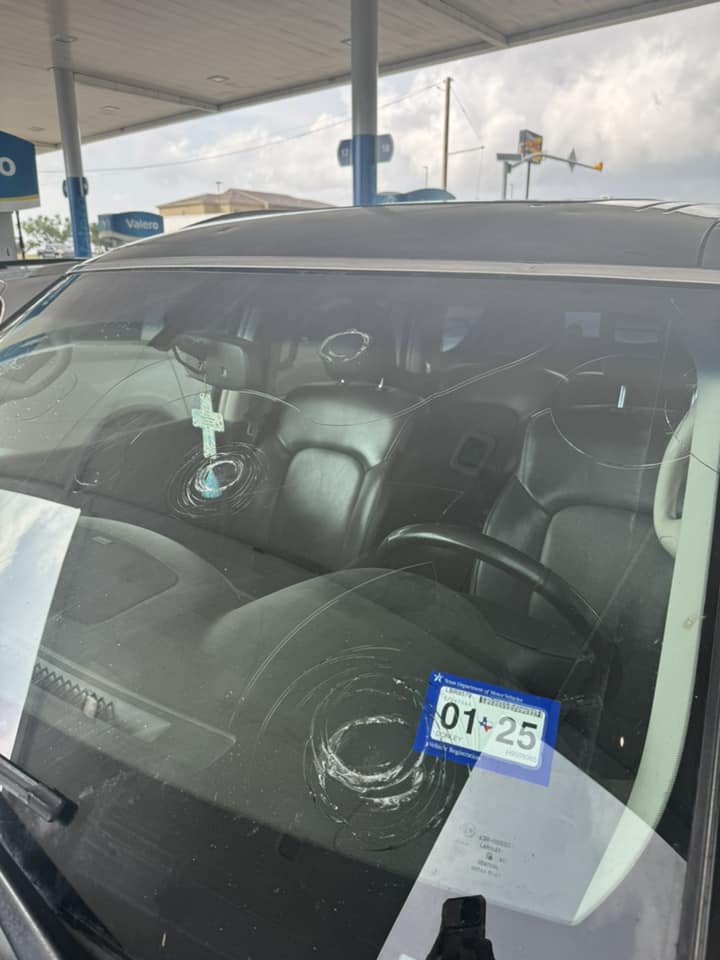
An elongated upper level trough promoted a dryline setup for severe storms in the eastern Texas Panhandle. Parameters that day begun as conditional, as a thick layer of low level clouds were present that morning in the far east, and an outflow boundary had moved in from convection on the previous day. However, as skies started to clear out and the cap was eroded, the true potential of the system was realized and thunderstorms initiated off the dryline between 3 -4 pm. A favorable environment for supercells to produce large hail and even some giant hail had materialized, and despite modest low level wind shear values at the onset of the event, tornadoes quickly spun up and posed threats for locations near Clarendon, in Spearman, and other parts surrounding. Strong downdraft and outflow winds were also a concern, but no reports had come in for straight line wind damage. As storms moved east throughout the afternoon and evening, they weakened as they entered into a less favorable environment thanks to some of the low clouds from the morning not clearing up in time to sustain thunderstorms.Tornadoes
|
Tornado - Southwest of Clarendon
Track Map 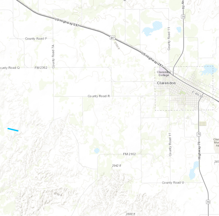 
Downloadable KMZ File |
||||||||||||||||
|
Tornado - Southwest of Clarendon
Track Map 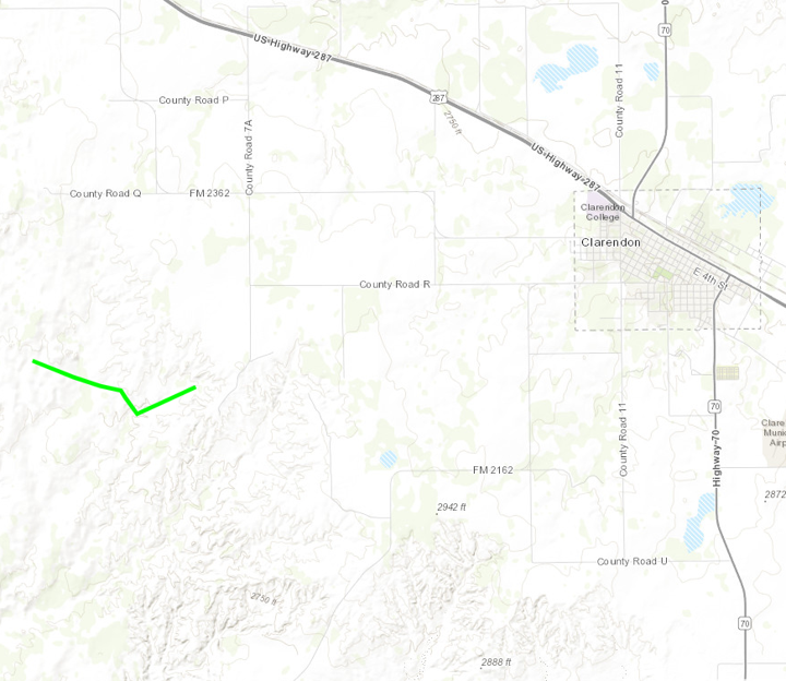
Downloadable KMZ File |
||||||||||||||||
|
Tornado - South Southeast of Spearman
Track Map 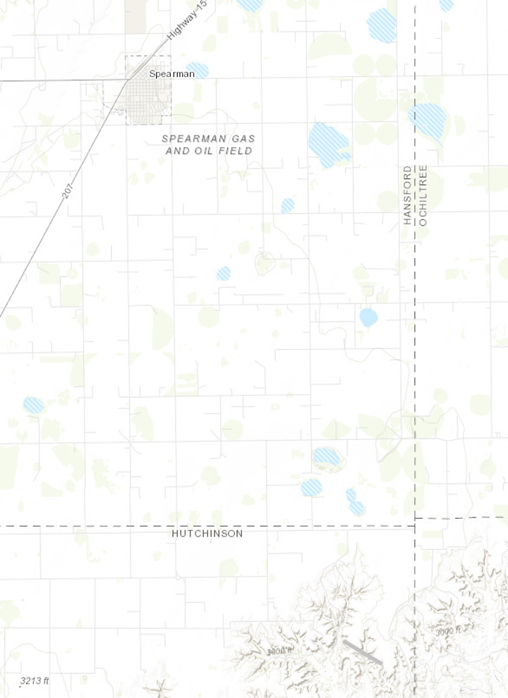
Downloadable KMZ File |
||||||||||||||||
|
Tornado - West Southwest of Spearman
Track Map 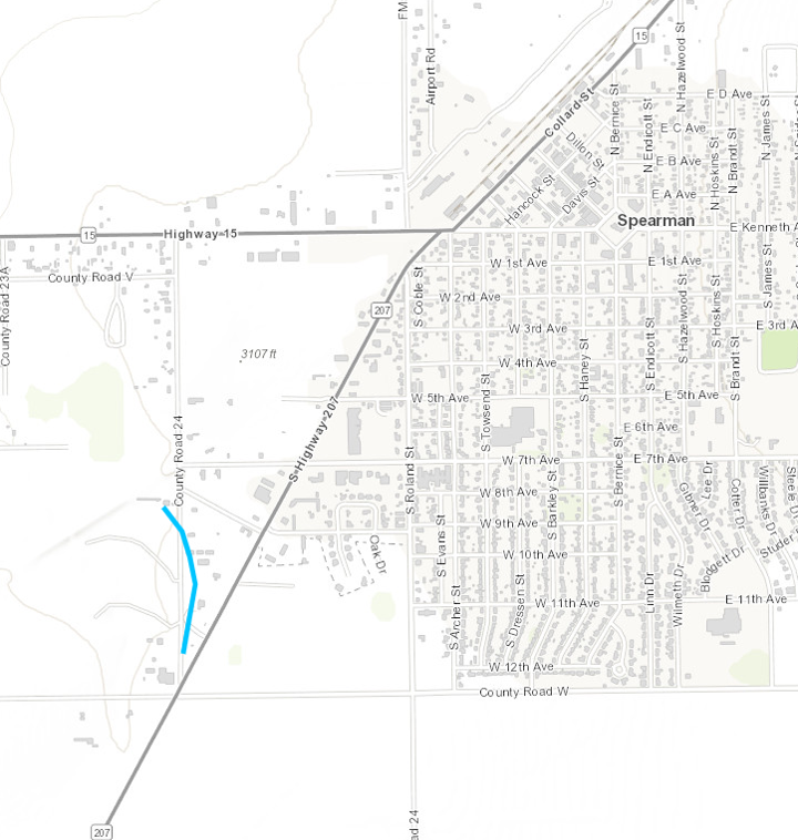
Downloadable KMZ File |
||||||||||||||||
|
Tornado - Southeast Spearman
Track Map 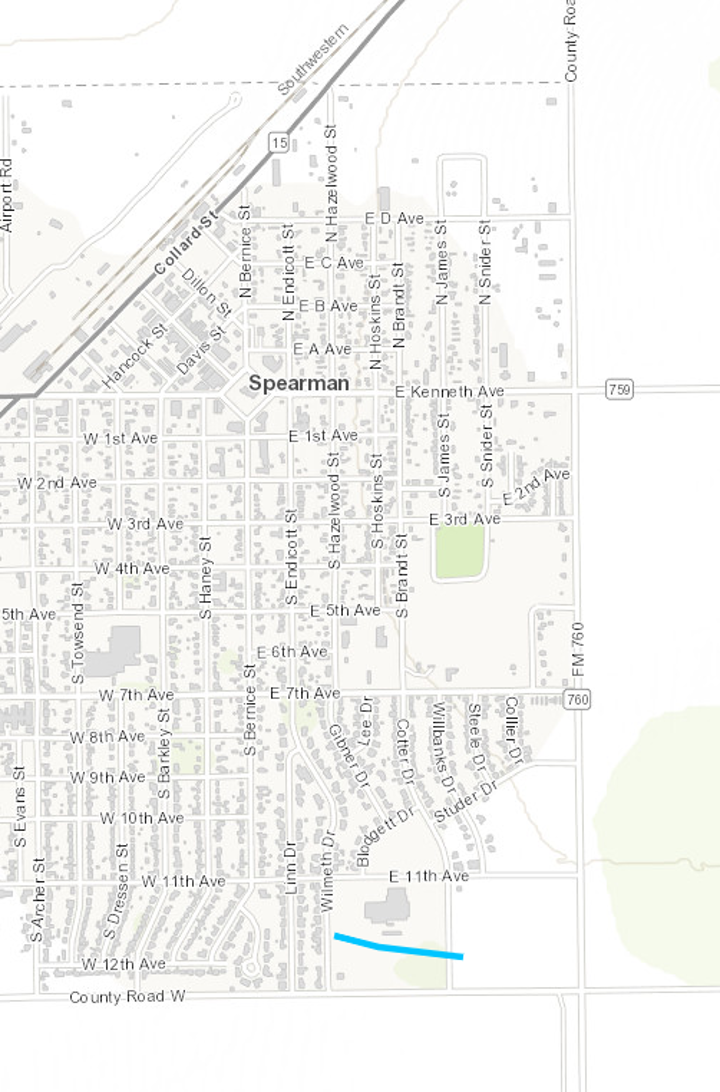
Downloadable KMZ File |
||||||||||||||||
|
Tornado - Northeast Spearman
Track Map 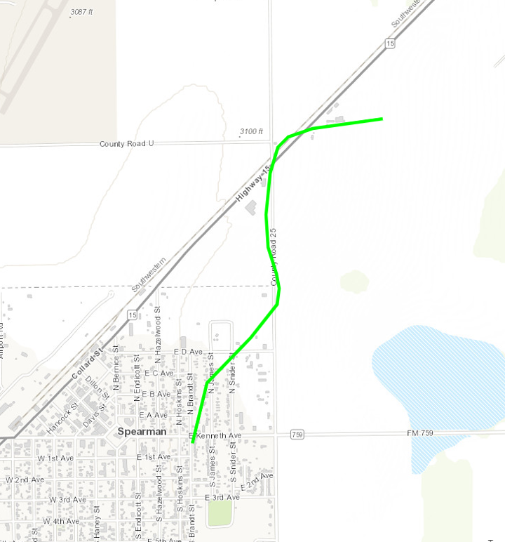
Downloadable KMZ File |
||||||||||||||||
The Enhanced Fujita (EF) Scale classifies tornadoes into the following categories:
| EF0 Weak 65-85 mph |
EF1 Moderate 86-110 mph |
EF2 Significant 111-135 mph |
EF3 Severe 136-165 mph |
EF4 Extreme 166-200 mph |
EF5 Catastrophic 200+ mph |
 |
|||||
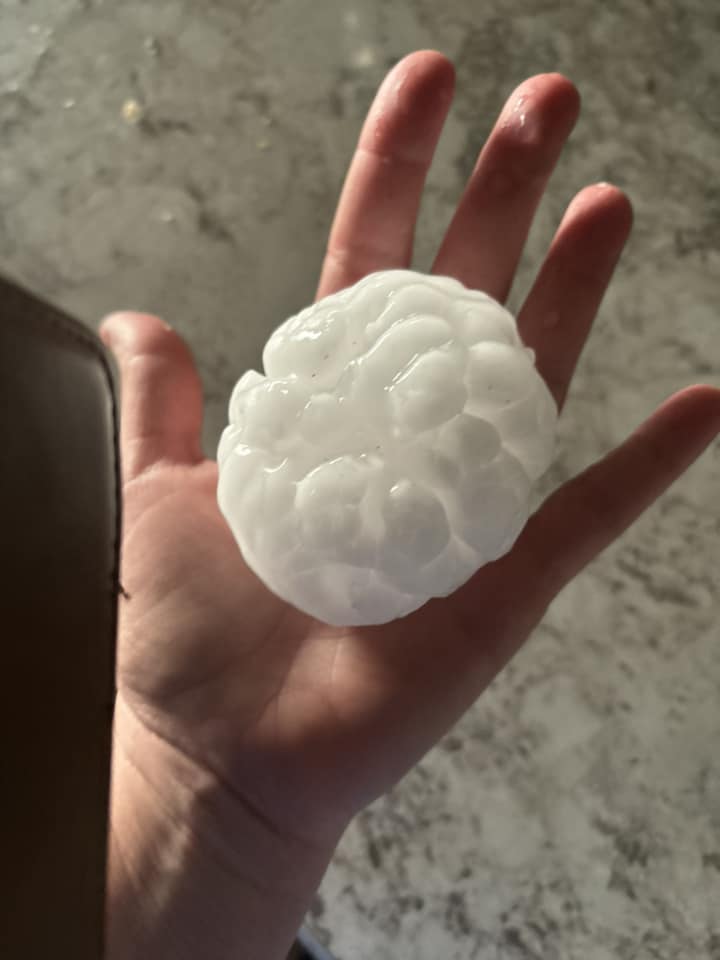
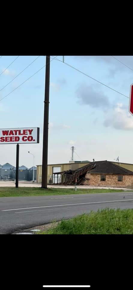
Photos & Video
 |
 |
 |
 |
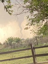
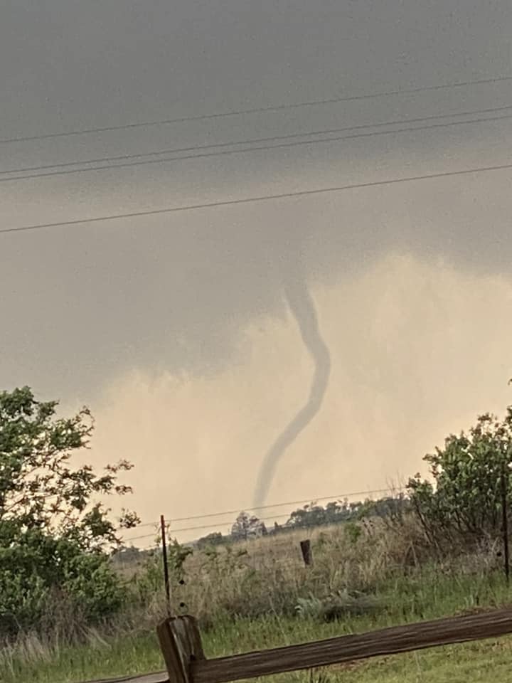
| Southwest of Clarendon, TX (Cali Ritchie) |
Southwest of Clarendon, TX (Cali Ritchie) |
East of Spearman (Dawn Davis) |
Southwest of Clarendon, TX (Renee Cosper Mott) |
 |
 |
 |
 |
| Spearman, TX (Hannah Martinez) |
Clarendon, TX (Kimberly Harper) |
Clarendon, TX (NEED PERMISS) (Amanda Baily Smith) |
Spearman, TX (Hannah Martinez) |
| Caption (source) |
Caption (source) |
Caption (source) |
Caption (source) |
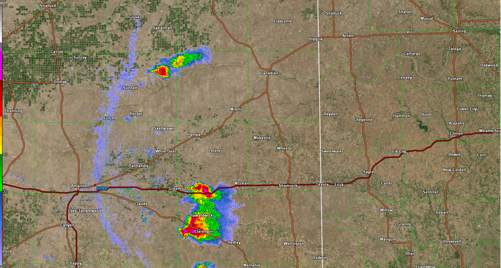
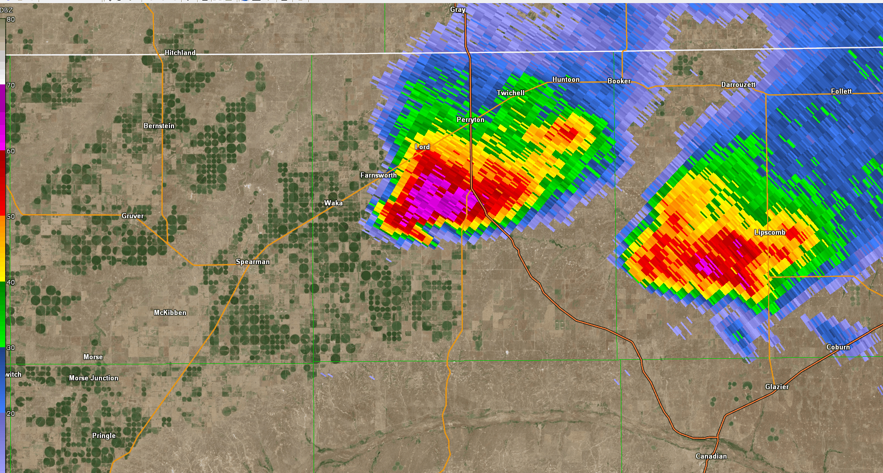
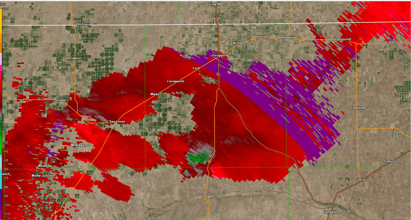
Radar
Header
 |
 |
 |
|
| Radar loop of two storms that produced tornadoes | Radar loop zoomed into Spearman storm | Radar Loop SRM Spearman Storm | Caption |
Storm Reports
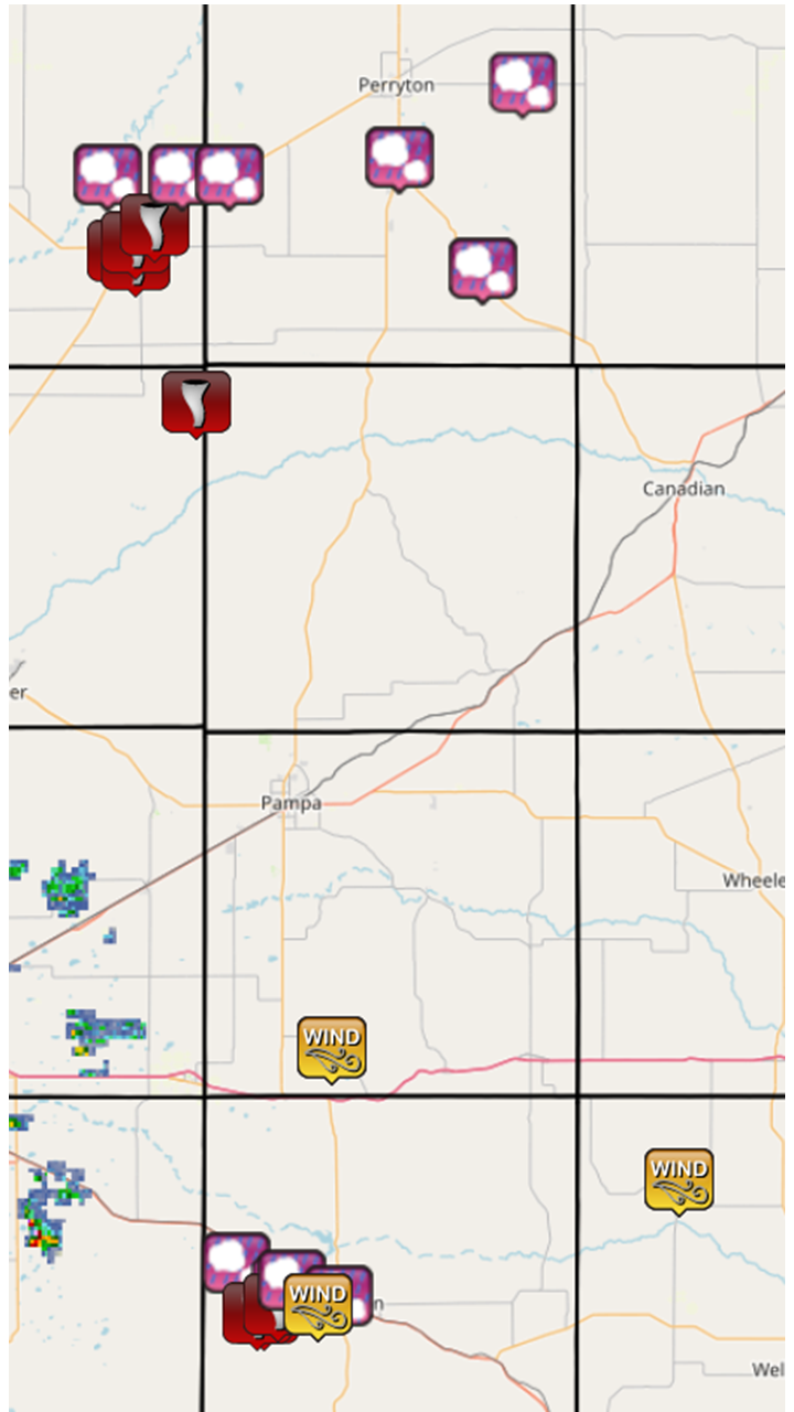 |
||||||||||||||||||||||||||||||||||||||||||||||||||||||||||||||||||||||||||||||||||||||||||||||||||||||||||||||||||||||||||||||||||||||||||||||||||||||||||||||||||||||||||||||||||||||||||||||||||||||||||||||||||||||||||||||||||||||||||||||||||||||||||||||||||||||||
|
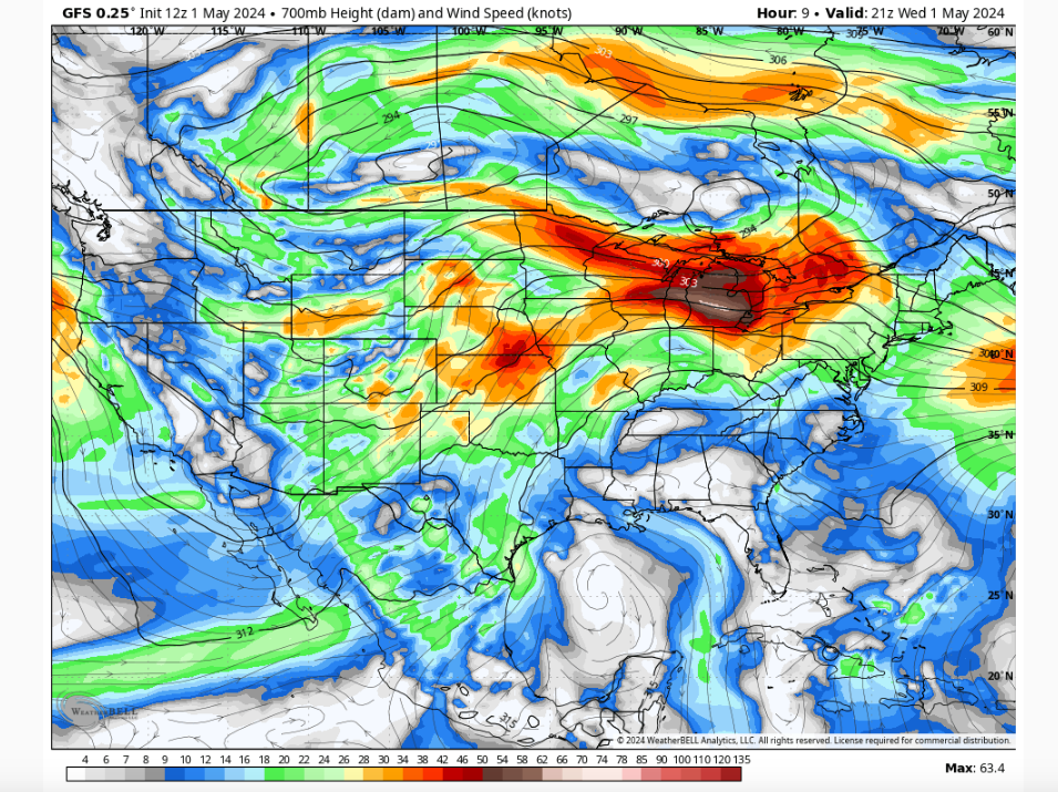
Environment
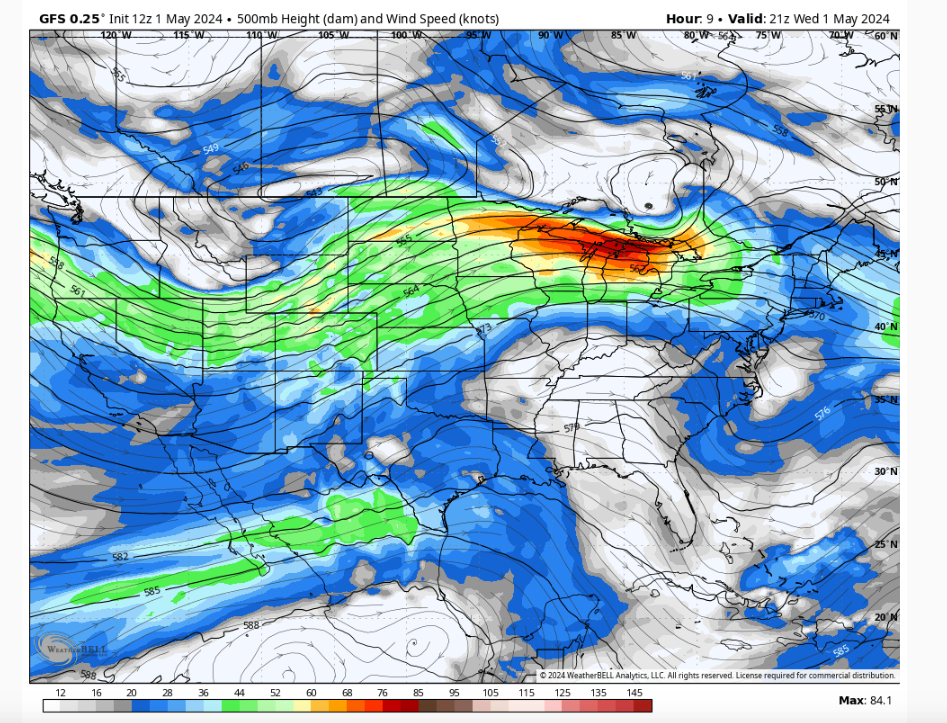 |
 |
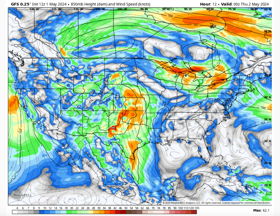 |
| Figure 1: 500mb pattern. The panhandles are in the right entrance region of the jet, which supports good vertical motion for enhanced storm lift. | Figure 2: 700 mb pattern. Main focus here is to see the streamline wind direction coming from the southwest, and there's decent wind speeds aloft which would support a well sheared environment. | Figure 3: 850 mb pattern. The main focus here is to see that the winds not far from the surface are now south to southeasterly, and have decent speeds associated. This now supports both good turning of the winds and strong speed shear as we move up in the atmosphere. Favorable pattern for tornadoes to occur. |
 |
 |
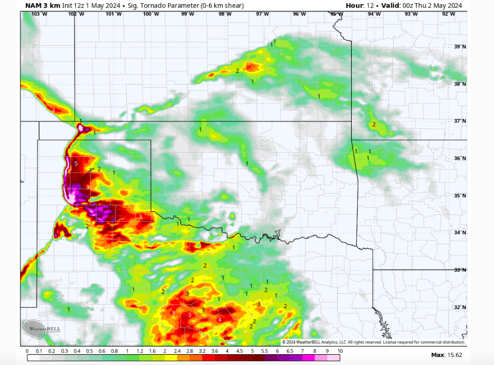 |
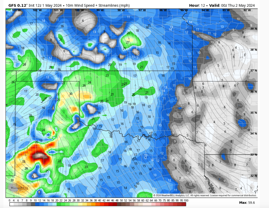
| Figure 4: Surface winds and direction. Dryline can be spotted by the west and east winds converging right where the tornadic activity was found. Again east of the dryline we have good southeast directional winds with decent speeds associated. | Figure 5: Surface based CAPE values ranged from 1500 - 3000 J/kg which supports ample instability for severe storms as they develop. | Figure 6: Significant Tornado Parameter (STP). Supporting that the environment would support tornadoes that could be significant in nature along and east of the dryline. |
 |
 |
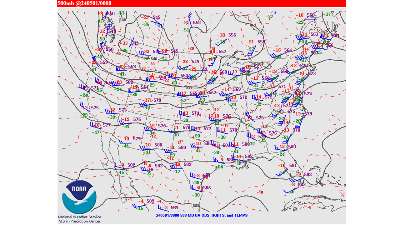 |
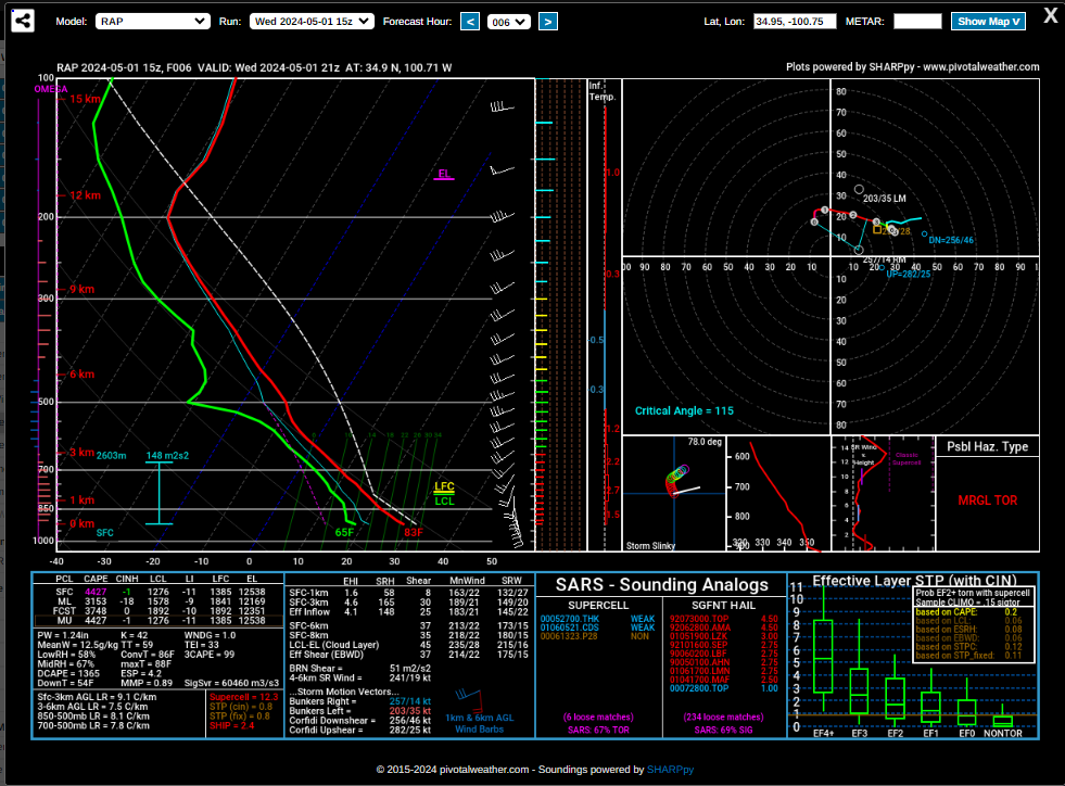
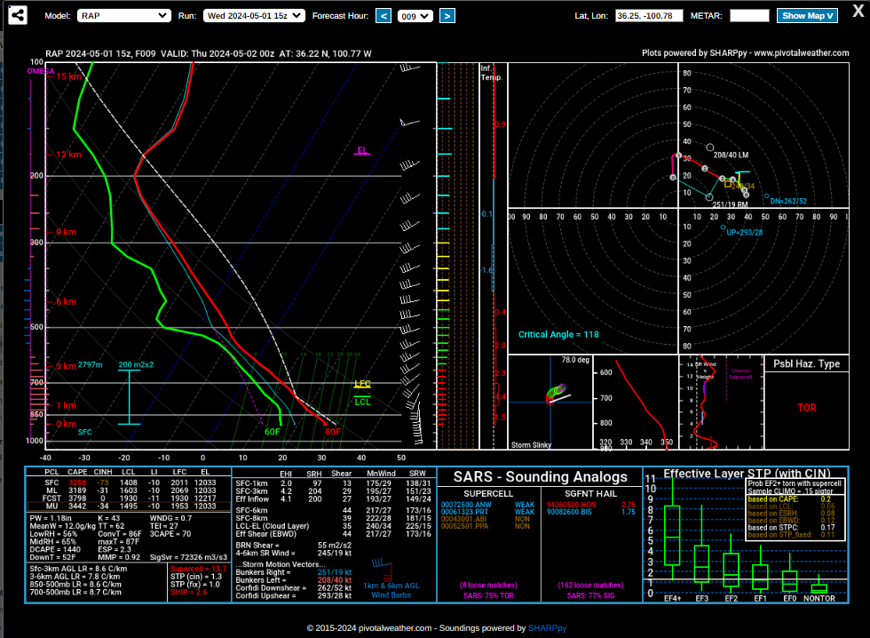
| Figure 7: Forecasted 21Z RAP Sounding over Donley County. Showed the potential for a tornadic environment. Overall, CAPE and shear we good, but low level turning and speed limited the low level helicity and suggested a marginal tornado environment. | Figure 8: Forecasted 00Z RAP Sounding over Perryton, TX. Showed better potential for a tornadic environment. Strong CAPE and shear was slightly better, low level turning got a little better as well as speed gave a boost to the the low level helicity and suggested a better tornado environment. 4 Tornadoes occurred to the southwest. 3 were in Spearman and 1 well southeast of Spearman in rural area. | Figure 9: Observed 500mb pattern. |
 |
Media use of NWS Web News Stories is encouraged! Please acknowledge the NWS as the source of any news information accessed from this site. |
|

