
Numerous severe thunderstorms are expected across a broad region from the Ohio Valley to the Mid-Atlantic and Northeast States today into tonight. Swaths of damaging wind gusts are expected and some tornadoes are possible. Bertha is expected to bring tropical storm conditions to portions of the Gulf Coast from the Florida Panhandle westward to southeastern Louisiana later today and Wednesday. Read More >
Overview
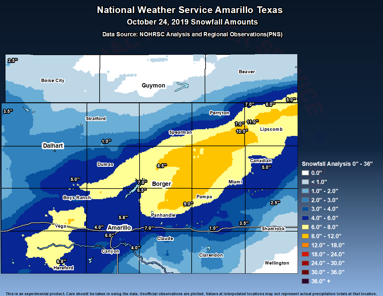
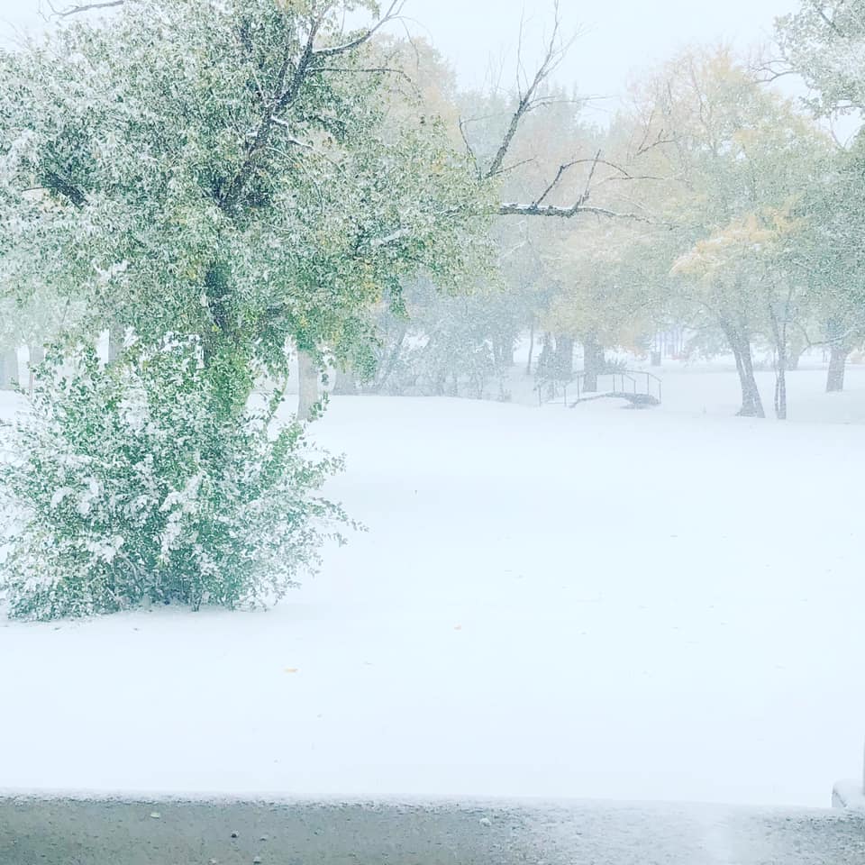
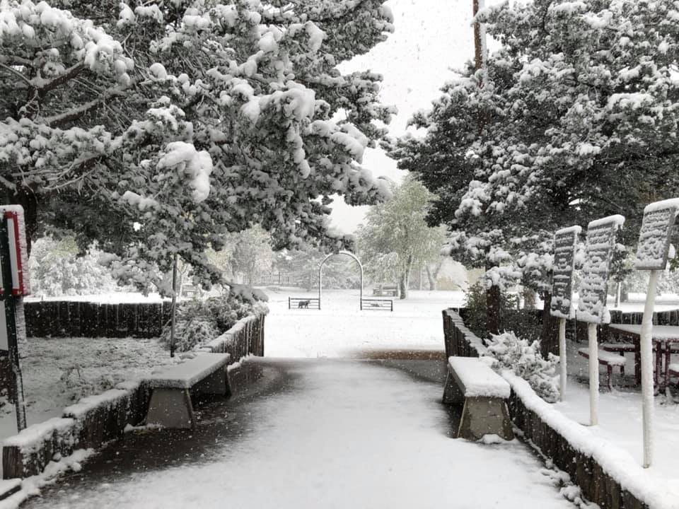
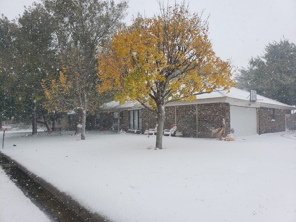
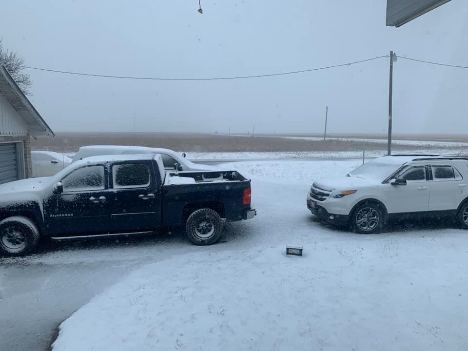
On October 24, 2019, a strong closed 500mb low pushed across the Texas and Oklahoma Panhandles while a surface cold front provided a surge of cold air across the area. Lift along the surface boundary paired with the mid-level moisture allowed precipitation to form in the far northwestern Panhandles as early as 1AM Thursday morning on October 24, 2019. However, the main event was the banding that occurred across the central Panhandles from southwest to northeast. Enhanced lifting from the surface, interacting with the upper level system and very cold temperatures brought multiple heavy bands of snow along with thundersnow to the Panhandles. By 9 AM, the first sign of snow in the southwest Texas Panhandle appeared on radar reflectivity and this led to hours and hours of snowfall before ending the heavy banding around 2 AM Friday morning October 25, 2019. Lingering snow flurries continued in the far eastern Texas Panhandle through midday Friday. Snowfall amounts ranged from 1” in Boise City, Oklahoma as well as Cactus and Howardwick, Texas to 11” in Booker and Miami, Texas. A tricky aspect to this event were the strong winds of 25 to 35 mph with gusts up to 40 mph across the area, which made snowfall measurements very difficult due to blowing snow causing drifts of a foot or more in localized areas.
Snow Amounts
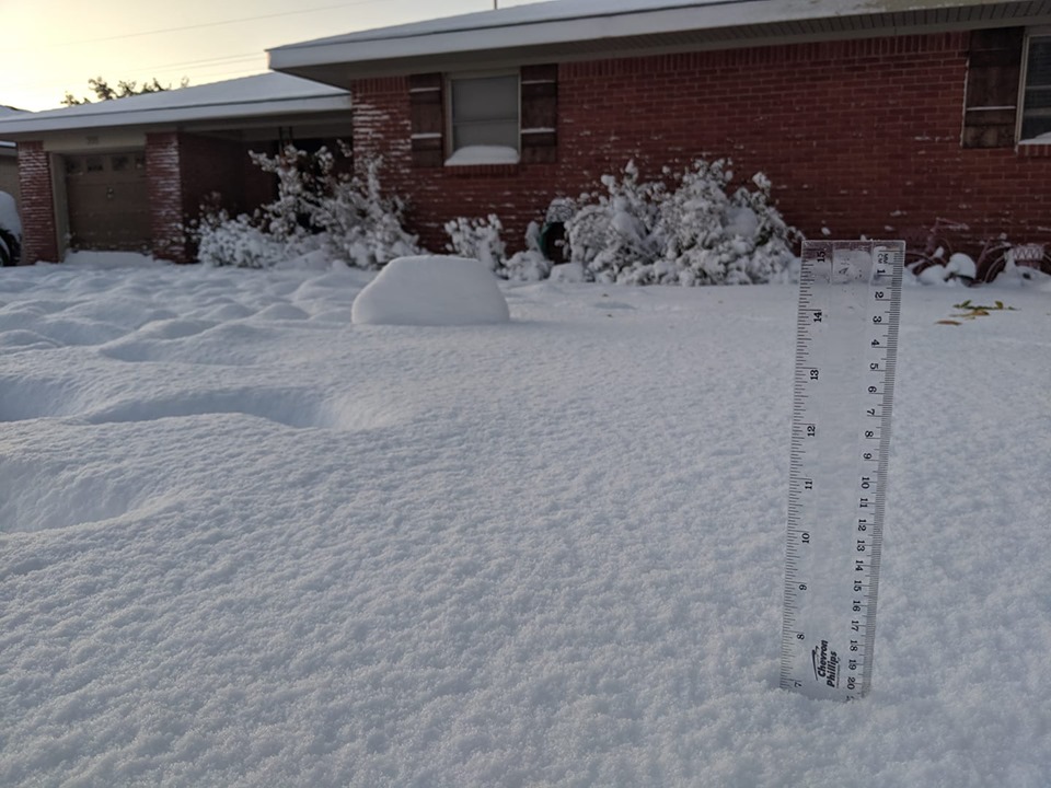
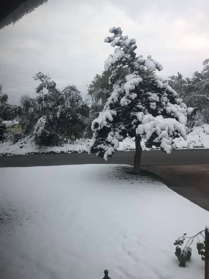
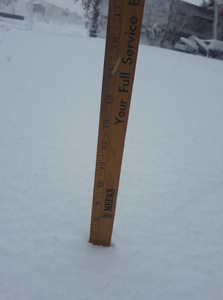
Photos & Video
 |
 |
 |
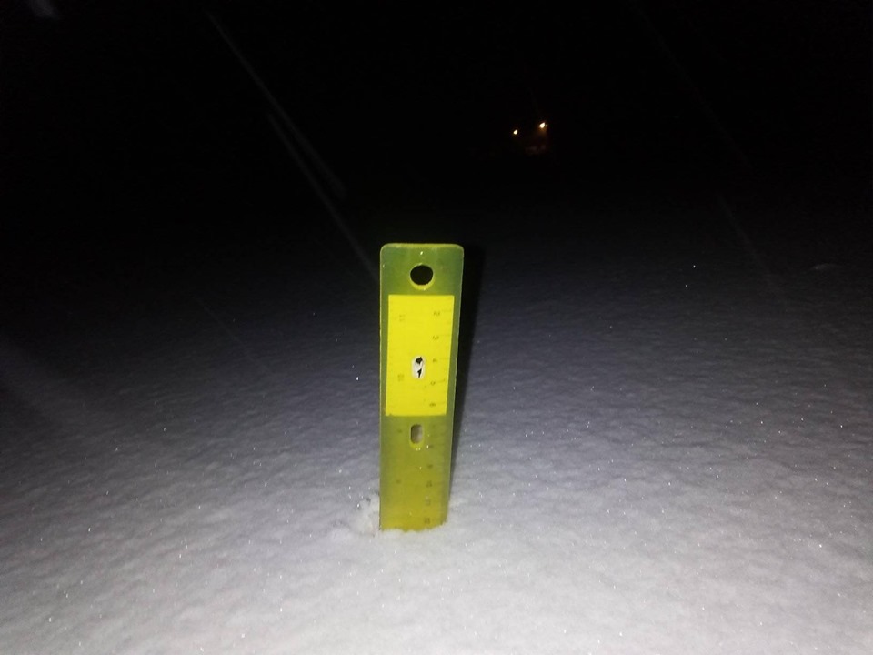
| East of Bishop Hills, Texas (Photo Credit: Lynn Braudt) |
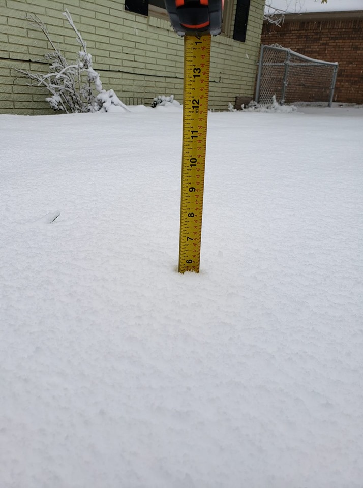
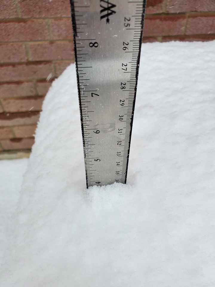
7" measured in Borger, Texas (Photo Credit: Sarah Richter) |
Canadian, Texas (Photo Credit: Lindsey Pursley) |
 |
 |
 |
| 6.5" measured in Fritch, Texas (Photo Credit: Robin Alexander) |
7" measured in Washburn, Texas (Photo Credit: Brittaney Maddox) |
Hereford, Texas (Photo Credit: Clarissa Medrano) |
 |
 |
 |
| 5.8" measured in Canyon, Texas (Photo Credit: Shelby Hanes) |
Lake Fryer, Texas (Photo Credit: Brenda Sparks Huddleston) |
4" measured in Amarillo, Texas (Photo Credit: Joshua Lewis) |
 |
 |
| Canyon, Texas (Photo Credit: Brandy Jolly Ellison) |
Boise City, Oklahoma (Photo Credit: Dustin Cox) |
Storm Reports
PRELIMINARY LOCAL STORM REPORT...SUMMARY
NATIONAL WEATHER SERVICE AMARILLO TX
306 PM CDT FRI OCT 25 2019

..TIME...   ...EVENT...      ...CITY LOCATION...     ...LAT.LON...
..DATE...   ....MAG....      ..COUNTY LOCATION..ST.. ...SOURCE....
            ..REMARKS..

0917 AM     SNOW             BOISE CITY              36.73N 102.51W
10/24/2019  E1.0 INCH        CIMARRON           OK   EMERGENCY MNGR


0917 AM     SNOW             KENTON                  36.90N 102.97W
10/24/2019  M2.5 INCH        CIMARRON           OK   EMERGENCY MNGR

            .

0430 PM     SNOW             DALHART                 36.06N 102.52W
10/24/2019  M2.0 INCH        DALLAM             TX   CO-OP OBSERVER

            DALHART COOP MEASURED 2 INCHES OF SNOW, AND
            SNOW HAS PRETTY MUCH ENDED.

0715 PM     SNOW             1 SE BORGER             35.65N 101.39W
10/24/2019  M5.5 INCH        HUTCHINSON         TX   PUBLIC

            PICTURE OF 5.5 INCH SNOW DEPTH FROM
            SOUTHEAST BORGER.

0736 PM     SNOW             SPEARMAN                36.19N 101.19W
10/24/2019  E2.5 INCH        HANSFORD           TX   TRAINED SPOTTER

            TWO TO TWO AND A HALF INCHES HAS BEEN
            ESTIMATED TO HAVE FALLEN. SNOWFALL IS MOVING
            EAST OUT OF THE AREA WITH A CLEARING BEHIND.

0900 PM     SNOW             HEREFORD                34.82N 102.40W
10/24/2019  M4.0 INCH        DEAF SMITH         TX   LAW ENFORCEMENT

            SHERIFF OFFICE REPORTED SEVERAL AREAS IN AND
            AROUND HEREFORD HAD GOTTEN 4 INCHES OF SNOW
            FOR THE EVENT. SNOW IS ENDING IN HEREFORD.

0906 PM     SNOW             2 N CACTUS              36.07N 102.01W
10/24/2019  E1.0 INCH        SHERMAN            TX   LAW ENFORCEMENT

            SHERIFF OFFICE REPORTED ABOUT A QUARTER OF
            AN INCH IN STRATFORD, BUT FURTHER SOUTH NEAR
            CACTUS GOT ABOUT AN INCH OF SNOW.

0915 PM     SNOW             5 SW AMARILLO           35.15N 101.87W
10/24/2019  M6.0 INCH        RANDALL            TX   NWS EMPLOYEE

            STORM TOTAL.

0916 PM     SNOW             4 SSW AMARILLO          35.14N 101.86W
10/24/2019  M5.6 INCH        RANDALL            TX   NWS EMPLOYEE

            5.6 INCHES OF SNOWFALL MEASURED AND THE SNOW
            HAS STOPPED.

0930 PM     SNOW             3 E CANYON              34.98N 101.87W
10/24/2019  M5.8 INCH        RANDALL            TX   NWS EMPLOYEE

            NWS EMPLOYEE MEASURED 5.8 AS A FINAL SNOW
            AMOUNT AS VERY LIGHT SNOW IS FALLING AND
            WILL BE ENDING SOON.

1000 PM     SNOW             10 N HOWARDWICK         35.18N 100.91W
10/24/2019  E1.0 INCH        DONLEY             TX   TRAINED SPOTTER

            SPOTTER REPORTED 1 INCH OF SNOW WHILE
            RETURNING TRAVELING ALONG TX HIGHWAY 70.

1030 PM     SNOW             BOOKER                  36.28N 100.54W
10/24/2019  M7.0 INCH        LIPSCOMB           TX   EMERGENCY MNGR

            EMERGENCY MANAGER REPORTED 7 INCHES OF SNOW.

1100 PM     SNOW             4 W AMARILLO            35.20N 101.87W
10/24/2019  M6.0 INCH        POTTER             TX   PUBLIC

            MEASURED IN MULTIPLE SPOTS, AVERAGED TO 6
            INCHES.

1100 PM     SNOW             CANYON                  34.98N 101.92W
10/24/2019  M5.8 INCH        RANDALL            TX   PUBLIC

            FACEBOOK PICTURE OF MEASURED SNOW IN CANYON.

1100 PM     SNOW             WASHBURN                35.18N 101.57W
10/24/2019  M7.0 INCH        ARMSTRONG          TX   PUBLIC

            FACEBOOK PICTURE SHOWING 7 INCHES OF
            MEASURED SNOW.

1124 PM     SNOW             8 SE SLAPOUT            36.54N 100.01W
10/24/2019  E5.0 INCH        BEAVER             OK   PUBLIC

            REPORT EMAILED TO THE OFFICE, WITH A PICTURE
            SUGGESTS 4 TO 6 INCHES POSSIBLE. ELEVATED
            SURFACES LOOK TO HAVE 6 INCHES.

1205 AM     SNOW             PERRYTON                36.39N 100.80W
10/25/2019  E3.0 INCH        OCHILTREE          TX   LAW ENFORCEMENT

            STORM TOTAL.

1232 AM     SNOW             MIAMI                   35.69N 100.64W
10/25/2019  E11.0 INCH       ROBERTS            TX   LAW ENFORCEMENT

            STORM TOTAL.

0112 AM     SNOW             6 ENE AMARILLO          35.24N 101.72W
10/25/2019  M5.5 INCH        POTTER             TX   OFFICIAL NWS OBS

            STORM TOTAL.

0126 AM     SNOW             DARROUZETT              36.45N 100.33W
10/25/2019  M6.0 INCH        LIPSCOMB           TX   LAW ENFORCEMENT

            STORM TOTAL.

0700 AM     SNOW             BORGER                  35.66N 101.40W
10/25/2019  M6.5 INCH        HUTCHINSON         TX   TRAINED SPOTTER

            OFFICIAL OBSERVER IN BORGER MEASURED 6.5
            INCHES.

0700 AM     SNOW             CHANNING                35.68N 102.33W
10/25/2019  M5.0 INCH        HARTLEY            TX   PUBLIC

            .

0700 AM     SNOW             CLAUDE                  35.11N 101.36W
10/25/2019  M5.0 INCH        ARMSTRONG          TX   EMERGENCY MNGR

            EMERGENCY MANAGER MEASURED 5 INCHES OF SNOW.

0700 AM     SNOW             FRITCH                  35.64N 101.60W
10/25/2019  M6.5 INCH        HUTCHINSON         TX   PUBLIC

            FACEBOOK REPORT OF 6.5 INCHES OF MEASURED
            SNOW.

0700 AM     SNOW             MCLEAN                  35.23N 100.60W
10/25/2019  M3.5 INCH        GRAY               TX   PUBLIC

            FACEBOOK PICTURE OF 3.5 INCHES.

0700 AM     SNOW             STINNETT                35.82N 101.44W
10/25/2019  M8.5 INCH        HUTCHINSON         TX   PUBLIC

            FACEBOOK PICTURE OF 8.5 INCHES MEASURED IN
            STINNETT.

0700 AM     SNOW             WHEELER                 35.44N 100.28W
10/25/2019  E2.5 INCH        WHEELER            TX   EMERGENCY MNGR

            APPROXIMATELY 2.5 INCHES OF ACCUMULATED SNOW
            REPORTED BY COUNTY EM.

0800 AM     SNOW             12 S BOOKER             36.28N 100.54W
10/25/2019  M11.0 INCH       LIPSCOMB           TX   PUBLIC

            FACEBOOK PICTURE OF 11 INCHES OF SNOW.

0800 AM     SNOW             BOYS RANCH              35.51N 102.25W
10/25/2019  M4.0 INCH        OLDHAM             TX   PUBLIC

            SNOW OBSERVATION TAKEN FROM BOYS RANCH.

0800 AM     SNOW             7 S CANADIAN            35.81N 100.38W
10/25/2019  M5.0 INCH        HEMPHILL           TX   FIRE DEPT/RESCUE

            CANADIAN FIRE CHIEF MEASURED 5 INCHES.

0800 AM     SNOW             21 ESE CANADIAN         35.79N 100.04W
10/25/2019  M3.5 INCH        HEMPHILL           TX   FIRE DEPT/RESCUE

            .

0800 AM     SNOW             DUMAS                   35.86N 101.96W
10/25/2019  M4.0 INCH        MOORE              TX   BROADCAST MEDIA

            BROADCAST MEDIA PASSED ON REPORT OF 4 INCHES
            IN DUMAS.

0800 AM     SNOW             3 NW PALO DURO CANYON   34.98N 101.71W
10/25/2019  M4.0 INCH        RANDALL            TX   PUBLIC

            FACEBOOK PICTURE RECEIVED OF 4 INCHES OF
            SNOW AT THE RIM OF PALO DURO CANYON.

0800 AM     SNOW             WOLF CREEK PARK         36.21N 100.65W
10/25/2019  M10.0 INCH       OCHILTREE          TX   PUBLIC

            WOLF CREEK PARK STAFF MEASURED 10 INCHES
            THIS MORNING.

0832 AM     SNOW             VEGA                    35.25N 102.43W
10/25/2019  M8.0 INCH        OLDHAM             TX   TRAINED SPOTTER

            .

0838 AM     SNOW             BUSHLAND                35.19N 102.06W
10/25/2019  M4.0 INCH        POTTER             TX   PUBLIC

            FACEBOOK REPORT OF 4 INCHES IN BUSHLAND.

0848 AM     SNOW             3 NW AMARILLO           35.23N 101.86W
10/25/2019  M5.5 INCH        POTTER             TX   PUBLIC

            FACEBOOK PICTURE OF 5.5 INCHES MEASURED IN
            NORTHERN AMARILLO.

0848 AM     SNOW             WHITE DEER              35.43N 101.17W
10/25/2019  M9.0 INCH        CARSON             TX   PUBLIC

            FACEBOOK PICTURE OF 9 INCHES OF SNOW.

0851 AM     SNOW             1 E LAKE MEREDITH       35.65N 101.64W
10/25/2019  M7.0 INCH        MOORE              TX   COUNTY OFFICIAL

            CANADIAN MUNICIPAL WATER AUTHORITY OFFICE
            MEASURED 7 INCHES.

0855 AM     SNOW             PANHANDLE               35.35N 101.38W
10/25/2019  M7.0 INCH        CARSON             TX   TRAINED SPOTTER

            SPOTTER MEASURED 7 INCHES OF SNOW SHORTLY
            AFTER THE EVENT ENDED.
 |
Media use of NWS Web News Stories is encouraged! Please acknowledge the NWS as the source of any news information accessed from this site. |
|

