Flash flooding threatens areas from the Tennessee Valley to the Carolinas as storms repeat along a stalled front. Monsoonal storms may trigger flooding in the Southwest. Dangerous heat expands across the Desert Southwest, Plains, mid-Mississippi Valley and Southern Tier. Critical fire weather for interior Pacific Northwest. Cooler, drier air brings brief relief to the Great Lakes and Northeast. Read More >
Overview
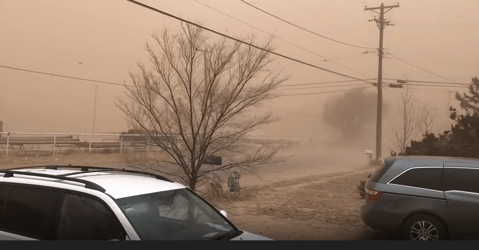
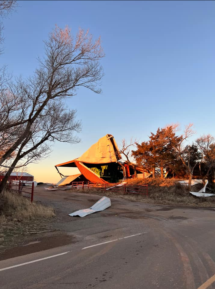
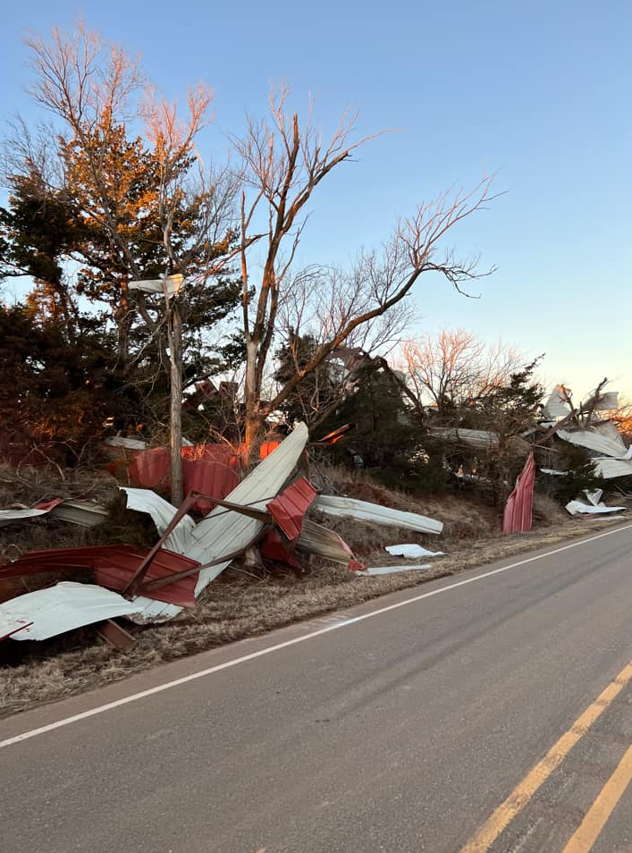
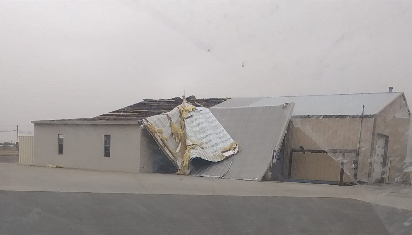
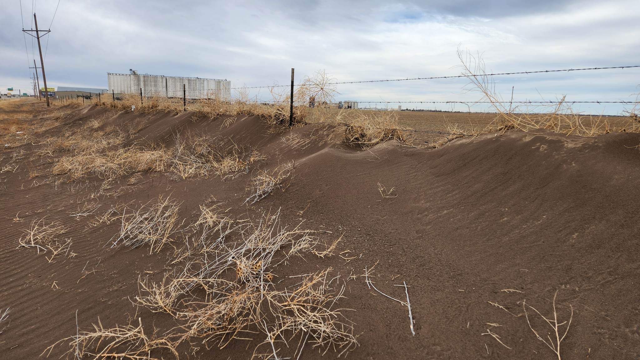
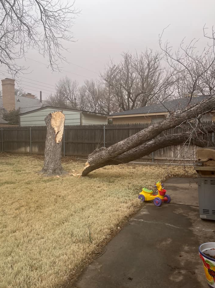
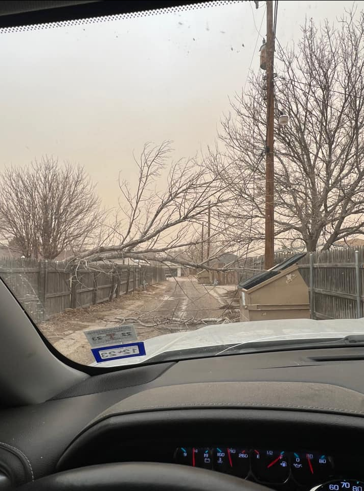
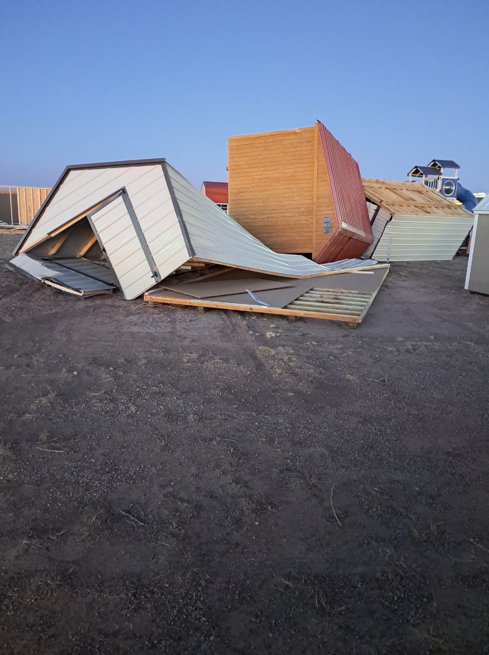
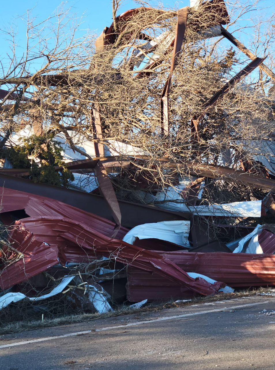
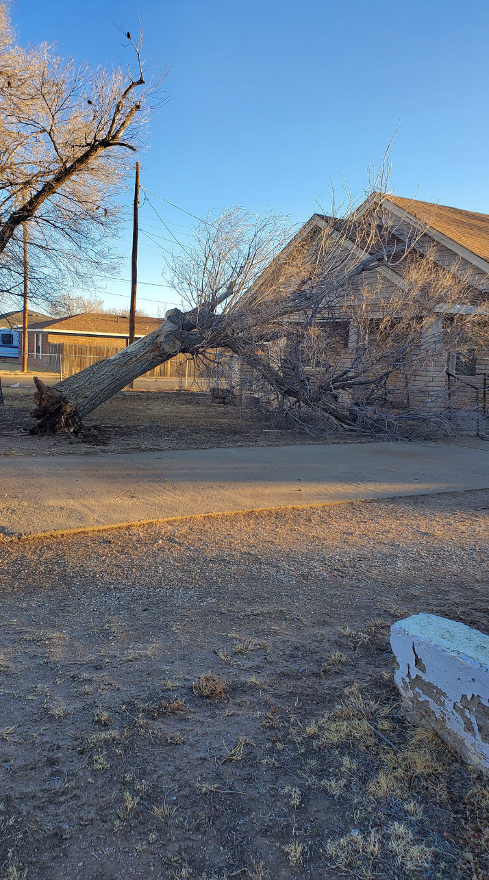
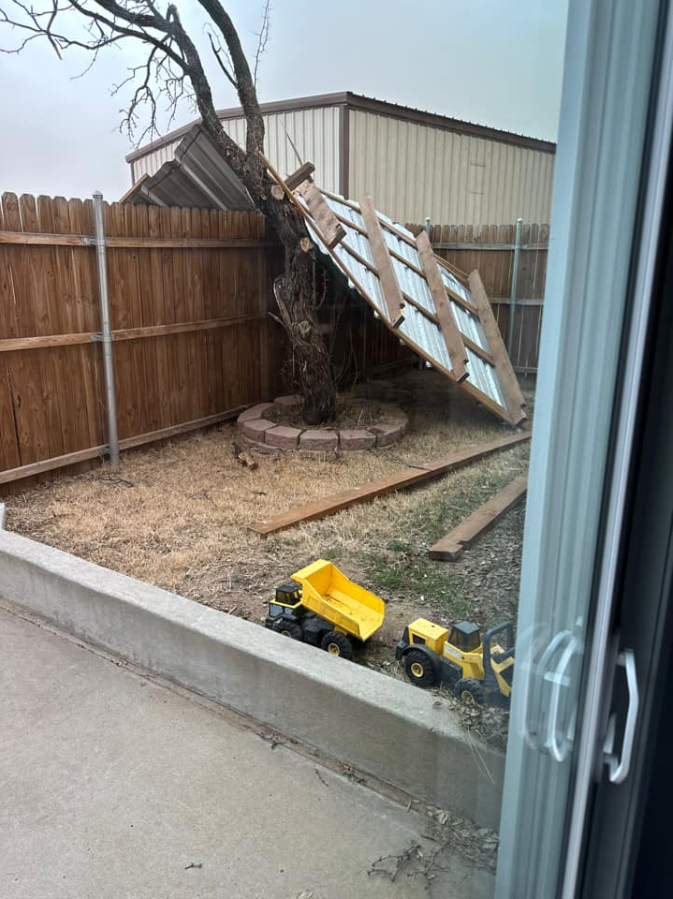
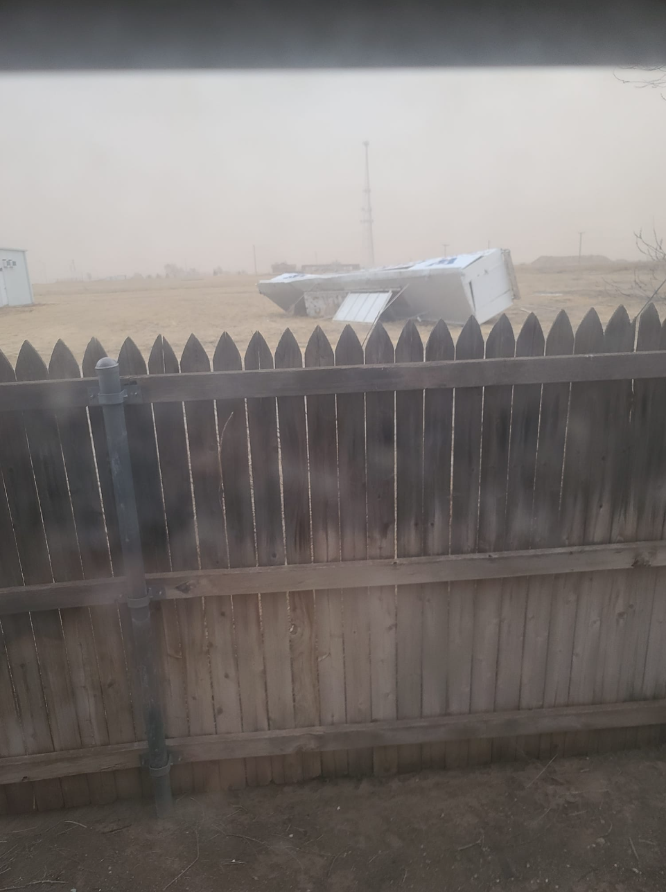
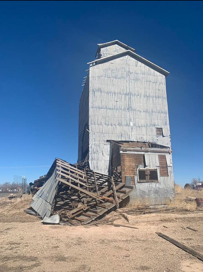
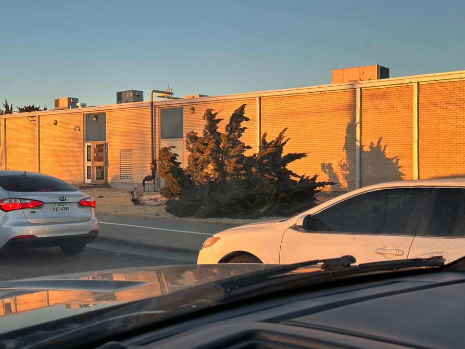
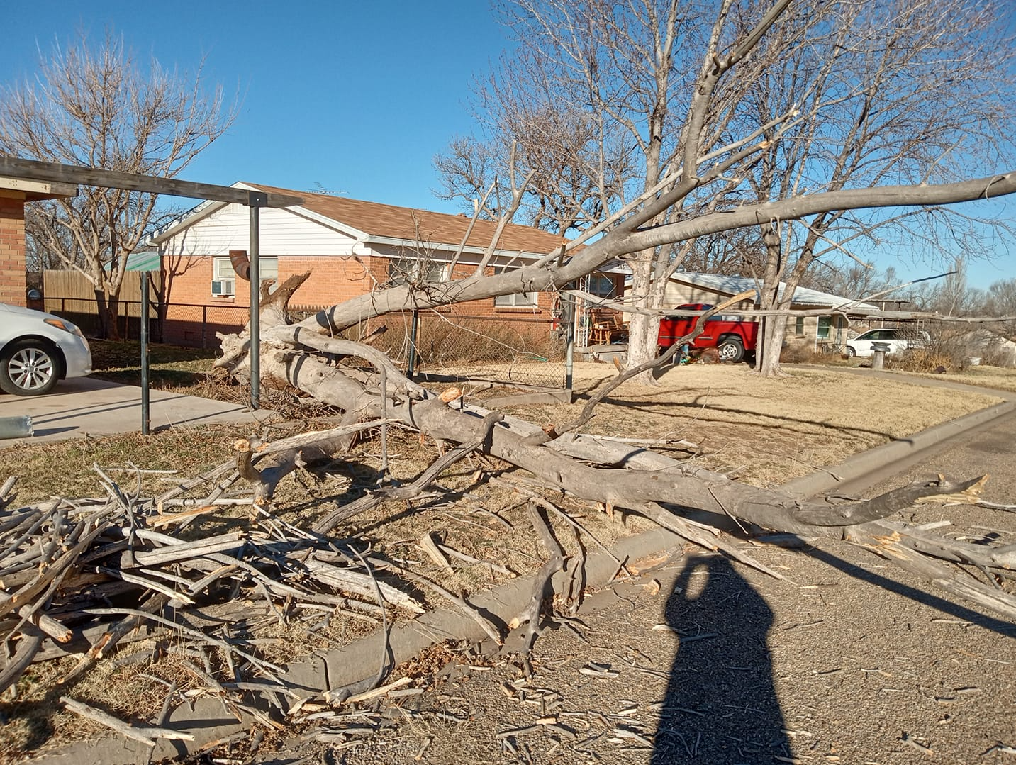
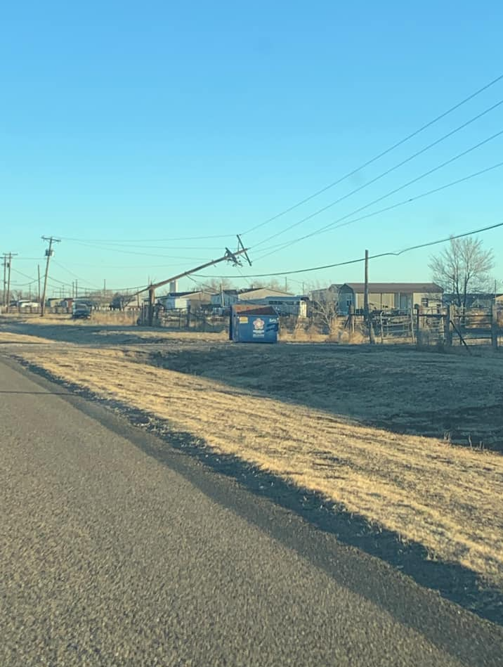
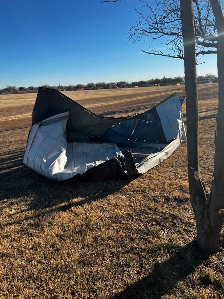
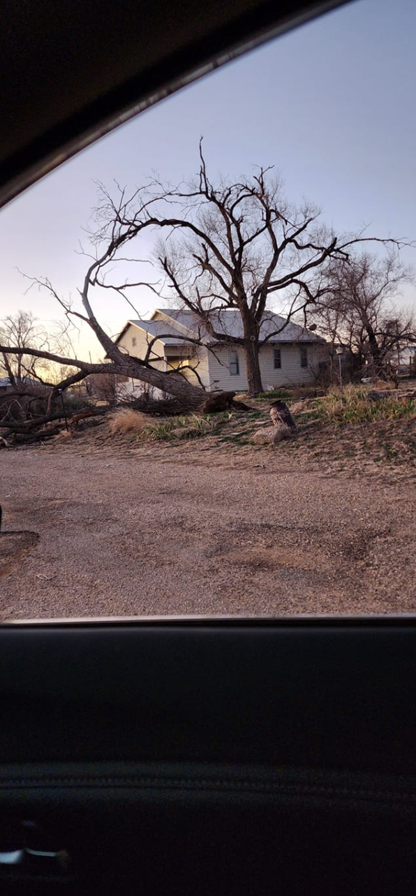
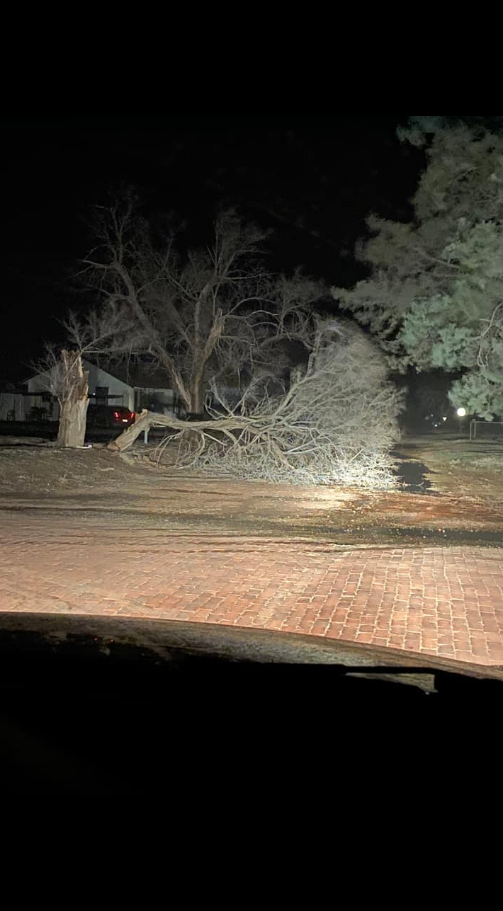
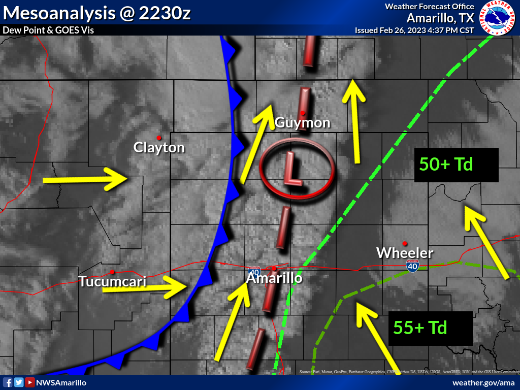
A vigorous upper level storm system passed through the Southern Great Plains on February 26th, 2023. This brought widespread strong winds, blowing dust leading to visibility restrictions, large hail, and a couple tornadoes. The severe thunderstorms were out ahead of the main Pacific front and mainly impacted the eastern combined Panhandles. The stronger of the two tornadoes produced EF-1 damage on an outbuilding in Wheeler County. Widespread blowing dust due to strong winds out of the west led to visibility restrictions that caused vehicle accidents near Adrian and Dalhart, Texas. The largest reported hail stone was golf ball size hail 5 miles east of McLean, Texas and the strongest measured wind gust was 87 mph at Stratford, Texas.
 |
 |
|
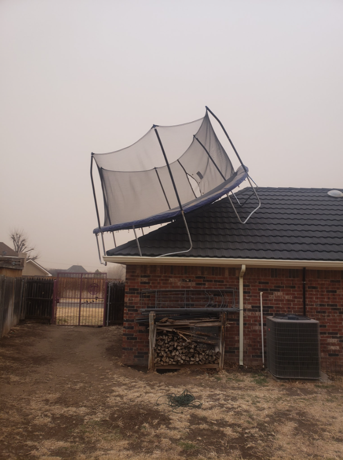
| Trampoline on house in north Amarillo. Photo courtesy of Matt Thomason. | Tornado damage near Kelton. Photo courtesy of Shawna Powell Hennig. | Reduced Visibility in Dalhart from Dust. Courtesy of @DalhartWx |
Tornadoes
|
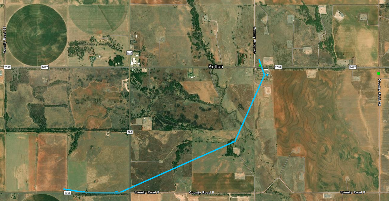
Tornado - Kelton
|
||||||||||||||||
|
||||||||||||||||
|
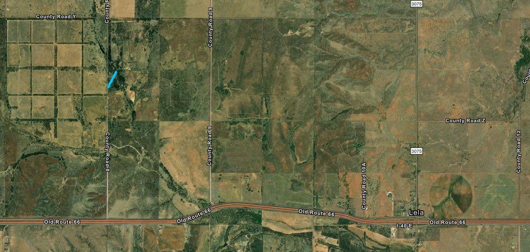
Tornado - Lela 3 NW
|
||||||||||||||||
The Enhanced Fujita (EF) Scale classifies tornadoes into the following categories:
| EF0 Weak 65-85 mph |
EF1 Moderate 86-110 mph |
EF2 Significant 111-135 mph |
EF3 Severe 136-165 mph |
EF4 Extreme 166-200 mph |
EF5 Catastrophic 200+ mph |
 |
|||||
Photos & Video
|
|
|
 |
|
| Dalhart, TX (Debrah Frazier) |
Dust Drift (Corbin Voges) |
Amarillo, TX (Jerilyn Rule-Brewer) |
Borger, TX (Liesa Keeney Whiteley) |
 |
|
 |
 |
| Amarillo, TX (Amanda L Brown) |
Amarillo, TX (Hunter Corona) |
Canyon, TX (Amanda Tidwell) |
Dawn, TX (Michael Valdovinos) |
 |
 |
 |
 |
| Gene Howe Elementary School, Amarillo, TX (Trisha Webb Myres) |
Fritch, TX (Katherine Denise Washer Stowell) |
Amarillo, TX (Shela Grant) |
Amarillo, TX (Colton Stamps) |
|
|
|
 |
 |
| Canyon Firework Stand (Amanda Tidwell) |
Dalhart, TX (Karen Files Line) |
Clarendon, TX (Jen Mitchel) |
Wellington, TX (Jen Nanez) |
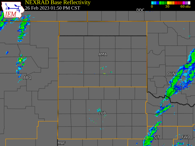
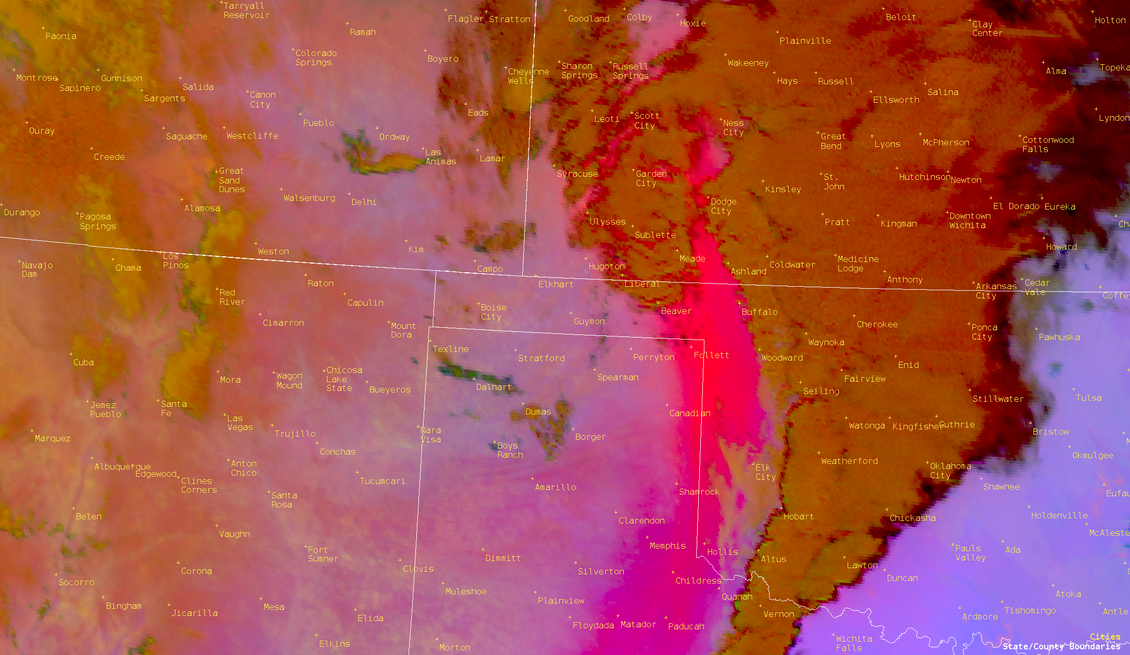
Radar
 |
 |
 |
| Radar Loop of the Event | Satellite Loop of the Dust Storm | Big Fin Flats Fire |
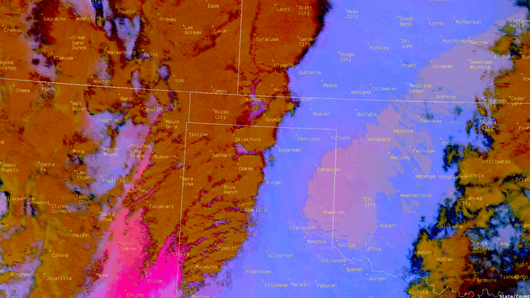
Environment
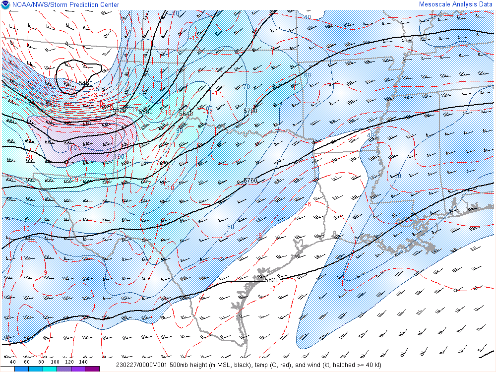
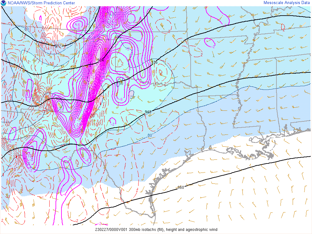
A compact but strong upper level shortwave moved through the Panhandles on Feb 26th which resulted in broad scale lift along with increased moisture return across the area. The very cold mid level temperatures promoted steep lapse rates and increased instability while the very strong kinematics primed the atmosphere for supercell thunderstorms.
 |
 |
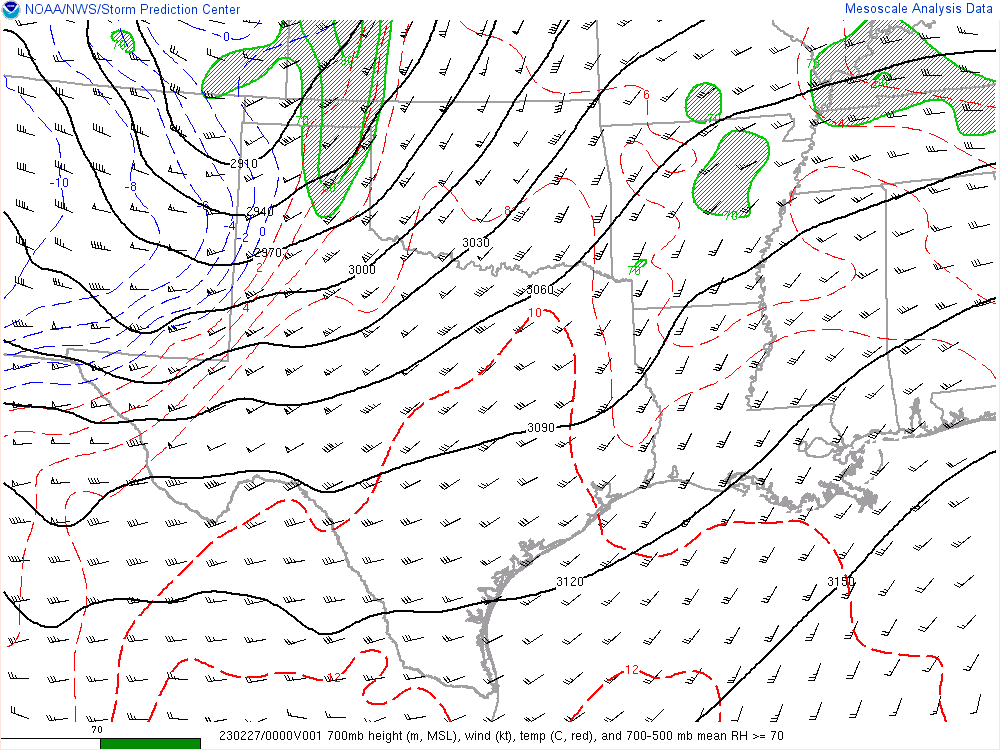 |
| Figure 1: 500mb Winds and Heights | Figure 2: 300mb Heights and Ageostrophic Winds | Figure 3: 700mb Heights, winds, temps, and 700-500 mb mean RH |
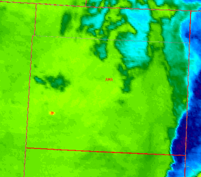
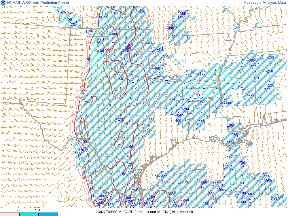
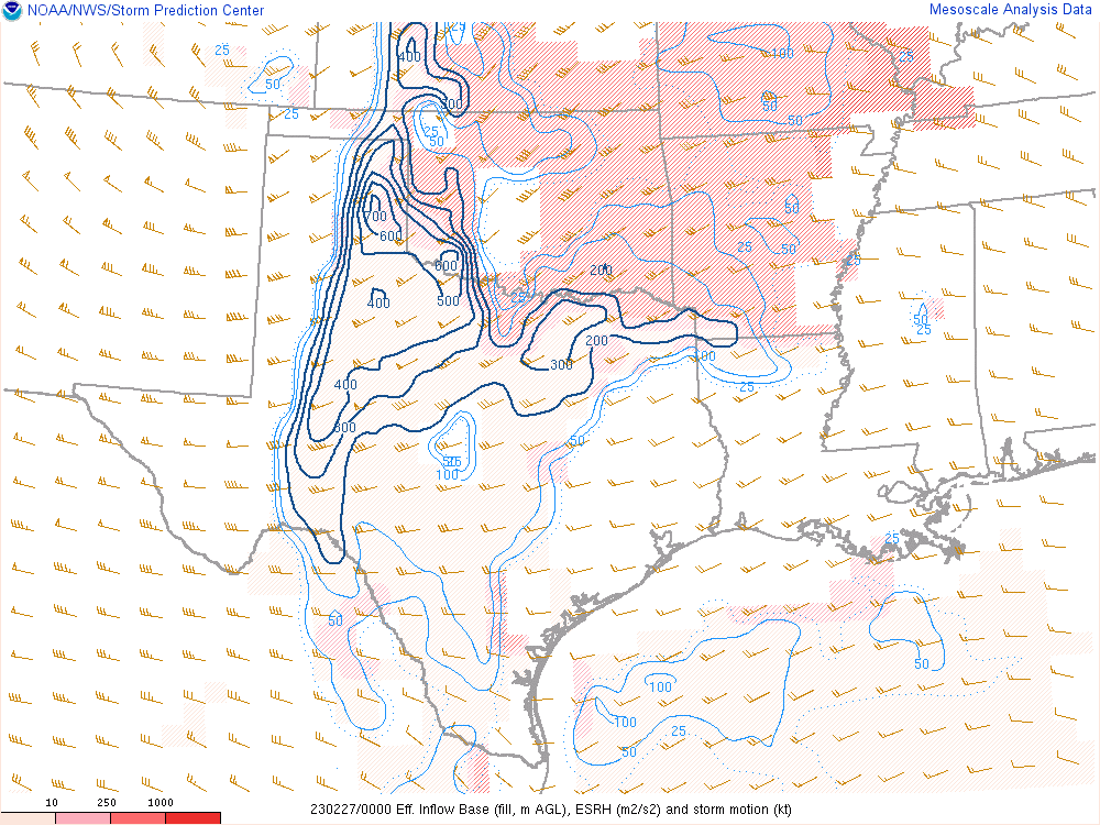
Although instability was not impressive compared to what we see in May and June, it was more than sufficient for strong updrafts given the strong lift and very strong shear present. Backed winds at the surface resulted in large effective SRH in the east where multiple tornadoes were confirmed. There was some concern that some stable air ahead of the storms would limit surface based parcel ingestion, but the strong mass flux elimenated any cap that was present.
 |
 |
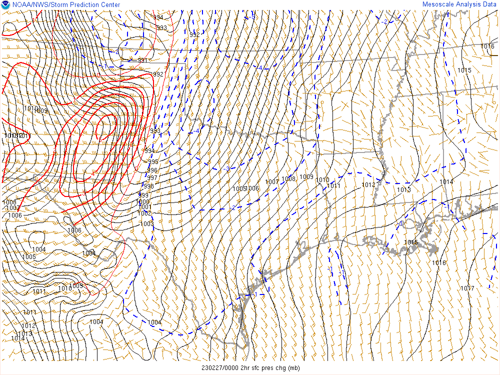 |
| Figure 4: MLCAPE and MLCIN | Figure 5: Effective SRH | Figure 6: 2-hr Surface Pressure Change |
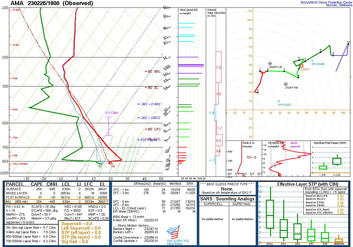
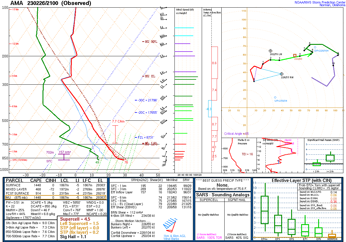
Additional environmental data. Notice the extreme low level helicity measured with the 03z OUN sounding. This was measured about 20 minutes before a tornado caused damage very near the same location.
 |
 |
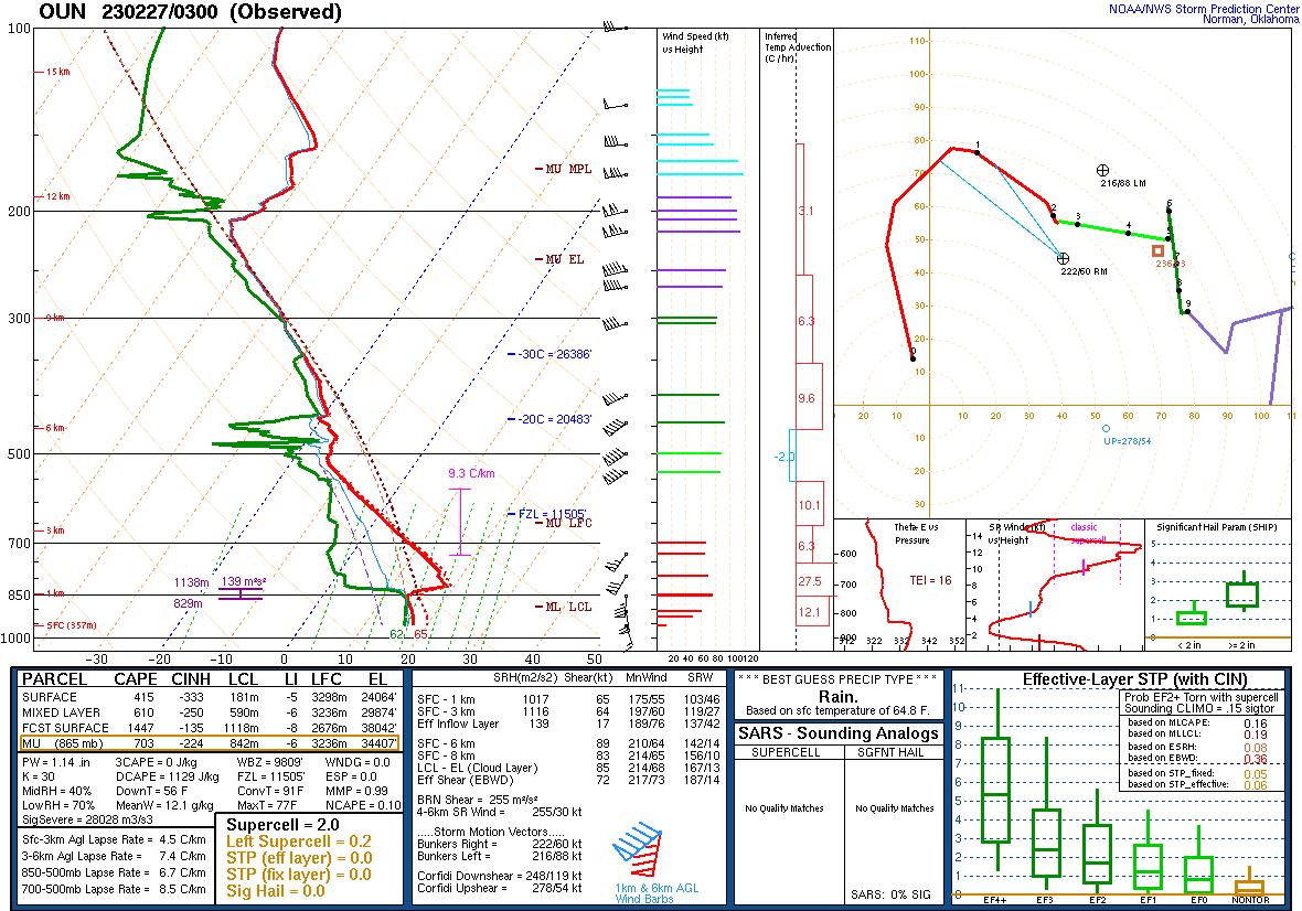 |
| Figure 7: Feb 26 18z AMA Special Sounding | Figure 8: Feb 26th 21z AMA Special Sounding | Figure 9: Feb 27th 03z OUN Special Sounding |
 |
 |
 |
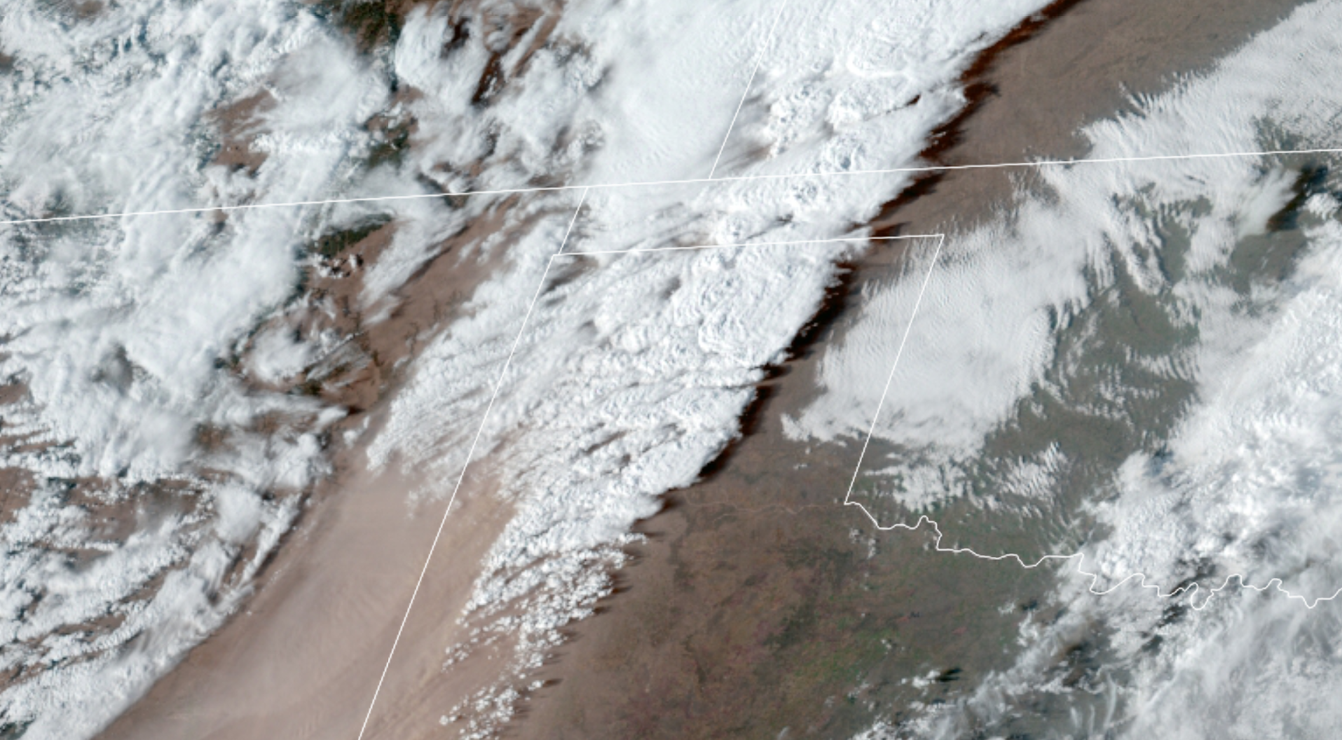
| Figure 10: Pacific Front Overtaking Surface Trough | Figure 11: GOES GeoColor Shows Dust and Leading Line of Severe Storms | Figure 12: GOES Dust RGB shows dust plume in pink. |
 |
Media use of NWS Web News Stories is encouraged! Please acknowledge the NWS as the source of any news information accessed from this site. |
|