An outbreak of severe thunderstorms is expected across portions of Illinois and Indiana tonight. Intense tornadoes, swaths of damaging gusts, and hail in excess of 2 inches in diameter possible. Tropical Storm Arthur will continue to produce strong winds across coastal Upper Texas and Louisiana tonight, as well as potentially life-threatening flooding across southern Louisiana into Mississippi. Read More >
 |
|
The prolonged dry conditions occurring across the Texas and Oklahoma Panhandles finally received some much welcomed moisture. Although some of that moisture fell in the form of large hail and flooding rains. So what caused this wet week of weather? Well let’s start at the beginning. (Click on the images to see a bigger picture).
|
|
|
|
|
|
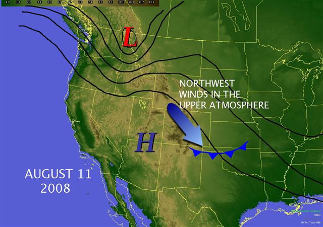
The graphic above depicts the upper atmospheric pattern in place on August, 11th 2008. Pay special attention to the big red “L” near northern Idaho. This was a low pressure system that would soon become the Panhandle rain producer. On the 11th, the cold front positioned over the Panhandles along with the northwest Winds in the upper atmosphere, helped generated a few storms over the western Panhandles.
|
On the 12th, the cold front pushed well south of the Panhandles while the northwest winds in the upper atmoshere (aloft) remained in place. Northwest winds aloft often bring thunderstorms to the Panhandles. Thunderstorms form over the Rocky Mountains and then "ride" the winds into the Panhandles. Not the low pressure system moving north into southern Canada.
|
 |
 |
|
On the 13th, high pressure in the upper atmosphere began to strengthen over the Southwest United States. Moist air from the Gulf of America began to move back toward the Panhandles after the cold front deteriorated. The low pressure system took a slight turn to the southeast. |
By the 14th, the high pressure ridge in the upper atmosphere became amplified and allowed the winds in the upper atmosphere to move from the northwest to the north. This acted much like a slide allowing the low pressure system over the northern United States to start moving south. This seemingly subtle change created an environment favorable for Thunderstorms. In fact, widespread severe weather developed during the afternoon on the 14th. A particularly intense severe thunderstorm moved south along the eastern Panhandles and produced large hail up to tennis ball size near Booker, Texas in Lipscomb County. Please see the photo slideshow below.
|
 |
 |
|
The upper level low pressure system made a quick move to the south and helped generate a cold front that moved through the Panhandles on the 15th. A second round of severe thunderstorms developed mainly across the western Panhandles. This event was characterized by what is known as a “Bow Echo” which produced strong winds, and hail up to golf ball size in Adrian, Texas (Oldham County) and again in Hereford, Texas (Deaf Smith County). Wind speeds with this storm topped out around 70 mph which combined with the falling hailstones to create many projectiles. These hail stones shattered the windows in cars and homes.
|
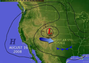
By the 16th, most of the severe weather had come to an end, but the heavy rain and flooding began especially around Hereford in Deaf Smith County. The upper level low pressure system parked over Colorado and provided abundant support for shower and thunderstorm development. Storms lasted nearly the entire day and produced some record daily rainfall totals.
|
 |
 |
|
Heavy rain continued on the 17th and led to additional reports of flash flooding from around the Panhandles. Water began to fill into the San Jose community near Hereford.
|
On the 18th, the heavy rain transitioned from the western Panhandles to the eastern Panhandles as the upper level low pressure system parked right over the area. Beaver, Lipscomb and Ochiltree Counties received the most rain and had a few reports of flash flooding.
|
|
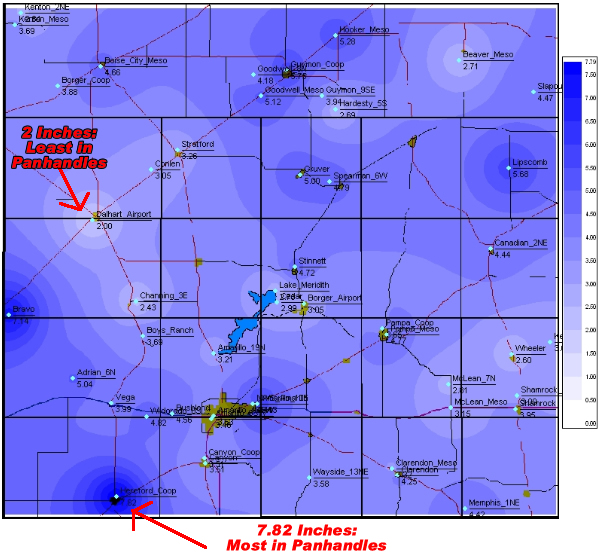
Overall, the main contributor to the heavy rain was the large and slow moving upper level low pressure system. However we also benefited from a few thunderstorms prior to the upper low reaching the Panhandles. We also had abundant moisture in the atmosphere as winds near the surface were pumping moisture into the area from the Gulf of America. The graphic below displays the total rainfall accumulation from August 11th through August 18th, 2008. The graphic is hard to read, but the main idea is that every location in the Panhandles received rain. Furthermore, the lowest rain total for that week was in Dalhart with 2.00 inches! And, most location received around 4 inches or more of rain!!! |
 |
|
|
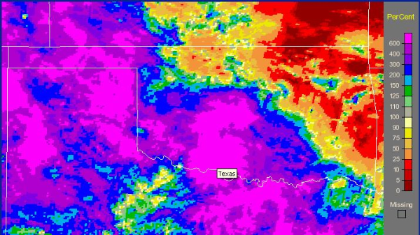
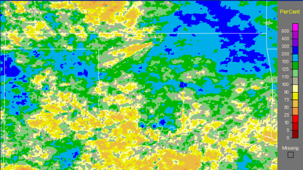
This next image shows a radar estimated percent of normal rainfall for that weeklong period from August 11th through the 18th. Again, the image is hard to read, but the bright purple colors show 600% of normal (or roughly 6 times the amount of rain) with the lowest values over the Panhandles being 200% of normal (or roughly 2 times the amount of rain).
|
|
 |
|
|
Did this solve our drought problem?! Not necessarily...The following image displays the radar estimated percent of normal rainfall over the last 90 days. A few locations (northeast and northwest Texas Panhandle) do show nearly twice the normal amount of rain for that 90 day period (May 18th through August 18th). However, there are still some places falling slightly below normal. These areas are mainly across the central to southwest Texas Panhandle, and the western Oklahoma Panhandle.
|
|
 |
 |
 |
 |
 |
|
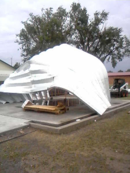
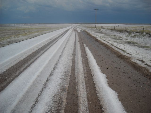
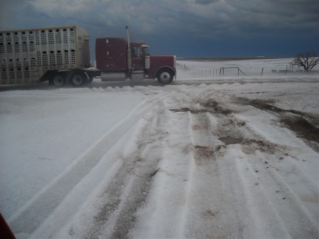
We have received a few pictures from the week of wet weather. The first set above shows the inredible hail event that impacted Lipscomb and Beaver Counties (photos near Booker, Texas). These are NOT pictures from the middle of winter. This is in fact a thick ground cover of hail. A similar situation occured near Hereford. In both locations, emergency officials contemplated using snow plows to clear the roads covered with hail. |
|||
 |
 |
 |
 |
|
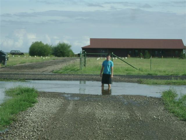
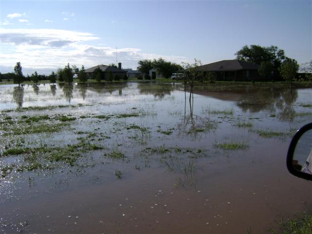
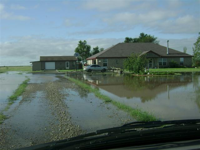
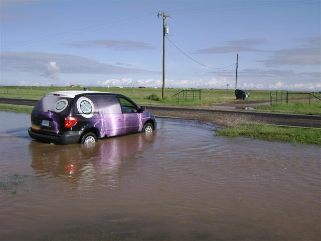
These images above show some of the result from the heavy rain that impacted Amarillo. Steve Drillette, the Warning Coordination Meteorologist at the NWS in Amarillo, supplied these pictures. The heavy rain caused a small lake to form near his home near Highland Park High School east of Amarillo. |
|||
 |
 |
 |
 |
|
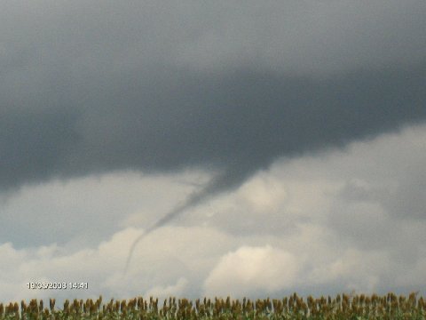
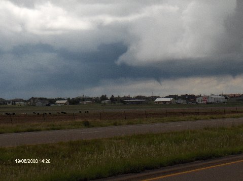
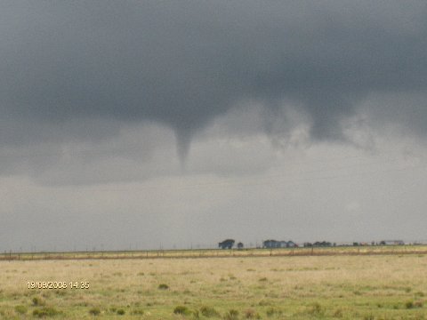
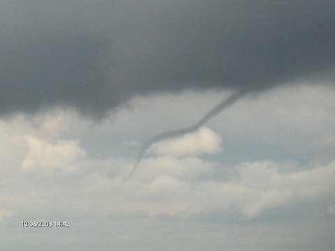
Another result of the abnormally cool atmosphere was a number of “Cold Air Funnels”. Cold Air Funnels typically do not reach the ground and they are usually completely harmless. On occasion, they can briefly touch the ground but generally fall in the EF0 (weak) category for tornadoes. A number of Cold Air Funnels developed on the 19th as the upper level low pressure system moved to the southeast of the Panhandles. Kevin Starbuck, the Amarillo Emergency Manager, supplied these pictures above. |
|||