
A significant heat wave continues for the Rockies, Northern Plains, and Great Lakes into the Mid-Atlantic, peaking in intensity through midweek and lingering across parts of the Northern Plains and Midwest until this weekend. Excessive rainfall my bring life-threatening and locally catastrophic flash and urban flooding across portions of southwestern Texas through early Friday. Read More >
|
|
|
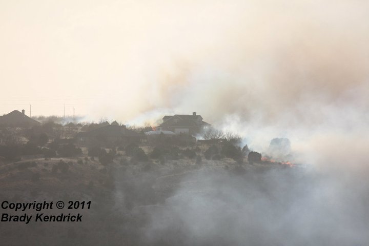
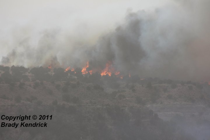
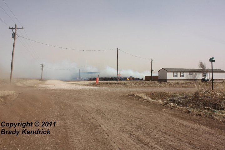
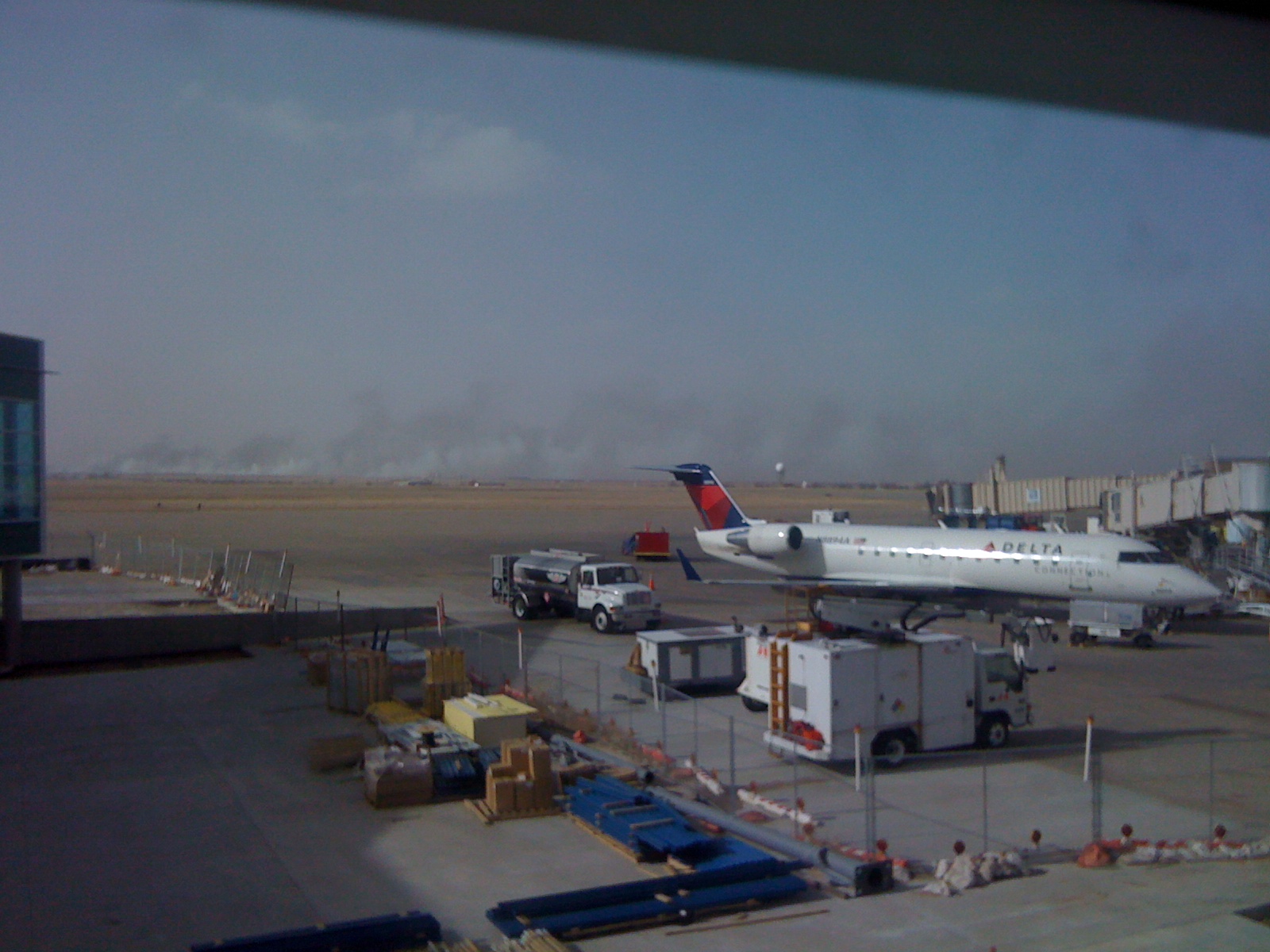
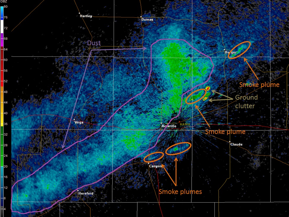
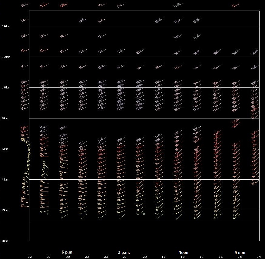
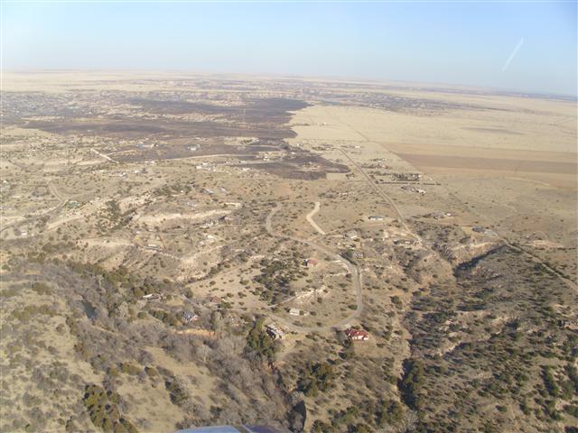
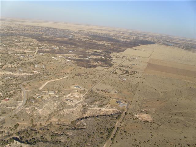
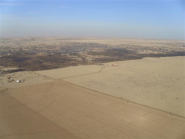
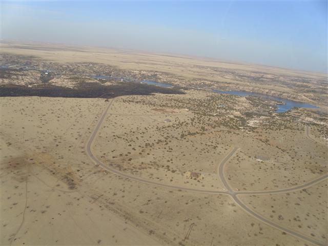
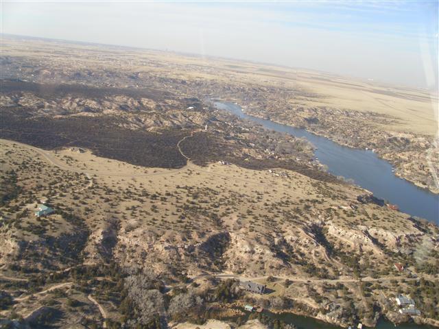
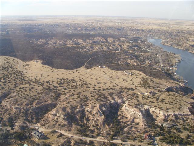
On Sunday, February 27, a powerful upper-level disturbance ejected from the Desert Southwest into the southern High Plains. In response to this, a deepening area of low pressure developed in Southeast Colorado and an associated dryline rapidly moved eastward across the Texas and Oklahoma Panhandles. Behind the dryline, unseasonably warm temperatures combined with extremely dry air to result in very low relative humidity values. The combination of a tightening pressure gradient, a deep boundary layer with steep lapse rates, and a core of 80 mph winds at 12,000 feet (AGL) being transported toward the surface resulted in strong southwesterly winds behind the dryline, especially across the southwestern Texas Panhandle. In fact, a peak wind gust of 69 mph was measured at 1:38 p.m. at Rick Husband International Airport in Amarillo. These strong winds were also responsible for widespread blowing dust across much of western Texas, including the southern Texas Panhandle. At times, the blowing dust resulted in visibilities being reduced to 1 mile. In addition to the strong winds and low relative humidities, 1-hour fuel moisture levels were around 2% and 10-hour fuel moisture levels were around 3%. Needless to say, this resulted in an extreme fire danger rating. During the afternoon and evening hours, several fires broke out across the Texas Panhandle. Some of the more significant fires occurred in Potter County, Randall County, Lipscomb County, Wheeler County, Hutchinson County, and Carson County. |
 |
 |
 |
| Wildfire in Lake Tanglewood (Courtesy of Brady Kendrick) | Wildfire in Lake Tanglewood (Courtesy of Brady Kendrick) | Wildfire in Lake Tanglewood (Courtesy of Brady Kendrick) |
 |
 |
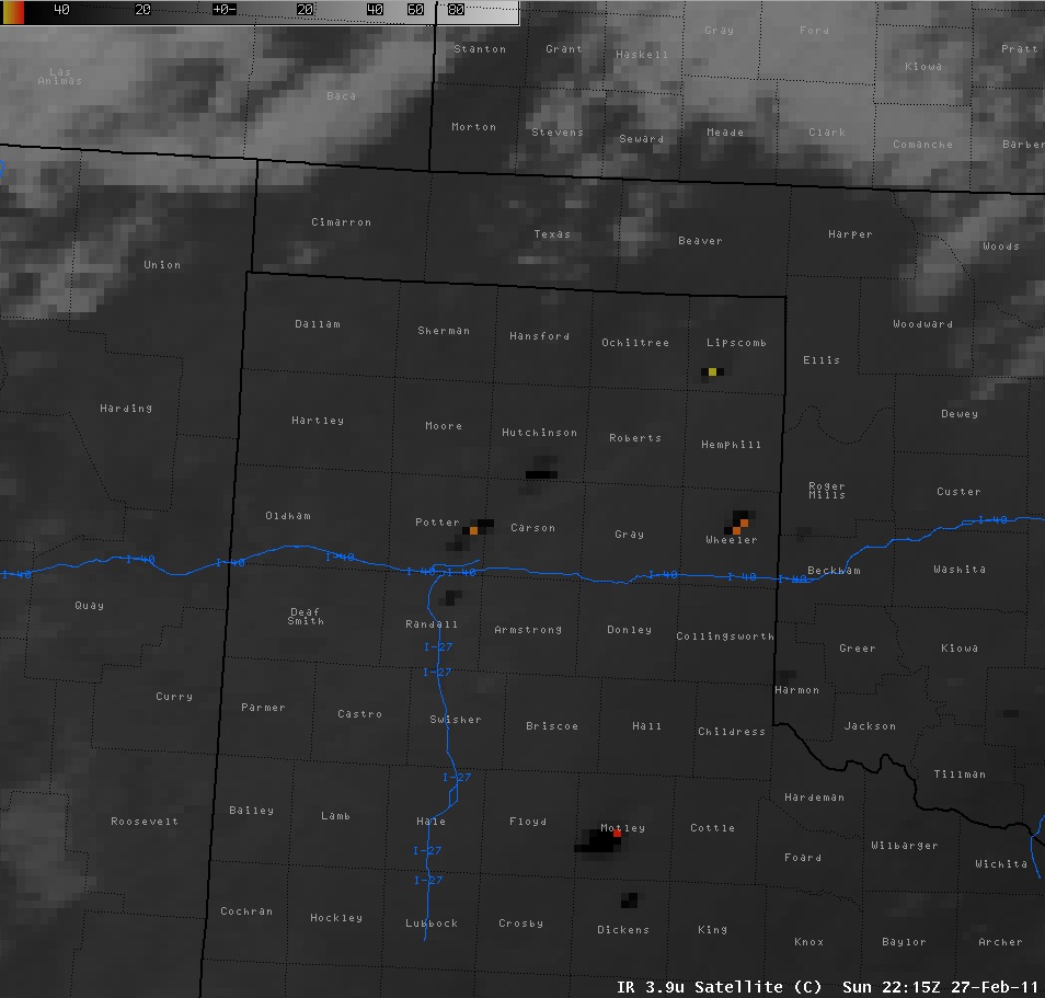 |
| Wildfire east of Canyon (Courtesy of Brady Kendrick) | Smoke visible from Rick Husband Airport in Amarillo (Jose Garcia) | Satellite image showing the fires. Black and colored pixels represent fire locations. |
 |
 |
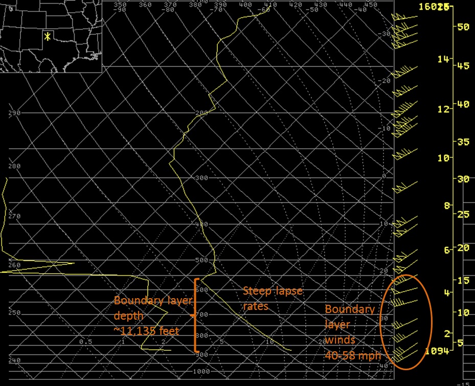 |
| KAMA radar image showing dust and smoke plumes. | Wind profile taken at Tucumcari, NM. | Sounding taken Sunday at 6 p.m. |
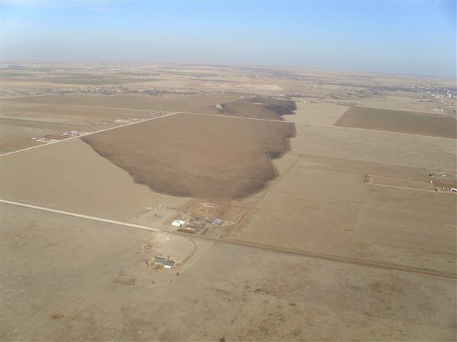
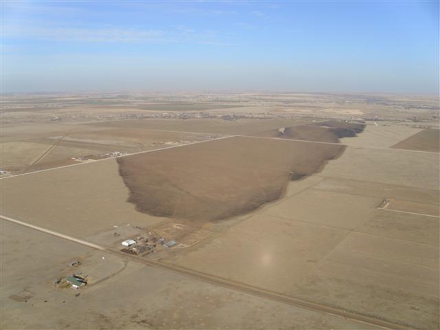
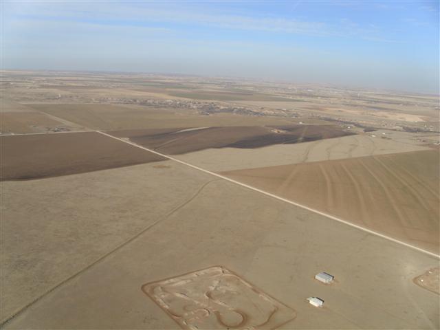
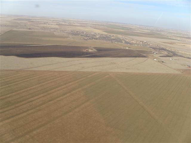
| Burn Scars from Canyon and Lake Tanglewood (Scott Plischke) | ||
 |
 |
 |
 |
 |
 |
 |
 |
 |
 |
 |
 |
Fires and blowing dust across western Texas (CIMSS)
| Date/Time | Event/Magnitude | Location | Comments |
| 1251 PM 2/27 | Non-Tstm Wind Gust -- M59 MPH | 5 ENE Hereford | AWOS |
| 105 PM 2/27 | Non-Tstm Wind Gust -- M61 MPH | 5 ENE Hereford | AWOS |
| 138 PM 2/27 | Non-Tstm Wind Gust -- M69 MPH | 6 ENE Amarillo | ASOS |
| 140 PM 2/27 | Non-Tstm Wind Gust -- M65 MPH | Amarillo | Recorded at Carver Elem. |
| 145 PM 2/27 | Non-Tstm Wind Damage | 8 E Amarillo | NWS Employee noticed that a storage building just west of Lakeside and I-40 lost part of the roof. |
| 243 PM 2/27 | Non-Tstm Wind Gust -- M70 MPH | 3 E Bushland | Reported from Oasis RV Park |
| 245 PM 2/27 | Non-Tstm Wind Gust -- M64 MPH | Skellytown | |
| 247 PM 2/27 | Non-Tstm Wind Gust -- M61 MPH | 11 NNW Codman | Report at Robert Clark Ranch |
| 250 PM 2/27 | Non-Tstm Wind Gust -- M59 MPH | 5 ENE Hereford | AWOS |
| 253 PM 2/27 | Non-Tstm Wind Gust -- M58 MPH | 2 N Borger | ASOS |
| 148 PM 2/27 | Wildfire | 4 N Amarillo | 29 homes were destroyed. No injuries were reported. Burned 24,310 acres. |
| 302 PM 2/27 | Non-Tstm Wind Gust -- M58 MPH | 6 ENE Amarillo | ASOS |
| 432 PM 2/27 | Wildfire | 1 NNW Lake Tanglewood | 26 homes were destroyed. No injuries were reported. Burned 1,659 acres. |
| 220 PM 2/27 | Wildfire | 5 W Canyon | No injuries were reported. Burned 419 acres. |
| 400 PM 2/27 | Wildfire | Borger | Many outbuildings destroyed. Acreage unknown. |
| 400 PM 2/27 | Wildfire | Wheeler | Acreage unknown |
| 500 PM 2/27 | Wildfire | 5 SW Lipscomb | Acreage unknown |
This information is preliminary, but more details will be available at a later time.

