
Wildfire smoke continues to impact air quality from the Great Lakes region into New England and the Mid-Atlantic today with widespread Air Quality Alerts in effect. Severe thunderstorms are expected across portions of the Ohio Valley and Lower Great Lakes into the Mid-Atlantic and Northeast, this afternoon into the evening. Monsoonal thunderstorms may bring areas of flooding to the Southwest. Read More >
Amarillo, TX
Weather Forecast Office
|
|
 |
|
|
|
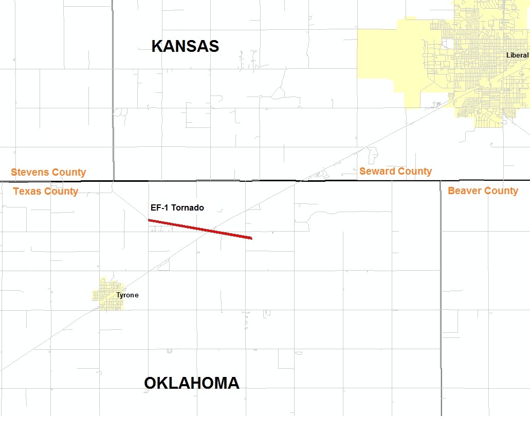
| Rating (EF Scale) | EF-1 |
| Estimated Maximum Wind | 90 mph |
| Injuries/Fatalities | None |
| Damage Path Length | 2.1 miles |
| Maximum Path Width | 50 yards |
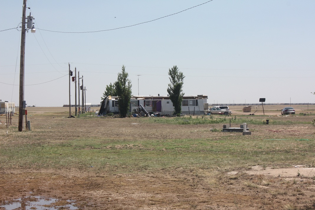
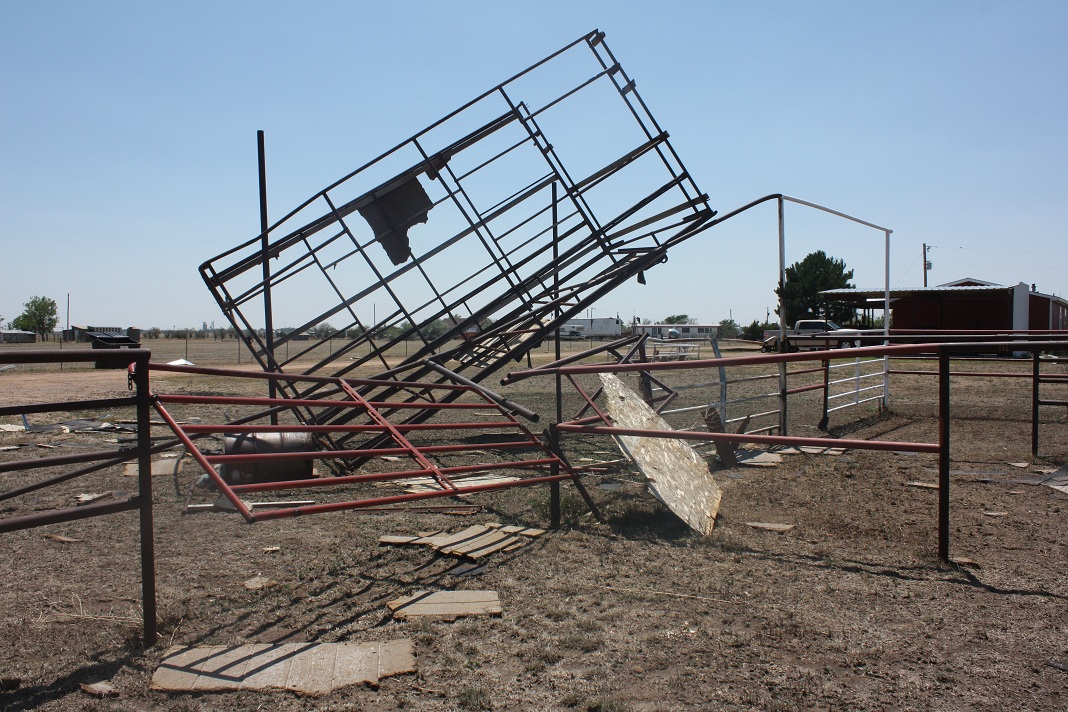
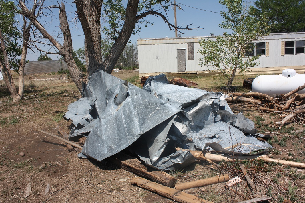
| The tornado first touched down near the intersection of Mile 54 Road and B Road northeast of Tyrone around 7:11 p.m. CDT. The tornado was on the ground for about 2.1 miles with a maximum width of 50 yards. The maximum wind speeds were around 90 mph. The tornado dissipated just southeast of the intersection of Mile 56 and B Road around 7:25 p.m. CDT. No injuries or fatalities were reported. This is a preliminary report and is subject to revision based on new or additional information. | |
 |
 |
 |
US Dept of Commerce
National Oceanic and Atmospheric Administration
National Weather Service
Amarillo, TX
1900 English Road
Amarillo, TX 79108
(806) 335-1121
Comments? Questions? Please Contact Us.

