
Hazardous heat will continue across the Southern Plains, Gulf Coast and Desert Southwest through the weekend. Additional heat will build into the Great Basin and Northern Plains this weekend. A stalled front is expected to bring periods of heavy to excessive rainfall and flooding from the Tennessee Valley to the Southeast U.S on Friday. Read More >
Amarillo, TX
Weather Forecast Office
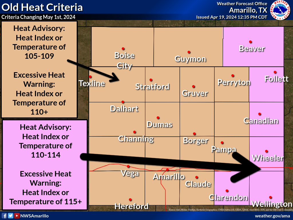
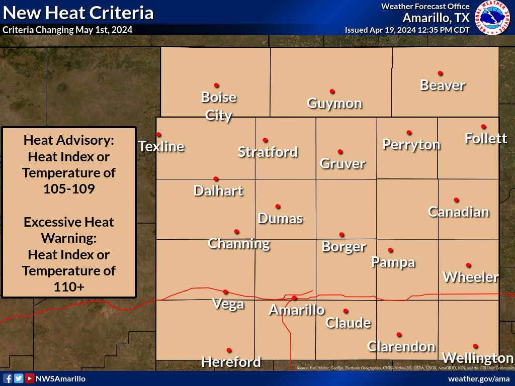
The criteria for Heat Advisories and Excessive Heat Warnings are changing in the eastern Oklahoma and Texas Panhandles.
Beaver, Lipscomb, Hemphill, Wheeler, Collingsworth, and Donley Counties previously needed either a temperature or heat index value of 110 to 114 for a Heat Advisory and 115 or greater for an Excessive Heat Warning.
On May 1st, 2024, the criteria for these counties will change: a temperature or heat index of 105 to 109 will be needed for a Heat Advisory and 110 or greater will be needed for an Excessive Heat Warning.
This means that, starting May 1st, 2024, the criteria for the entirety of the Oklahoma and Texas Panhandles, including Palo Duro Canyon, will be the same: 105 to 109 for a Heat Advisory and 110 or greater for an Excessive Heat Warning.
The following maps illustrate this change:
US Dept of Commerce
National Oceanic and Atmospheric Administration
National Weather Service
Amarillo, TX
1900 English Road
Amarillo, TX 79108
(806) 335-1121
Comments? Questions? Please Contact Us.

