Record setting heat is expected over the next several days from the Intermountain West through the northern Plains. Furthermore, fire weather concerns increase with dry and breezy conditions. Meanwhile, heavy rainfall and severe thunderstorm threats for the Ohio/Tennessee Valleys, central Appalachians and Southeast today. The threat shifts to central Gulf Coast and across central Texas this week. Read More >
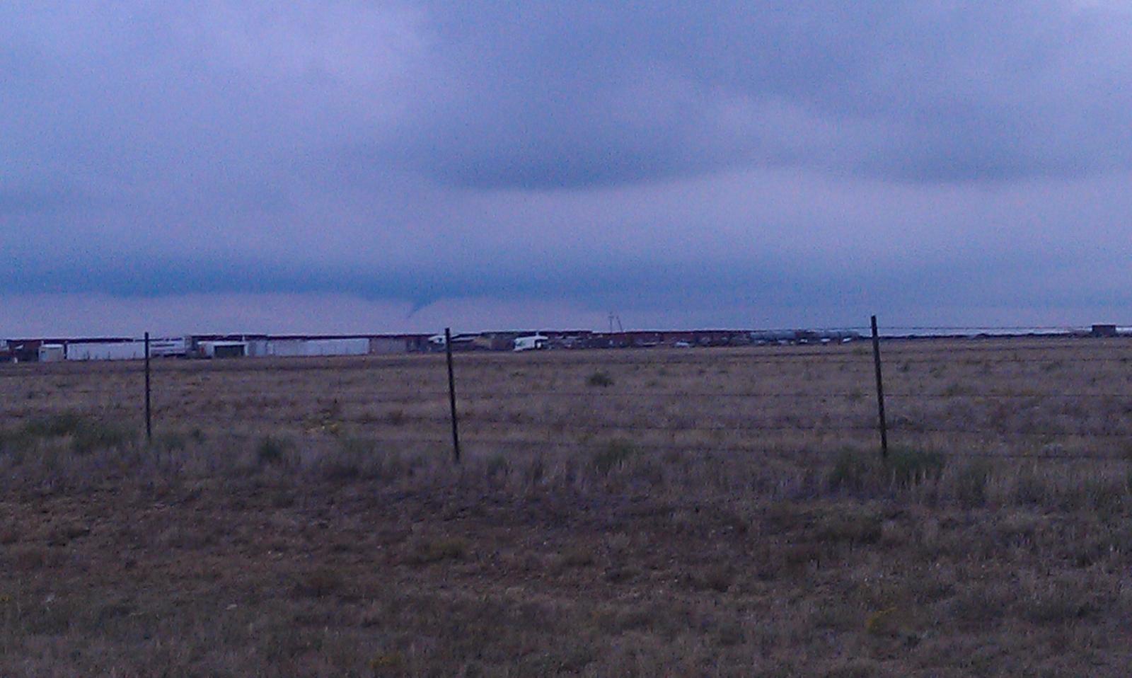
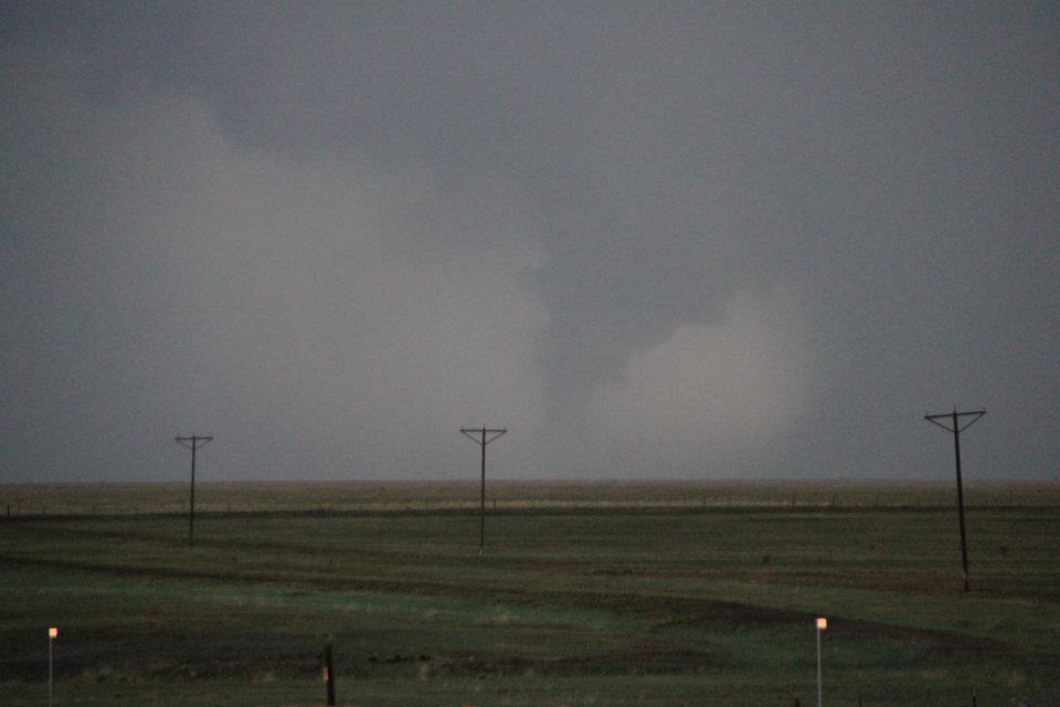
| September 28th Tropical Funnels in the Texas Panhandle | ||||||||||||
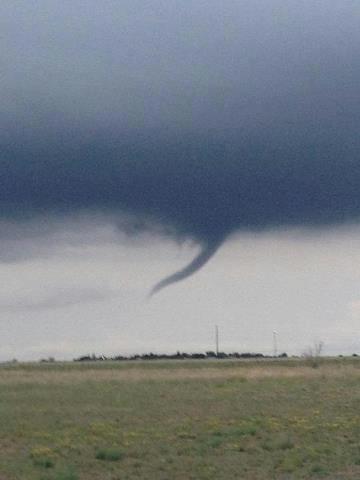
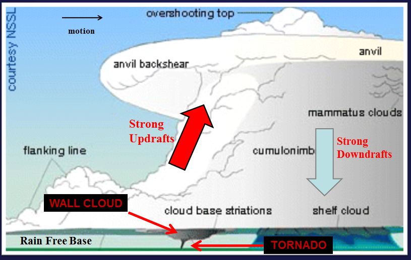
| Tropical funnels were spotted near several communites on the evening of the 28th. These funnel clouds were seen near Hereford, Clarendon, and Amarillo for brief periods. Tropical funnels (and the similar cold air funnel) are not as well understood as funnel clouds that form in supercells and produce classic tornadoes. Tropical funnels form in tropical environments, which Texas was experiencing due to moisture from Hurricane Miriam off the west coast of Mexico on the 28th. Meteorologists have an idea of how these tropical funnel clouds form, but the exact process (much like classic tornadoes) is not completely understood. This lack of understanding is due in large part to how quickly these funnel clouds form and then dissipate, usually within just a few minutes. Funnel clouds are caused by vertical stretching of vorticity. Vorticity can be thought of as "spin" in the atmosphere, which is usually produced by wind shear. As this vorticity is streched vertically the area of rotation shrinks and the spinning air speeds up. The old analogy is an ice skater twirling who pulls in her arms and starts to spin faster. Funnel clouds from supercells have the same general process, however tropical funnels have this happen on a much smaller/slower scale which leads to these funnel clouds having shorter life-spans and much weaker wind speeds. One very important fact to note is that a tornado does not exist until the rotation is in contact with the base of the cloud AND the ground. If it is not in contact with the ground, then it is considered a funnel cloud. These tropical funnels rarely make contact with the ground, (in part due to their short-lived nature) and if they do reach the ground they have been known to cause winds up to 70 mph. All around these storms are much less dangerous than tornadoes that form from supercells, but they should be noted as they can cause minor damage if they reach the ground. | ||||||||||||
|
|
||||||||||||
|
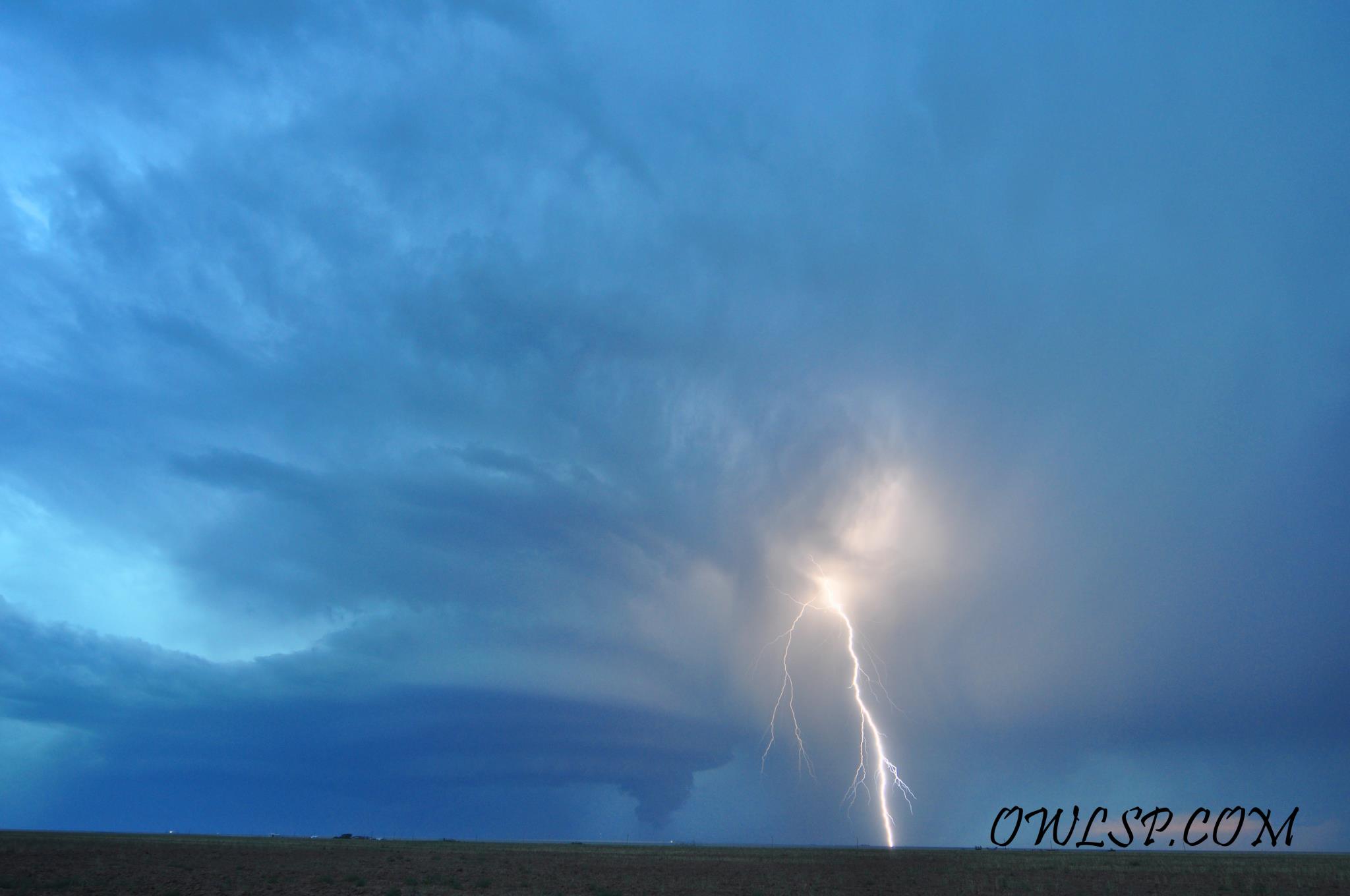
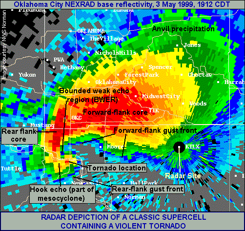
The images below will show how radar data and pictures are different for classic tornadoes/funnel clouds from supercells and tropical funnels from the evening of the 28th. Classic tornado/funnel cloud images will always be on the left, and tropical funnels from the 28th will be on the right
|
||||||||||||
|
RADAR IMAGES |
||||||||||||
|
||||||||||||
|
STORM IMAGES |
||||||||||||
|


.JPG)
.JPG)
.JPG)
.png)