National Weather Service United States Department of Commerce
Click a location below for detailed forecast.

Last Map Update: Mon, Mar 17, 2025 at 12:14:37 pm CDT

A Fire Danger Statement is in effect from 1 PM to 8 PM today for an increased threat of erratic wildfire behavior and rapid wildfire spread. Please be safe and help prevent wildfires by doing everything possible to avoid open flames or sparks.
A Fire Weather Watch is in effect from 10 AM to 8 PM Tuesday for all of inland and coastal Deep South Texas except for Island Cameron, Willacy, and Kenedy Counties. Dry fuels, stronger winds, and low relative humidity values are expected to enhance wildfire growth and spread potential across deep South Texas and the RGV.
There is a High Risk of rip currents at the local beaches from 7 AM Tuesday morning until 7 PM Tuesday evening.
Very warm and dry conditions will prevail in advance of the late Wednesday passage of a cold front. Cooler conditions will prevail late in the week behind the front, but dry weather is still expected. Strong winds will occur Tuesday into Tuesday night.
Today's high temperatures and rain chances.
Tonight's low temperatures and rain chances.
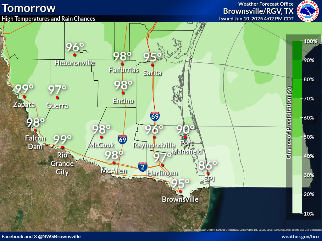
Tomorrow's high temperatures and rain chances.

 
Current Observations ( )
Location Sky/Weather Temp Dewpt RH Wind Baro Remarks
Brownsville
N/A
N/A
N/A
N/A
N/A
N/A
N/A
Harlingen
N/A
N/A
N/A
N/A
N/A
N/A
N/A
McAllen
N/A
N/A
N/A
N/A
N/A
N/A
N/A
Bayview
N/A
N/A
N/A
N/A
N/A
N/A
N/A
Weslaco
N/A
N/A
N/A
N/A
N/A
N/A
N/A
Edinburg
N/A
N/A
N/A
N/A
N/A
N/A
N/A
Zapata
N/A
N/A
N/A
N/A
N/A
N/A
N/A
Hebbronville
N/A
N/A
N/A
N/A
N/A
N/A
N/A
Falfurrias
N/A
N/A
N/A
N/A
N/A
N/A
N/A
Laredo
N/A
N/A
N/A
N/A
N/A
N/A
N/A
Kingsville
N/A
N/A
N/A
N/A
N/A
N/A
N/A
Alice
N/A
N/A
N/A
N/A
N/A
N/A
N/A
Notes:
  • In the Location column, click on links for a list of recent observations at sites of interest. A new window will open.
  • In the Wind column, the letter indicates direction the wind blows from (N=North, E=East, S=South, W=West, NE=Northeast, etc). VRB is "variable" and G is "gust". Wind speeds are in MPH.
  • In the Baro (pressure) column, values are in inches.
  • In the Remarks column, HX is the Heat Index and WCI is Wind Chill Index (if shown). These are "Feels Like" temperatures. VSB is Visibility. "N/A" will be displayed if values are not available.
 
Text Product Selector (Selected product opens in current window)


Beach Page Tropical Marine Weather Fire Weather Hazards Outlook Rivers-Flooding
Beach Tropical Marine Weather Fire Weather Hazards Outlook Rivers-Flooding
Observations Forecaster Discussion Satellite Preparedness NOAA Weather Radio Spanish Weather Radio
Observations Forecasters Discussion Satellite Preparedness Weather Radio Spanish Weather Radio
RGV Outreach Web Newsletter RGV Drought Rip Current Safety Flood Safety Skywarn
Outreach Newsletter Drought Rip Current Safety Flood Safety Skywarn
RGV Event Summaries Seasonal Outlooks RGV Storm Data Reports (short form) Research User Guides Skywarn
Event Summaries Seasonal Outlooks Storm Data Research User Guides Severe Weather Drill